
Menu
Popular Walks
-
Hooker Valley Track
(20 ticks) -
Tongariro Alpine Crossing
(17 ticks) -
Milford Track
(14 ticks) -
Everest Base Camp
(14 ticks) -
Kepler Track
(13 ticks)
Sub-Regions
- Albania
- Antarctica
- Argentina
- Canada
- China
- Cook Islands
- Croatia
- Czech Republic
- Egypt
- Fiji
- France
- Germany
- Greece
- Guatemala
- Hawaii
- Ireland
- Italy
- Japan
- Jordan
- Malaysia
- Nepal
- New Zealand
- Norfolk Island
- Papua New Guinea
- Peru
- Poland
- Seychelles
- Singapore
- South Africa
- South Georgia Island
- South Korea
- Spain
- Spitsbergen (Svalbard)
- Taiwan
- Tonga
- Turkey
- United Kingdom
- United States of America
- Vietnam
Summary
We all know Australia is the place for bushwalking... New Zealand has some good tracks too... but surprisingly the rest of the world has some places worth visiting too! (imaging that!)
This is the place to share walks from outside of Australia/New Zealand.
Popular Walks
-
Hooker Valley Track
(20 ticks) -
Tongariro Alpine Crossing
(17 ticks) -
Milford Track
(14 ticks) -
Everest Base Camp
(14 ticks) -
Kepler Track
(13 ticks)
Sub-Regions
- Albania
- Antarctica
- Argentina
- Canada
- China
- Cook Islands
- Croatia
- Czech Republic
- Egypt
- Fiji
- France
- Germany
- Greece
- Guatemala
- Hawaii
- Ireland
- Italy
- Japan
- Jordan
- Malaysia
- Nepal
- New Zealand
- Norfolk Island
- Papua New Guinea
- Peru
- Poland
- Seychelles
- Singapore
- South Africa
- South Georgia Island
- South Korea
- Spain
- Spitsbergen (Svalbard)
- Taiwan
- Tonga
- Turkey
- United Kingdom
- United States of America
- Vietnam
Walks in North Island NZ
(New Zealand)
 1.9
km
one-way
1.9
km
one-way
 45
mins
45
mins
Mount Victoria to Mount Alfred via Hobbit's Hideout
Go to both the scenic lookout and trigpoint of Mount Victoria (196m) then follow the forest ridge of the Wellington town belt to Mount Alfred (133m) the site of the Te Akatarewa Pa. With the detour to the Hobbit's Hideout a LotR film location along the way the walk will be 1.9kms one way. A straight return is about 1km.
 7.4
km
return
5
hrs
7.4
km
return
5
hrs
Mt Karioi
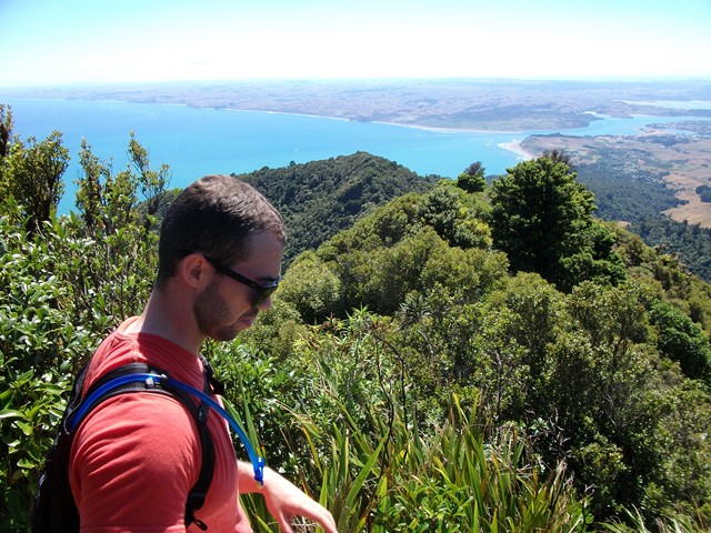
About an hour west of Hamilton lies the extinct Volcano known as Mt Karioi. The track starts off fairly steep through grassland and then thick forest on a very well marked track. Upon reaching the ridgeline you are greeted with excellent views that only get better the higher you go. After the initial climb the walk is fairly undulating until you reach the summit. There are a few ladders/stairs/near vertical ascents where you have the aid of a series of chains but nothing too challenging. The track, though well marked, gets very muddy, so if you decide to attempt this after wet weather be prepared to wreck the clothes you're wearing because you almost certainly will slip at some point. There is a helipad at the very top with 320 degree views out to the Raglan Harbour and beyond.
 3.5
km
return
1
hr
3.5
km
return
1
hr
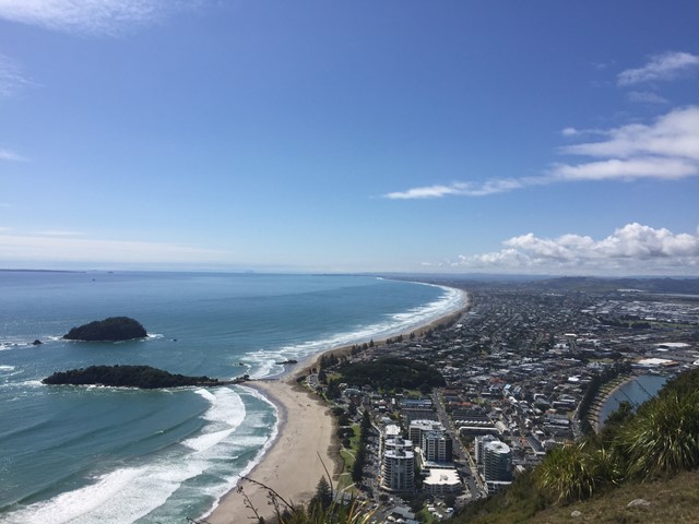
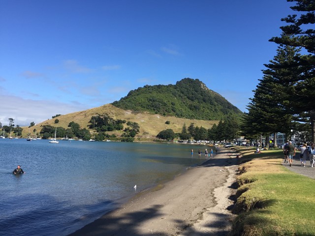
Mt Maunganui
A nice casual stroll up a well marked trail to the summit of Mt Maunganui where fantastic coastal views await you.
 10
km
return
6
hrs
10
km
return
6
hrs
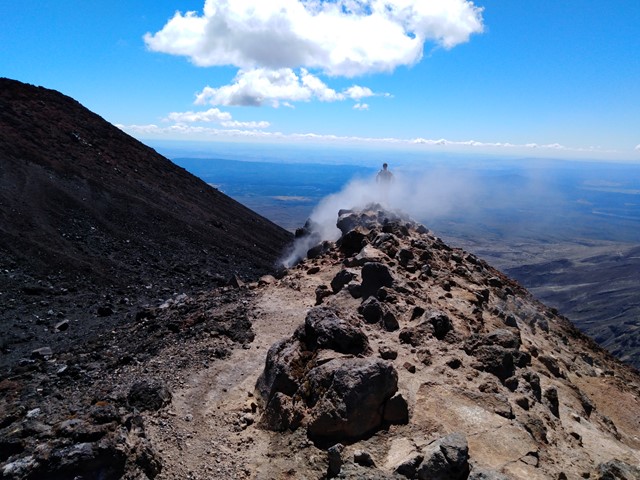
Mt Ruapehu Crater Climb
http://www.doc.govt.nz/parks-and-recreation/places-to-go/central-north-island/places/tongariro-national-park/things-to-do/tracks/mount-ruapehu-crater-climb/
 12.6
km
return
8
hrs
12.6
km
return
8
hrs
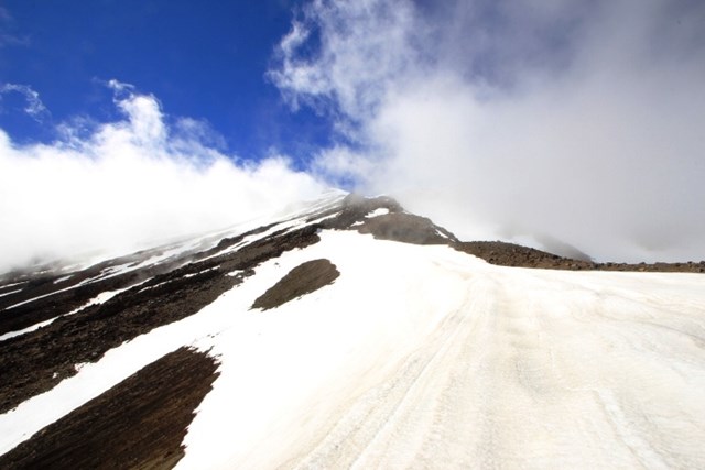
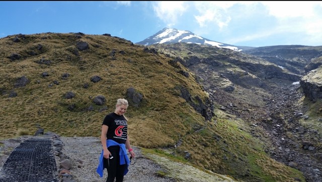
Mt Taranaki
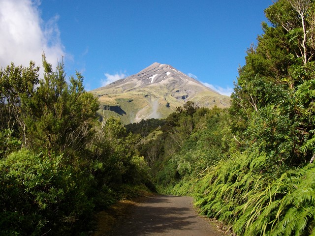
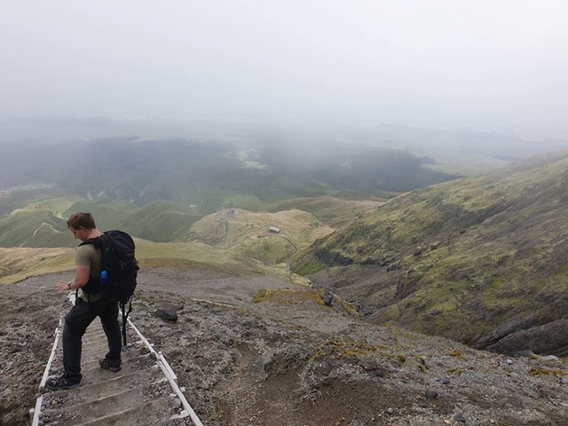
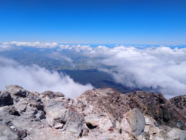
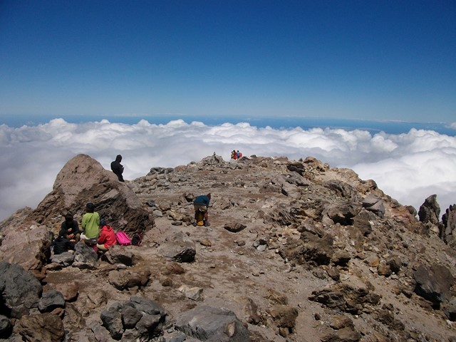
Active Stratovolcano located just east of New Plymouth on the North Island of New Zealand. 2nd highest mountain on the north island and was used as the backdrop in the film 'The Last Samurai' due to its similarity to Mt Fuji. You can see it all the way from the Tongariro Alpine Crossing on a clear day! It should only be climbed in summer unless you have proper mountaineering experience, even then expect it to be snow/ice capped. An excellent and challenging walk to the summit with a bit of everything - scree/hiking/scrambling/crossing ice plains.
 6
km
return
2
hrs
6
km
return
2
hrs
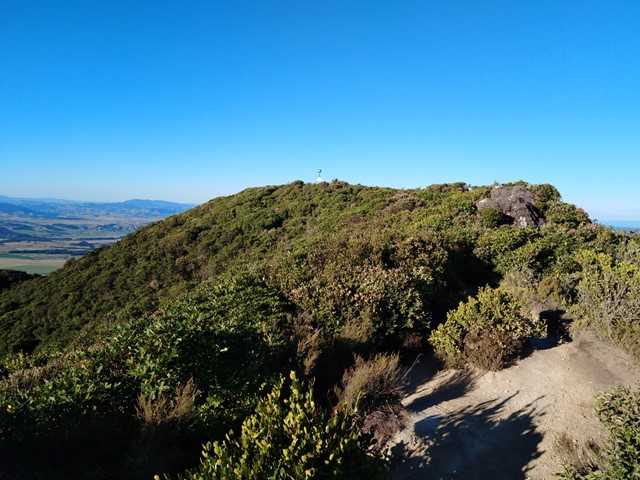
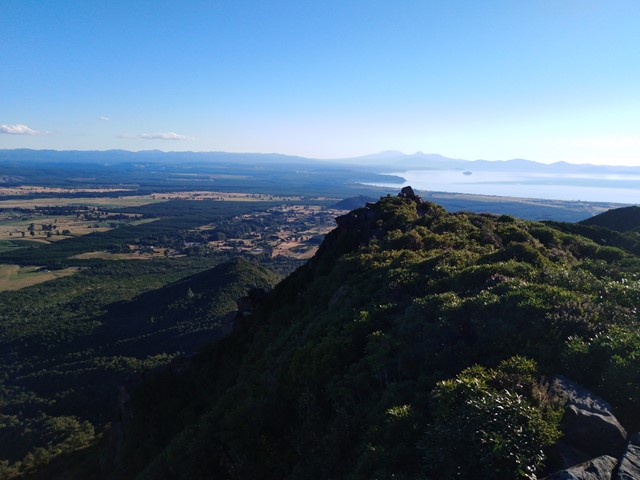
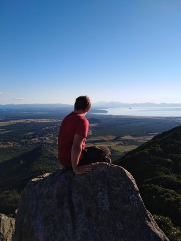
Mt Tauhara
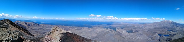
A moderate hike to the summit that offers excellent views of Lake Taupo, Mt Ruapehu and Mt Tongariro. The track is very well marked however it branches off quite frequently, don't panic all tracks lead to the summit so you won't get lost. The summit has great views but the best views are a bit further down the ridge line on a rocky outcrop.
 8
km
return
6
hrs
8
km
return
6
hrs
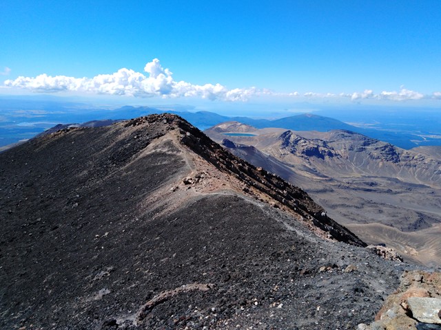
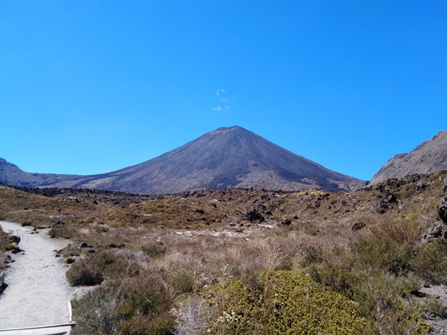
Mt. Ngauruhoe (aka Mt Doom)
The volcano where the one ring to rule them all was forged, or more accurately the volcano Mt Doom was modelled off for Lord of the Rings movies. Located just off the track on the Tongariro Crossing is a very intimidating climb to the summit of Mt Ngauruhoe. In recent years climbers have been encouraged not to climb it due to the dangers involved with climbing to the summit.
*On way up make sure to use the solid ground of the ridge line otherwise you will end up sliding down as much as you gain height with each step. This is very important to remember if you are going to try to summit Mt. Ngauruhoe.*
On the way down you will be able to 'scree ski' down which allows you to make it down the mountain very quickly around half an hour where as getting up would've taken around two hours.
 3
km
return
1
hr
3
km
return
1
hr
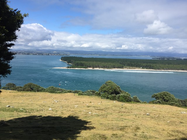
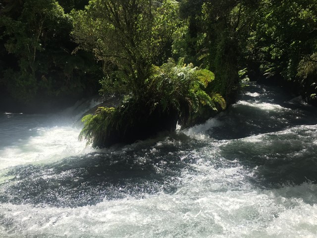
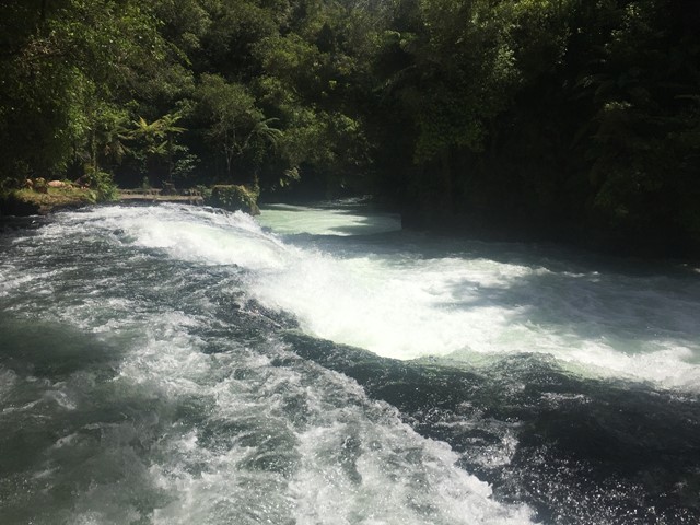
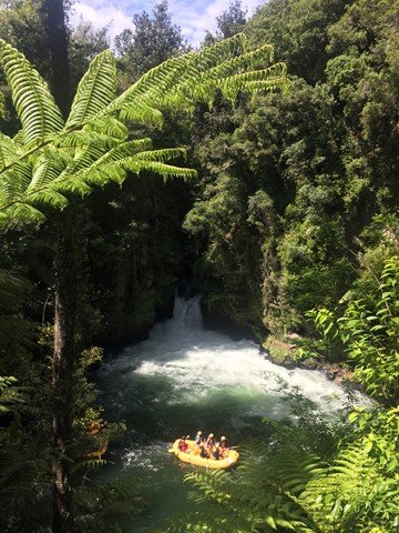
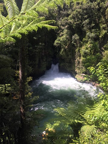
Okere Falls Track and Ridge Track loop
A walk in the Okere Falls Scenic Reserve following the Kaituna River. The Walk takes you to the Trout Pool, Trout Pool Falls, Tutea Falls, Hinemoa's Steps and Tutea's Cave and Okere Falls.
 3.5
km
return
90
mins
3.5
km
return
90
mins
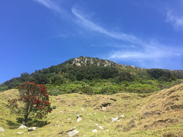
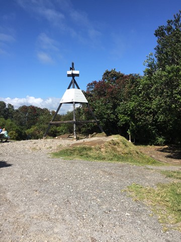
Otanewainuku Lookout Track
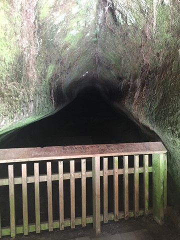
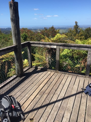
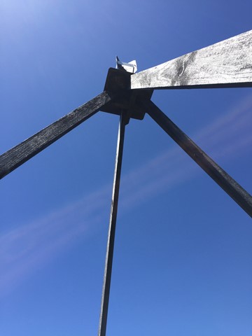
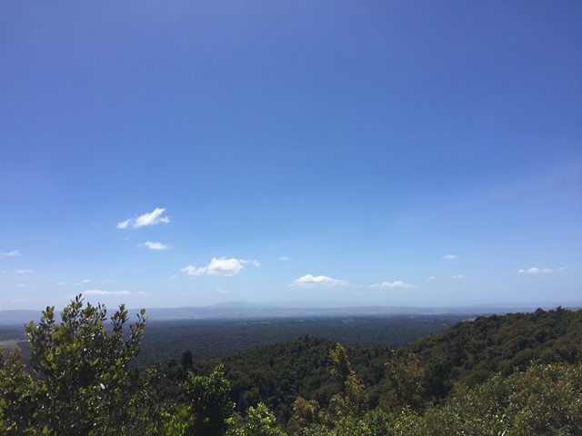
A walk in the Otanewainuku Forest Reserve to the top of Mt. Otanewainuku where there is a trig station with a tower for views.
 1.7
km
return
45
mins
1.7
km
return
45
mins
Otanewainuku Rimu Loop Walk
This gently graded walk with some impressively large rimu trees is suitable for walking children - it's not suitable for strollers or wheelchairs.