


 300
300 20
20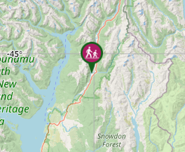
Aussie Bushwalking can keep track of your bushwalks.
Login/signup to tick this walk off.Eglington Valley Walk
South Island NZ
Menu
Also known as the Mackay Creek Walk it is a short walk along the valley floor with some information boards to a view over the creek.
317m
Maximum Elevation
Getting there
How do you get to the start of the walk?
Just past the Mackay Creek Campsite on the Te Anau Milford Highway.
Maps
Which maps cover the area?
Maps of Fiordland NP
Route/Trail notes
A detailed description of the walk!
Short walk to a small cliff ledge above a stream.
Permits/Costs
Do you need any permits? What's the cost?
Free
Other References
How can I find more info? Any guide books?
GPS Tracks
- No GPS available for this walk yet.
Comments
Nobody has commented on this walk yet. If you've done it then tick it off and add a comment.