
Mt Gower
Lord Howe Island


Menu
GPS Tracks


Not for the faint hearted, this 875m very special guided climb to the top of Mt Gower and the 'cloud forest' is the highest easily accessible rainforest in the world.
Mt Gower is rated one of Australia’s best day walks and the hike is a challenging eight hour return trek, complete with rope-assisted climbs and dizzying drops.
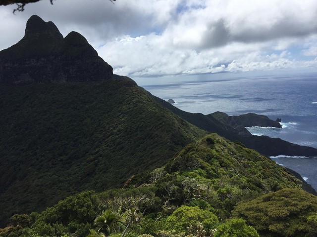
Walkers traverse over 12km across the mountain’s rugged terrain, encountering some of the island’s rarest plants and wildlife along the way.
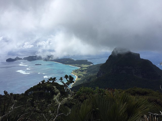
Standing atop Gower’s iconic peak, amongst its misty forest, walkers experience breathtaking 360° views of the island and its crystal blue waters.


Getting there:
First you have to get to Lord Howe Island! Direct flights are available from Sydney (most days) or Brisbane (weekends) and your accommodation on the island must be pre-booked, as only 400 visitors at any one time can be accommodated. You will need a week to fully enjoy what this wonderful paradise island has to offer. Or you could arrive by boat!
From then on, everything is by bike (or walk), which you hire from your accommodation.
From your accommodation head out towards Mt Gower to the end of Lagoon Road, where there are bike racks, you meet you guide(s) for the day and start the walk.
Maps:
Lord Howe Island Walking Tracks
Island maps are available from your accommodation or the Information Centre/Museum on Middle Beach Road.
Route/Trail notes:
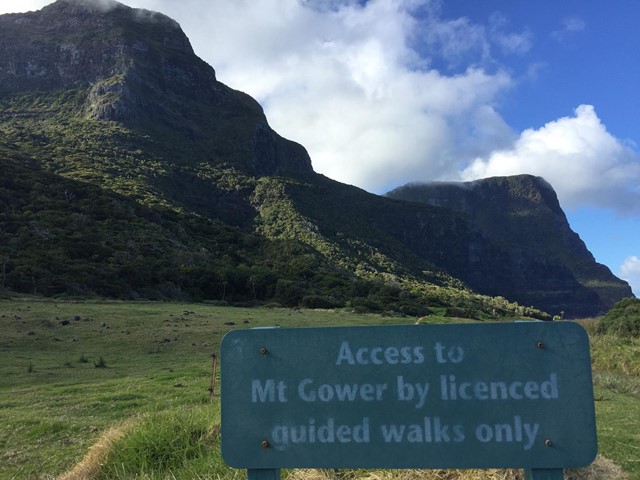
There is only one way up and one way down and as this is a guided trek, you follow the leader. All difficult sections include ropes and in some cases hardhats and your pace is governed by that of the slowest.
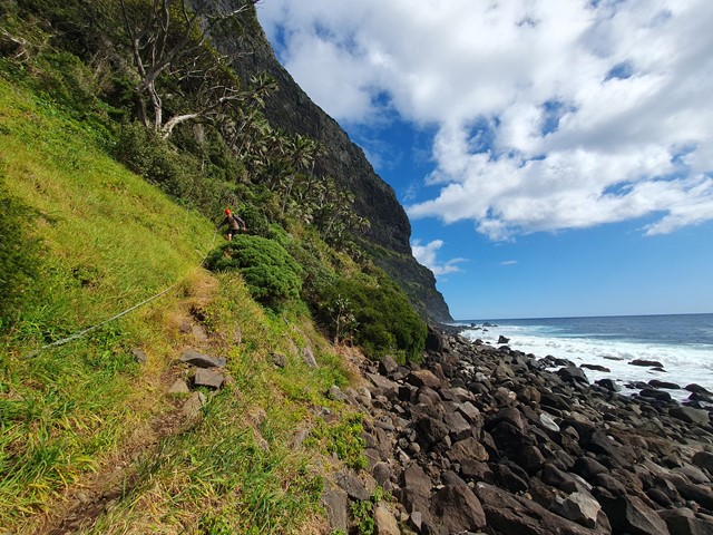
The walk starts from the end of the sealed section of Lagoon Road and follows the dirt road for about 1km to Little Island. 500m beyond this, the climb starts and within 100m you reach the cliff line.
The track travels along a ledge, which narrows into a grassy slope called Lower Road; an unnerving experience given the cliffs rise straight up on the one side and drops 100m to the sea on the other. Lower Road continues for 500m till you round the corner into Erskine Valley and after 1km of relatively flat terrain you reach Erskine Creek; your last source of water on the climb.
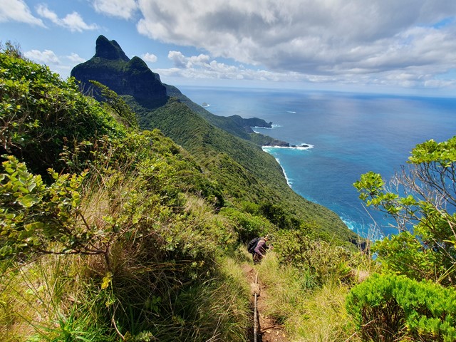
From here, you have a steep climb of 200m in less than 1km, which brings you out at the top of the valley on the saddle between Mt Gower and Mt Lidgbird, where you get your first spectacular views back up the island; you are now at 400m with another 450m to go and there is only about 1km to the top.
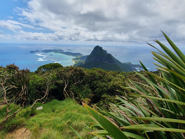
There is a lot of climbing/scrambling required over this last 1km, but there are ropes and plenty of handholds to help you. There are several great views including Ball's Pyramid (a 562m rocky peak jutting up out of the ocean 20km to the south east). The top of Mt Gower, know as a 'cloud forest' is often covered in cloud, but if you are lucky, you will be rewarded with those classic views of the rest of the island as you take a well earned rest and a bite to eat.
Return by the same route, which takes about 3hr but is relatively easy using the ropes.
Permits/Costs:
By guided tour only on Mondays and Thursdays (price $100 in 2020).
Enjoy a day with Jack Shick climbing Mt Gower, rated one of Australia's twenty best day walks. Jack is a 5th generation Islander and 3rd generation mountain guide, following in the footsteps of his Father and Grandfather. He is the most experienced guide on Lord Howe Island with more than 1,800 guided trips to the summit.
Other References/Comments:
Take a picnic and plenty of water, your binoculars, swimmers and a towel, as on this island, you are never too far from a beach to cool off on after your walk. Oh, and always have some bread to hand feed the fish.
Track notes for Mount Gower
 8 Mt Gower (GPX)
 12.3
12.3 8
8
Comments