
Menu

 1.5
km
return
1.5
km
return
 35
mins
35
mins
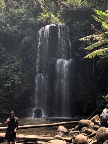
Melba Gully
A beautiful walk in the Otways, known as one of the wettest places in Victoria.
2.2
km
return
30
mins
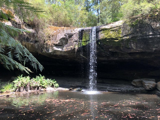
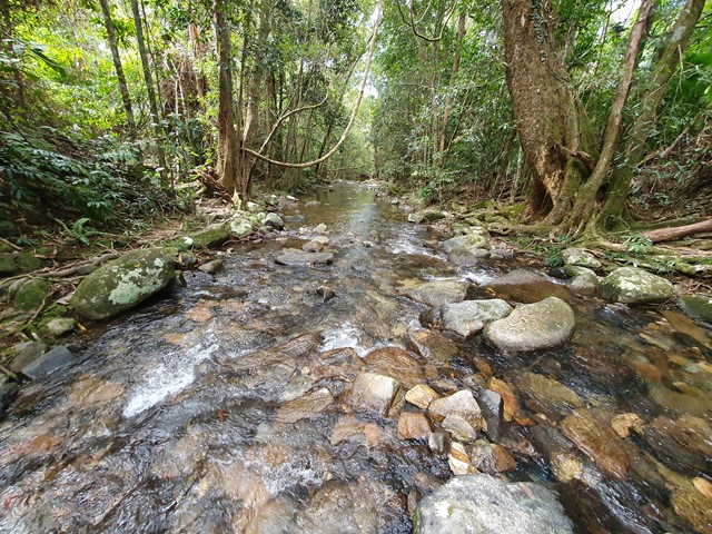
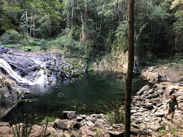
Lower Kalimna Falls
A walk near the Great Ocean Road that follows an old trolley way that was used for hauling timber many years ago. It takes you to a waterfall that falls over an overhang into a pool below.
 2
km
return
45
mins
2
km
return
45
mins
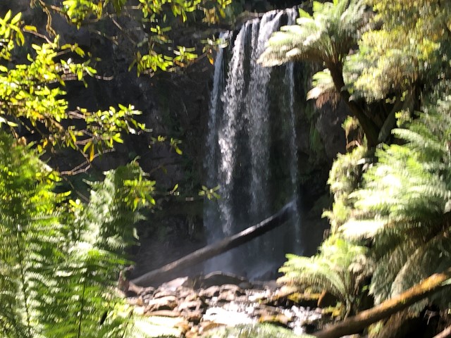
Hopetoun Falls
A very picturesque waterfall in Great Otway National Park.
 9.2
km
return
3
hrs
9.2
km
return
3
hrs
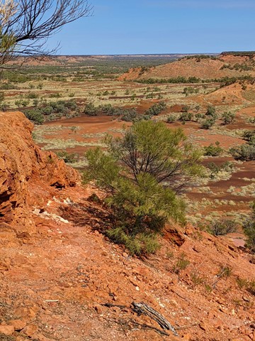
Bindegolly National Park
This is only a good walk when there's actually water in the Lake. The lake does dry up making for a sandy experience. When full with water it should be an amazing experience as it attracts various wildlife. Ideal for birdwatching with a bird viewing site 4.5 km from car park
400
m
return
15
mins
White Woman's Waterhole Walk
Grade 2, 15 minutes, 0.4km loop, formed Track with directional signage.
A short loop on a well formed track this walk makes its way around the unique waterhole from which the adjacent campsite takes its name.
 18
km
return
7
hrs
18
km
return
7
hrs
Northern Scenic Rim Trail to Mt Mistake Campsite Day walk
Explore the first part of the Scenic Rim Trail walk - a good workout and nice views
 10.6
km
return
8
hrs
10.6
km
return
8
hrs
Devils Thumb
A long, steep and tiring ascent up and over a mountain to get to the enormous granite rock feature that overlooks Port Douglas and beyond. Quite possibly the best lookout in North Queensland!!
 9.3
km
return
4
hrs
9.3
km
return
4
hrs
Saddle Mountain
A steep walk up to the top of Saddle Mountain where you will get great coastal views from the radar station that sits at its summit.
 8.3
km
return
3
hrs
8.3
km
return
3
hrs
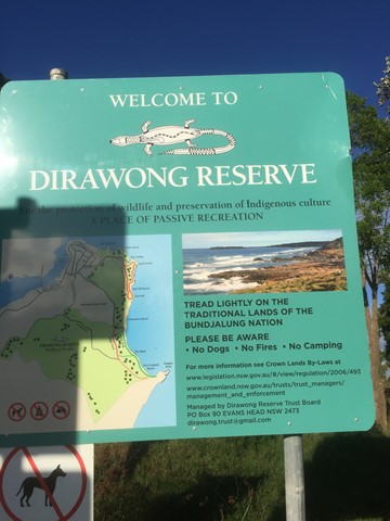
Snapper Point
A lovely easy walk in the Dirawong Reserve (Dirawong is the aborigine word for goanna) for all the family, with plenty of ‘rewards’ through low coastal scrub, along the coastal pathways, pebble and sandy beaches, swimming, rock pools and rock hops, to the great views from the headland
 6
km
return
2.5
hrs
6
km
return
2.5
hrs
The Pinnacle and Fairview Mountain via Valley Break
From the end of Austinville rd follow the 4wd track of Valley Break to Fairview Mountain and then turn left onto a at times overgrown single track till The Pinnacle (Springbrook Pinnacle) which is contoured around to the right where the route up becomes apparent (on the opposite side of the pinnacle as of that you approached (Southern side)). A scramble to the summit which offers 360 views.
 3.5
km
return
90
mins
3.5
km
return
90
mins
Lark Quarry Conservation Park
Most people come here for the Dinosaur Stampede exhibit, a unique preservation of footprints and multimedia presentation of how they may have come to be. Around the site are a couple of walks - the Spinifex circuit (500m, 30mins) and Jump-Up Loop (90mins, 3.5km) - that showcase the arid landscape around this area and are well-signposted with information cards to entertain the young and old and worthwhile either before or after viewing the Stampede. Do take a hat and water. The sun is cruel even in winter.
 12
km
return
6
hrs
12
km
return
6
hrs
Mt Huntley
A steep walk up one of the lesser climbed peaks on the Great Dividing Range. Though Mt Huntley is usually tackled when doing the Main Range traverse, this route allows you to directly hit the summit in a single day trip.
 3
km
return
1
hr
3
km
return
1
hr
East Lookout
Climb to a lookout at the base of Glen Rock. This walk provides great views down the valley carved by Blackfellow Creek and a good overview of Glen Rock Regional Park.
 17.8
km
return
6
hrs
17.8
km
return
6
hrs
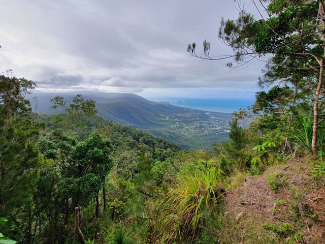
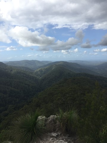
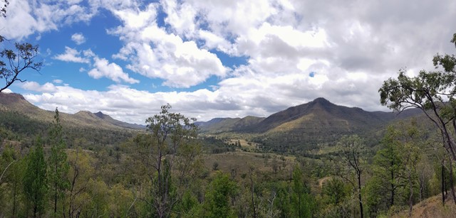
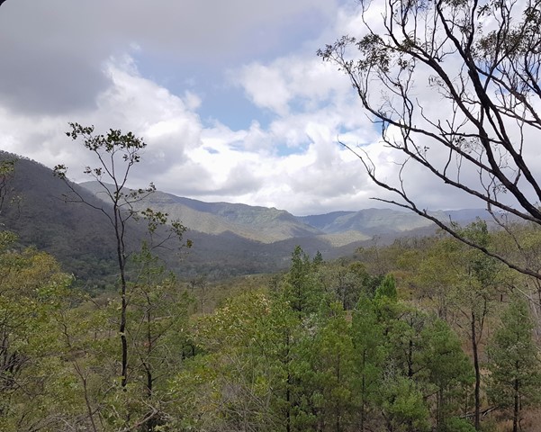
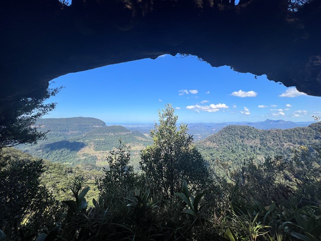
Araucaria Lookout
An awesome but seldom visited lookout offering near 360 degree views along the Numinbah Valley.
Araucaria Lookout is named after the hoop pines Araucaria cunninghamii, which can be viewed from the lookout. These hoop pine communities are a living representative of the Jurassic Age (the age of the conifers) of about 180 million years ago.
At 18km return it's a long walk but on graded tracks so there are no navigational issues or bush bashing to worry about. There are a few ups and downs to contend with but nothing really steep or nasty. Allow 5-6 hours at a steady pace including time to enjoy the views.
 5
km
return
4
hrs
5
km
return
4
hrs
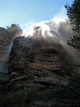
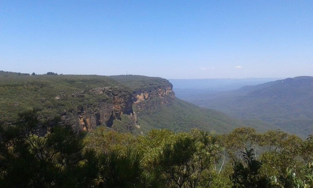
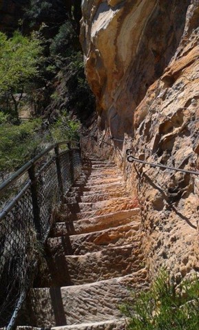
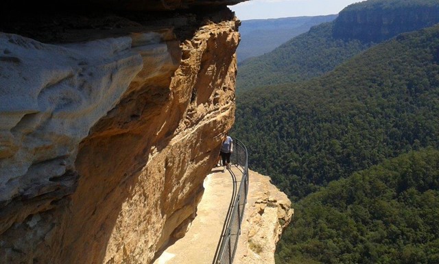
National Pass, Overcliff and Den Fenella Circuit
This grand tour of the Wentworth Falls area explores many waterfalls, lookouts and cliff edges. The walk has a lot of steps and runs beside fenced cliff edges, so walkers will need to be fit and comfortable with heights. The walk explores the historic National Pass, Wentworth falls, the Valley of the Waters and many other highlights. There is an optional side trip to the Conservation Hut for lunch, before returning to the start via the Overcliff walk and Den Fennella. A great way to explore the majestic views.
** NATIONAL PASS CLOSED FROM 2017 UNTIL FURTHER NOTICE - check NPWS for latest info **
 2
km
return
2
hrs
2
km
return
2
hrs
Table Top Loop
Table Top mountain on the edge of Toowoomba, provides views of the Lockyer Valley and surround. The climb itself can be quite demanding with a lot of large steps over the Camel's Hump and a scramble just before the summit. But the reward at the top, with a circuit all the way around, provides a spectacular vista.
Table Top is an area of high significance to the Traditional Owners, recognised in the Aboriginal Cultural Heritage Register and protected under the Aboriginal Cultural Heritage Act 2003. You are respectfully requested to consider your decision to climb this mountain.
 5.7
km
return
105
mins
5.7
km
return
105
mins
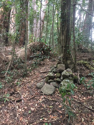
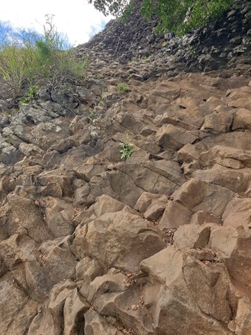
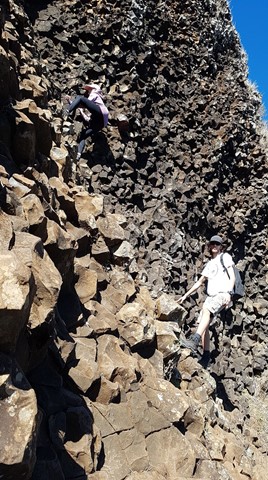
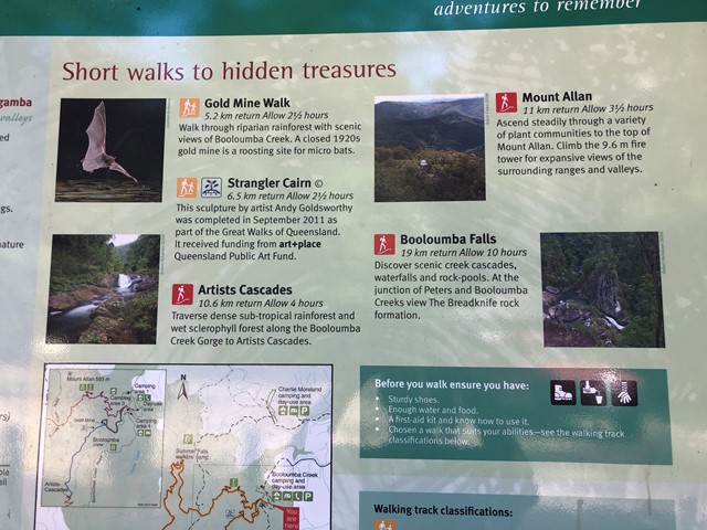
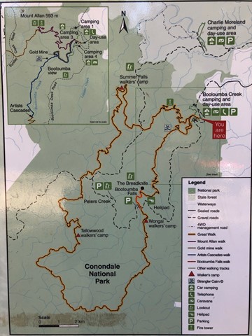
Strangler Cairn
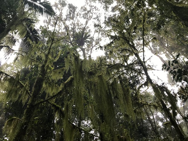
The Strangler Cairn was made by world renounced artist Andy Goldsworthy. It is composed of granite blocks shaped together with a strangler fig planted in the top. Over time the roots of the fig should grow down over the cairn. The walk is consists of a short side track off the Conondale Great Walk which is between the Gold Mine track and the Artists Cascades. The main track is through sub-tropical rainforest and wet sclerophyll forest.