
Frenchmans Cap
Franklin-Gordon Wild Rivers National Park


Menu
A brilliant walk through some characteristic Tasmanian wilderness. Well-defined, well-maintained tracks, as well as scrambling and cairns at the summit. Breathtaking views, a variety of ecosystems, and comfortable trail huts. Well worth the walk!

Getting there
The start of the track is located along the Lyell Highway (A10) within the Wild Rivers National Park. The start is signposted beside the Lyell Highway about 200 km from Hobart and 55 km from Queenstown.
Private vehicles may be parked in the carpark beside the highway at the start of the track. Walkers are warned, however, that some vehicles parked beside the highway have been robbed or vandalised. An alternative is to park your car at Lake St Clair and arrange transport with a commercial operator to the start of the track.
Visitors wishing to use public transport to access the start of the walking track should visit our web page on Access to Tasmania's National Parks, Reserves and Walking Tracks.
Maps
The 1:50,000 scale map called 'Frenchmans Cap Map And Notes' is recommended for this walk. It shows the track, huts, plus walking notes and safety information on the reverse. You can get the map from outdoor gear shops, and online at TASMAP.
Route/Trail notes
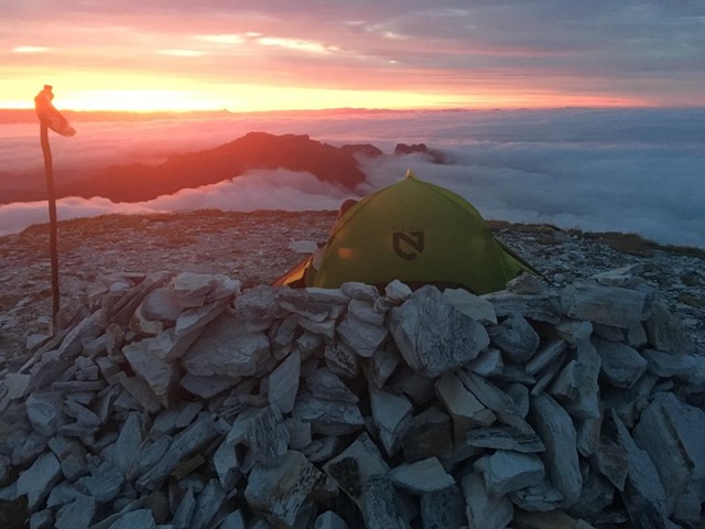
This track leads to the summit of the magnificent white quartzite dome of Frenchmans Cap (1446 m), the most prominent mountain peak in the Franklin-Gordon Wild Rivers National Park, a part of the Tasmanian Wilderness World Heritage Area. The track passes buttongrass plains, unusual rainforest where Huon pine grows alongside King Billy pine, and spectacular glacial valleys, up to Lake Tahune, perched under the huge and spectacular cliff face of Frenchmans Cap. The silvery Precambrian quartzite is some of Australia’s oldest exposed rock.
The track is considerably more arduous than many other Tasmanian walks, including the Overland Track, so it is recommended that you gain experience on other Tasmanian walking tracks before attempting Frenchmans Cap. The track is often rough and muddy and is steep in places. To do the summit climb you must have good weather and a good head for heights and exposure. Most walkers spend between 3 and 5 days completing the return trip, a distance of about 23 km each way. You may want to allow extra time to wait at Tahune in case the summit is cloudy, as the views from the summit are a highlight of the trip. Allow extra time for adverse weather.
Permits/Costs
You are required to pay a fee to enter the national park. Updated information on park entry fees can be obtained online - see our price list. Bookings are not required to do the Frenchmans Cap Track, and no other permits are required.
Other References
Information gathered from the Local Parks website: http://www.parks.tas.gov.au/?base=2255
Books by John Chapman (e.g. South west Tasmania)
GPS Tracks
- No GPS available for this walk yet.
 23
23 4
4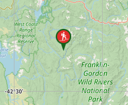
Comments
Nobody has commented on this walk yet. If you've done it then tick it off and add a comment.