
Menu

 4.2
km
return
4.2
km
return
 2
hrs
2
hrs
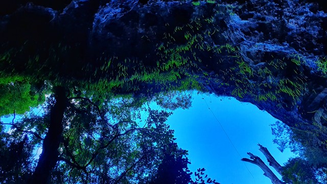
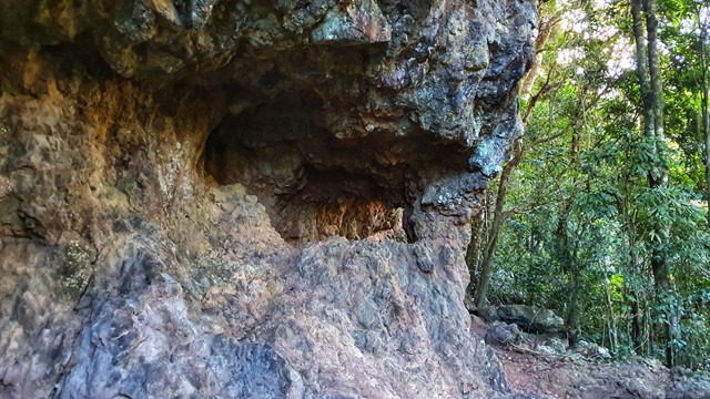
Bushrangers Cave
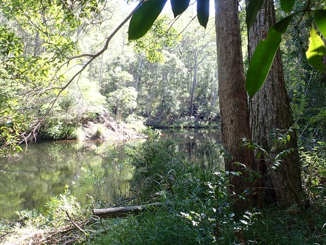
An off-track walk from the border gate to Bushrangers Caves, which used to be an aboriginal camp. The adventurous can head on up Mt Wagawn to join up with the main Lamington track system.
 2.3
km
return
1
hr
2.3
km
return
1
hr
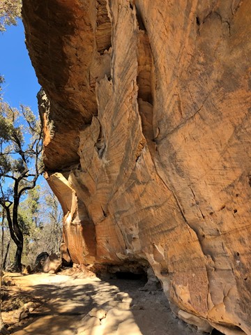
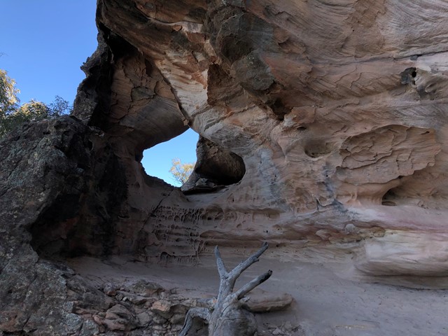
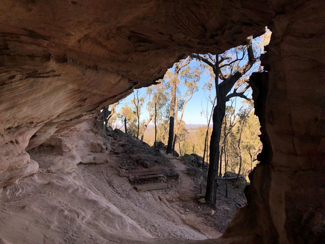
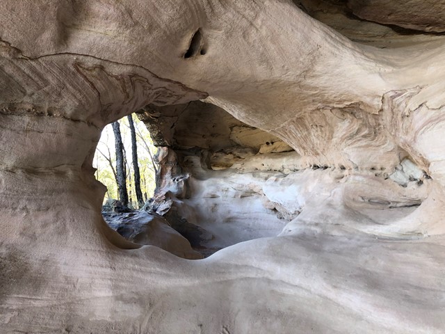
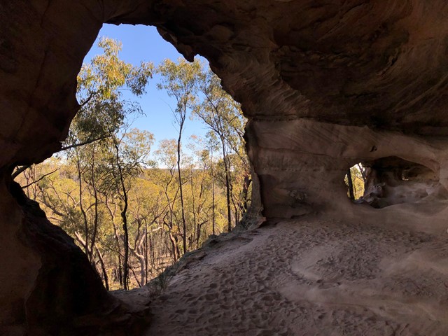
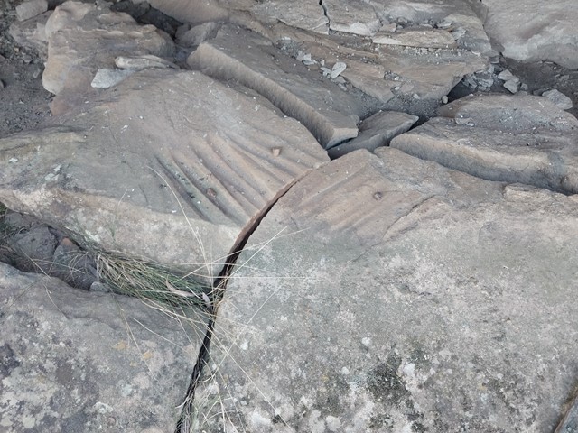
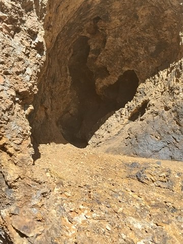
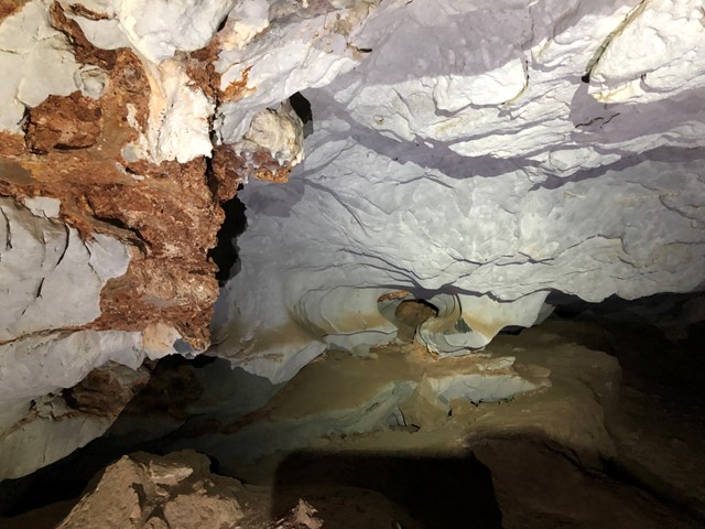
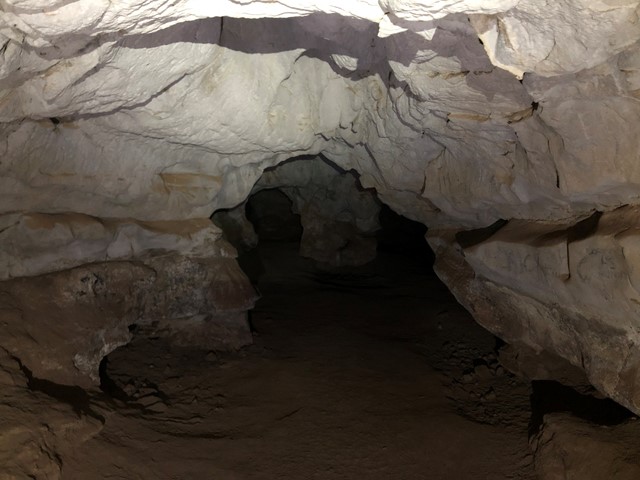
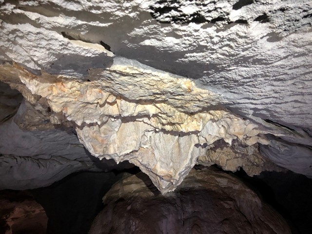
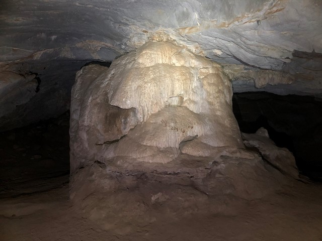
Sandstone Caves
Situated around a large sandstone outcrop, the Sandstone Caves are a series of cathedral type caves and overhangs displaying an array of interesting colours and shapes. They have been formed over tens of thousands of years through the weathering of the fragile sandstone.
The Sandstone Caves are an Aboriginal site for the local Gamilaraay people. Grinding grooves, rock art and other Aboriginal sites provide a strong link with their traditional times.
 13
km
return
6
hrs
13
km
return
6
hrs
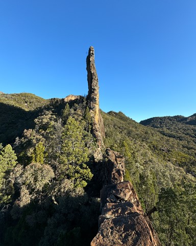
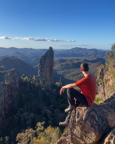
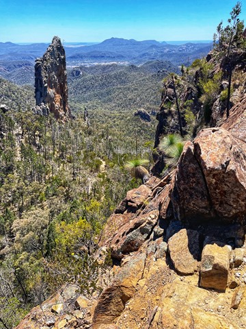
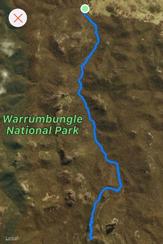
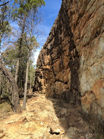
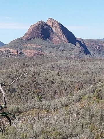
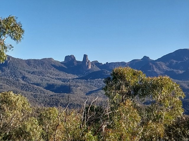
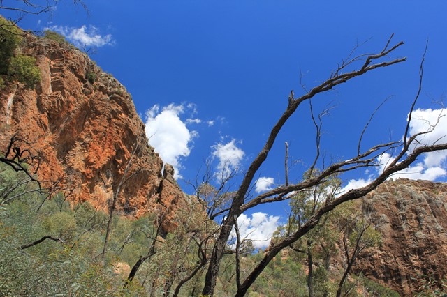
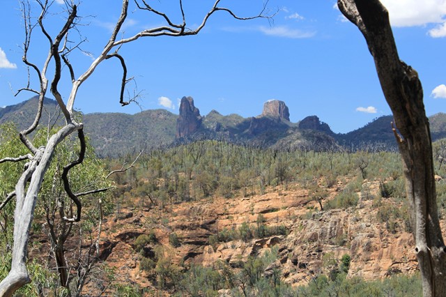
Breadknife and Grand High Tops Circuit
Breadknife and Grand High Tops Circuit in Warrumbungle National Park is regarded as one of the best walks in New South Wales, offering close up views of the park’s iconic rock formations.
 2.5
km
return
90
mins
2.5
km
return
90
mins
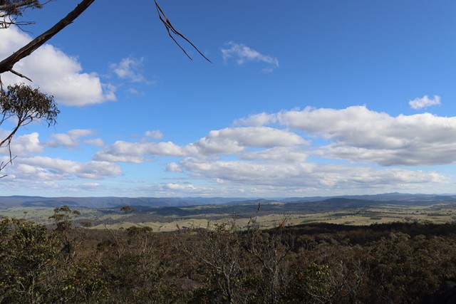
Stephens Peak
Stephens Peak has 360 views of the region. It is more the local alternative to Mt Tamoree which is more touristy
 4
km
return
90
mins
4
km
return
90
mins
Tara Cave
Tara Cave walking track is ideal for bushwalkers interested in the area’s Aboriginal culture. The track leads to Tara Cave, which has evidence of Aboriginal occupation and along the way there are interpretive displays about the local Aboriginal people’s connection with the land.
Until recently, Aboriginal people used caves in the area for shelter. Tara Cave was also used for manufacturing stone tools, and you can see a stone slab with ‘grinding grooves’ at the cave entrance.
 1.25
km
return
30
mins
1.25
km
return
30
mins
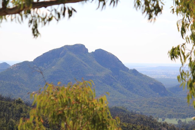
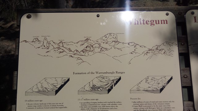
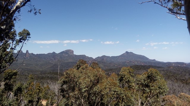
Whitegum Lookout
Spectacular views of the volcanic landscape of Warrumbungle National Park await you at Whitegum Lookout. It provides you with a perspective of the many other walks and climbs that the National Park has to offer.
 4.6
km
return
3.5
hrs
4.6
km
return
3.5
hrs
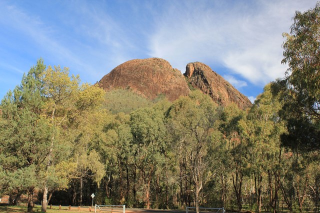
Belougery Split Rock
A medium length tracks with some fun scrambling and fantastic views across to the Warrumbungles major features including the Breadknife, Grand High Tops, Belougery Spire and Siding Spring Observatory. The rock is a lava dome formed by viscous lava. This is a great half-day walk as an introduction to the Warrumbungles or if you have limited time.
 18
km
2
days
18
km
2
days
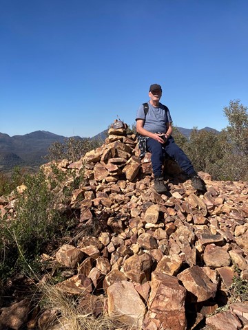
Spicers Peak West
We have ventured to this part a couple of times now and still find it a challenge worth doing.
Nothing massively hard in the climb to the top except when we last did the climb and indeed every time before that we were carrying way too much weight.
We followed the old track up from Governors Chair lookout for about 3.5km until seeing a clearing on the left hand side of the road.
From there we left the road to find the bigger of the the spurs that lead to the main ridge. The climb up the spur did get a bit steep towards the ridge and was quite soft dirt under foot so takes a bit of time to get through. We like to do things the hard way ...(:
Once on the ridge the route does get a bit easier for a while with a gental climb for a couple of hundred meters.
From there it gets steeper and rockier with some minor obstacles and scrambling.
Camping before reaching the overgrown part on a grassy outcrop, we have an awesome view of the Darling Downs district and the sun set.
As much as like new places, this mountain keeps me coming back for more.
Maybe it's because it's not as popular as other walks near by.
5.6
km
return
4
hrs
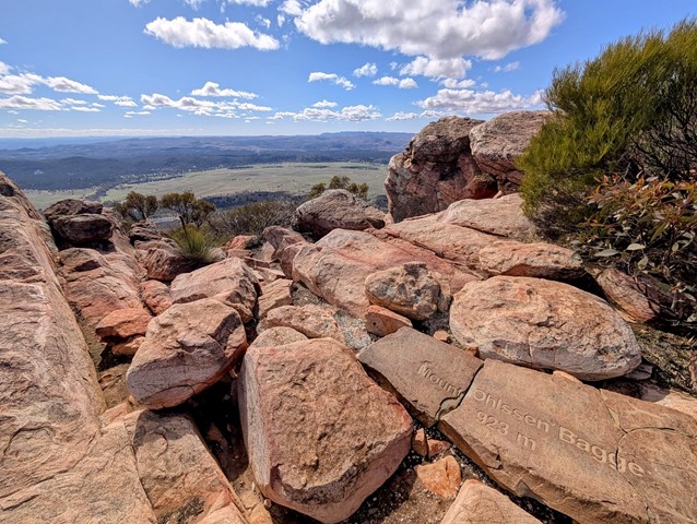
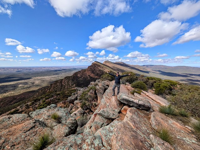
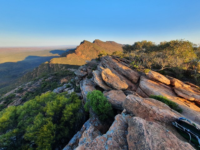
Mt Ohlssen Bagge
A quick steep ascent up Mt Ohlssen Bagge which has amazing views of the Flinders Ranges especially during sunset and sunrise.
 8.9
km
return
4
hrs
8.9
km
return
4
hrs
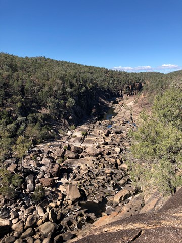
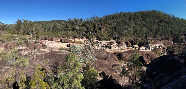
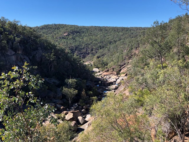
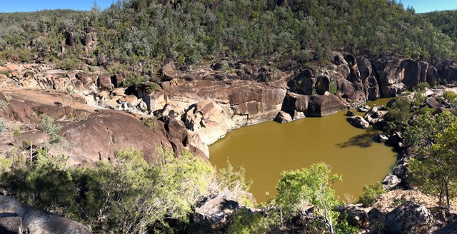
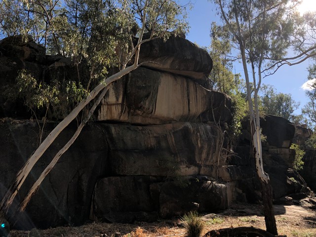
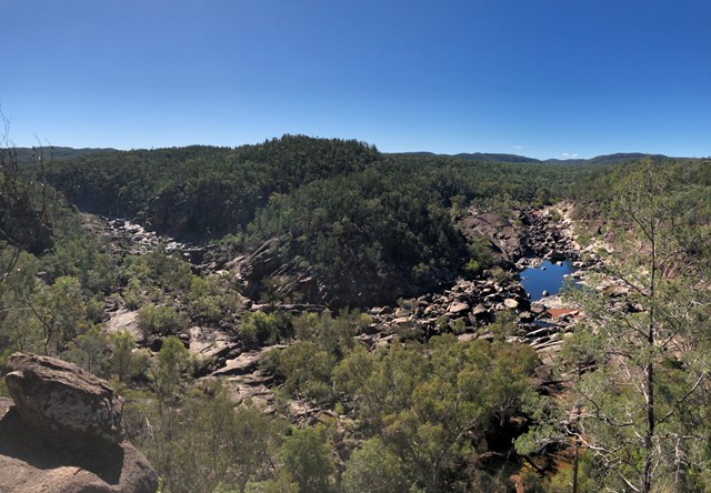
Alligator Gorge Ring Route Hike
A circuit hike along the full length of Alligator Gorge, including the Narrows and the Terraces. Explore the gorge during Spring to see abundant wildflowers.
The Narrows is a gorge a couple of metres wide which stretches for several hundred metres. The Terraces are a series of platforms which the creek flows down.
Walking anti-clockwise, when you leave the gorge and reach the Ring Route Track, you could undertake a short sidetrip by turning right and heading up the firetrack to The Battery for spectacular views over the Spencer Gulf.
10.6
km
return
5
hrs
Dutchmans Stern Hike
Hike the prominent landmark bluff known as the Dutchmans Stern. Home to a host of plants and animals, explore the rugged landscape. Make your way to the summit via the walking trail. The summit offers spectacular views of Spencer Gulf, surrounding ranges and the Willochra Plain. Choice of two walks: 10.6km circuit walk, 5 hours 4.2km one-way to Summit Viewpoint, allow 2 hours (4 hours return) Follow the interpretive guide & map, featuring plants, animals and geology found along the trail. The guide was produced by the Walking Trails Support Group, in conjunction with the Royal Geographic Society of SA. The trail is well made, with gentle grades, and some rocky, but not steep, sections.
2.4
km
return
3
hrs
Devil's Peak Trail
This climb is an awesome one, when you get to the top, you get an awesome view especially at sun set!
The Devil’s Peak trail is a moderately difficult bushwalk becoming increasingly strenuous towards the summit, where some scrambling over rocks is required. Allow 1.5 to 3 hours to complete this walk.
From the summit you will be rewarded with extensive panoramic views of Quorn, the Southern Flinders Ranges, the Horseshoe Range, Pichi Richi Pass, Port August, Upper Spencer Gulf and beyond to Wilpena Pound.
Devil’s Peak is 697m high, and along this walk you may observe many good examples of “faulting”, discover fossil impressions of ancient lifeforms, and see a variety of native fauna and flora.
 22
km
6
hrs
22
km
6
hrs
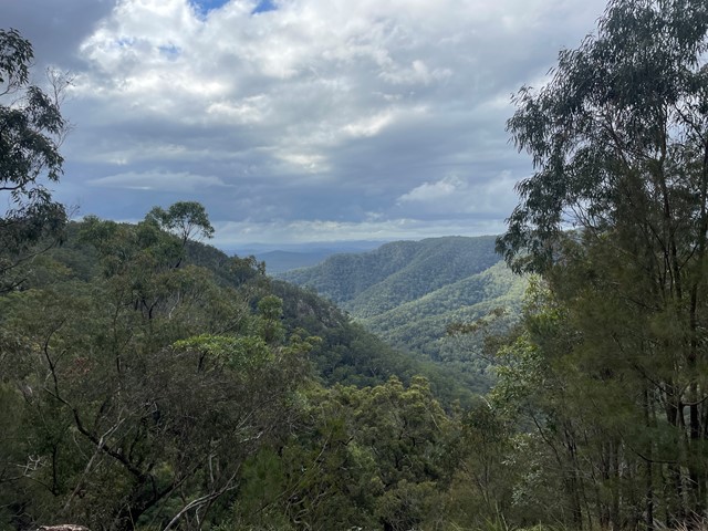
Gheerulla Valley Circuit
A pleasant day walk in the spectacular Gheerulla Valley including some steep sections from the river up and some great lookouts at the top.
 500
m
return
30
mins
500
m
return
30
mins
Limestone Caves
THIS WALK IS CURRENTLY CLOSED (MAY 2023). CHECK NATIONAL PARK'S WEBSITE FOR UPDATES.
Explore the Limestone Caves located in Kwiambal National Park.
 4
km
return
2
hrs
4
km
return
2
hrs
Slippery Rock Walking Track
THIS WALK IS CURRENTLY (MAY 2023) DUE TO FLOOD DAMAGE. CHECK NATIONAL PARK'S WEBSITE FOR UPDATES.
Slippery Rock walking track is in Kwiambal National Park near Inverell This walk offers gorge views of the Macintyre River.
As this walk starts at the Macintyre Falls Picnic Area the falls are a short walk from the carpark, which can be added onto this walk.
 7
km
return
2
hrs
7
km
return
2
hrs
Junction Walk
THIS WALK IS CURRENTLY CLOSED (MAY 2023) DUE TO FLOOD DAMAGE. CHECK NATIONAL PARK'S WEBSITE FOR UPDATES.
The Junction walk in Kwiambal National Park goes to the junction of the Severn and Macintyre Rivers and along the way passes via The Dungeon Lookout which is steep gorge formation.
 900
m
return
45
mins
900
m
return
45
mins
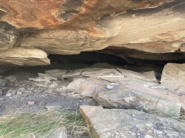
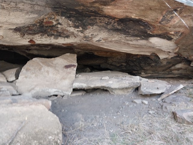
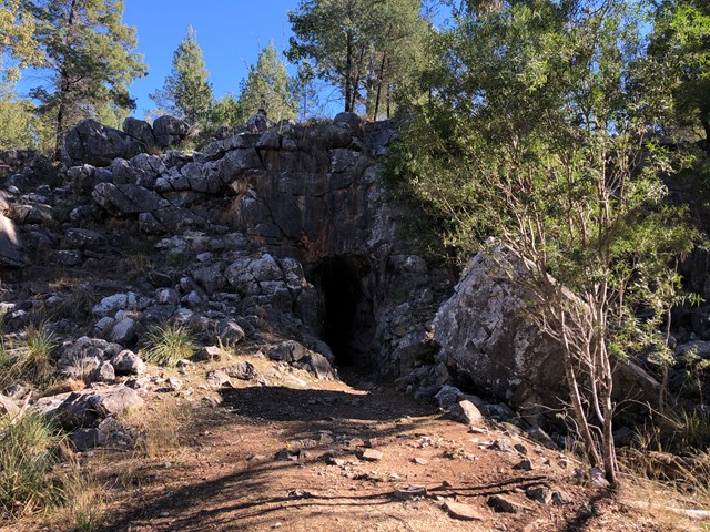
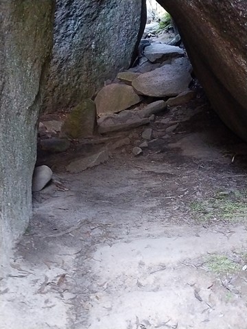
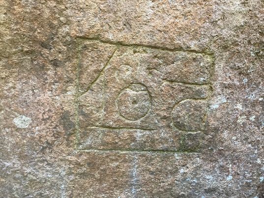
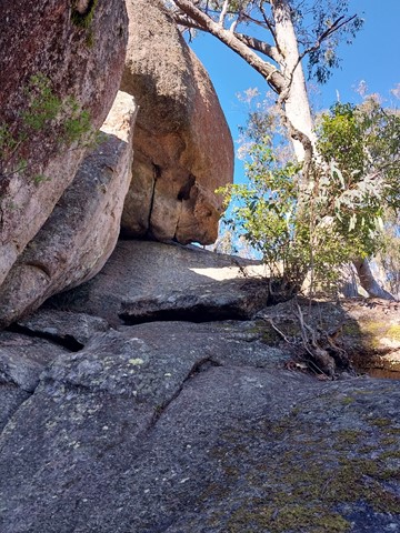
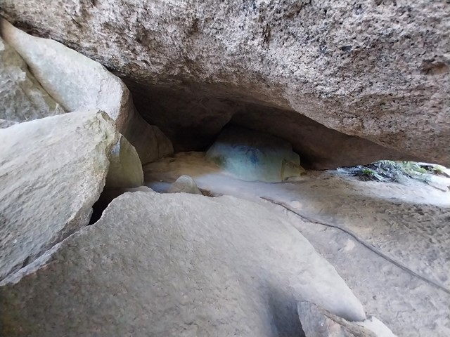
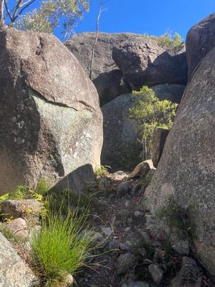
Thunderbolts Hideout
Fred Ward (1835 - 1870), better known as Captain Thunderbolt, was the longest roaming bushranger in Australia’s history. He was very familiar with the Tenterfield region, using it as both a hideout and hunting ground for his hold-ups. The large area between the rocks was used to stable horses and the small shelter under the large rock was a great place to camp. The top of the rock made an ideal lookout, as this was the main road to Warwick during the gold-mining days.
 300
m
return
1
hr
300
m
return
1
hr
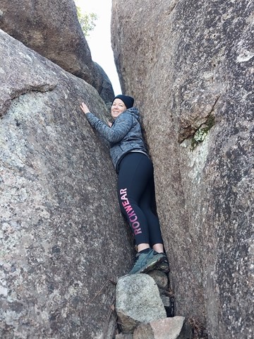
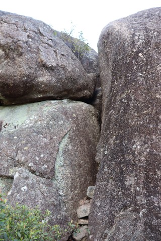
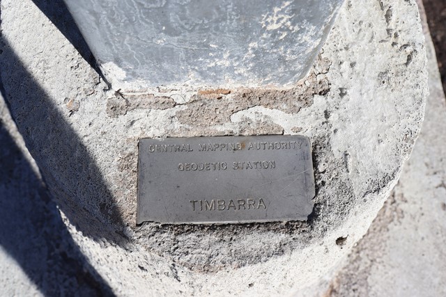
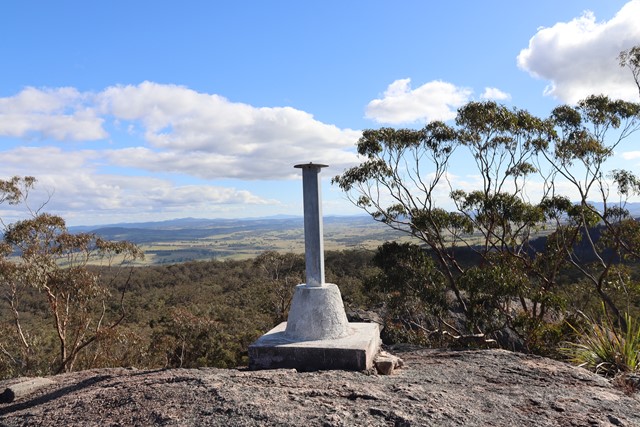
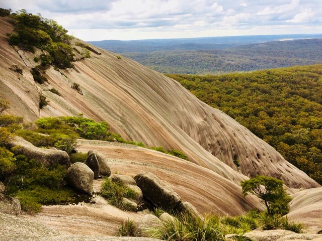
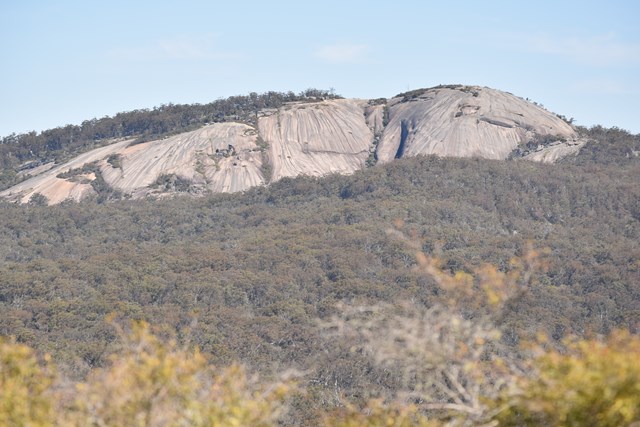
Timbarra Lookout
An outcrop of granite rocks near the southern edge of the Basket Swamp National Park. An easy 100-metre walk trail brings you to the base of this trig point which is high on the tallest rock in this outcrop though to get to the trig on top of the rock requires a hard climb up a very narrow crevasse. 180 degree views across farmlands and the Bruxner Highway and as far as Tenterfield can be seen from the rock.
 1.1
km
return
75
mins
1.1
km
return
75
mins
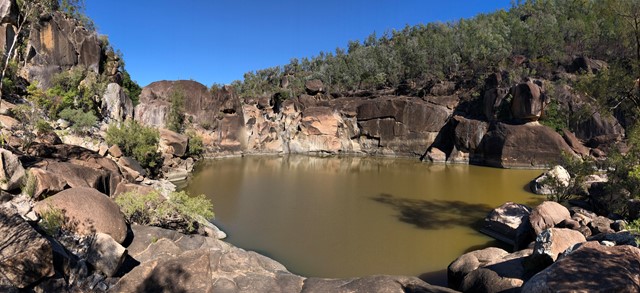
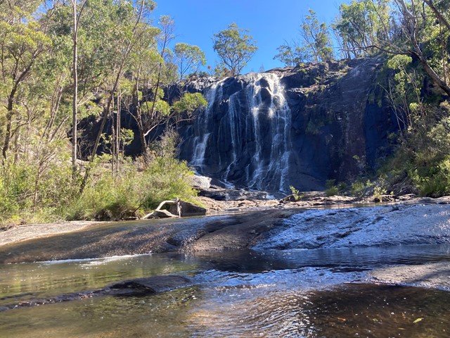
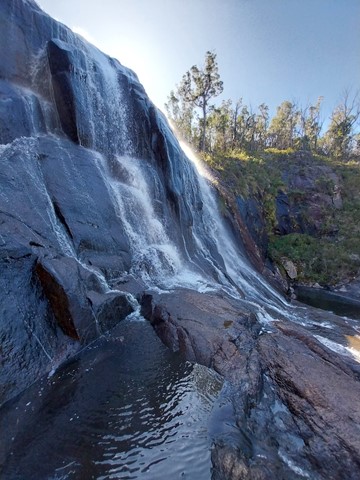
Basket Swamp Falls
Well worth the effort to visit this stunning multi-faceted waterfall situated in Basket Swamp National Park; the little sibling to Bald Rock and Boonoo Boonoo. There is a slippery fire trail where you can walk down to view the lower pools and rock hop back under the falls.
 14.2
km
return
3.5
hrs
14.2
km
return
3.5
hrs
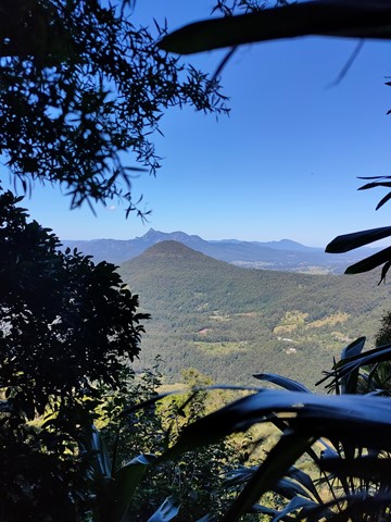
Border Walk Loop
Easy walk along the New South Wales and Queensland border.