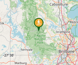
Love Creek Falls

D'Aguilar National Park

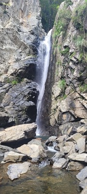
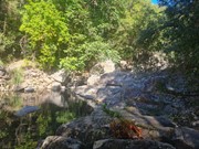
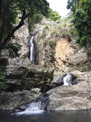
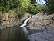
Rock hop up Cedar Creek past Cedar Falls and take the right turn onto Love Creek then follow it to Love Creek Falls.

Waterfalls
Swimming
Scrambling or Climbing
410m
Maximum Elevation
203m
Total Climb

Getting there

How do you get to the start of the walk?

The end of Cedar Creek Road.

Maps

Which maps cover the area?

Maps of D'Aguilar National Park.

Route/Trail notes

A detailed description of the walk!

Rock hop up Cedar Creek past Cedar Creek Falls and take the right turn onto Love Creek and follow it to Love Creek Falls.

Permits/Costs

Do you need any permits? What's the cost?

Free

Other References

How can I find more info? Any guide books?

GPS Tracks

  • No GPS available for this walk yet.

Comments

Constant rock hopping require good knees. Efforts are rewarded.

Wanderlust on 16 Jun, 2024

Hiked this today. Found it hard going lots of rock hopping and scrambling along bush tracks. We found it slow picking the easiest and safest way to place our feet. Very slippery in places especially the last 200 metres or so to get right up to the falls. Definitely need good footwear for this one. Lots of amazing waterfalls and waterholes to cool off in. My Garmin recorded it at 12.05 klm and we spent 6.5 hours on the track. Not sure where the 4.9 klm comes from that some guides are saying. Really nice walking creekside all day.

ian parker on 16 Mar, 2024

Such a beautiful place. We had a 3 year old with us in a carrier and some assisted scrambling so we're a bit slower. Took us about 4 hours. Need to focus on your footing a lot as it's pretty much all rock walking, particularly after the turn off up Love Creek.

Natalie Taylor on 13 Aug, 2023

Where

Click here to load this map.

Nearby Walks

Done this walk?

This walk has been ticked 15 times

Aussie Bushwalking can keep track of your bushwalks.

Login/signup to tick this walk off.

Tick walks to keep track of where you've been. You must Login to tick walks. Accounts are 100% free so sign up if you don't have one.