
Menu

 800
m
return
800
m
return
 30
mins
30
mins
Timberyard Point Loop at Lakeside Domain - Lake Ellesmere
A short loop around the edges of Timberyard Point which juts out into Lake Ellesmere.
 1
km
return
30
mins
1
km
return
30
mins
Dobson Peak (Mount Dobson)
From the top of the Fairlie Ridge T-Bar at Mount Dobson Ski Field hike up the ridge to the top of Dobson Peak (2095m) in the Two Thumb Range.
2.3
km
return
1
hr
Oamaru Lookout Point Walk
A short loop out on Cape Wanbrow with access down to the beach and old fortification buildings. Watchout for mountain bikes on the mountain bike trails at track junctions.
1
km
return
30
mins
Moeraki Boulders Trail Loop
A short loop using the beach & forest trail to see the famous Moeraki Boulders.
8
km
return
3
hrs
Mihiwaka, Mt Kettle & Mt Cutten via Blueskin Road
A section of bush with a reservoir surrounded by three peaks.
3.4
km
one-way
2
hrs
Mt Cargill, Buttars Peak, Mt Holmes & the Organ Pipes
A oneway track as the walk can be done as a through walk / point to point but if doing as return then tick the walk twice and it will be ~6.6kms. From the carpark ascend to the organ pipes formation which you can scale to reach the summit of Mt Holmes then continue to Buttars Peak which is best ascended from the saddle between it and Mt Cargill. Finally summit Mt Cargill to finish your walk if you are doing it return then congratulations you have reached half way although the vast majority of the uphill will be done.
5.4
km
return
2
hrs
Milford Foreshore Walk & Lookout
From the freeparking on Deepwater Basin Road follow the trail past the airstrip to the ferry terminal make your way out onto the breakwater and then return via the lookout behind the small workers township & via the foreshore walk loop.
200
m
return
10
mins
Tūtoko Suspension Bridge
A short walk with information boards over the Tūtoko Suspension Bridge & back.
400
m
return
20
mins
The Chasm Walk
A short walk that loops over the chasm though the loop section can be closed due to damage.
400
m
return
10
mins
Mirror Lakes Walk
A short board walk along the reflective Mirror Lakes in Fiordland National Park.
300
m
return
20
mins
Eglington Valley Walk
Also known as the Mackay Creek Walk it is a short walk along the valley floor with some information boards to a view over the creek.
500
m
return
20
mins
Wilderness Lookout Walk
A short walk to a viewpoint of the Takitimu Mountains with interesting vegetation & informational signage.
6.2
km
return
2
hrs
Queenstown Hill Walkway
From the edge of Queenstown follow the Queenstown Hill Time Walk trail up through the forest past information boards and a statue to this popular viewpoint over Queenstown.
1.4
km
return
30
mins
Ayrburn Waterfall Walk
A short walk from the Ayrburn entertainment & eatery complex to a waterfall.
200
m
return
10
mins
Crown Range Saddle
A short walk from the Crown Saddle (1076m) which is where the Crown Range Road reaches its highest point & this is the highest sealed road in New Zealand. From the pullover read the information & monuments & make your way to the gate where longer trails can be undertaken.
1.4
km
return
45
mins
That Wānaka Tree Walk
A short walk along the Lakeside Shared Path or along the lakeside itself to the famous tree. This route can be shorter or longer depending where you start along the lake shore.
2.9
km
return
1
hr
Tasman Lake
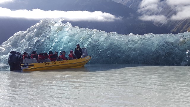
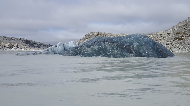
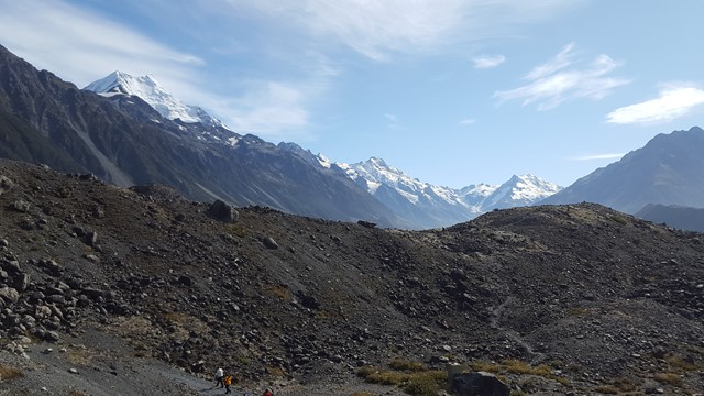
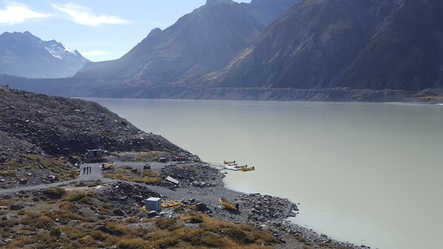
Icebergs can usually be seen floating in the lake in summer and in winter, the lake freezes over. The track leads through the old terminal moraines of the glacier to the lakeside boat ramp and you can see good examples of plant succession along the route. Tasman Lake is a relatively recent addition to the scene, starting its formation in 1974 and growing steadily since then. The large terminal moraines mark the foot of the Tasman Glacier at the time of the lake’s formation and are a sobering reminder of the glacier’s retreat. Can also take the side trail to the Tasman River outlet from the lake.
 1.5
km
return
1
hr
1.5
km
return
1
hr
Tasman Glacier View Track
A short walk in the Aoraki / Mount Cook National Park to the Tasman Glacier Viewpoint on the moraine wall. Overlooks the Tasman Lake & the remains of the glacier in the distance also includes a short detour to the first of the Blue Lakes before the path gets overtaken by bushes.
1
km
return
30
mins
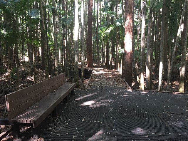
Piccabeen Walk
Wander along this trail to discover D’Aguilar National Park’s oldest trees—Sydney blue gums—and lush groves of piccabeen palms.