
Menu

 1.3
km
return
1.3
km
return
 30
mins
30
mins
Mt Dowe
This is just a quick walk up the road to the top of Mt Dowe, which is occupied by a communications station.
 6
km
return
4
hrs
6
km
return
4
hrs
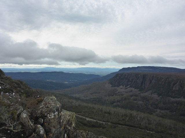
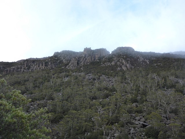
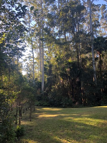
Quamby Bluff
The walk starts in farmland, then passes through vegetation ranging from eucalypt forest to rainforest before finally ending up in open high altitude scrub. This involves scrambling over boulders again but it's not really that steep.Track can be at times tricky to follow so take note of pink ribbons and red markers ( yellow markers on descend )
 8.5
km
return
2
hrs
8.5
km
return
2
hrs
Projection Bluff
Short steep rough track ( little track to speak of really ) that will give you great views from the Lake Hwy about 30km (approx ) from Deloriane
 4.5
km
return
3
hrs
4.5
km
return
3
hrs
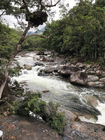
Ironstone Mountain
Challenging track with steep sections , scrambling over boulders and crossing the Western Creek waterfall makes for a very fun hike. Do NOT attempt this one if you are unfit, inexperienced or ill-prepared. This is for the more serious of hikers/walkers.
 20
km
return
5
hrs
20
km
return
5
hrs
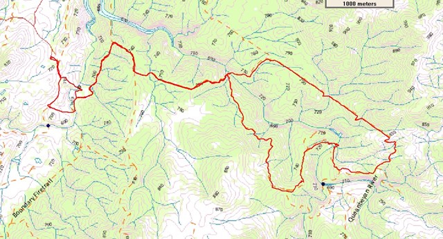
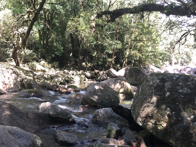
Queanbeyan River Loop Walk
A 20km walk at the southern end of Googong Dam, near Queanbeyan NSW. There are 2 options, one is to walk to Flynns Crossing and back or take the cycling route and turn the end of the walk into a slightly longer loop. An excellent walk through dry forest with a couple of river crossings to test out your boots and finding a way around one too deep to walk. Good walk for training purposes as there are regular climbs, steep and short and long and not so steep.
 2
km
return
45
mins
2
km
return
45
mins
Keppel Falls
Another short walk on the Lady Talbot Drive section of Yarra Ranges. See Keppel Falls on the Taggerty River and stop off up the road at Keppel Falls Lookout for a view of the Taggerty River Valley including the falls.
1.6
km
return
45
mins
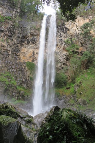
Phantom Falls
A short steep walk through a moist fern gully leads to a wonderful view of these falls. Spring is the best time as the melting snow brings the falls to life.
4
km
return
2
hrs
Beeches Rainforest Walk
Magnificent trees, cascades and a meeting of rivers - the Beeches Rainforest Walk is a beautiful walk on Lady Talbot Drive. It includes the Taggerty Cascades and groves of Myrtle Beech trees (Nothofagus cunninghamii) including many trees over 300 years old.
2.4
km
return
45
mins
Sherbrooke Falls
Pleasant walk through ferns and majestic Mountain Ash to Sherbrooke Falls. Falls are best after rain.
5.4
km
return
2.5
hrs
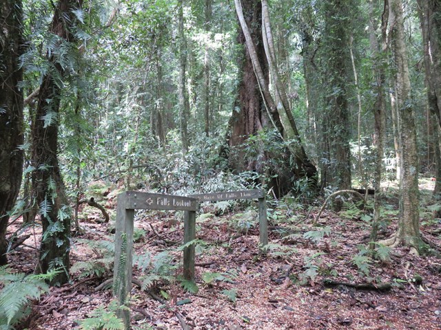
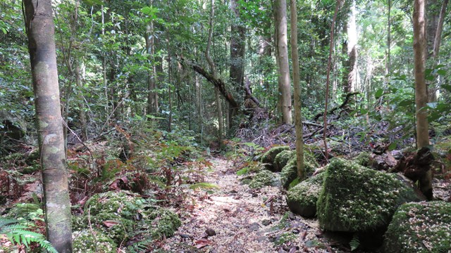
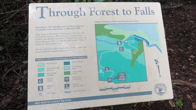
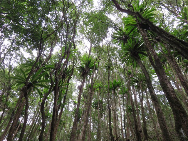
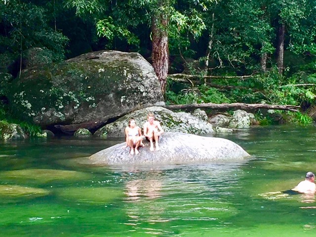
Rawson Falls Walk
A trip to the 40m high waterfall, with a relaxed lunch at the picnic area and a refreshing dip at the bottom of the falls makes for a perfect day trip. The track is even signposted along the way with interesting facts about the rainforest and its history. The time is a rough guide, you could spend hours at the bottom in good weather.
 3.5
km
return
2
hrs
3.5
km
return
2
hrs
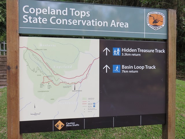
Hidden Treasure Track
An interesting walk through dry rainforest telling the story of gold mining in the area, and taking you to some relics from the past.
 7
km
return
7
km
return
Basin Loop Track
This track is an extension of the Hidden Treasure track, if you would like a more strenuous, longer walk.
 2.6
km
return
1
hr
2.6
km
return
1
hr
Monument Hill + Powder Magazine Tracks
Starting at the historic Trial Bay Gaol and featuring stunning coastal views, the Monument Hill walk takes in the monument built for German gaol internees before finishing at Little Bay picnic area. You can turn it into a 2.6km loop by then linking with Bridle trail and returning on Powder Magazine trail. There's also a much longer walk that continues on from Little Bay all the way to Smoky Cape lighthouse that is 10km one way.
 6
km
return
90
mins
6
km
return
90
mins
Grants Beach Coastal Walk
The Grants Beach Coastal Walk in the Camden Haven area of the NSW Mid North Coast is an easy graded walk featuring coastal heath, paperbark swamp forest, pockets of littoral rainforest and some spectacular views from Grant's Head. This short walk is suitable year round as you walk adjacent to the beach so you can cool off anytime during summer. Start at either the North Haven or Bonny Hills end.
 1.7
km
return
45
mins
1.7
km
return
45
mins
Cabbage Palm Loop
Cabbage Palm loop walking track in Wallingat National Park is a relatively short bushwalk over gentle hills with plenty of wildlife spotting and birdwatching opportunities.
 1.5
km
return
1
hr
1.5
km
return
1
hr
Ms Kellys Walking Track
Ms Kellys walking track in Brimbin Nature Reserve is a short walking track near Taree, that follows a historic bullock route and takes in landmarks with names significant to the area’s historic heritage.
5
km
return
90
mins
Rainforest Circuit
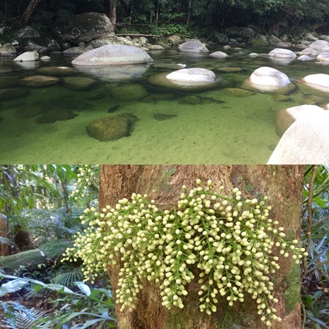
Located in the southern part of the World Heritage Listed, Daintree National Park, Mossman Gorge is one of the few places in the country that visitors can gain an insight into the lives, culture and beliefs of Australia’s Indigenous population and their connection to the natural environment.
 5.8
km
return
90
mins
5.8
km
return
90
mins
Cudgen Creek Estuary
This short walk will take you to Cudgen Headland and South Kingscliff, this goes along beaches and Cudgen Creek.
 1.5
km
return
30
mins
1.5
km
return
30
mins
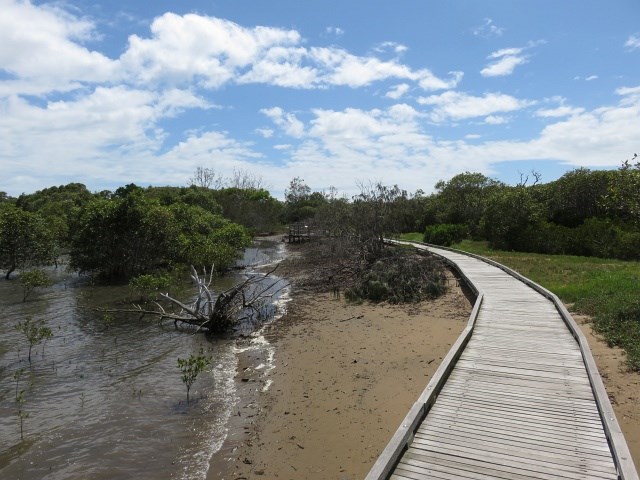
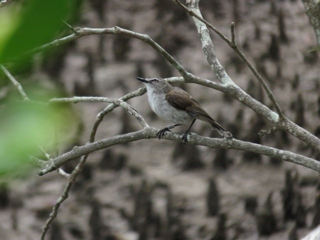
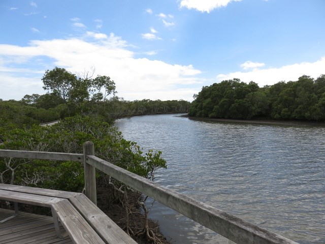
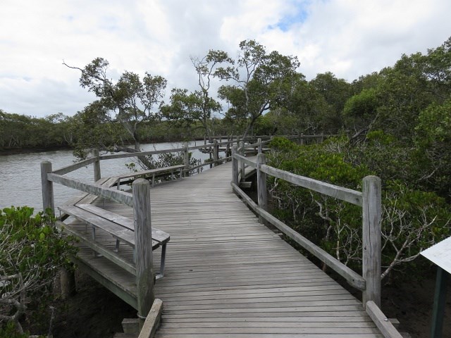
Tabbil-ban dhagun
This track is in the Boondal wetlands and passes through mangroves fringing the shores of Moreton Bay and the banks of Nudgee Creek. Birdlife abounds in the mangroves and a birdhide overlooks the tidal flats at the creek mouth. The boardwalk allows you to explore the mangroves at anytime. but make sure you carry repellent as the sandies can be murder. The name means "Place of salt water"
 2.4
km
return
45
mins
2.4
km
return
45
mins
Koolabung Creek Walk Circuit 1
A walk in central Port Macquarie around Kooloonbung Creek, including Wetlands and a flying fox colony.