
Menu

 840
m
return
840
m
return
 15
mins
15
mins
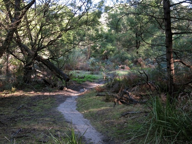
Cattai Wetlands Forest Loop
A short walk through the forest near the Cattai Wetlands.
1.1
km
return
20
mins
Cattai Wetlands Lookout Loop
A side track off the Cattai Wetlands Loop Track which gives views over the area including the Three Brothers Mountains to the north.
 2.2
km
return
1
hr
2.2
km
return
1
hr
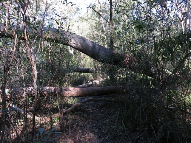
Cattai Wetlands Loop
Cattai Wetlands was once farmland suffering from the effects of land clearing, but was purchased by council with a view to restoring the ecosystem to what it should be. This is a walk around the wetland.
1.4
km
return
45
mins
Potoroo Falls Walk
A short walk to a beautiful waterfall and swimming hole.
 500
m
return
10
mins
500
m
return
10
mins
Mountain Brush Walk
A shorter, easier walk than the Red Cedar Walk on the other side of the road, which still gives identification on the local trees.
 1.3
km
return
30
mins
1.3
km
return
30
mins
Red Cedar Walk
A walk through rainforest which highlights the trees in the area by identifying them.
 900
m
return
20
mins
900
m
return
20
mins
Graham Allen Walk/Flying Fox Circuit
A short walk through rainforest to a colony of endangered grey headed flying foxes.
 4
km
return
2
hrs
4
km
return
2
hrs
Cliff Face Track
A strenuous walk which takes you past the bottom of the cliff face. The track begins with dry rainforest, but changes to eucalypt when you reach the top.
1
km
return
30
mins
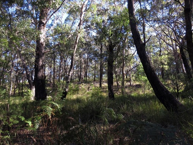
Brush Turkey Track
An easy walk through dry rainforest in Woko National Park.
10
km
return
5
hrs
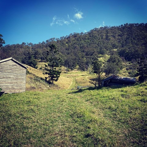
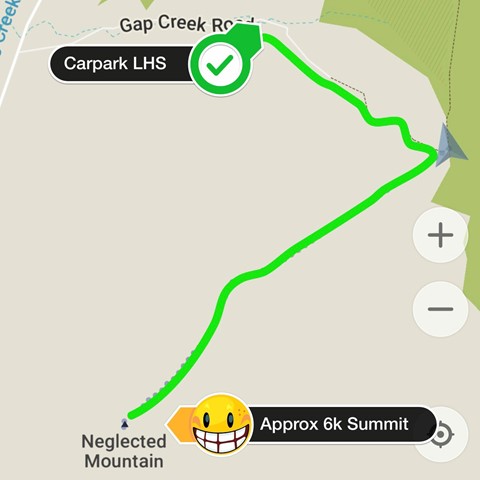
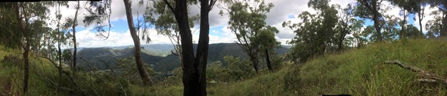
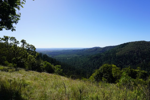
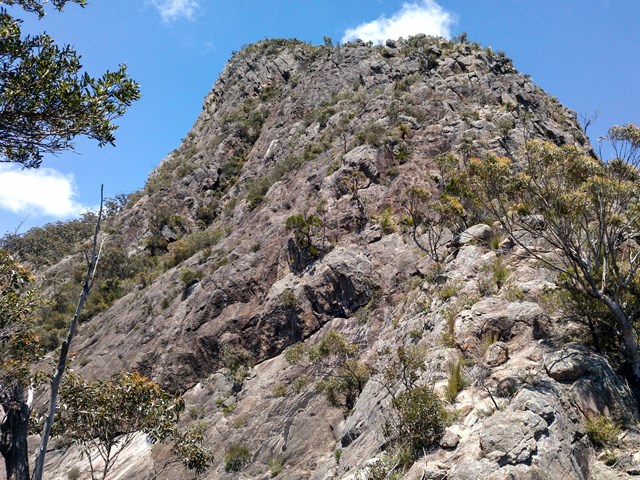
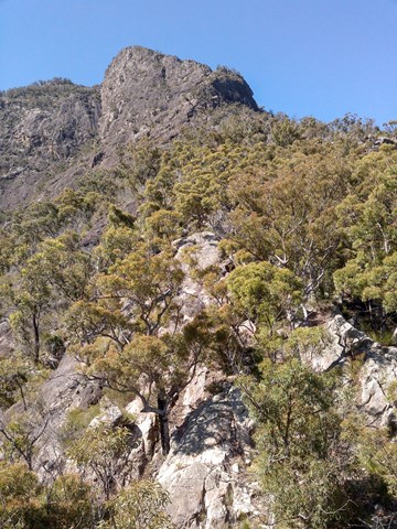
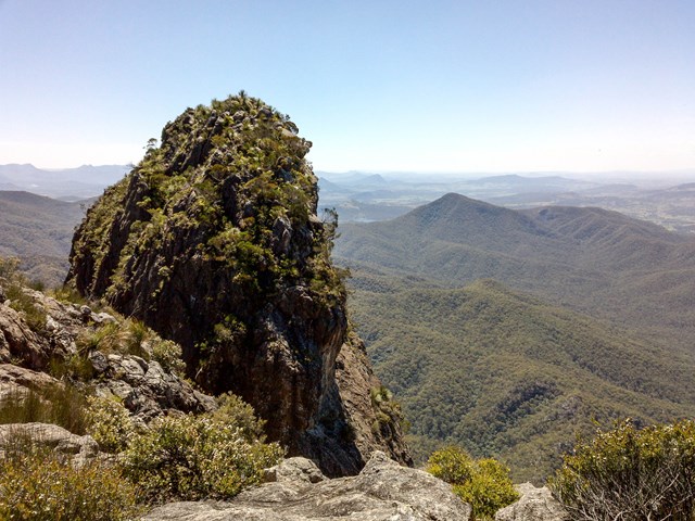
Neglected Mountain
Neglected Mountain lives up to it's name which is a shame because the walk provides excellent views from the top.
 4
km
return
80
mins
4
km
return
80
mins
Scenic Circuit
This walk on the eastern side of Bunya Mountains is mainly through rainforest, and passes a side track to a water fall, plus another side track to a lookout over the valley. It then passes Tim Shea falls before returning to the start
 10
km
one-way
6
hrs
10
km
one-way
6
hrs
Mt. Barney - Short Leaning Ridge
The ridge from Barney waterfall leading to Leaning Peak. One of the hardest bushwalk in the area. A rope is mandatory to abseil of the peak. A rewarding climb.
 9
km
one-way
3
hrs
9
km
one-way
3
hrs
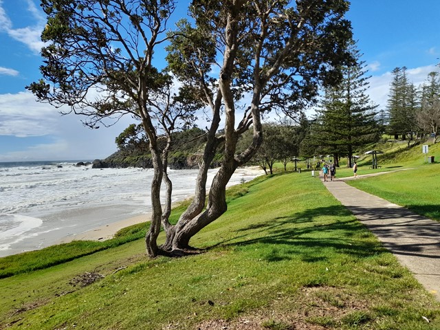
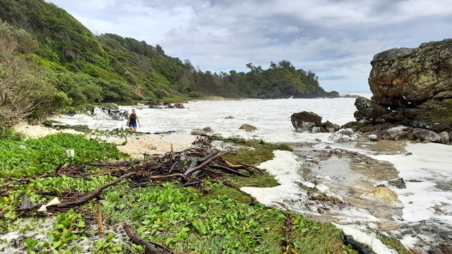
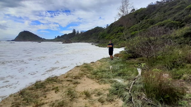
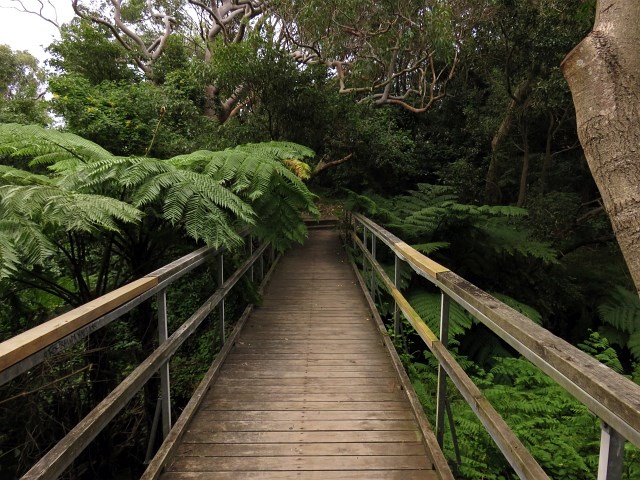
Port Macquarie Coastal Walk
The Port Macquarie Coastal walk takes in historic sites and stunning coastal scenery, beaches and rainforest. It can be enjoyed as a day walk or several short walks.
The walk can be divided into four sections:
- Westport to Town Beach (2km)
- Town Beach to Flynns Beach (2.2km)
- Flynns Beach to Shelly Beach (2.2km)
- Shelly Beach to Tacking Point (2.7km)
 6
km
return
2
hrs
6
km
return
2
hrs
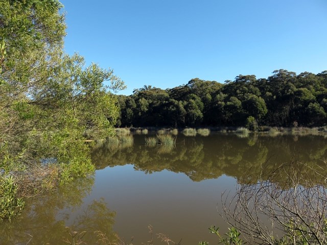
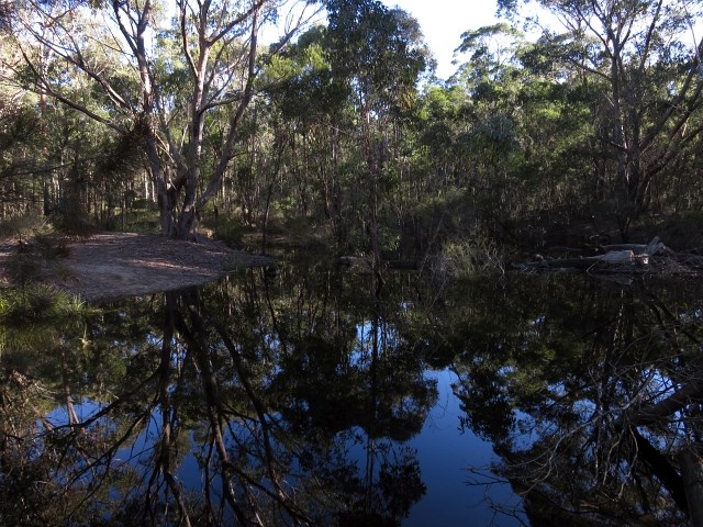
Thirlmere Lakes
A fantastic birdwatching walk, Thirlmere Lakes walking track is unmarked but well-defined. Setting out from Couridjah picnic area, the flat, enjoyable 6km loop joins Dry Lakes Road and passes Werri Berri picnic area and Heritage Pump Station as you return along Slades Road. Even though there's no directional signage, you'll have no trouble finding your way.
 2
km
return
90
mins
2
km
return
90
mins
Glow Worm Glen Walk
Glow worms can only be seen after dark, and a torch (or two) is essential. It is easiest when each person has a torch. Where shoes suitable for slippery mossy rocks.Please be quiet and turn your torches off when you reach the actual glen, as the glow worms can be harmed by bright light.
4
km
return
1
hr
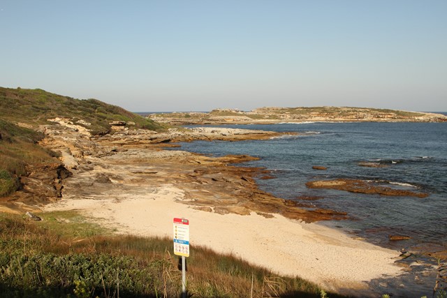
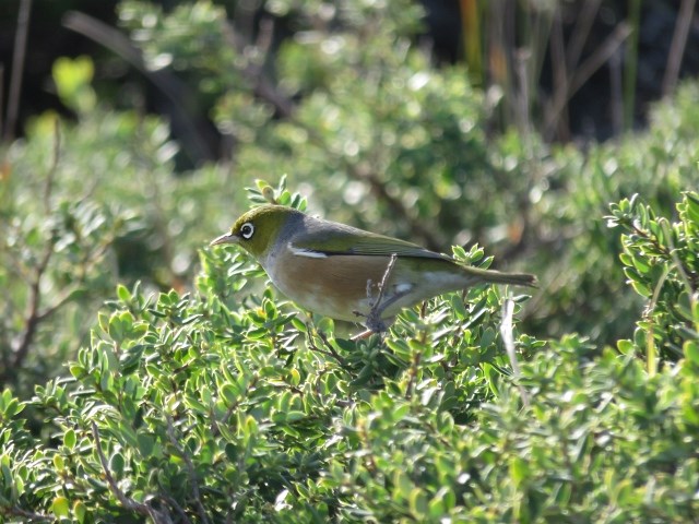
Henry Head Walking Track
Enjoy spectacular views from Henry Head walking track at La Perouse in Sydney. This easy coastal walk offers great bird watching and several historic sites along the way.
 7.3
km
return
3
hrs
7.3
km
return
3
hrs
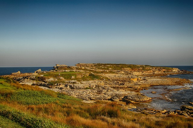
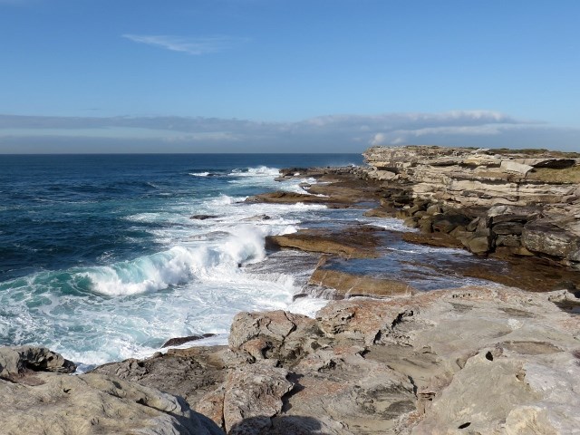
Cape Banks Circuit
This Cape Banks Circuit has a lot to offer and is thoroughly recommended. The walking travels over beaches, through coastal forest and across exposed headlands. Historically, this walk shows glimpses into the fortifications required during both World Wars. The optional side trip to the coast hospital cemetery, with over 2000 graves, is worthwhile. The Cape Banks Circuit makes for a fascinating walk, both scenically and historically, and is recommended.
 1
km
return
45
mins
1
km
return
45
mins
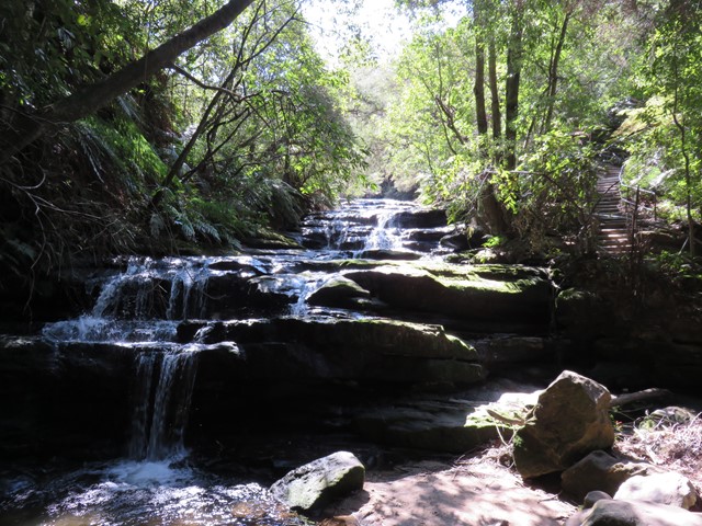
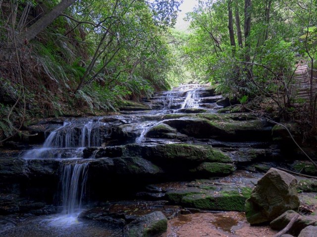
Leura Cascades Circuit
Following Leura Creek down to a beautiful small waterfall, this is one of the prettiest short walks in the Leura area. Sit under the overhang and watch as the falls cascade down around you, then climb to great views of the Leura cliffline. This circuit track leads back to the park.
 700
m
return
20
mins
700
m
return
20
mins
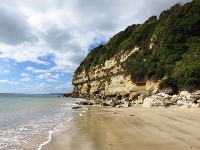
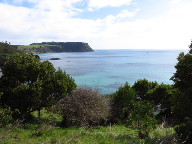
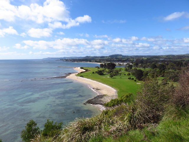
Fossil Bluff and Lookout
For the geological buff these amazing sandstone cliffs are over 275 million years old and offer a rare insight into fossils. It’s the discovery site of Australia’s oldest fossil marsupial uncovered in the mid 19th century estimated to be approximately 25 million years old. Visitors can expect to see and touch several hundred different types of fossils preserved in the rocks – see how many you can find! This walk also includes the short lookout walk which is also accessible from the carpark.