
Menu

 1.2
km
return
1.2
km
return
 30
mins
30
mins
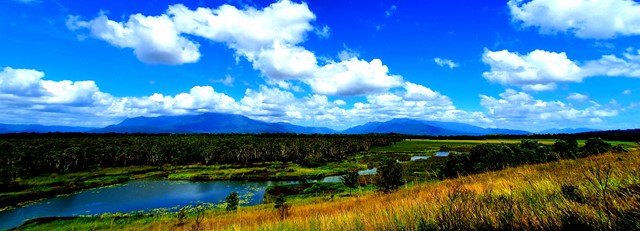
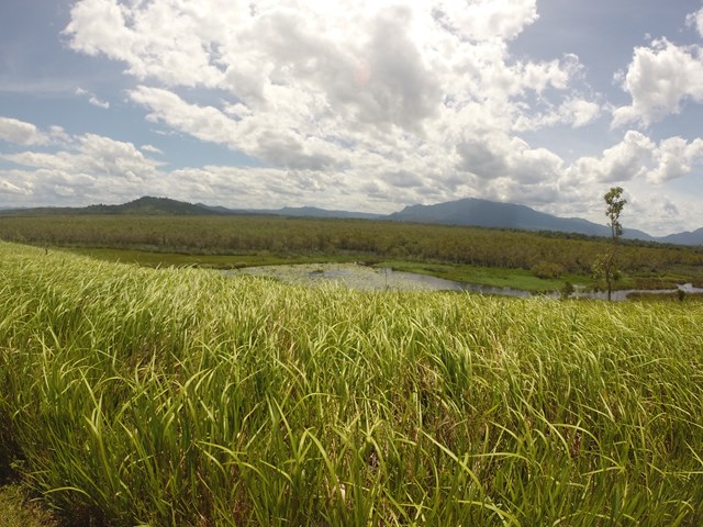
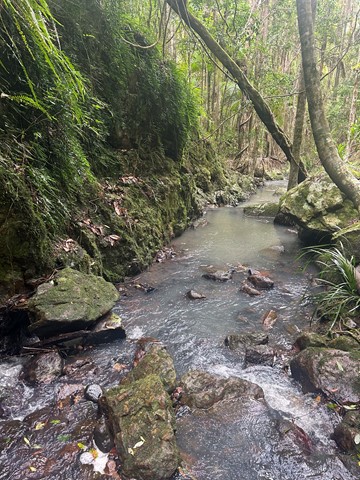
Eubenangee Swamp
Well maintained track following the river then opens into farmland where you will climb a hill to the wetland lookout. High grass on both sides of the farmland track.
Good for viewing wetland birds and crocs if you're lucky (or unlucky).
 3
km
return
90
mins
3
km
return
90
mins
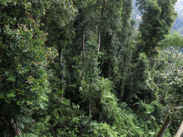
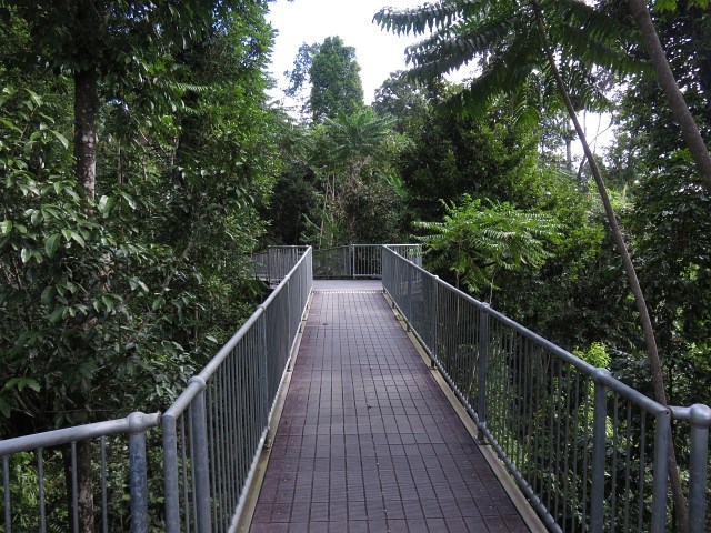
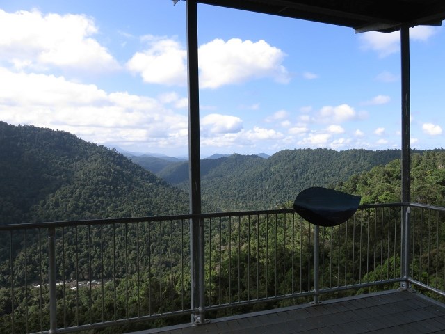
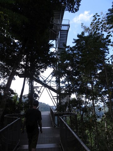
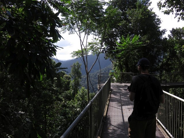
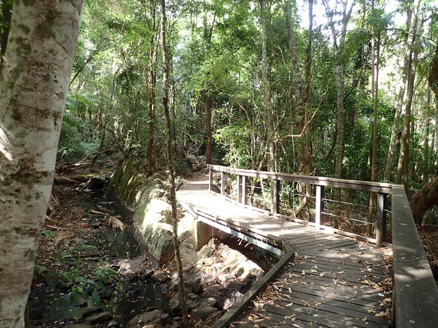
Mamu Tropical Skywalk
Take a walk in the clouds in Wooroonooran National Park just 15 minutes out of Innisfail. Elevated walkways, a cantilever, and observation tower offer visitors the exhilarating experience of being high in the rainforest canopy, along with providing spectacular panoramic views of World Heritage rainforest landscapes.
 2.2
km
return
90
mins
2.2
km
return
90
mins
Platypus Track (Castle Hill/Eric Mobs Reserve)
This walk provides the opportunity for views into Bidjigal and Excelsior Creeks and then a walk along the shady valleys of these creeks amongst ferns and Coachwood trees. On warm days Eastern Water Dragons can be seen in Excelsior Creek.
 4
km
return
1
hr
4
km
return
1
hr
Pelican Waters to Golden Beach (SCCP 1)
This is currently the southernmost start of the Sunshine Coast Coastal Pathway (SCCP) as it winds its way along the shoreline on the inside of Bribie Island. This section is very popular with visitors enjoying various water sports and with great views across Punicestone Passage.
 4.7
km
return
75
mins
4.7
km
return
75
mins
Blackbutt Trail
A hilly landscape with grassy open forest features in this park. Along creeks and sheltered gullies, tall wet eucalypt forest and rainforest grows. Horseriders, mountain bike riders and walkers can enjoy the tranquillity of this park on shared trails, natural surfaces and gentle gradients.
 2.3
km
return
100
mins
2.3
km
return
100
mins
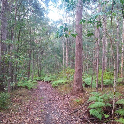
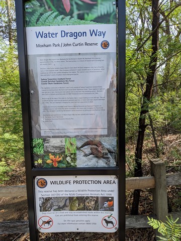
Water Dragon Way
Water Dragon Way runs between Moxhams Road, Northmead and Goodin Road, Winston Hills along the eastern side of Quarry Branch Creek. The distance is 2.3km and duration of 1hr 40min return. The track is a mixture of natural earth and rocky path including some rock and wooden stairs. Walking from south to north is a consistent incline.
 4.9
km
return
2
hrs
4.9
km
return
2
hrs
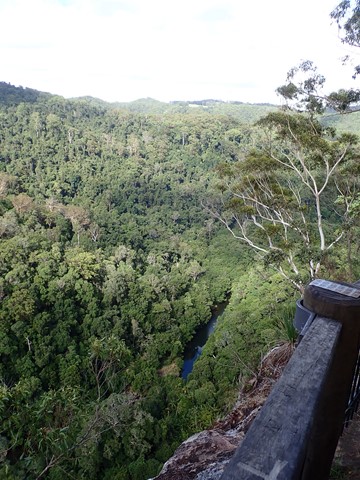
Baroon Lookout
A great family walk up the side of the gorge to the lookout out across Obi Obi Creek as it heads north from the Baroon Dam and into the Blackall Range to join the Mary River.
 60
km
return
4
days
60
km
return
4
days
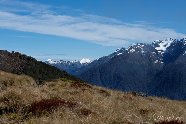
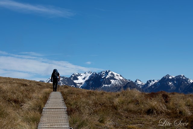
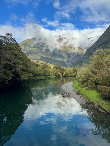
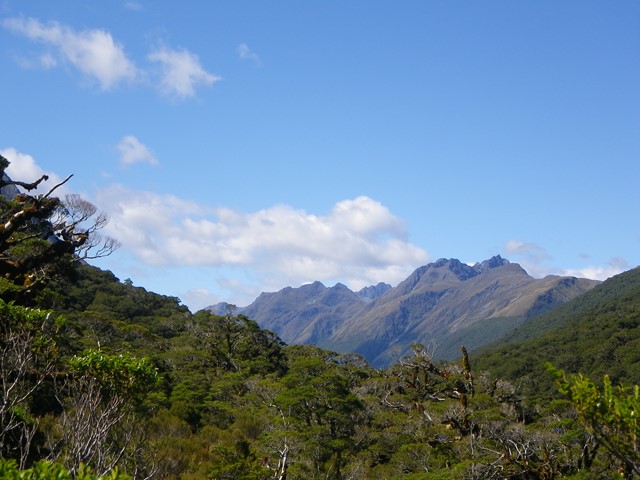
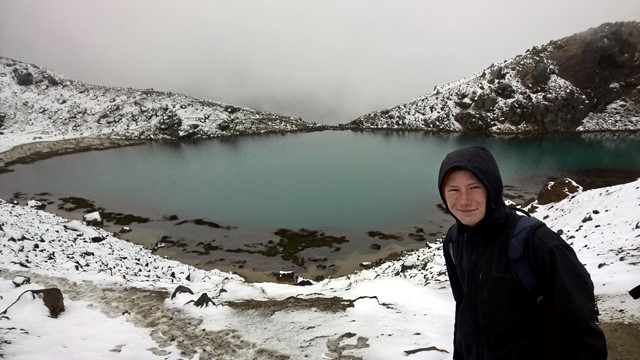
Kepler Track
The Kepler Track is a 60 km, 3-4 day loop track taking you from the gentle, beech-forested shores of lakes Te Anau and Manapouri to the tussocky alpine tops and grand Mt Luxmore. Your reward for the hill climb is a long section above bushline with marvellous panoramic views of the Kepler Mountains on one side, and lakes, rivers and hanging valleys on the other.
The Kepler Track is an excellent track for you and your family and friends, especially if you love the outdoors, want an adventure with a bit of a physical challenge that is not too hard to get to and has excellent facilities.
This is a Great Walk and offers a high standard of track and very comfortable, serviced huts as well as camping opportunities. During the winter months (May to October) the Kepler Track remains open, but with reduced facilities.
 26
km
8
hrs
26
km
8
hrs
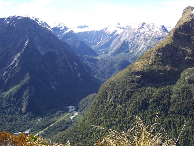
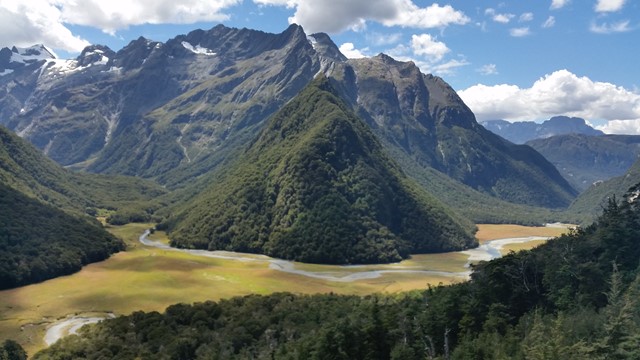
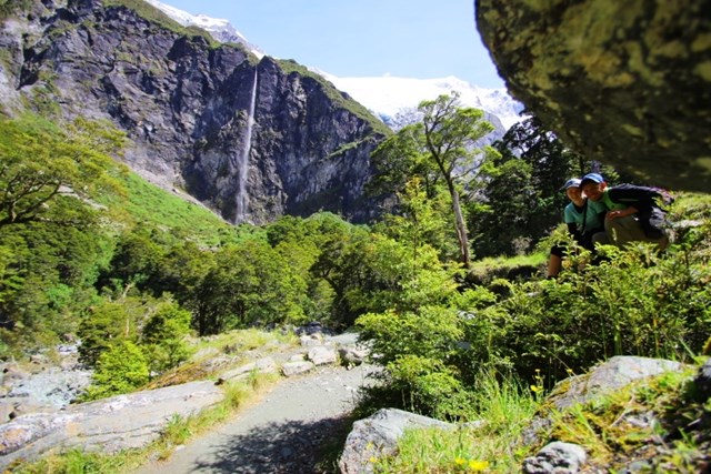
Routeburn Track (At least to Harris Saddle and back)
Part of the Routeburn Great Walk in Otago, I only had a day and one car so I couldn't go to the end. Most fit walkers I talked to said you can easily do it in a day.
 10
km
return
5
hrs
10
km
return
5
hrs
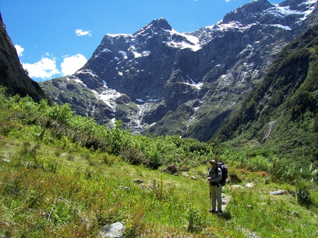
Rob Roy Glacier
http://www.doc.govt.nz/parks-and-recreation/places-to-go/otago/places/mount-aspiring-national-park/things-to-do/rob-roy-track/
 3.3
km
return
2
hrs
3.3
km
return
2
hrs
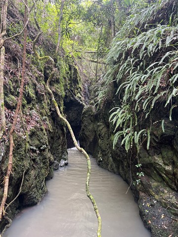
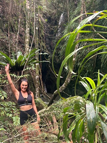
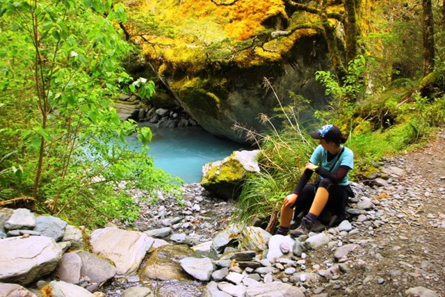
Stevensons Creek (Excelsior Reserve/Baulkham Hills)
Beautiful creek valleys, sandstone shelters and some sandstone heath land. This walk is one of the more challenging walks in the Hills Shire.
 10.5
km
one-way
5
hrs
10.5
km
one-way
5
hrs
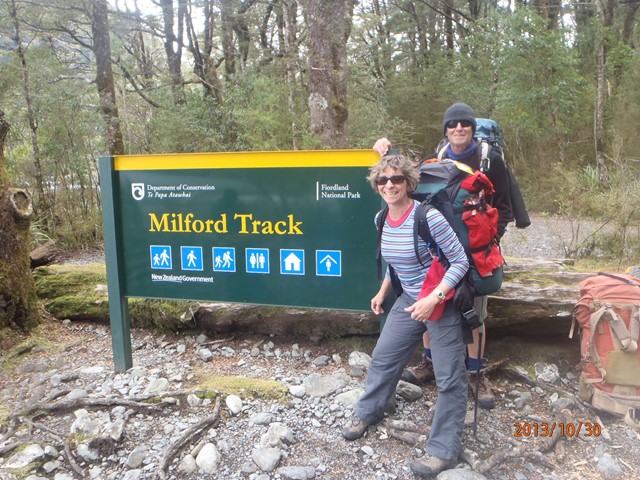
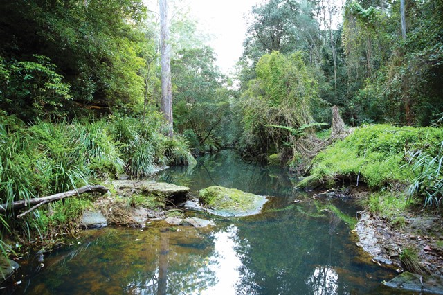
Booyong Walk
A rainforest walk linking The sheepstation Creek campsite with the Forest Tops campsite in the Boarder Ranges National Park.
 800
m
return
20
mins
800
m
return
20
mins
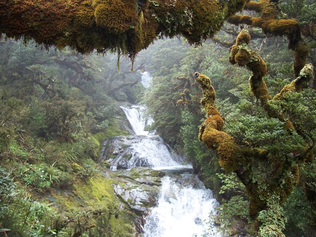
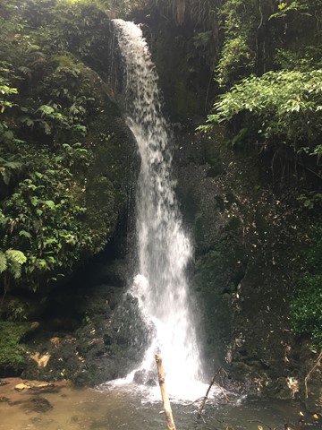
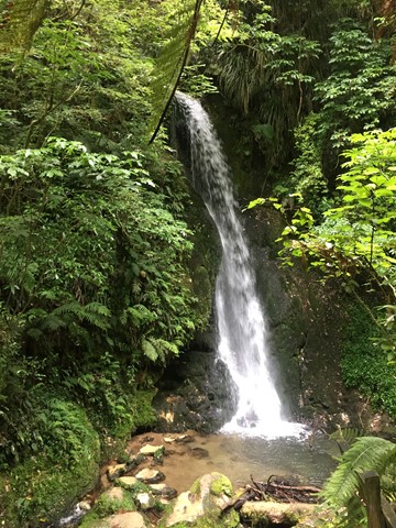
McLaren Falls Park Waterfall Track
A short walk in McLaren Falls Park which takes you to Marshall's Falls and there are some overhangs that house glow worms on the right hand side of the creek when looking upstream.
 100
km
one-way
8
days
100
km
one-way
8
days
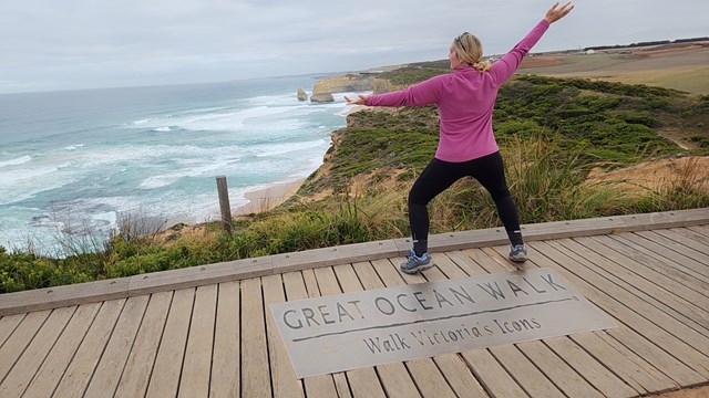
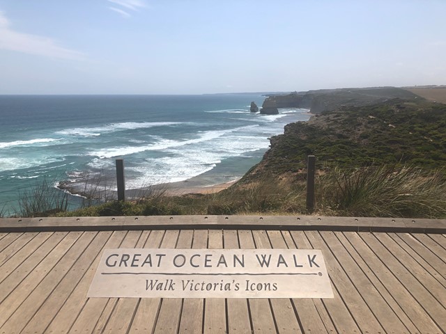
Great Ocean Walk
This walk takes you from the Apollo Bay Visitor Centre to the 12 Apostles Visitor Centre with many views of the coastline that you don’t see from the Great Ocean Road.
 1.4
km
return
30
mins
1.4
km
return
30
mins
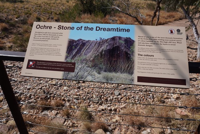
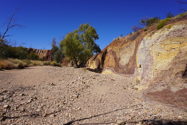
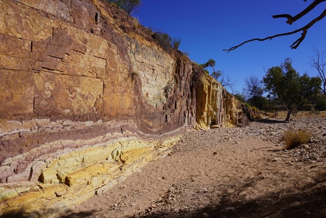
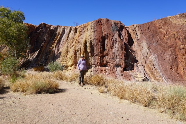
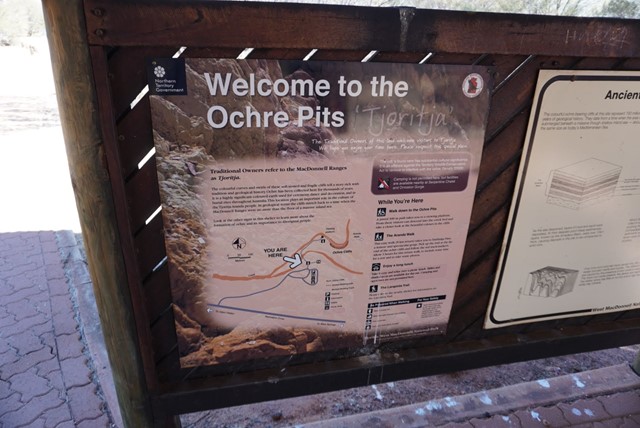
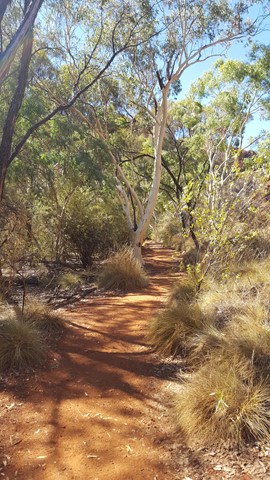
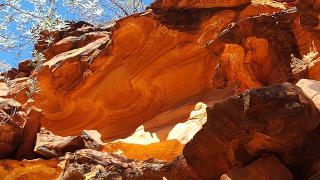
Ochre Pits
A colourful outcrop of ochre on the banks of a sandy creek. Ochre has always been an important part of Aboriginal culture and a vital part of everyday life. For medicinal purposes red ochre can be mixed with grease and applied as an ointment and to relieve congestion when mixed with eucalyptus leaves. White ochre was used as a magical charm, when mixed with water and blown from the mouth it is believed to abate the heat of the sun or the force of the wind. Weapons were painted with ochre to increase the success of hunting. It also protected the wooden weapons from termites.
 2
km
return
1
hr
2
km
return
1
hr
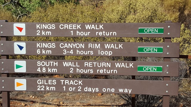
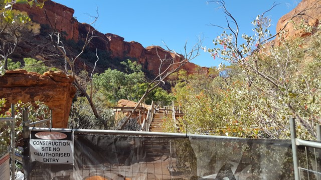
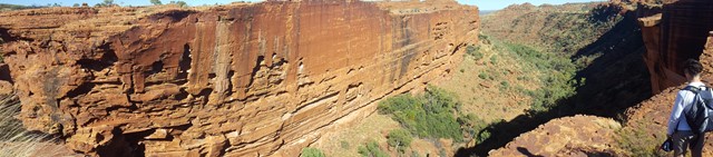
Kings Creek Walk
The gentle slope of the track meanders along Kings Creek, ending at a viewing platform, where you experience stunning views of the sheer canyon walls. Take your time to ready the informative signage on the flora and fauna and scan the etched sculptures in the sandstone. Can you spot the pirate's face?
 6.6
km
return
4
hrs
6.6
km
return
4
hrs
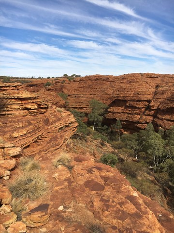
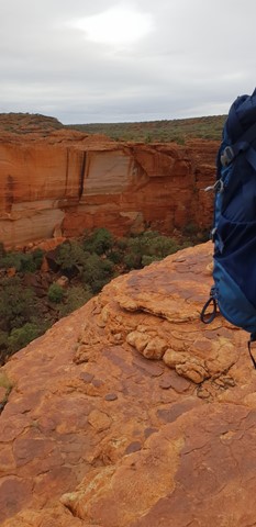
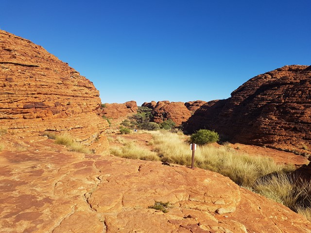
Kings Canyon Rim Walk
Take your time to absorb your surrounding as the steep climb takes you to the top of the Canyon, then follows the Canyon rim through the awesome domes of the Lost City and out to Cotterill's Bridge and Lookout, before dropping down into the lush surrounding and tranquillity of the Garden of Eden sacred waterholes. Climb back to the top and continue along the Southern Wall, with views to die for.
 8
km
return
6
hrs
8
km
return
6
hrs
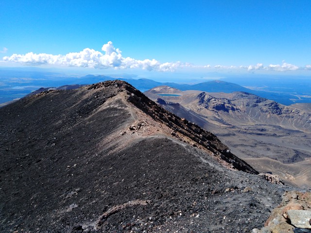
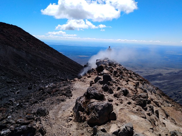
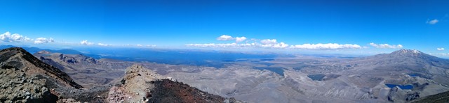
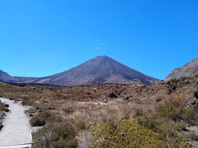
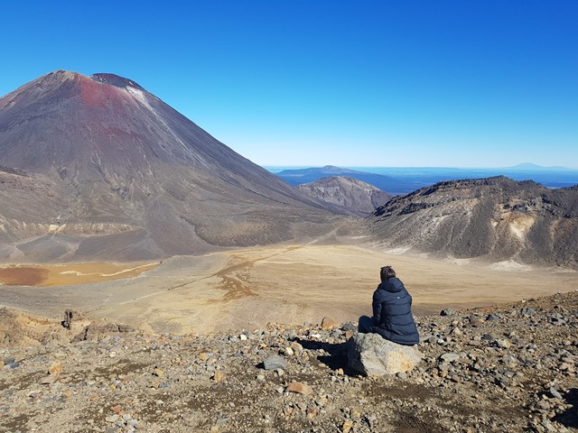
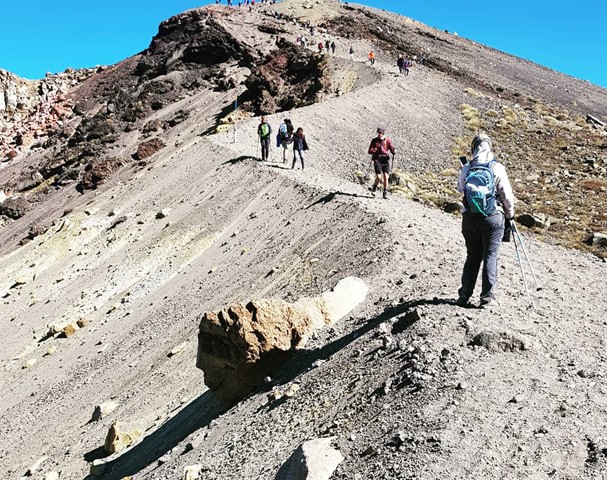
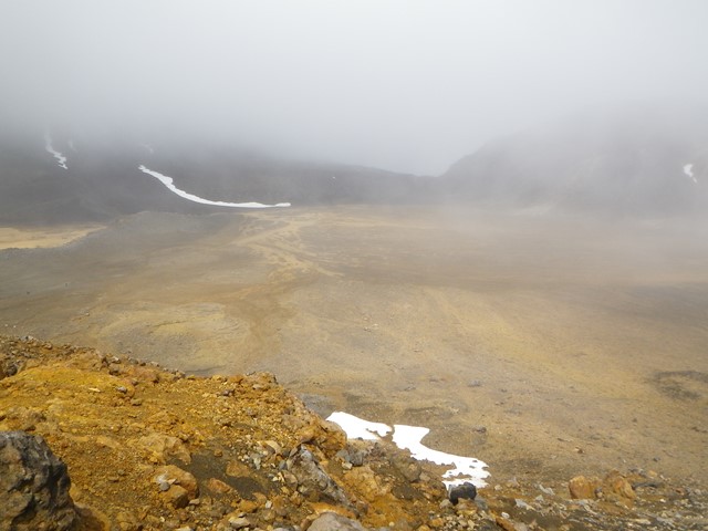
Mt. Ngauruhoe (aka Mt Doom)
The volcano where the one ring to rule them all was forged, or more accurately the volcano Mt Doom was modelled off for Lord of the Rings movies. Located just off the track on the Tongariro Crossing is a very intimidating climb to the summit of Mt Ngauruhoe. In recent years climbers have been encouraged not to climb it due to the dangers involved with climbing to the summit.
*On way up make sure to use the solid ground of the ridge line otherwise you will end up sliding down as much as you gain height with each step. This is very important to remember if you are going to try to summit Mt. Ngauruhoe.*
On the way down you will be able to 'scree ski' down which allows you to make it down the mountain very quickly around half an hour where as getting up would've taken around two hours.
 19.4
km
one-way
7
hrs
19.4
km
one-way
7
hrs
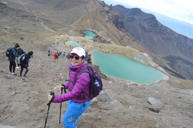
Tongariro Alpine Crossing
This is a wonderfully atmospheric walk through an active volcanic area. It is considered as being one of the best day walks in the world. Highlights include, soda springs which is a waterfall, views of Mt. Ngauruhoe which was used in the lord of the rings films as Mount Doom, south crater, red crater (1868) which is the highest point on the Tongariro Alpine Crossing if done with no diversions, emerald lakes, blue lake and Mt. Tongariro.