
Menu
Suggested searches
Your search found 2418 results...

 1.5
km
return
1.5
km
return
 30
mins
30
mins
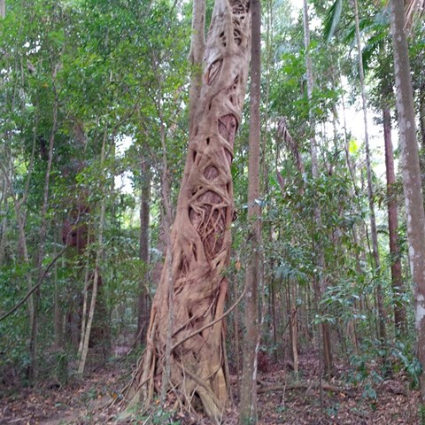
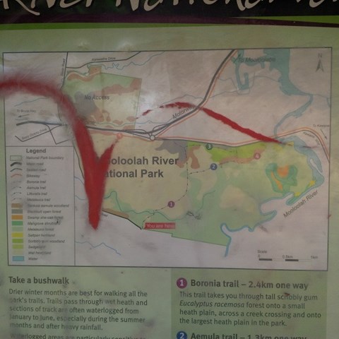
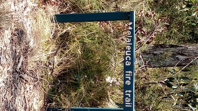
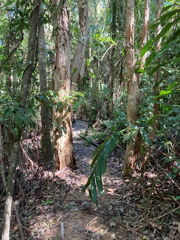
Melaleuca Trail
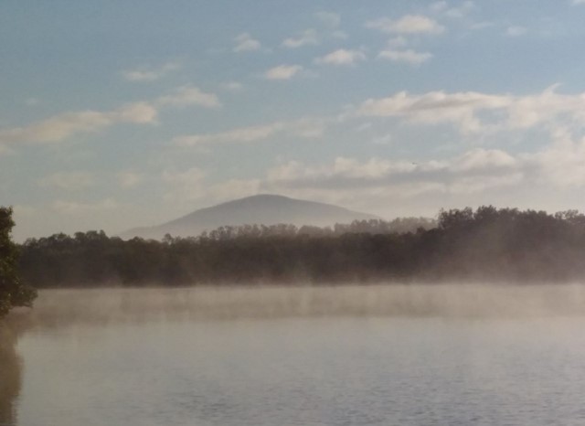
Mooloolah River National Park
Adjoining the Mooloolah River, the Mooloolah River National Park protects valuable remnants of coastal lowland habitat, rainforest, open eucalypt woodlands, melaleuca forests, wallum banksia woodlands, scribbly gum open forests, wallum heath and sedgelands.
 2
km
return
1
hr
2
km
return
1
hr
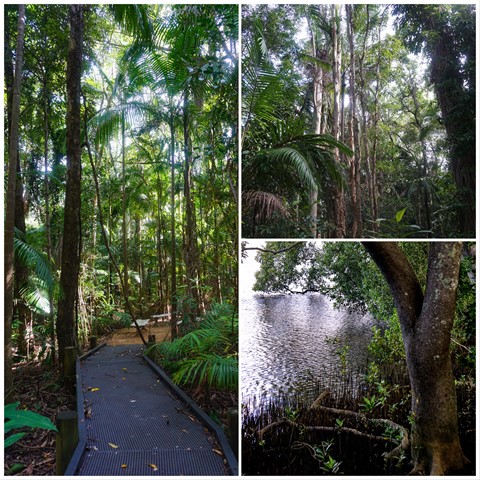
Maroochy Wetland Conservation Park
Sunshine Coast
The Maroochy Wetlands Sanctuary boardwalk passes through eucalypt, rain and mangrove forest down to the river. Native fauna including River Mangrove, Orange Mangrove, Swamp Oak, Milky Mangrove, Grey Mangrove, Native Wisteria, Flooded Gum, Bungwall Fern, Paperbarked Tea-Tree and Mangrove Fern. There is abundant bird life, as well as crabs, butterflies, reptiles, fish and other wildlife species that frequent the wetlands.
 3
km
return
45
mins
3
km
return
45
mins
Elanora Wetlands
Gold Coast
Elanora Wetlands Habitat is a Gold Coast City Council (GCCC) reserve in the upstream estuarine reaches of Tallebudgera Creek. Adjacent to tidal wetlands, a scenic walking track follows the perimeter of the Water Quality Control Centre (WQCC). There are excellent views of mangroves and saltmarsh vegetation along the track where they form a thin fringe along the creek.
 8
km
one-way
6.5
hrs
8
km
one-way
6.5
hrs
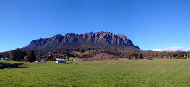
Mt Roland
Tasmania
Located near Sheffield, on the edge of the Great Western Tiers region of Tasmania. Looks quite ominous as you approach from Sheffield with its many sheer cliffs. A good day walk that is easy to follow, with a large portion of the walk done across the plateau along to the summit. The path has branches off to the other mountains near by (Mt Van Dyke, Mt Claude), but the Mt Roland track is much better maintained.
 5
km
return
2.5
hrs
5
km
return
2.5
hrs
Branding Yard Trail
You Yangs Regional Park
Part of the You Yangs Regional Park between Melbourne and Geelong. There are many hiking, running and mountain bike trails in the park which range in difficulty. I ran the Branding Yard Trail as part of a run that incorporated other trails in the area. It is a mostly flat trail with a few ups and downs particularly at the start/finish part of the trail. The trail starts and finishes at the turn table car park which inside the park grounds past the main office about 2km up. There is a monolith monument along the trail that is pretty cool. It's is a moderate run and would be an easy walk.
5.4
km
return
2
hrs
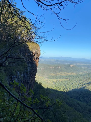
Pats Bluff
Lamington National Park
The West Cliff Track branches to the right from the Python Rock Track and then immediately sharp left past a Black Booyong with extensive buttressing and a tall Hoop Pine 30 metres further down the track.
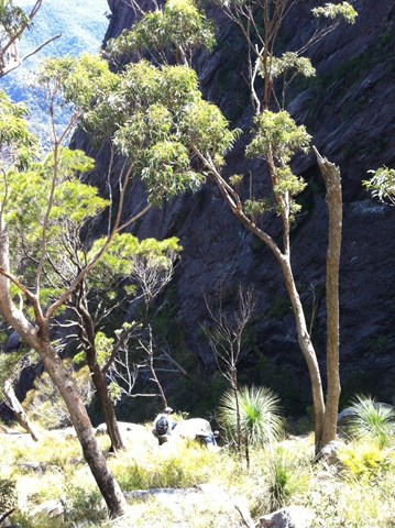
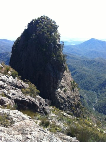
Pat’s Bluff affords a view over the Albert and Logan River valleys to the Great Dividing Range. Follow the cliff line down past a view of Raining Cliff to the picnic area. Pat O’Reilly’s log cabin is 70 metres in from this spot. Peregrine Falcons nest in caves in these cliffs and often rest in the dead trees above the cliff line
 16
km
one-way
1
days
16
km
one-way
1
days
Mt Barney East Peak via SE Ridge, traverse North Pinnacle to Leaning Peak, descend to Barney Gorge and Lower Portals
Mt Barney National Park
We did this as a day walk, starting at Yellow Pinch carpark around 7AM and arriving at Lower Portals about 4PM. We were told by a professional guide we bumped into at Yellow Pinch carpark that we wouldn't be able to complete our planned route in 1 day. We completed it easily in about 9 hours and taking plenty of stops, but we're experienced hikers and you need to hold a good pace. Most people would probably prefer to break it up into a 2-day walk.
A couple things you need to know first up:
1. This route starts at Yellow Pinch Carpark but finishes at Lower Portals Carpark, so you either need to pre-arrange a way to get back to your car or you have an extra walk at the end from Lower Portals back to Yellow Pinch.
2. A rope is needed to descend a couple short sections of the couloir on the western side of Leaning Peak. This is a very steep scramble through thick grass and over a few small cliffs, so only attempt if you are comfortable with doing this, as once you pass the first cliff you're pretty much committed to continuing the descent because it's difficult to get back up.
 2.8
km
one-way
1
hr
2.8
km
one-way
1
hr
Pine Grove -Cedar Grove Track
Mackay, Isaac and Whitsunday
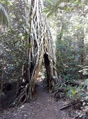
A walk through rain forest which takes you through a strangler fig arch and past red cedars, tulip oaks and lots of palm trees. This track links the Pine Grove Carpark and the Sky Window carpark.
 250
m
return
10
mins
250
m
return
10
mins
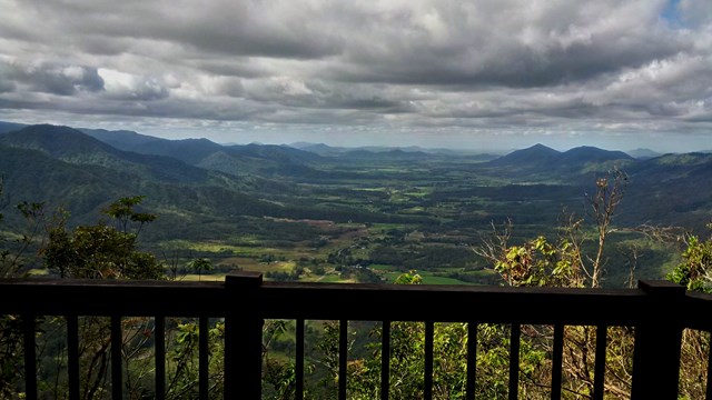
Sky Window Circuit
Mackay, Isaac and Whitsunday
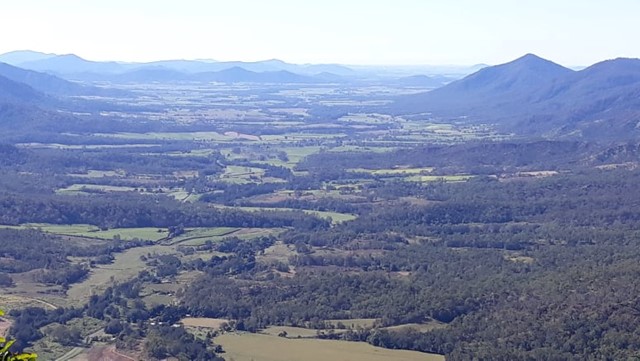
A short easy track that takes you to two lookouts over the Pioneer Valley
 8.2
km
one-way
90
mins
8.2
km
one-way
90
mins
Clark Range Track
Mackay, Isaac and Whitsunday
A walk through picabeen and Alexandra palms, linking the Broken River Car Park with the Sky Window Car Park.