
Menu
Suggested searches
Your search found 2418 results...

 5.2
km
return
5.2
km
return
 90
mins
90
mins
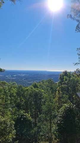
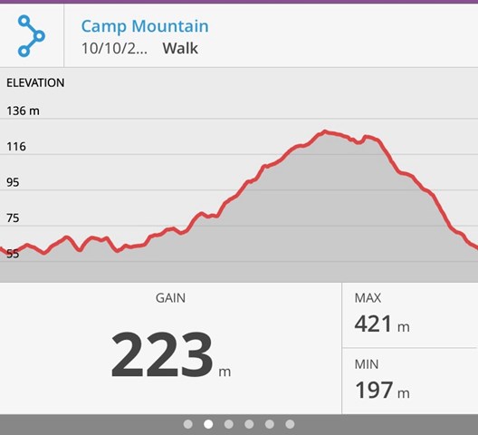
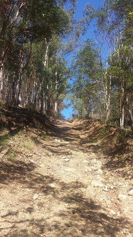
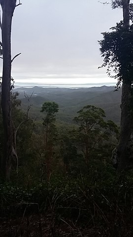
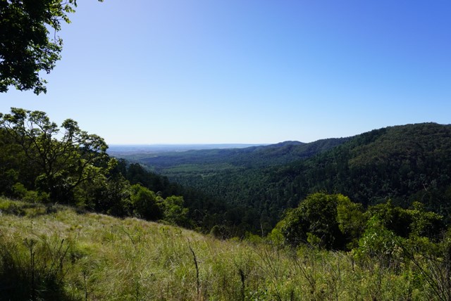
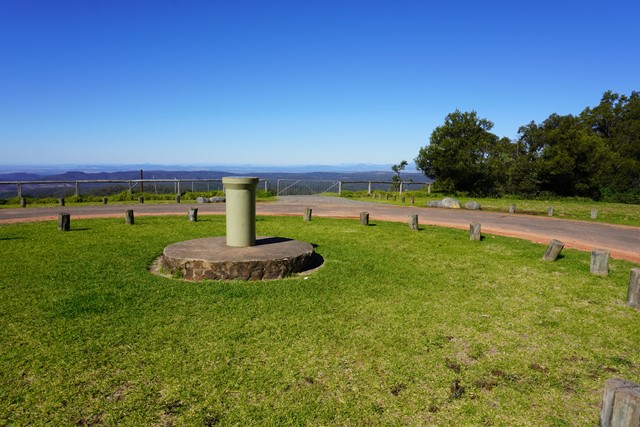
Camp Mountain Lookout
Brisbane Forest park D'Aguilar National Park
Beautiful walk through eucalypt forest along a well maintained fire trail. We parked at the junction of Suttons Road & Suttons Court, Camp Mountain, parked the car at the horse step through and headed up the hill. It's a steep walk up to the lookout where you will find spectacular views of Brisbane City and Moreton Bay. Wander a little further and you can see the beautiful Samford Valley and Glass House Mountains in the distance. You can also drive into the lookout from Mt Nebo Road.
If you are feeling energetic and want to add an extra hour to your walk, head down the hill towards Bellbird Grove - the trail splits just after the water tank, instead of going left to do the circuit, go straight ahead. Follow the trail and you will come into the back of Bellbird Grove - have a toilet stop, a little rest and then turn around and head back the same way to join back onto the circuit.
 10
km
return
3
hrs
10
km
return
3
hrs
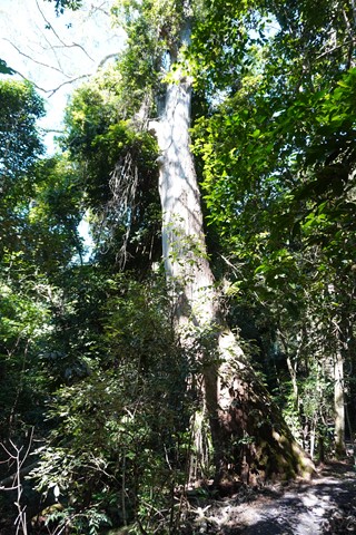
Enoggera Reservoir Circuit
Brisbane Forest park D'Aguilar National Park
This is a great walk through mostly canopied forest that skirts around Enoggera Reservoir. There are some quite steep hills which will be a challenge if you are not very fit, but most of the walk is easy. Glimpses of the reservoir, lots of beautiful trees, the odd encounter with wildlife make for a very enjoyable couple of hours.
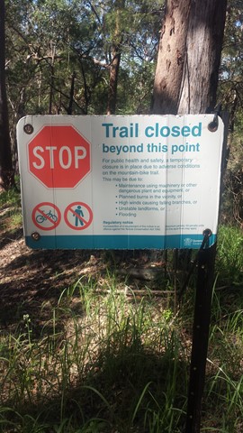
It is best to call into the Information Centre at Walk About Creek before starting this walk as they have detailed instructions on navigating the bit of suburb walking required to complete the circuit. It's also useful to have the topographical map as the hike isn't on marked trails - it would be difficult to get lost - but it's possible! If you are doing a circuit then just keep taking Left hand turns if going anti clockwise! After reaching the dam wall keep on the left until you reach the transport hub (The Gap), The parking area has an exit that leads to the Walkabout Creek area with proper walkways.
 15.4
km
one-way
4
hrs
15.4
km
one-way
4
hrs
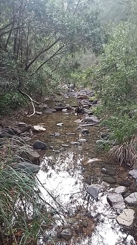
Mt Glorious to Dundas Road
Brisbane Forest park D'Aguilar National Park
This is a fantastic walk which is actually the first leg of the annual Oxfam Walk. You do need two cars for this walk - park one car at Mt Nebo Road transfer station, Dundas Road and another at Miala picnic Grounds, Mt Glorious. We started from Miala and enjoyed spectacular views out towards Lockyear Valley before we gently wound our way down to the bottom of the valley. Make sure you enjoy a rest at the creek because ahead of you is a VERY steep walk out of the valley. This is the steepest hill I have ever walked and the trail was very slippery - it was actually easier to walk beside the trail, then we could use the trees to hold onto! The hill goes on FOREVER, but when you eventually reach the top you will have a real sense of achievement - and more sensational views!
More detailed information about this walk can b e found here: https://trailwalker.oxfam.org.au/wp-content/uploads/2014/12/BNE_map1.pdf
 19.5
km
one-way
7.5
hrs
19.5
km
one-way
7.5
hrs
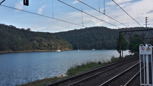
Patonga to Wondabyne Station via Mt Wondabyne (GNW)
New South Wales
This walk explores some grand views, pleasant cascades, varied bushland and remote areas of Brisbane Waters National Park. From Patonga you will walk up the ridge and take a short side trip to enjoy the wonderful views from Warrah Lookout, before following a series of dirt roads and management trails to Patonga Creek in the heart of the national park. The walk then leads along a mix of trails and tracks mostly passing Mt Wondabyne, a worthwhile side trip, before crossing a few gullies with cool creeks and cascades. Past Myron Brook you will walk back down the waters edge at the remote and unique Wondabyne Train Station.
 4
km
return
80
mins
4
km
return
80
mins
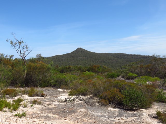
Scenic Circuit
Bunya Mountains
This walk on the eastern side of Bunya Mountains is mainly through rainforest, and passes a side track to a water fall, plus another side track to a lookout over the valley. It then passes Tim Shea falls before returning to the start
 4.8
km
return
75
mins
4.8
km
return
75
mins
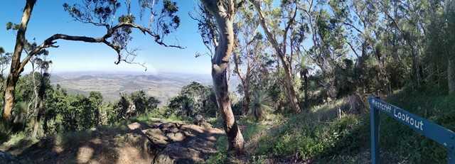
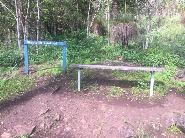
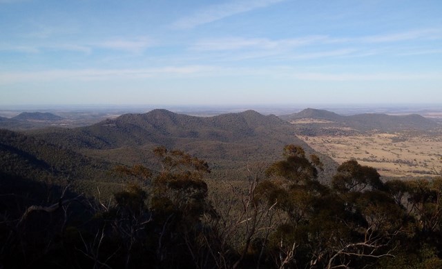
Westcliff Lookout
Bunya Mountains
This track follows part of the cliff-line on the mountain's western side with Westcliff lookout providing clear views over the open plains of the Darling Downs. Soon after leaving the Paradise car park, the track passes through Little Pocket, one of the small natural clearings or 'balds' scattered over the Bunya Mountains.
 4.8
km
one-way
90
mins
4.8
km
one-way
90
mins
Westcott to Cherry Plain
Bunya Mountains
The second section of track along the western side of the Bunya Mountains with views over the plains.
 2.5
km
return
1
hr
2.5
km
return
1
hr
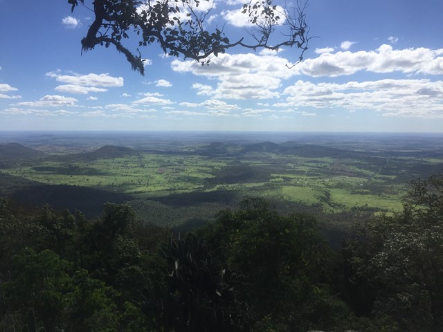
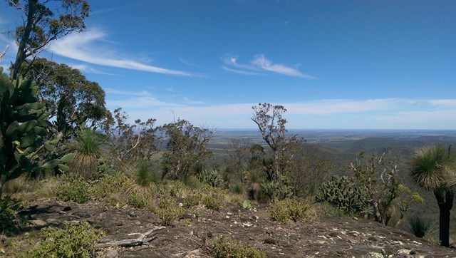
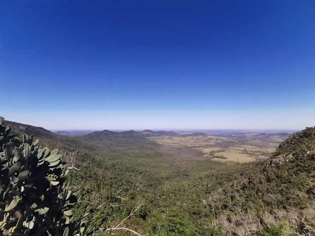
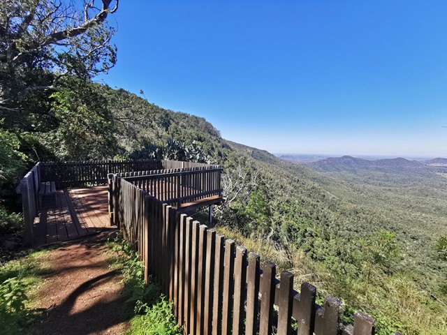
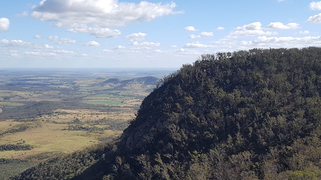
Koondaii Circuit
Bunya Mountains
A short circuit which takes you through shady dry rainforest then out to Koondaii Lookout with views of the western side of the Bunya Mountains over the Darling Downs. The cliff face falls away sharply providing you with a treetop canopy view into the valley below.
Officially a Grade 4/Hard track (some steep sections, stairs, and cliff-edges to be aware of), this walk would be manageable for most people with a moderate level of fitness.
 5.4
km
return
90
mins
5.4
km
return
90
mins
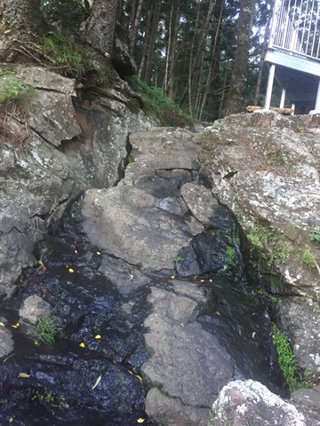
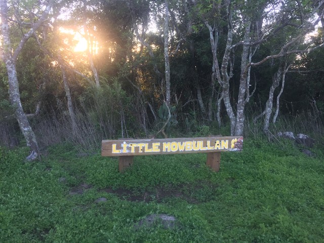
Russel Park Walking Tracks
Bunya Mountains
A circuit which takes you to Cunjevoi falls, Little Mobullan (mountain), Chute #3 and back to the picnic area down the road. You return via the road.
 500
m
return
20
mins
500
m
return
20
mins
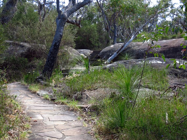
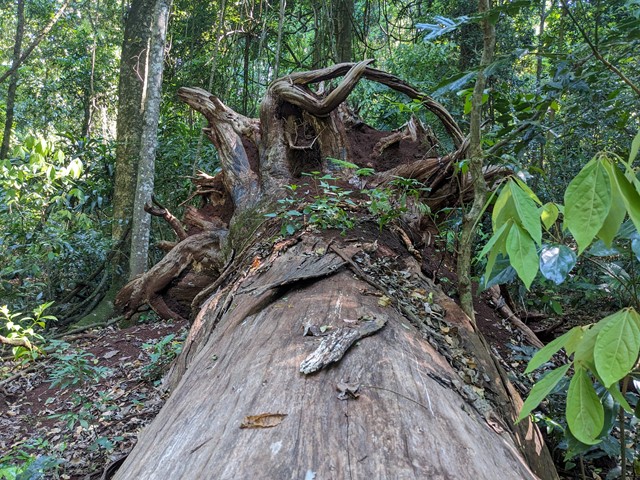
Cedar Block Circuit
Ravensbourne National Park
A short walk in Ravensbourne National Park through rainforest with information boards about Indigenous culture and native trees/plants.
Officially listed as Grade 3/Medium difficulty (includes a series of natural stone stairs), this trail is easily manageable for walkers of most ages and fitness levels (though not suitable for wheelchairs).