
Menu
Suggested searches
Your search found 2425 results...

 12
km
12
km
 4
hrs
4
hrs
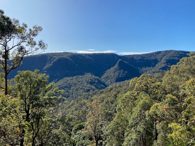
Brandy Flat
Namadgi National Park
Great walk to a beautiful hut, great for overnight (bring a a tent, not recommended to use huts except in emergency). Can also walk in/out via Caloola Farm, 6kms. Very cold in winter!
 8
km
2
hrs
8
km
2
hrs
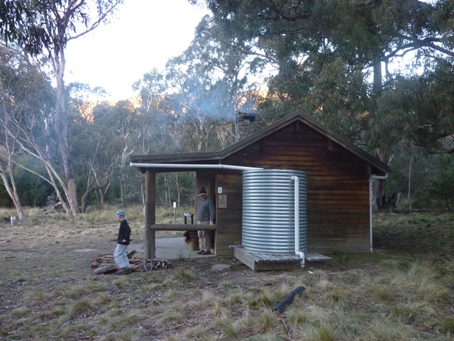
Horse Gully Hut
Namadgi National Park
Walk along Naas River. Info posts along the way. All on fire trail. Also goes past Demandering Hut. Both huts are in good condition, recommended to take a tent though & avoid staying in the huts except in case of emergency. Most Namadgi huts have basic supplies - matches, info, wood etc.
 18
km
10
hrs
18
km
10
hrs
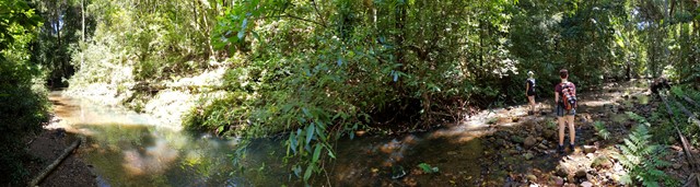
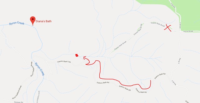
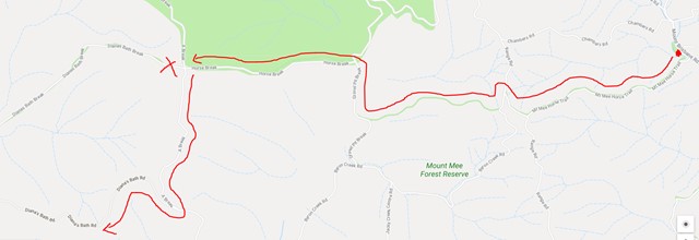
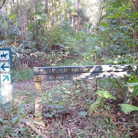
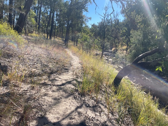
Mt Mee Horse Trail - Dianas Bath
D'Aguilar National Park
Follow the Mt Mee horse trail through a variety of forests to a stunning natural waterhole known as Dianas Bath.
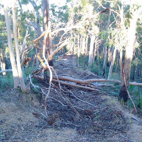
This walk traverses two peaks, with a total rise and descent of 600m each way (so 1.2kms overall!!). The trail is loose weathered gravel and stones, is often very rutted and is quite slippery going up and much more slippery going down! The hills are between 15-29% gradients and quite long so you need to be very fit.
Much of the trail is overgrown with grasses and lantana, as well as the occasional fallen tree but the waterhole at the end is worth the walk, and definitely worth a swim!
Just after the first descent you cross Byron creek, which flows all year round and the rocks can be quite slippery. The water in this creek is a stunning shade of blue and crystal clear!
Start and end at the carpark just off Mt Brisbane rd - no messing around here - the walk immediately starts up to the peak of the first hill.
This walk should take between 7-10 hours with breaks dependent on your level of fitness and the state of the track.
 800
m
18
mins
800
m
18
mins
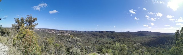
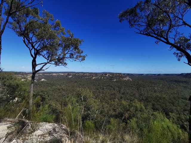
Isla Gorge
Central Queensland
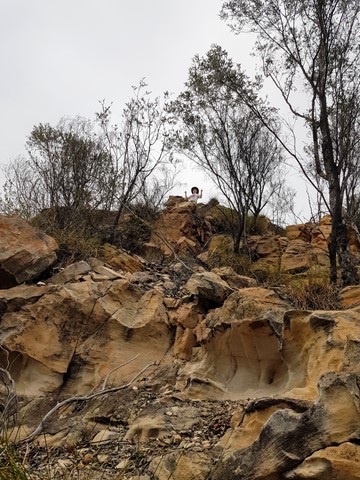
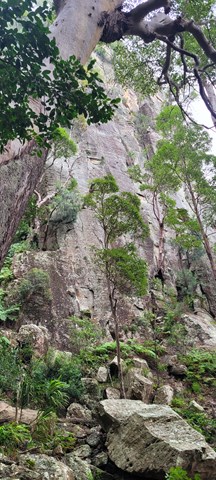
An easy walk from the camping ground along a rocky ridge to the end of a spur where you can view the spectacular gorge below. This is a landmark for those more intrepid walkers who venture down into the gorge where there are no set tracks. This is scrambling at its best - quite difficult and, in late September, very hot. We trekked down into the gorge and made our way through thick scrub to the other side to camp overnight. Heavy going with backpacks laden with water bottles. The return hike back up the spur to the camp grounds was quite arduous, but all in all, well worth the effort.
 12
km
return
3.5
hrs
12
km
return
3.5
hrs
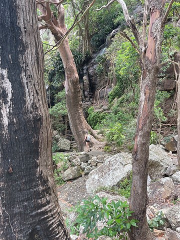
Lower Bellbird Circuit
Lamington National Park
This circuit branches off ship's stern 3.7 km from the trail head. It passes through a variety of habitat types and there are some impressive views. You can start from either just south of the information center (500 m) and walk clockwise or start at Binna Burra and walk anticlockwise. Either way, you'll be walking down or up 2.5km of road. A nice 3 km diversion is to go down to Lower Ballunjul Falls.
 4
km
2
hrs
4
km
2
hrs
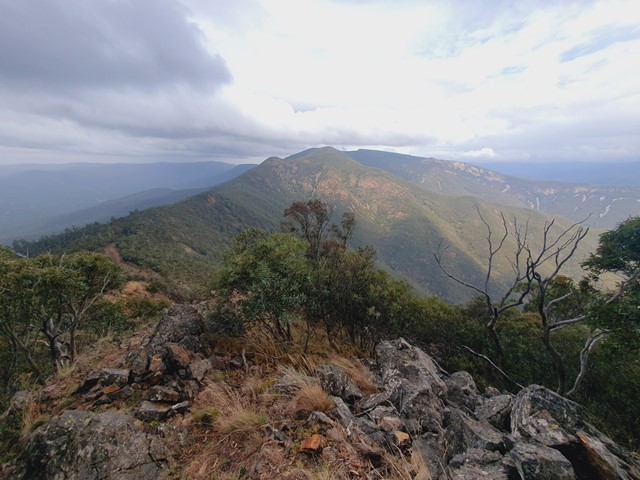
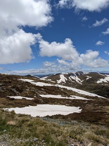
Mt Piper (Smiggin Holes)
Kosciuszko National Park
From Perisher carpark follow the fenceline that seperates the snowplay area from the ski runs. Follow the piper t-bar lift to the end. Walk along the ridge line keeping Smiggins Hole resort on the right. As you appriach the summit you will find a false summit surrounded by large rocks. Look to the north north west and you will see a second summit with a radar tower to the right. This is the true summit (1850m) and is marked by a survey marker on a large rock. Return either by Smiggins Hole resort or the same way on ascent. Good views of Guthega, Blue Cow to the south. Difficult in snow (advise to take snowshoes but not neccesary). Be careful not to disturb snowwalls near rocky areas.
11.6
km
4
hrs
Camels Hump
Australian Capital Territory
This walk begins at Mountain Ck Car park within Tidbinbilla nature Reserve. The track is a fire trail, Quite steep at first then becoming moderate until 'Camels Back' (signed) beyond this a 500 mtr, unmarked but quite well defined track will lead you to the summit. The veiws of Canberra and surrounds from this last section are spectacular. Well worth the $10 reserve entrance fee (unless you get there between 730 and 9 am.
 18
km
9
hrs
18
km
9
hrs
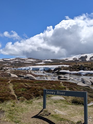
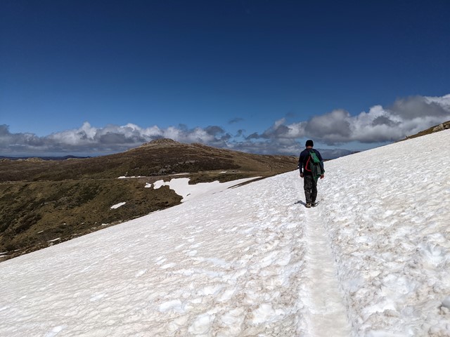
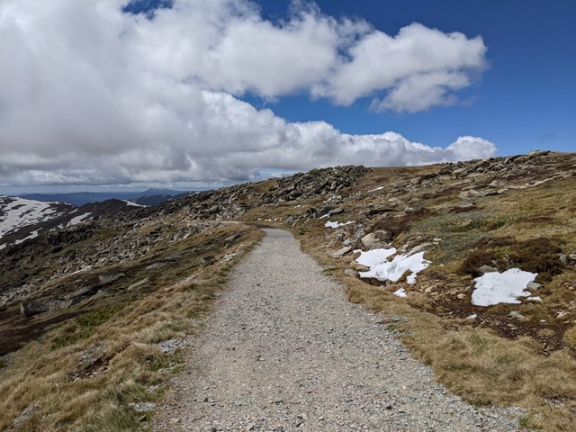
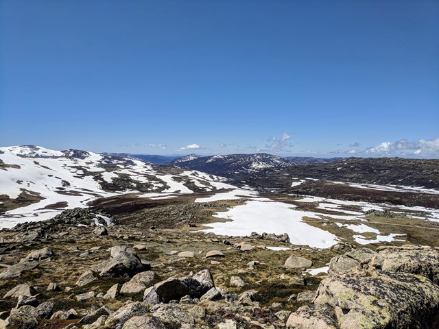
Kosciuszko Summit (Winter)
Kosciuszko National Park
Start at Charlottes Pass carpark and cross the Snowy River and then onto Seaman's Hut. Follow the road markers the entire way to Rawson's Pass. Depending on snow depth Ski or snow shoe walk around to Rawson's Pass where Australia's highest toilet is and usually covered in snow. Scale the summit of Kosciuszko in a straight line from this point on watching out for icy conditions on the ascent. Summit carn is normally identifiable in good weather. Return by the same path. An Alternate route is to scale Etheridge Ridge avoiding deep snow drift near Rawson's Pass which can be up to 2-3 metres in depth in section. Utilise Seaman's Hut as the half way point to rest, warm up and have a break. Always check weather conditions before attempting.
 7.7
km
3
hrs
7.7
km
3
hrs
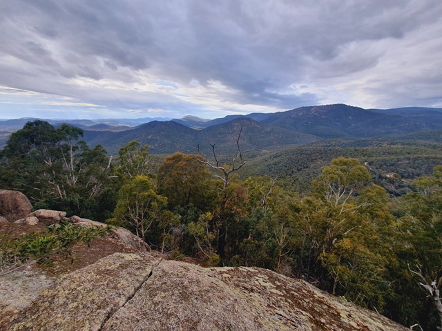
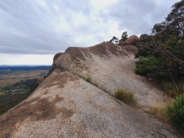
Gibraltar Peak
Australian Capital Territory
Gibraltar Peak (1,038m), is a rocky outcrop with extensive views over the ACT, including Canberra and Black Mountain to the east. It's accessible via a walking trail or fire trail, or combine the two to form a loop. Locatted in the Tidbinbilla Nature Reserve, it's only 45min from the Canberra city centre.
 88
km
6
days
88
km
6
days
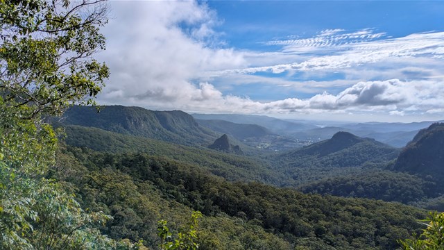
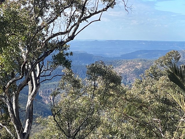
Carnarvon Great Walk
Carnarvon National Park
Walk the trails of the Carnarvon Great Wallk to experience a remote and beautiful landscape of towering sandstone cliffs, sweeping tablelands and shaded side-gorges.
The Carnarvon Great Walk links the Carnarvon Gorge and Mount Moffatt sections of Carnarvon National Park, an area of outstanding natural beauty and human history set within the highlands of the Central Queensland Sandstone Belt.