
Menu
Suggested searches
Your search found 2398 results...

 1
km
return
1
km
return
 20
mins
20
mins
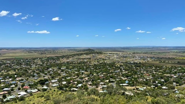
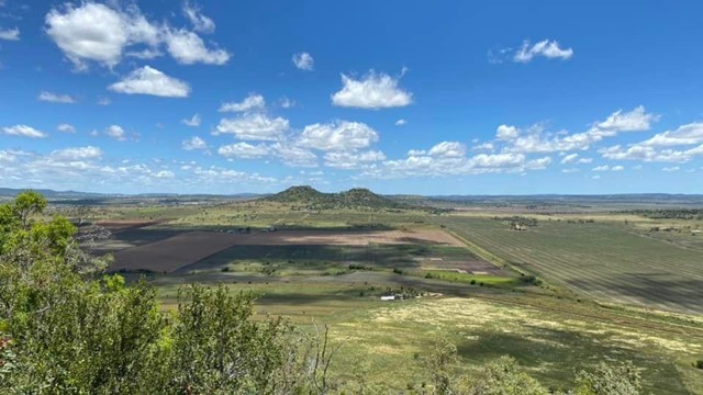
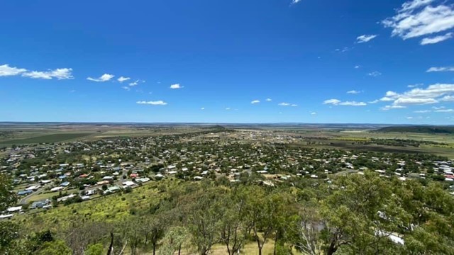
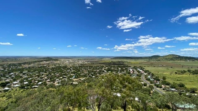
Mount Kingsthorpe
Toowoomba
A short walk zigzagging to the summit of Mt Kingsthorpe with panoramic views over the town of Kingsthorpe and surrounding farmland. The trail is unsealed and contains several natural stone steps. There are a few bench seats along the trail to rest but no other facilities.
Officially listed as Grade 4/Hard (loose/uneven surface, natural steps), this track is suitable for walkers of all ages and most fitness levels.
 90
mins
90
mins
Western Circuit
Sundown National Park
A fairly easy but very picturesque walk. Lots of wildlife, beautiful wildflowers and eucalypts.
6
km
return
2
hrs
Musgravea Track
Far North Queensland
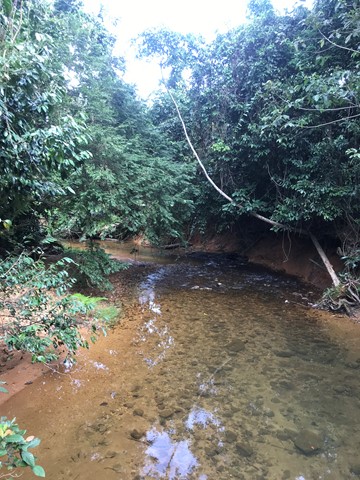
This track is a multi-use track for walkers and mountain-bike riders. It is the only track in Djiru National Park where bicycles are permitted.
This mainly flat track is suitable for dry weather access and requires a medium level of fitness. It follows an old forestry road used in the 1960s and 1970s to haul timber from South Mission Beach to the El Arish timber mill. The track heads north from the car park at the Licuala day-use area and exits on to the El Arish–Mission Beach road about 2 km east of the Lacey Creek day-use area. For safety reasons, the old vehicle bridges have been removed and detours to the two creek crossings have been marked for walkers and cyclists. Bicycles will have to be carried down several steps, through the creek and up several steps at each creek crossing. Creeks in this area are subject to flash flooding and caution should be exercised.
 40
km
one-way
3
days
40
km
one-way
3
days
Numinbah Gap to Christmas Creek
Lamington National Park
A challenging 2-day or 3-day hike along the QLD/NSW border.
2-day option: camp at Echo Point
3-day option: camp at Bithongabel and Point Lookout
A good challenge for experienced walkers with good experience and navigation skills. Points of interest along the way include Bushranger's Cave, Mt Wagawn, Mt Hobwee, Dacelo Lookout, Merino Lookout, Bithongabel Lookout, Echo Point Lookout, Point Lookout, and the Stinson Crash.
This walk can be done in either direction. In any case, you will either have to do a car shuffle or very nicely ask friends or family to do a drop-off and pick-up.
Make sure that you take a PLB and proper emergency provisions (first aid kit, shelter, wet weather gear, warm clothes, extra food rations etc.).
300
m
return
5
mins
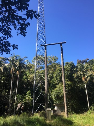
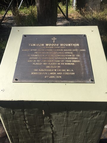
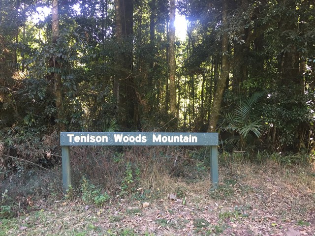
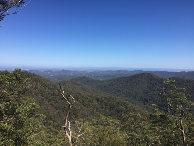
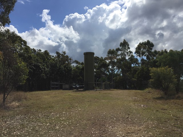
Tenison Woods Mountain
D'Aguilar National Park
A short walk to the summit of Tenison Woods Mountain the tallest mountain in the D'Aguilar Range at 770 metres through some rain forest to the summit clearing with repeater tower.
 200
m
return
10
mins
200
m
return
10
mins
Westridge Outlook
D'Aguilar National Park
An elevated board walk with views to the West.
 2.5
km
return
1
hr
2.5
km
return
1
hr
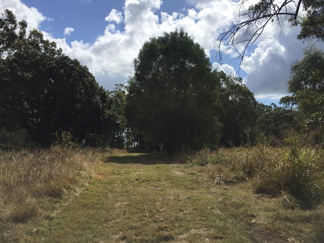
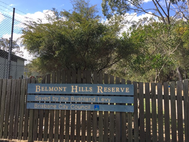
Belmont Hills Reserve
Brisbane City Council Local Walks
A short walk to the top of Belmont Hill. Journey to the top of the hill has some great views of the city and surrounding suburbs.
Top of the hill has some great places to rest under the tree canopy and have a picnic
 2
km
return
1
hr
2
km
return
1
hr
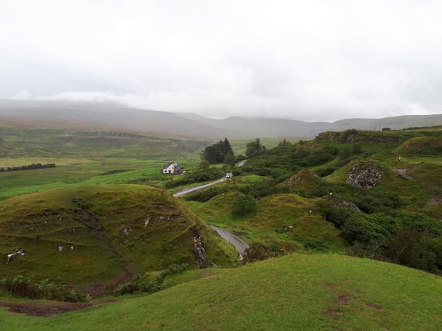
Fairy Glen
United Kingdom
A small walk through the Fairy Glen hills, full of peaceful treks and beautiful views.
 18
km
one-way
5
hrs
18
km
one-way
5
hrs
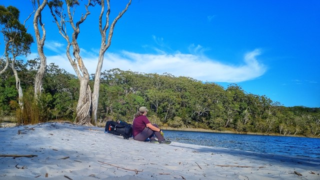
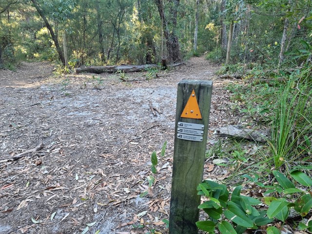
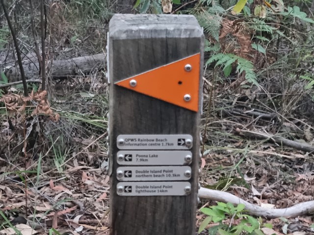
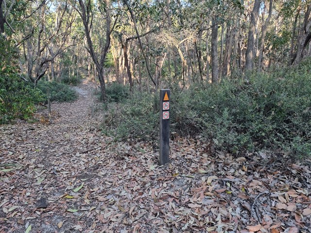
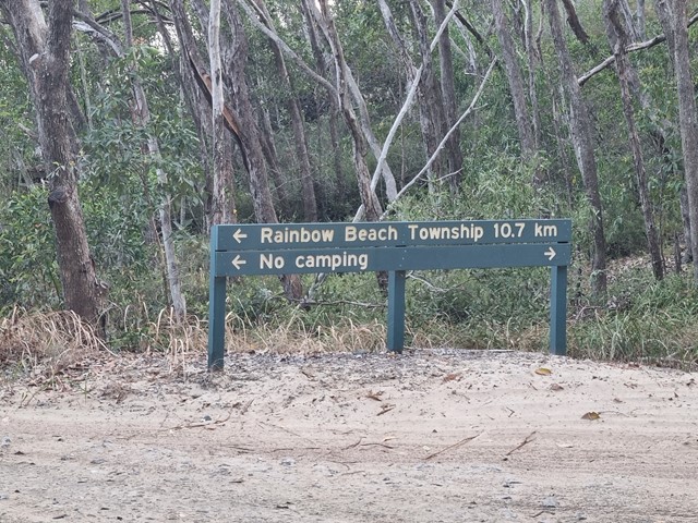
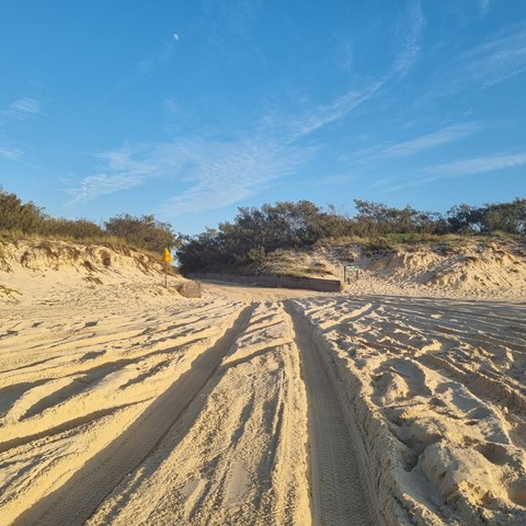
Cooloola Great Walk - S5 track to Freshwater Campground
Great Sandy National Park
Day 1 of the Cooloola Great Walk starting at the Rainbow Beach end but staying at the Freshwater campground rather than the walkers camp.
 20
km
one-way
5.5
hrs
20
km
one-way
5.5
hrs
Cooloola Great Walk - S6 track vis Leisha Track
Great Sandy National Park
Freshwater Campground to Rainbow Beach via Leisha Track