
Musgravea Track
Far North Queensland


Menu
This track is a multi-use track for walkers and mountain-bike riders. It is the only track in Djiru National Park where bicycles are permitted.
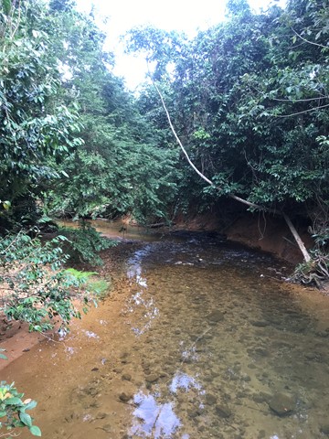
This mainly flat track is suitable for dry weather access and requires a medium level of fitness. It follows an old forestry road used in the 1960s and 1970s to haul timber from South Mission Beach to the El Arish timber mill. The track heads north from the car park at the Licuala day-use area and exits on to the El Arish–Mission Beach road about 2 km east of the Lacey Creek day-use area. For safety reasons, the old vehicle bridges have been removed and detours to the two creek crossings have been marked for walkers and cyclists. Bicycles will have to be carried down several steps, through the creek and up several steps at each creek crossing. Creeks in this area are subject to flash flooding and caution should be exercised.

Getting there
Park at the Licuala day-use area
Maps
https://parks.des.qld.gov.au/__data/assets/pdf_file/0027/159156/mission-beach-area-map.pdf
Route/Trail notes
It's a straight line! When you get to the exit on to the El Arish–Mission Beach road it's time to walk back.
Permits/Costs
None
Other References
GPS Tracks
- No GPS available for this walk yet.
 6
6 2
2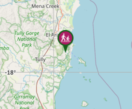
Comments
Nobody has commented on this walk yet. If you've done it then tick it off and add a comment.