
Numinbah Gap to Christmas Creek
Lamington National Park


Menu
GPS Tracks
A challenging 2-day or 3-day hike along the QLD/NSW border.
2-day option: camp at Echo Point
3-day option: camp at Bithongabel and Point Lookout
A good challenge for experienced walkers with good experience and navigation skills. Points of interest along the way include Bushranger's Cave, Mt Wagawn, Mt Hobwee, Dacelo Lookout, Merino Lookout, Bithongabel Lookout, Echo Point Lookout, Point Lookout, and the Stinson Crash.
This walk can be done in either direction. In any case, you will either have to do a car shuffle or very nicely ask friends or family to do a drop-off and pick-up.
Make sure that you take a PLB and proper emergency provisions (first aid kit, shelter, wet weather gear, warm clothes, extra food rations etc.).

Getting there
From Brisbane, take the Pacific Motorway southbound. Take Exit 69, and turn right onto Southport Nerang Rd (which becomes Price St and Nerang Murwillumbah Rd). Just before the QLD/NSW cattle grid border crossing, turn right into Hayters Rd. There is a small carpark area and the start of the hike is just over the barbed wire fence.
Maps
QTopo: https://qtopo.information.qld.gov.au/
Route/Trail notes
Numinbah Gap to Echo Point:
Cross the barbed wire fence, which someone has put piping over to make it easier to cross. Follow the track up the hill to Bushranger's Cave. At the end of the cave section, follow the track South-west up a very steep hill until a sort of cliff line with a cairn. Head south (left) and follow the base of the cliff line for a couple of hundred metres. Then the track joins the ridge and heads to Mt Wagawn, which is part of the Binna Bura track system. The track is pretty good from here to Echo Point and is relatively flat as well. Follow Border Track signs to Green Mountains/O'Reilly's. After Bithongabel, at the junction, take the Albert River Circuit (south-east direction) to Echo Point (NOT to Green Mountains). The Echo Point lookout is great and the campsite is a few minutes further down the track.
There are various little sides trips to do depending on how much time you have (e.g. Garragoolba Lookout, Mt Hobwee, Dacelo Lookout, Merino Lookout, Bithongabel lookout). Along the Border Track, there is a sign pointing to water 20m away and you can see a puddle from the track (but hard to say how reliable it is). Near Cominan lookout there are apparently glow worms at night!
This section takes about 8 hours.
Echo Point to Point Lookout:
Head into the Echo Point campsite and there is a small trail heading west up a hill. There is another, more obvious path which looks like it's been lined with stones. However, it seems to be used as a toilet track these days and it's not the path you are looking for!
The track to Rat-a-tat is quite well marked with pink tape and the trail is obvious enough despite some tree falls. The turn off to Rat-a-tat is marked by a small aluminium sign and is about two hours or so from Echo Point. The track to the campsite descends West (right) to the creek. There is a water source about 30m down from the campsite and a small waterfall, and water can be collected from here. It's a long way to the next water source (at Christmas Creek itself), so stock up on water at Rat-a-tat. Re-trace your steps back to the main track.
Continue heading along the track. If you get lost (or lose track of the pink tape), just remember that the track generally sticks close to the ridge line. There are a couple of excellent lookouts (in particular, one just under halfway between Mt Throakban and Point Lookout).
Even with a relatively clear track, this section of the hike can take about 8 hrs.
Point Lookout to Christmas Creek:
Only attempt this section if there is enough daylight to get to Christmas Creek. The walk along Christmas Creek can be done in the dark.
At the Point Lookout campsite, take a track North-West down the hill. It gets quite steep. Just a few minutes down the track there is a cairn and a track junction. The track heading West-South-West (left) is the Stretcher track. The track heading North-West (right) is the Stinson track. Take the Stinson track to the Stinson campsite. There is a track descending east to the Stinson wreck site (although only memorial plaques and a couple of bits of plane remain). Re-trace your steps to the Stinson campsite. Continue heading down the spur on an obvious track.
Eventually, you hit the top of the cliff line. There is an orange arrow pointing to the track heading South-west (left). The track becomes very steep from here until Christmas Creek. The track is still relatively obvious and well-marked with pink tape. At one point, there is a small cliff, and someone has attached a rope to help get down. Check the condition of the rope before trusting it with your bodyweight!
Once at Christmas Creek, either head upstream to Westray’s Grave and Larapinta Falls, or downstream to the end of the track. The track follows the creek downstream, crossing several tributaries before flattening out for the last couple of kilometres. Cross Christmas Creek once you have passed the National Parks sign. If the creek is low, simply rock hop across. Aim for the bank directly across from you. There is a dirt slope with roots which you climb up to get to the path. Follow the track to a road. Follow the road to the carpark, which is about 500m from the causeway.
This section of the track takes about 4 hours (2.5hrs to get from Point Lookout to Christmas Creek and 1.5 hours to get to the carpark).
Permits/Costs
Camping can be booked on the QPWS site for about $7 pp/pn: https://qpws.usedirect.com/QPWS/default.aspx
Other References
Various track notes on Aussie Bushwalking of smaller section of the track, e.g. Bushranger's Cave, Mt Wagawn, The Border Track, Albert River Circuit, Stinson Crash Site from Christmas Creek.
Track notes also available in Take a Walk South-East Queensland for another version of the hike going from Green Mountains to Christmas Creek.
 Numinbah Gap to Christmas Creek (GPX)
 40
40 3
3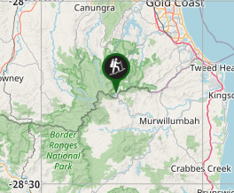
Comments
Nobody has commented on this walk yet. If you've done it then tick it off and add a comment.