
Menu
Suggested searches
Your search found 2398 results...

 4
km
return
4
km
return
 90
mins
90
mins
Transit Hill
Lord Howe Island
An easy walk along Bowker Avenue and through a dry rainforest of Greybark, Palms, Blackbutt, Maulwood and Sallywood trees, before following the pathway above Pinetrees Paddock to the viewing platform and then drop down to Blinky Beach.
 12
km
return
4
hrs
12
km
return
4
hrs
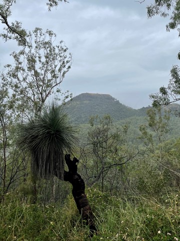
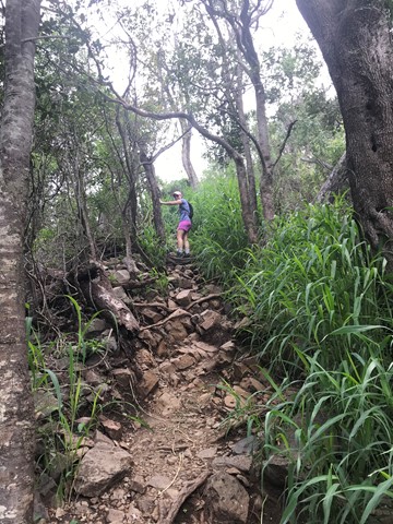
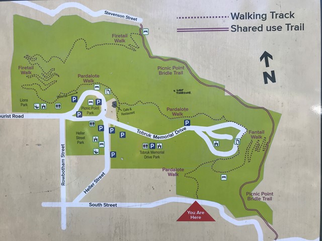
Picnic Point to Table Top
Toowoomba
A terrific hike from the waterfall at Picnic Point to Table Top Mountain and return. Challenging in some sections of Table Top with rock scrambling and lots of gravel. The return trip to Picnic Point is also hilly. 12k is an approximate distance. You can add to this or shorten the walk with a few different options.
 11
km
one-way
4
hrs
11
km
one-way
4
hrs
Fira to Oia
Santorini
The Fira-Oia Hike is a highlight of visiting Santorini.
The hike takes between 2 and 5 hours depending on how fast you walk and how often you stop.
The hiking trail from Fira to Oia is just under 10.5km (6.5 miles).
Elevation along the route: Oia 130 meters; Imerovigli 350 meters (the highest point on the hike);
 5
km
return
2
hrs
5
km
return
2
hrs
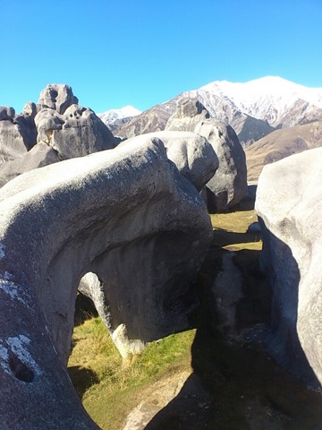
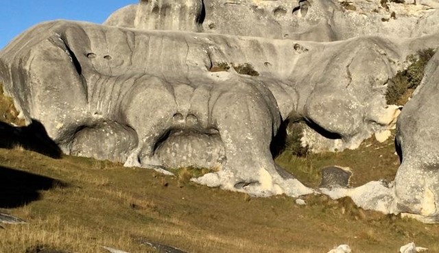
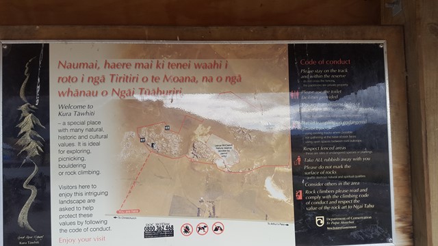
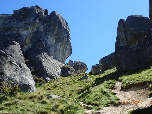
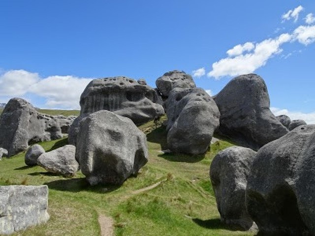
Castle Hill
South Island NZ
Castle Hill Basin lies between the Torlesse and Craigieburn mountain ranges and is characterised by its distinctive limestone rock formations. These limestone rock formations are the water eroded remnants of limestone formed during the Oligocene age 30-40 million years ago when much of present day New Zealand was covered by the sea.
The area is of special cultural, spiritual and historical significance to Ngai Tahu who named it Kura Tawhiti (treasure from afar). Hidden amongst the limestone outcrops of Castle Hill are traces of 500-year old charcoal drawings traditionally said to have been left by the Waitaha, the first people to travel through this area.
 1.7
km
return
1
hr
1.7
km
return
1
hr
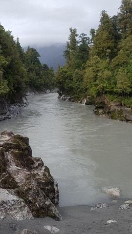
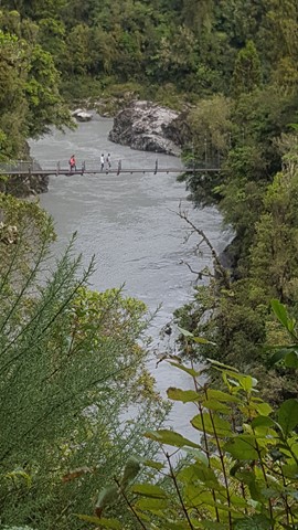
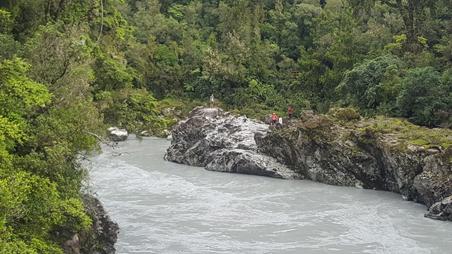
Hokitika Gorge
South Island NZ
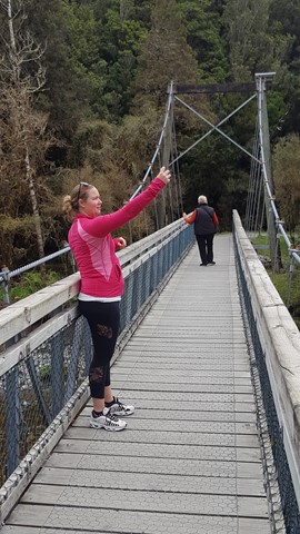
Hokitika Gorge, often referred to as the "Blue Gorge', due to its vivid turquoise water, swing bridge and surrounding of lush native bush, looks just too good to be true.
 1.4
km
return
1
hr
1.4
km
return
1
hr
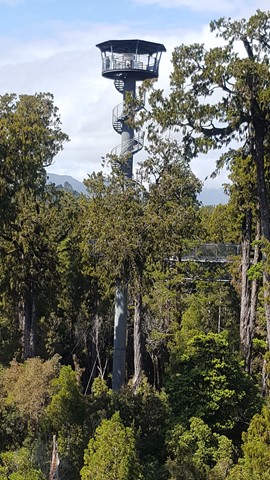
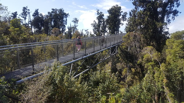
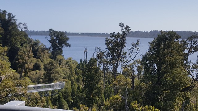
Treetop Walkway
South Island NZ
A treetop walkway that takes you 30m up into the canopy and includes a cantilever and 47m tower that provides a spectacular vista of the surrounding mountains, lakes and forest.
 900
m
return
30
mins
900
m
return
30
mins
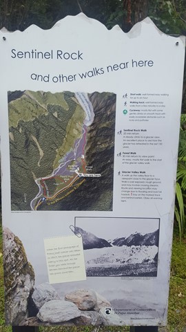
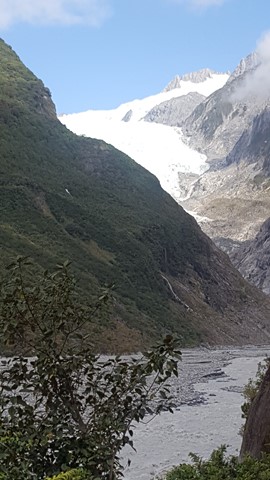
Sentinel Rock Walk
South Island NZ
This short steady climb up a now bush-covered ice-scraped rock offers the most impressive views of the glacier and the Waiho River.
Information panels at the viewpoint show dramatic photos of the glacial retreat, making it one of the best places to appreciate the power of the glacier.
Sentinel Rock emerged from beneath the glacier in 1865 and is an example of how the glacial ice ground the hard schist bedrock into a Roche moutonnee or ‘rock sheep’.
Since 1909 the glacier has retreated over 3 km and plants have progressively colonised where a veneer of rubble has been dumped over bedrock in the valley.
 2
km
return
1
hr
2
km
return
1
hr
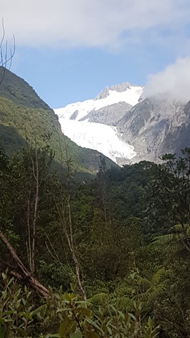
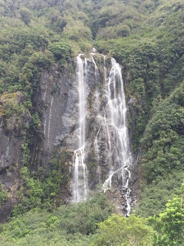
Franz Josef Glacier Valley Walk
South Island NZ
Franz Josef Glacier is now just 300m above sea level and 12km long, starting its journey in the neve of Mt Tasman, having once stretched as far as 35km out into the Tasman Sea. As a result of its accessibility, it is one of the most widely visited glaciers in the world.
This walk gives you some sort of perspective of the power of ice and water and includes a view of the spectacular 35m high Trident Falls.
 2.6
km
return
1
hr
2.6
km
return
1
hr
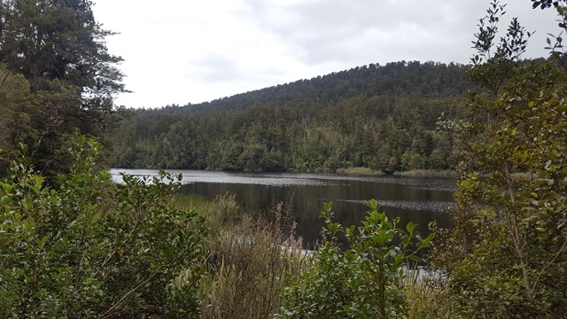
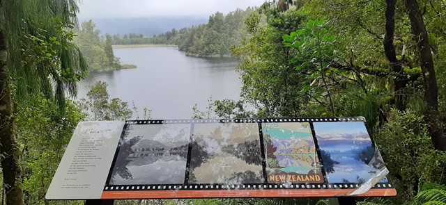
Lake Matheson Jetty
South Island NZ
Lake Matheson, nestled in ancient Forests, is famous for its stunning mirror reflections of Mt Cook and Mt Tasman, which are the result of leaf matter leaching into the water and turning it a dark brown colour.
 4.1
km
return
2
hrs
4.1
km
return
2
hrs
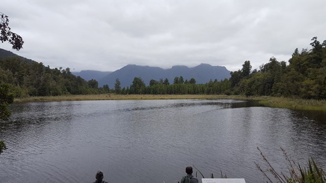
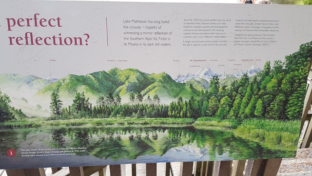
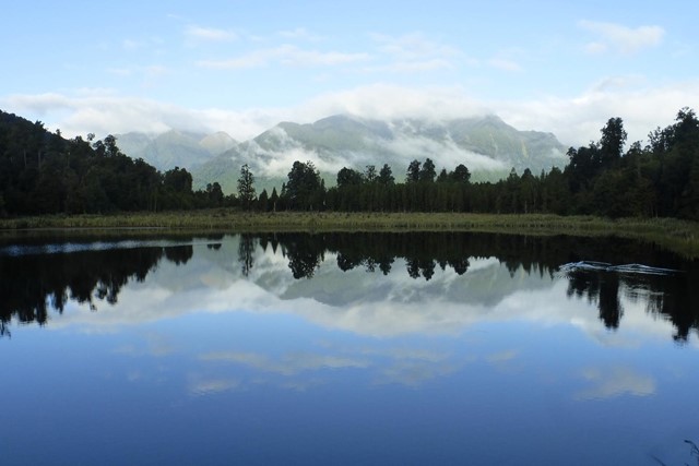
Lake Matheson Circuit
South Island NZ
Lake Matheson is one of the most photographed lakes in New Zealand. Its backdrop of the Southern Alps dominated by Mt Cook, provides an outstanding reflection across the waters from View of Views lookout.