
Mt Bangalore
Main Range National Park


Menu


An off track adventure up a mountain that barley anyone has heard of and even fewer have attempted. Navigation skills are a must, be prepared to spend copious amounts of time in long grass and spider webs.

Getting there
Set your GPS to Wickman Rd Carneys Creek. You will have to enter a gate as you turn off Head Rd (make sure to shut it behind you). The road is a decent dirt road with a small water crossing most 2wd cars shouldn't have any problems with. You will get to another gate with a small strip off grass off to the side that could fit maybe 1-2 cars. The gate says Private Property, however Wickman Rd continues past the gate and leads into National Park so it seems to be Public Access to a point. Definitely be respectful while you are on this hike, don't be the person who ruins it for everyone and forces the land owner to padlock up the gate and prohibit entry.
Route/Trail notes
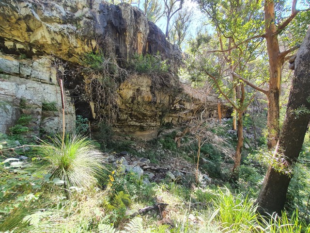
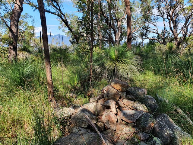
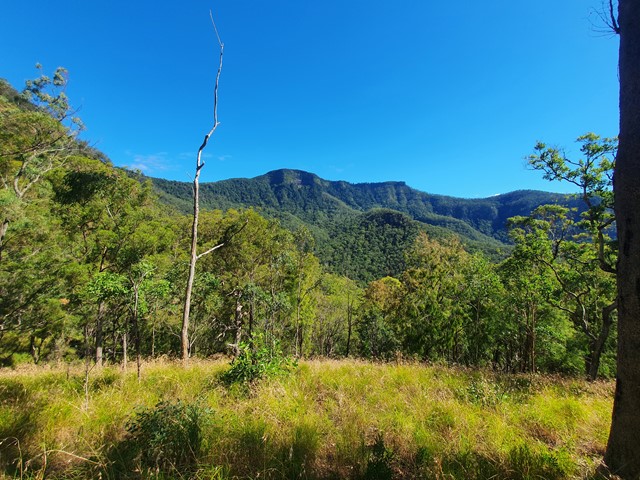
From the gate I followed the WikiLoc map attached below, however there are infinite ways to do this walk. Following the map you walk along the dirt road until you reach 2 gates, enter the gate in the walk photo. Follow the faint outline of a 4wd track before hooking left (no marker to indicate you need to turn left unfortunately) over a small creek and then intercepting a reasonable dirt track. This track gets fainter and fainter until you are full on bushbashing. You will get to a river bed and it appears that even the slightest trace of the track has disappeared, this is because you will now follow the river bed up to the mountain saddle. The river bed has some gorge like qualities with a huge rock cliff on your right. Eventually you will have to make a precarious ascent up the steep, loose, grassy incline to your left to get to the ridgeline (At the top you will get the best photos of the walk). Once you make it to the ridge follow a faint track through the long grass that leads all the way to the summit. The summit has a small cairn and some obstructed views. If you continue on the circuit you will be doing a substantial amount of bushbashing to get to the river and cave. The rocky riverbed is pretty cool however there are overgrown sections that will require you to climb over logs and through bushes. Once you reach the section where two rivers intersect you will bushbash out of the river bed and intercept a really well marked footpad that goes about halfway back to where you parked the car before it suddenly and unexpectedly stops. Luckily from this point it is all fairly open terrain so you can walk back fairly easily.
Other References
https://www.wikiloc.com/hiking-trails/mt-bangalore-circuit-71121699
GPS Tracks
- No GPS available for this walk yet.
 14
14 7
7
Comments