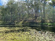
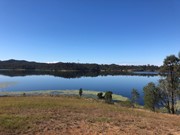
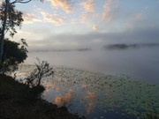
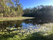
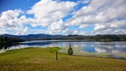
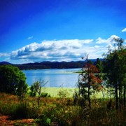
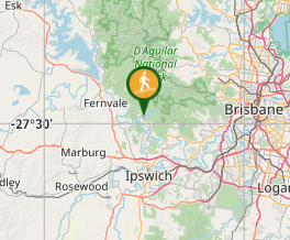
Starting and ending at the day use area, this is a clockwise loop in the hills around Lake Manchester through a conservation park adjacent to the D'Aguilar Range National Park (Brisbane Forest Park section).

Bird Watching
Picnic Facilities
BBQ
Toilets
Horses Permitted
Cycling Permitted
Swamp or Wetland
Eucalypt Forest

Getting there

Lake Manchester day use area is near Kholo, about 25km west of Brisbane off Lake Manchester Road. This is well signposted from Mt Crosby, west of Kenmore.

The last section of road is gravel, but well maintained.

Maps

A location map is available on the DERM website (PDF) with the trail map here. A sign outlines the route at the start of the walk also.

Route/Trail notes

It starts up past the dam wall, and for a time follows the lake shoreline before climbing up into the ridges. For most of the walk the lake itself is not visible.

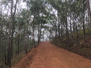
The route uses forest/fire roads which are well graded but a covering of loose gravel means caution must be taken on descents. The trail is very hilly with some testing steep sections.

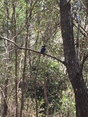
Most of the walk is through open eucalypt and ironbark forests with plenty of birdlife. Each intersection is signposted to remind you to turn right, without distances to the next feature. One sign towards the beginning of the trail going clockwise indicates that the trail continues up a hill, but it ends and goes nowhere so it is better to follow the shore.

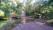
SEQwater signs warn that water should be boiled/treated before drinking so bring plenty of water. There are a few creek crossings but these are seasonal and for most of the year will be dry.

Sections of the track are shared use with horse riding and trail bikes.

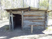
The loop passes a small hut but for the most part is open with some shade provided by trees.

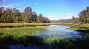
Camping is allowed at the Blue Gum Flats campsite which is reached on the walk. This is a large flat grassy area surrounded by forest but has no facilities. Bookings are required via DERM and the site may be closed periodically for regeneration and during the wildfire season.

The final leg of the walk is along Lake Manchester Road as the trail does not lead directly back to the BBQ area. As a variation here it is possible to keep to the ridge above the lake on the boundary of the paddocks by climbing through a locked gate on the right of the main track. You will find this about 50m after you pass the locked road gate with the trail map at around 15km (you will still need to get back onto Lake Manchester Road for some of the walk regardless, through the railing fence at the end)

Permits/Costs

None required for the walk, and access is free. Booking is required via DERM for camping at the Bluegum Flats.

Other References

None.

Comments

https://ofsoutheastqueensland.wordpress.com/2017/11/13/lake-manchester/
Here, I wrote a longer recount of my walk on this trail, and me and my companions' experiences around the lake. I think it's interesting, so maybe check it out of you're inclined.

This was a nice longer walk, with some interesting and pretty parts and much varied bird life.
Going clockwise, not too far from the beginning of the track a sign will point with an arrow up a hill. Going this way proved to me and my small group to be a waste of time, because the trail disappeared. It seemed to continue past the sign along the lake to the rest of the trail. Without distances marked on them, I'd say the signage on this trail is poor.

meadharry on 11 Nov, 2017

3hrs 15m from start to finish. Walking clockwise, there are some short but steep ascents until you reach the lakeside hut, after which the track is more gentle. Pleasant stroll with occasional views of Lake Manchester and a breeze at the higher parts. Straightforward to navigate, just keen turning right at the signposted intersections. Be prepared to get your feet wet if there has been rain - the walk starts with a broad creek crossing. Bring plenty of water.

spiggytopes on 4 Nov, 2017

I did this walk as a training hike with a 12kg pack and hiking poles and 3.5l of water. Even though I left at 6am, it still took me 5.5hrs to complete the circuit in a counter-clockwise direction. The steeply undulating hills in the final third of the walk were a killer. Towards the end of the walk, near the grassy area as the Dam comes into view, there is a sign pointing up the hill for bushwalkers. I took it, and it led up to the top of the hill overlooking the lake. Amazing view, but I really just wanted it all to be over at that point! This walk is not difficult to navigate, but was physically exhausting. A very good training hike, but not much fun.

Naomi12345 on 28 Oct, 2017

Great walk - bang on 4hrs. Did the circuit anti-clockwise as the stream under the dam wall was running and too deep to cross without getting feet wet so saved it to the end. Some decent inclines to get the lungs working and great scenery.

DavidC on 28 Oct, 2017

We started from the Day Use Area, it was planned to do the clock-wise loop but the water was up to the knee high (due to recent rain) at the very first creek crossing near the carpark! Then we changed our mind to do the anti-clockwise instead. All the direction sign posts are well placed. A bit disappointed that 2/3 of the course has NO lake views at all. With the photo and break times, it took us 3:45 to complete the circuit. Very nice walk, definitely will come back....

orienteer88 on 22 Oct, 2017

Well graded track, lots of up and down good work out

troy on 10 Sep, 2017

Did anti-clockwise and started at 2 pm. Took us 5 hours as part of the track had sign that led to a dead end and had to back track, however follow the signs that indicate trails for all 3 (walking, bicycle and horses) and you should be fine. Some of the hills have a killer incline. Bring atleast 2 litres water per person and if you are starting after 2 pm then DO CARRY TORCHES. Overall awesome walk, plan to do it clockwise also so that we can get the view during daylight that we missed towards the end of our walk when we did it anti-clockwise

TK on 3 Sep, 2017

Did the loop clockwise, some hard/steep inclines and declines for the first third. The cabin is easy to spot and a great place to take a rest. Blue Gum campground is also lovely. Started the walk at 10am and took 4hrs. Was very warm for most of the walk with patchy shade.

TJ on 22 Aug, 2017

Did anti-clockwise, great running loop with some creek crossings, climbs are not very steep, but accumulation of elevation in legs over many hills takes its toll.

Marcin Piotrowski on 16 Jul, 2017


Brian Darlington on 17 Jun, 2017

Great walk as described which we did in clockwise direction. Signage was spot on and the track well maintained. This took us 4hrs including lunch stop.

T18 on 13 May, 2017

Sadly I didn't get to complete this walk. I struggled to find the trail. I attempted anti-clockwise first but lost the track pretty well immediately. Then turned around to go clockwise and lost the path again a few times. I was on my own so I didn't pursue it for long as I was on my way and didn't want to get lost. Not sure if it's just quite overgrown since Cyclone Debbie or it was just too foggy and I couldn't see well. Will try again after the Trail runs happen later in the year.

Eileen on Apr, 2017

Nice walk. Did it clockwise and some good undulation for first third. The cabin at 5km makes a great morning tea/lunch spot with lovely views of the lake and a nice bench. Views of the lake are limited past this point until you get near the end. Creeks were dry today so the water filter didn't get any use, but I was glad of the extra water I'd brought with me (3l total). Well signposted the whole way round and there's now a path that takes you all the way round, skipping out the 800m on the road at the end that it appears you used to have to do. Overall a great day out

Henny on 22 Jan, 2017

**Good times!!**

Done this walk a few times now. Usually takes between 3-4 hours at a decent pace. If you are slow walker and like to slowly appreciate the nature, expect to walk for 5-6 hours. It can get warm quickly so doing this walk between 6am - 10am is a lot easier.

Well signed trail with a few extra trails going off the course (some of these trails are dead ends and you will have to turn back).
Hills: Majority of the Hills are in the first third of the course going clockwise (starting near the dam wall). However there are still some steep hills in the rest of the sections.

If you want to challenge yourself start anticlockwise and walk until the damn wall just before the course ends and turn back, this doubles the course distance and ends up being around 33-34km.

doc on 17 Nov, 2016

*** Please read before attempting this trek***

Bring lots of water!!

This was quite a difficult trek, my wife and I took 6 hours of solid walking with 15kg packs to complete the full circuit.

Some of the track isn't very well signed and its easy to get a little lost. Some of the hills have a killer incline so i hope you're keen! There was also an awesome spot for a rest just near the damn wall with a freshly mowed field (depending which way you started the hike). Enjoy!

Zach on 6 Nov, 2016

Started early around 7am kick off and went counter-clockwise. Took just over 3 hours to complete and the hills toward the end were quite tough especially after having completed 14 or 15 kms by that stage. Really enjoyable walk !

Pidge on 13 Aug, 2016

This walk was completed in an anti-clockwise direction commencing at 8.20 am, lunch at 12.00 pm at the log cabin and walk completed at 2.30pm. Strong south westerly wind blowing which was felt on the ridges to the north of the lake. Very scenic walk.

GlasshouseBW on 26 Apr, 2015

Lots of steep up and down with very loose gravel.
Nice and quiet with not a lot of people.

bronwenz on 21 Sep, 2014

A few big inclines and lots of loose gravel. A nice walk but you hardly see the lake and the circuit ends at a road you have to walk back to the car park. Don't do this walk for the scenery :0)

Handi on 26 Apr, 2014

The northern bank was closed due to back burning, so we did the southern trail up to Blue Gum Flats campsite. Easy walking through woodland with some glimpses of the lake - some of the hills seemed higher on the return! Will come back to do the whole loop out of fire season

Shorts on 13 Oct, 2013

Where

Click here to load this map.

Nearby Walks

Done this walk?

This walk has been ticked 107 times

Aussie Bushwalking can keep track of your bushwalks.

Login/signup to tick this walk off.

Tick walks to keep track of where you've been. You must Login to tick walks. Accounts are 100% free so sign up if you don't have one.