
Mount Ernest
Mt Barney National Park


Menu
GPS Tracks

IMPORTANT: The route to Mount Ernest from Yellow Pinch via the northeast ridge involve traversing private property. You should contact NPRSR to obtain contact details for the landowner in order to obtain permission to enter private property.
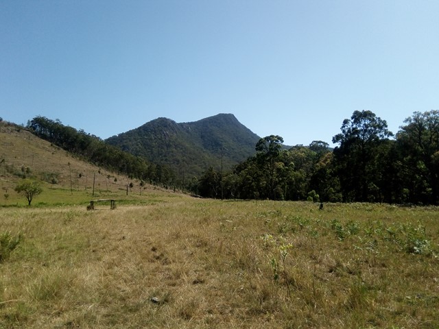
Mount Ernest lies on the opposite (northern) side of Mount Lindesay Highway from its namesake, and provides spectacular views of Mount Barney to the north. While much lower than the main peaks of Mount Barney, routes to the summit of Mount Ernest are less trodden take just as long.

Getting there
Drive 2 hours south of Brisbane to the Yellow Pinch reserve car park at the southern end of Upper Logan Road
Route/Trail notes
The northeastern ridge route starts off on the fire road to the southern Mount Barney routes before branching off and crossing the Logan River three times. The bottom of the northeastern ridge starts as a grassy slope, before you quickly encounter steep bands of rock. There is more than one feasible route through here, but all are steep and require caution. From there, the ridge ascends several false summits and any scrambling is generally straightforward, with the exception of an unavoidable exposed downclimb (though plenty of holds are available). It's advisable to have navigational aid, as a faint track only exists in places. Remember not to stray too far from the ridge.
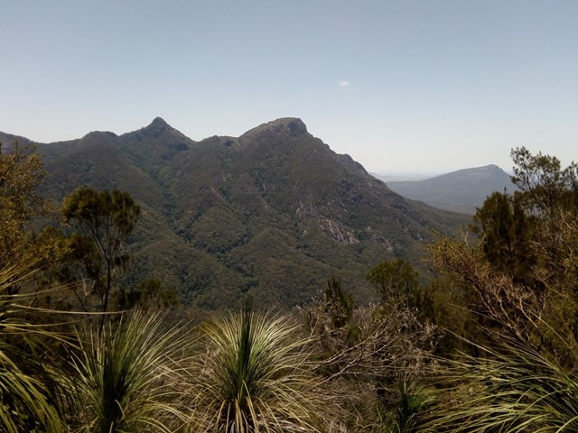
A small rock cairn marks the summit, with a rocky platform providing a great place to enjoy views of Mount Barney. Views of Mount Lindesay are limited to some of the earlier sections of the ridge, as it is obscured by vegetation at the summit.
Permits
All documented summit routes involve traversing private property (see notice at top).
Other References
https://www.npsr.qld.gov.au/parks/mount-barney/
http://www.southee.com/Bushwalking/Ch13-BarneyBallow.html#label066
 Mount Ernest - north east ridge (GPX)
 11
11 9
9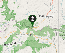
Comments