
Menu
Popular Walks
-
Hooker Valley Track
(20 ticks) -
Tongariro Alpine Crossing
(17 ticks) -
Milford Track
(14 ticks) -
Kepler Track
(13 ticks) -
Routeburn Track (At least to Harris Saddle and back)
(12 ticks)
Popular Walks
-
Hooker Valley Track
(20 ticks) -
Tongariro Alpine Crossing
(17 ticks) -
Milford Track
(14 ticks) -
Kepler Track
(13 ticks) -
Routeburn Track (At least to Harris Saddle and back)
(12 ticks)
Walks in North Island NZ

 2.4
km
return
2.4
km
return
 1
hr
1
hr
Maungauika / North Head Historic Walk
Loop around Maungauika / North Head and its historic Battery.
2.1
km
return
1
hr
Maungawhau / Mt Eden Path
Walk around and to the top of Maungawhau / Mt Eden a volcanic cone which is the tallest point on the Auckland isthmus.
 800
m
return
20
mins
800
m
return
20
mins
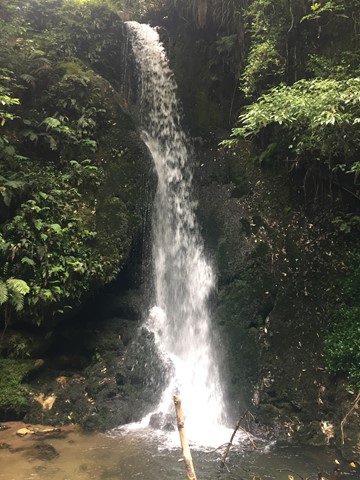
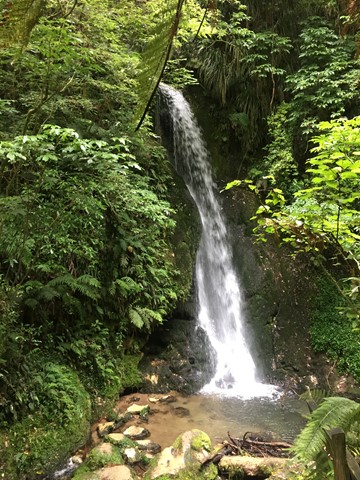
McLaren Falls Park Waterfall Track
A short walk in McLaren Falls Park which takes you to Marshall's Falls and there are some overhangs that house glow worms on the right hand side of the creek when looking upstream.
 340
m
return
15
mins
340
m
return
15
mins
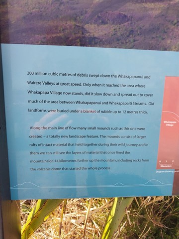
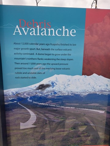
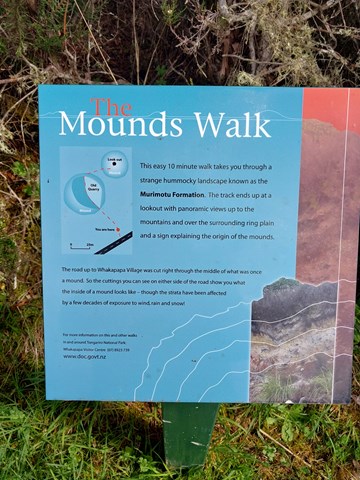
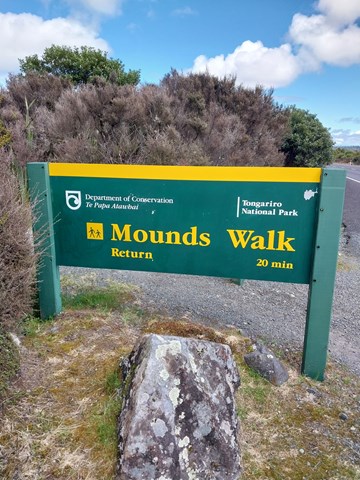
Mounds Walk
Debris avalanches during Ruapehu’s periods of volcanic activity are believed to have formed these mounds thousands of years ago. The top of the track offers good views of the volcanoes and surrounding area.
 4
km
return
2
hrs
4
km
return
2
hrs
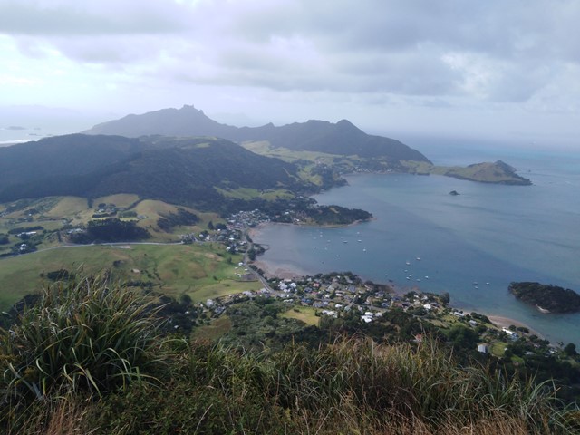
Mount Manaia
A steady walk with a lot of stairs to the lookout near the top of Mount Manaia. Very distinctive mountain with massive rock pillars on top of it. There is a rough track leading to the furthest pillar which you can climb up.
 1.9
km
one-way
45
mins
1.9
km
one-way
45
mins
Mount Victoria to Mount Alfred via Hobbit's Hideout
Go to both the scenic lookout and trigpoint of Mount Victoria (196m) then follow the forest ridge of the Wellington town belt to Mount Alfred (133m) the site of the Te Akatarewa Pa. With the detour to the Hobbit's Hideout a LotR film location along the way the walk will be 1.9kms one way. A straight return is about 1km.
7.4
km
return
5
hrs
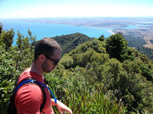
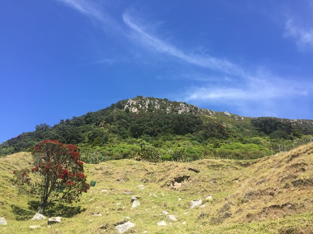
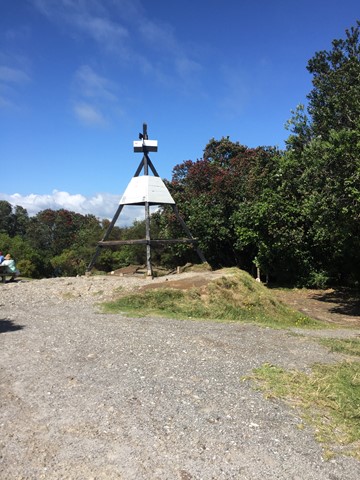
Mt Karioi
About an hour west of Hamilton lies the extinct Volcano known as Mt Karioi. The track starts off fairly steep through grassland and then thick forest on a very well marked track. Upon reaching the ridgeline you are greeted with excellent views that only get better the higher you go. After the initial climb the walk is fairly undulating until you reach the summit. There are a few ladders/stairs/near vertical ascents where you have the aid of a series of chains but nothing too challenging. The track, though well marked, gets very muddy, so if you decide to attempt this after wet weather be prepared to wreck the clothes you're wearing because you almost certainly will slip at some point. There is a helipad at the very top with 320 degree views out to the Raglan Harbour and beyond.
 3.5
km
return
1
hr
3.5
km
return
1
hr
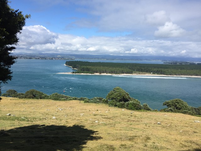
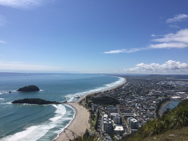
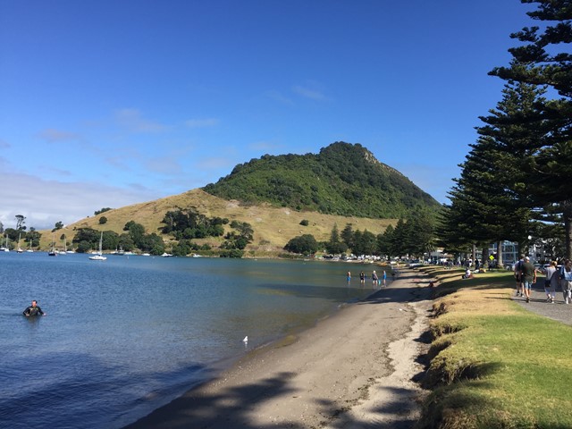
Mt Maunganui
A nice casual stroll up a well marked trail to the summit of Mt Maunganui where fantastic coastal views await you.
 10
km
return
6
hrs
10
km
return
6
hrs
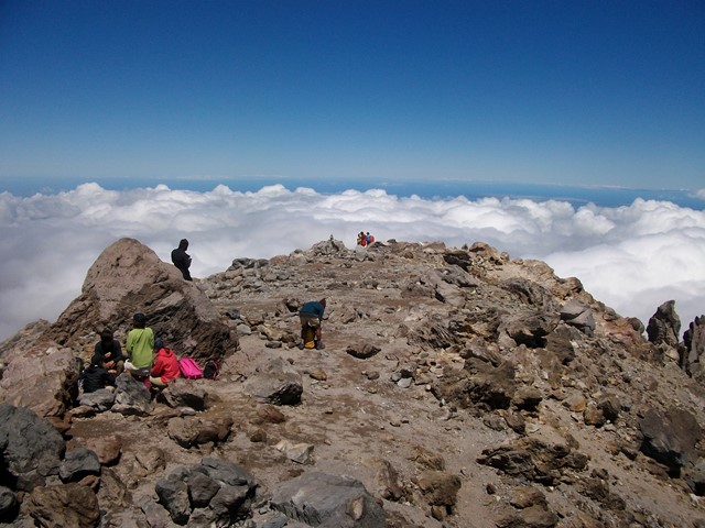
Mt Ruapehu Crater Climb
http://www.doc.govt.nz/parks-and-recreation/places-to-go/central-north-island/places/tongariro-national-park/things-to-do/tracks/mount-ruapehu-crater-climb/
 12.6
km
return
8
hrs
12.6
km
return
8
hrs
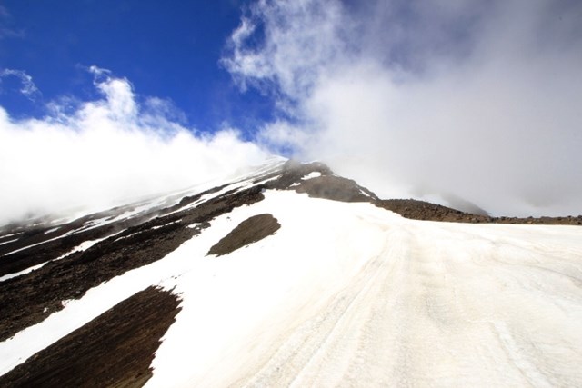
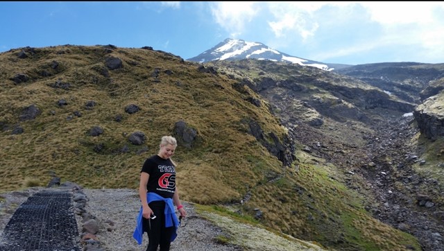
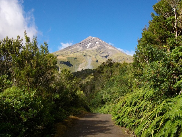
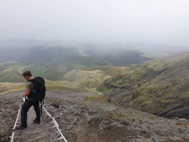
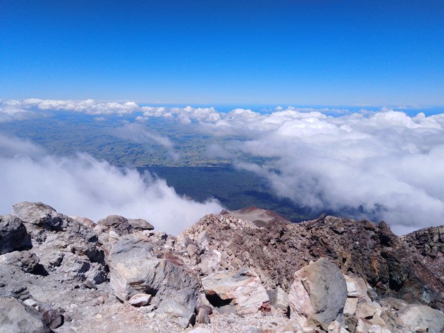
Mt Taranaki
Active Stratovolcano located just east of New Plymouth on the North Island of New Zealand. 2nd highest mountain on the north island and was used as the backdrop in the film 'The Last Samurai' due to its similarity to Mt Fuji. You can see it all the way from the Tongariro Alpine Crossing on a clear day! It should only be climbed in summer unless you have proper mountaineering experience, even then expect it to be snow/ice capped. An excellent and challenging walk to the summit with a bit of everything - scree/hiking/scrambling/crossing ice plains.