


 14
14 7.5
7.5- Fujimidai 富士見台 (Gifu/Nagano Prefectures) (Japan)
- Nakasendo Trail (Nakatsugawa to Nagiso section-Gifu/ Nagano Prefecture) (Japan)
- Nakasendo Trail 馬籠宿から妻籠宿まで (Magome to Tsumago section, Gifu/Nagano Prefecture) (Japan)
- The best rural landscape view in Japan 日本一農村景観 (Gifu Prefecture) (Japan)
- Mount Hananashi 花無山 (Gifu Prefecture) (Japan)
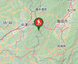
Mount Ena 恵那山 (Gifu Prefecture)
Japan
Menu

Mount Ena is located in the southern most end of the Central Japanese Alps. It is one of the '100 famous mountains' of Japan and is a holy place as it is the supposed birth place of Emperor Tensho.
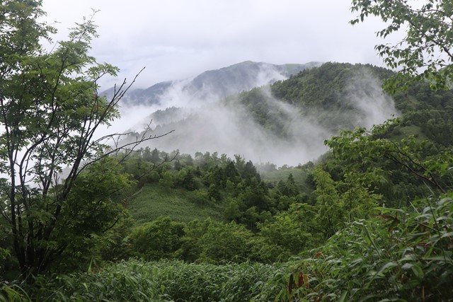
Mount Ena is a relatively difficult hike and requires stamina. It is not technically difficult as there are no long up-hill sections or scrambling involved, but is challenging as it is a long hike. Also be warned that the summit of Mount Ena offers limited views, the views at the beginning of the hike are better than those from the summit.
Lookouts
Bird Watching
Picnic Facilities
Toilets
Alpine
2191m
Maximum Elevation
Getting there
There are two trails that lead to the summit of Mount Ena, one is accessible via public transport and the other is accessible only via car.
Bus:
If using public transport, first take the Chuo line to Nakatsugawa Station. There is a direct train that departs from Nagoya Station and terminates at Nakatsugawa station. From Nakatsugawa station take the bus from platform 1 bound for "Enasan Weston Koen Mae"
Get off the bus at Enasan Weston Koen Mae, the last stop. Note that I have not personally done this route (Maenomiya) and cannot give a detailed hiking guide. By the looks of it, it is straight forward. Just follow signs for Ena-san and continue straight until you reach the peak. Unfortunately, this route does not appear to have many views.
The last bus returning to Nakatsugawa Station departs at 5:25pm. Make sure that you are at the bus stop before this time.
The first bus departing Nakatsugawa Station for Enasan Weson Koen Mae is 7:00AM.
I recommend taking the first bus to ensure that you have enough time do the hike. Bus times may be different on weekends and public holidays.
I recommend taking the first bus to ensure that you have enough time do the hike. Bus times may be different on weekends and public holidays.
<!-- wp:paragraph --> <!-- /wp:paragraph --> <!-- wp:image {"id":59,"sizeSlug":"large","linkDestination":"none"} --> <!-- /wp:image -->
<figure class="wp-block-image size-large">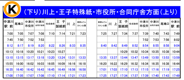 <figcaption class="wp-element-caption">
</figcaption> </figure>
Car:
The main route up Mt. Ena begins at Misakatouge (神坂峠) located on the border between Gifu and Nagano. You can approach Misakatouge from either the Gifu or Nagano side. If coming from Gifu, drive along the Old Nakasendo Road (Route 19) in Nakatsugawa and there will be a turn off near a Family Mart. Note that this is the last convience store along the way, stock up here for food on the hike. Continue down the road to the right of the Family Mart. This will take you on a very windy mountainous road. Turn on the lights on your car so that other cars can see you. Continue along this road until you reach the Misakatouge car park. There will be a map and sign there that marks the beginning of the hike.
Please be aware that there are no toilets at the carpark or along the Mount Ena trail. Use the toilet at the Family Mart when you turn off onto the windy mountain road. This is the last toilet.
< <figcaption
Maps
Check Yamap
https://yamap.com/activities/10769451
Route/Trail notes
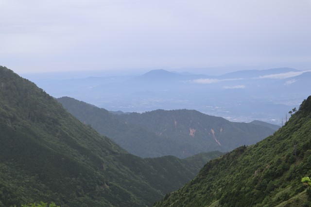
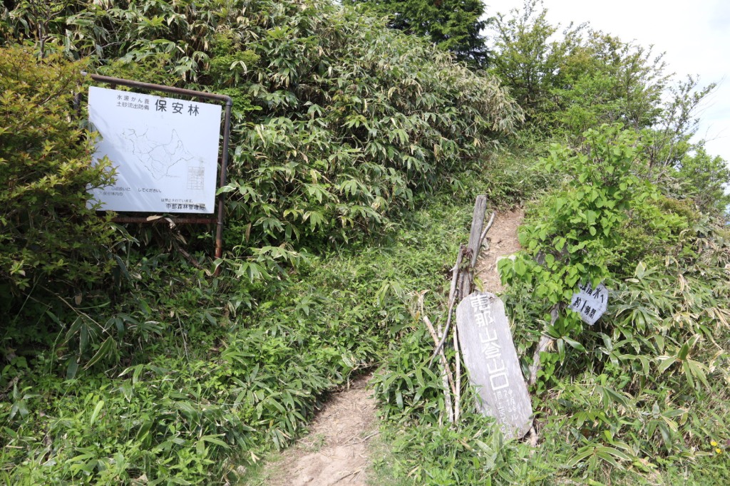
Begin the hike from the carpark. Look for signs that read 恵那山登山口. Make sure that you can read the kanji 恵那山 as it will be important to follow signs on the hike that have this written on it. From the beginning of the hike you should get sweeping views of the surrounding central and southern alps. Continue along this path until you read a 360 Panorama location that amazing views of the nearby mountains. Note that this is the best view on the entire Mount Ena hike.
At the 360 panroma location, take a right at the fork in the road (there should be a small sign pointing towards Mount Ena), the track should be heading downhill through the sasa bamboo grass. Continue along this path for about an hour and you will summit Oobanzan 大判山 where there are chairs to rest on. There will be a sign here that marks the elevation as 1,691m, you still have a long ways to climb from here.
Continue past Oobanzan, following signs for Mount Ena 恵那山. There will be a lot of uphil climbing, but no scrambling or anything technically difficult. Along the way you will pass a few shrines. Reaching the summit may take you up to two and half to three hours. Just before you reach the summit, you will see an emergency mountain hut and a toilet. You can stay at this hut for free if you need to.
Continue past the hut and walk for another five to ten minutes and you will reach the true summit of Mount Ena. There will be about three or four shrines along the way. At the true summit there will be a big lookout tower with a questionable ladder. Climbing the view point offers no views, just views of the tops of trees. There are benches at the summit for you to have lunch at before going back down the mountain.
Continue the same path down the mountain that you can up.
 <figcaption
GPS Tracks
- No GPS available for this walk yet.
Where
Click here to load this map.
Comments
Nobody has commented on this walk yet. If you've done it then tick it off and add a comment.