
Menu

 2
km
return
2
km
return
 1
hr
1
hr
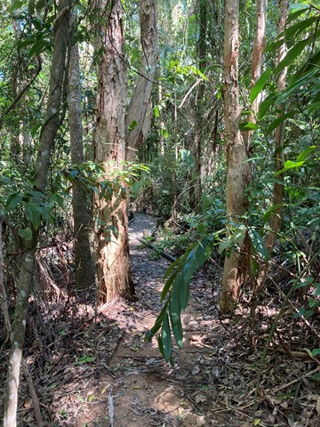
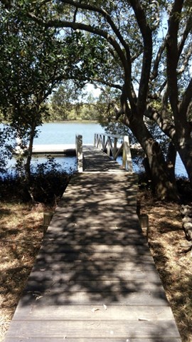
Maroochy Wetland Conservation Park
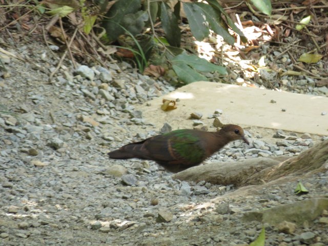
The Maroochy Wetlands Sanctuary boardwalk passes through eucalypt, rain and mangrove forest down to the river. Native fauna including River Mangrove, Orange Mangrove, Swamp Oak, Milky Mangrove, Grey Mangrove, Native Wisteria, Flooded Gum, Bungwall Fern, Paperbarked Tea-Tree and Mangrove Fern. There is abundant bird life, as well as crabs, butterflies, reptiles, fish and other wildlife species that frequent the wetlands.
 1
km
return
30
mins
1
km
return
30
mins
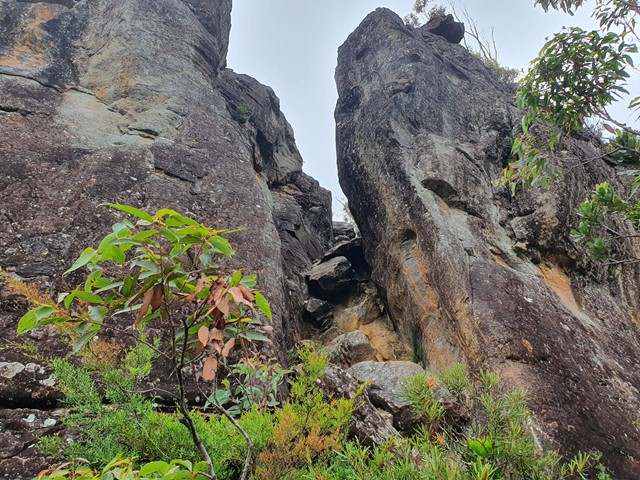
Ghost Hole Track
Went for a walk here to look at the location of the old gold mines.
 1.8
km
return
35
mins
1.8
km
return
35
mins
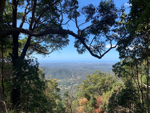
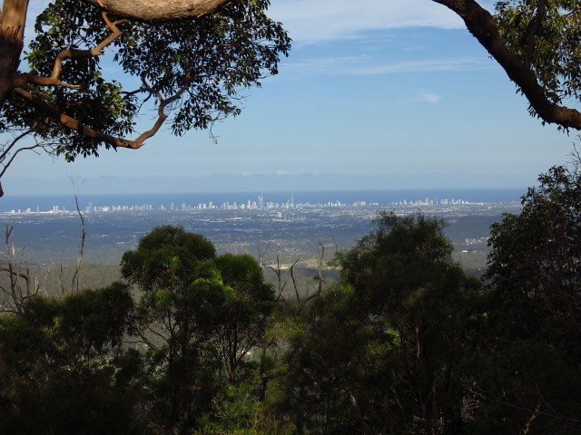
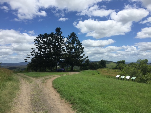
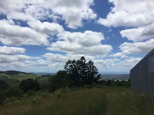
Freeman's Lookout Track
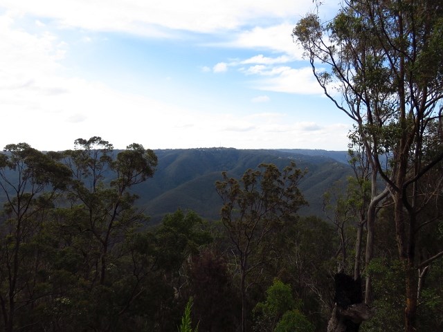
Access to Lower Beechmont Conservation Area from Freemans Rd, Lower Beechmont. Panoramic view out over the Gold Coast, north to Mt Tamborine and west to Canungra.
 2.7
km
return
1
hr
2.7
km
return
1
hr
Littoralis Trail
Adjoining the Mooloolah River, the Mooloolah River National Park protects valuable remnants of coastal lowland habitat, rainforest, open eucalypt woodlands, melaleuca forests, wallum banksia woodlands, scribbly gum open forests, wallum heath and sedgelands.
 2.9
km
return
1
hr
2.9
km
return
1
hr
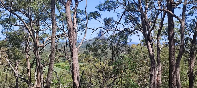
Apple Tree Park North and South Trails
A short walk in the forest from Apple Tree Park with views through the trees to Numinbah Valley.
 5.9
km
return
2
hrs
5.9
km
return
2
hrs
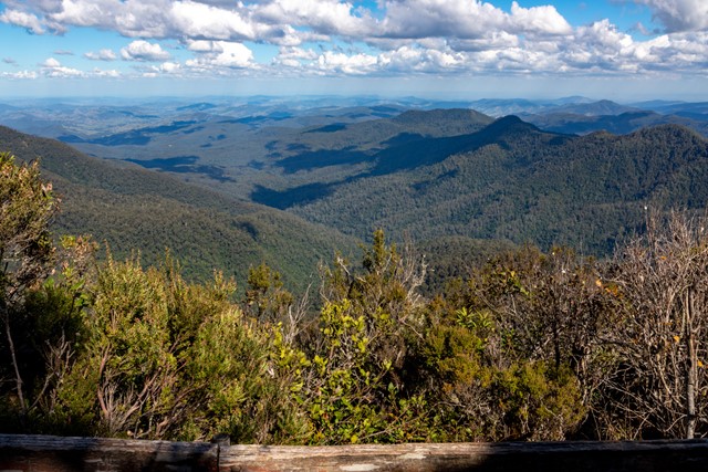
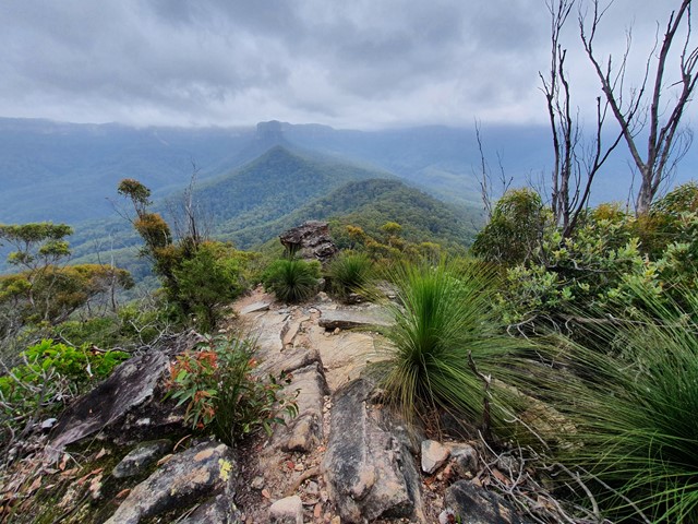
Trachyte Circuit
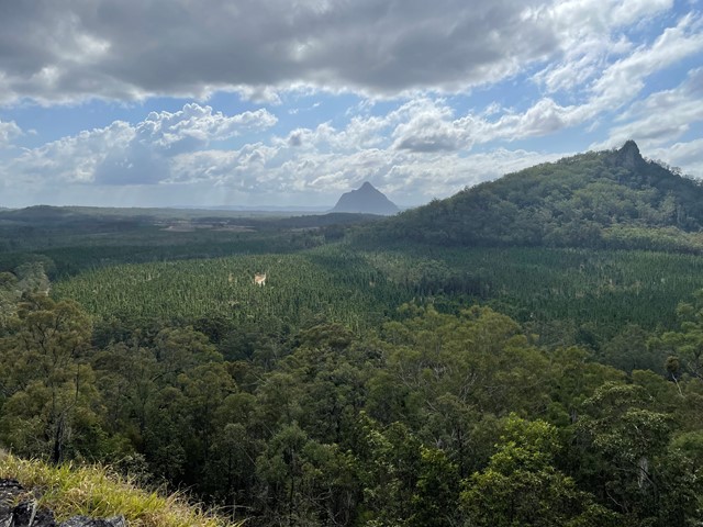
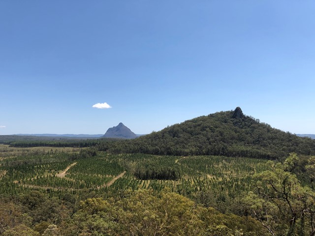
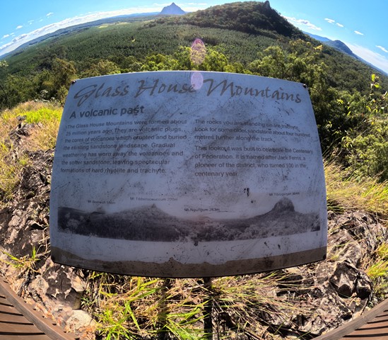
This circuit leads through open woodland and heathland linking Mount Tibrogargan and Mount Tibberoowuccum. Interpretive signs along the track provide details of the area's special features. The Jack Ferris lookout, on Trachyte Ridge, allows for good views of the surrounding peaks. This ridge owes its name to a type of volcanic rock which forms many of the Glass House Mountains peaks.
 1.5
km
return
1
hr
1.5
km
return
1
hr
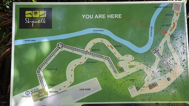
Tamborine Rainforest Skywalk
A spectacular elevated walkway through the beautiful middle and upper canopies of the rainforest. The walkway is a stable, high-tech steel structure enabling visitors to explore these canopies in a safe and secure way. It ascends gradually through the lower canopy and follows points of interest including rock pools and tumbling creeks, a butterfly lookout, local history enclosure and sheltered rest areas along the way until reaching the amazing Cantilever. This is a 40 metre long span soaring 30 metres above the valley, with spectacular views over the creek and the rainforest canopies below.
 3
km
return
2
hrs
3
km
return
2
hrs
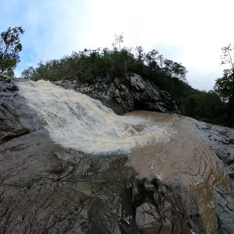
Kings Plains Creek Falls
A fun walk rock-hopping down the creek (no marked track) to the falls, best after rain. Lots of wildlife, and lovely orange gums. Although this walk is short, allow 2 hours to enjoy yourself and observe the birds and nature. Its a surprisingly pretty spot and uncrowded, in a park that protects rare woodland. If you need accommodation, check out nearby Kings Plains Castle for a change from a tent.
 20
km
return
5
hrs
20
km
return
5
hrs
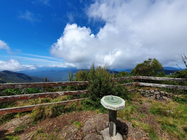
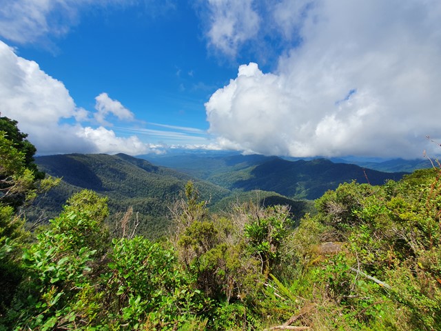
Careys Peak via the Corker Track
A steep track in The southern section of Barrington Tops National Park that takes you to an intersection with the Barrington Tops Link Track, a track that runs across the top of the range. This track is also used to access Careys Peak.
 160
m
one-way
3
mins
160
m
one-way
3
mins
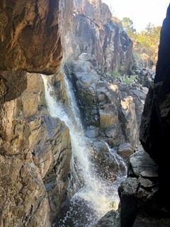
Bean Creek Falls
A (very) short down to a viewing platform to view the waterfall, if there has been some rain.
The last few hundred metres of the drive on on a chewed up dirt road, I was in a 2wd car and it was a bit iffy.
 3.3
km
return
90
mins
3.3
km
return
90
mins
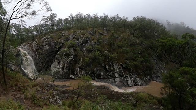
Tibrogargan Circuit
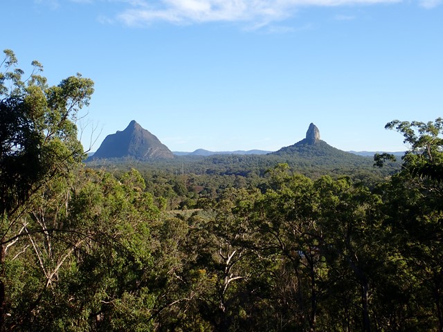
The walking track leads around the base of Mount Tibrogargan, through casuarina groves, open eucalypt and melaleuca forests. The track allows for great views of Mount Tibrogargan and Mount Cooee (to the north east). Keep an eye out for circling peregrine falcons. There are a number of seats along the way for those that like to stop and take it all in.
 500
m
return
20
mins
500
m
return
20
mins
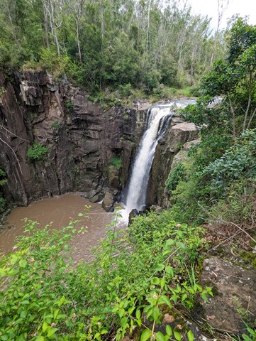
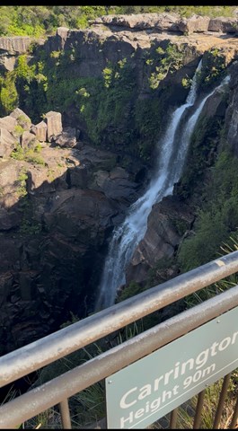
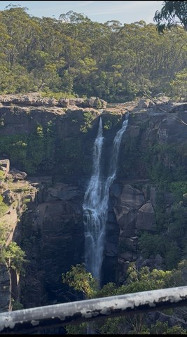
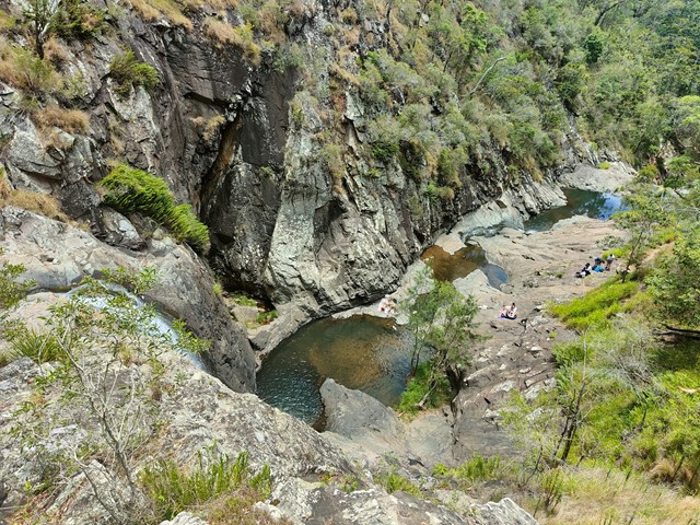
Carrington Falls Circuit
With its cascades, waterholes and rockpools, some regard Carrington Falls, where the Kangaroo River plunges over 50m to the gully below, as the most beautiful on the South Coast. Head to Carrington Falls picnic area, also known as Thomas Place, in the park’s north west to see for yourself and there’s a good chance you’ll agree.
Feeling energetic? From the picnic area you’ll find a variety of walking tracks that take you to a series of lookouts fronting the magnificent falls. Be sure to take the short walk along Izzards lookout track to enjoy another spectacular view. For longer walks head to the nearby Nellies Glen picnic area where you can choose from Warris Chair lookout track or Missingham lookout track for views over Carrington Falls Gorge.
After a more relaxed experience? Enjoy a picnic lunch as you listen to the distant crash of the falls or take a snooze in the shade.
 400
m
return
30
mins
400
m
return
30
mins
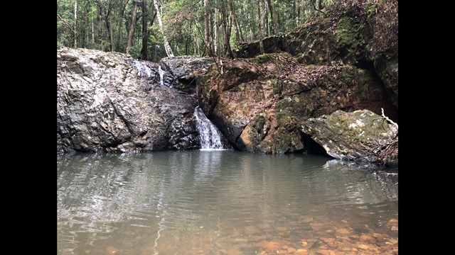
Unicorn Falls
A lovely hidden waterfall nestled in Mount Jerusalem National Park with a great waterhole for a swim.
 16
km
return
6
hrs
16
km
return
6
hrs
Mount Solitary
This day hike takes you on the Golden Stairs, past the Ruined Castle rock formation, and a rock scrabble up to Mount Solitary. Amazing views of the across Jamison's Valley and surrounding areas. Like all the guidebooks and signs say, this is for experienced bushwalkers and I would highly recommend not doing it solo due to the exposure during the scrabble up to Mount Solitary. If you feel like walking a little further, there are aboriginal cave paintings at Chinaman's Gap. Please be respectful and follow all instructions on the signs.
 350
m
30
mins
350
m
30
mins
Tea Tree Boardwalk Circuit
The Purga Nature Reserve allows visitors to view the largest
protected area of endangered Swamp Tea Tree forest in
Ipswich. These self-guided walks provide visitors a unique
opportunity to explore vegetation and watch wildlife while
only 15 minutes from Ipswich Central.
13.4
km
return
4
hrs
The Bump Track
A steep but relatively straightforward walk that takes you from the Mowbray River Valley near Port Douglas to the Black Mountain Road.
 5.7
km
return
2
hrs
5.7
km
return
2
hrs
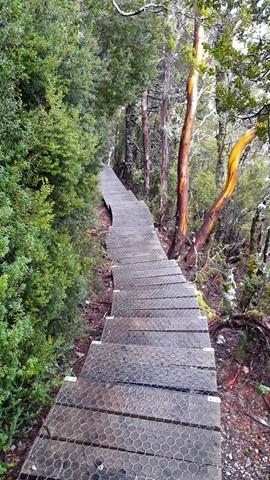
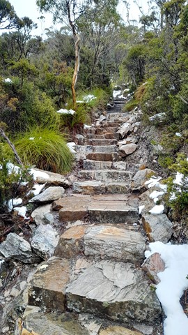
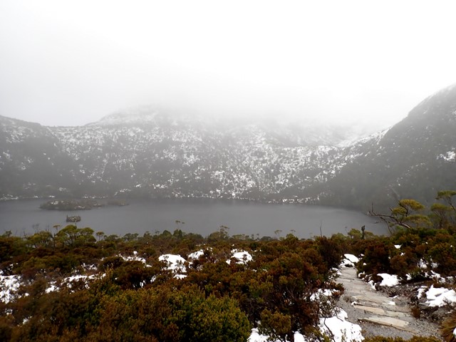
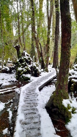
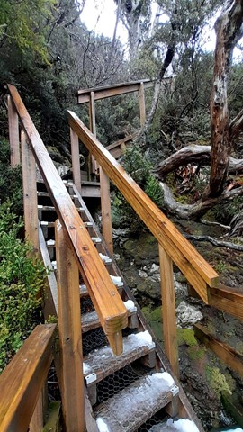
Dove Lake Circuit
This 6km track is one of Tasmania’s premier walks. It will take you right around Dove Lake and beneath the towering spires of Cradle Mountain. The track is boardwalked for much of the way. Highlights: Glacier Rock, Ballroom Forest and the Boatshed.
 1
km
return
30
mins
1
km
return
30
mins
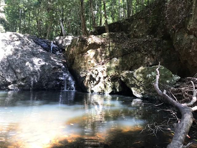
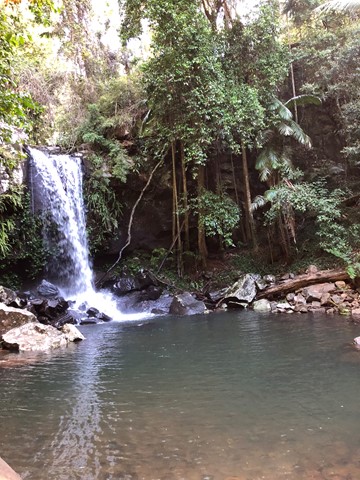
Cedar Creek Falls
From Cedar Creek Falls lookout, descend through eucalypt forest and dry rainforest to the rock pools below. Take your swimmers and immerse yourself in the cold cleat water of any of the three pool.
If you are swimming, please be aware that there are many hazards in natural waterways. Do not dive or jump into the pools.
 17
km
6.5
hrs
17
km
6.5
hrs
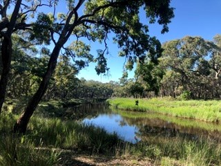
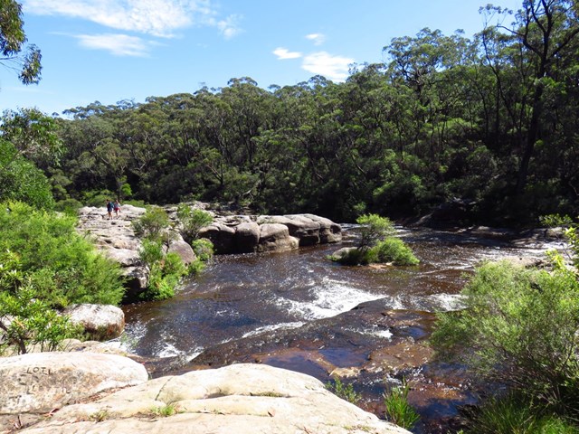
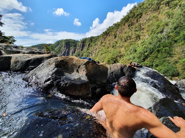
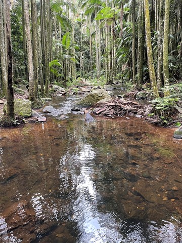
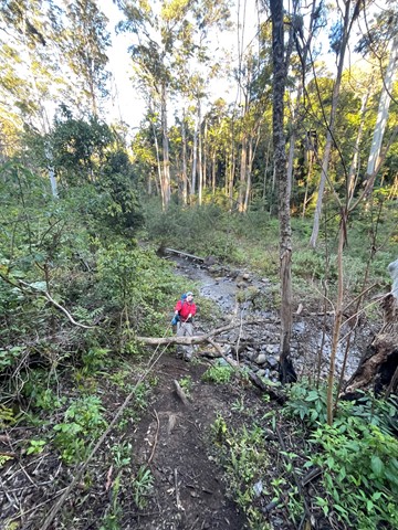
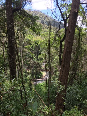
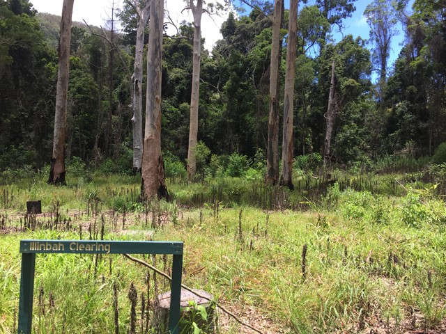
Illinbah Circuit
This track explores the lower reaches of the Coomera River. And there are many river crossings. The track may change slightly after heavy rains.