
Menu

 4.5
km
return
4.5
km
return
 2
hrs
2
hrs
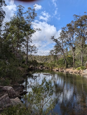
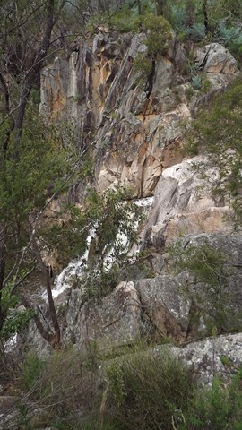
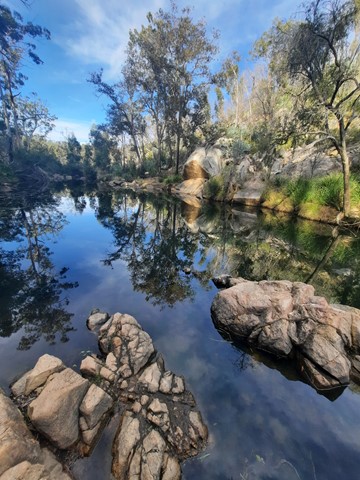
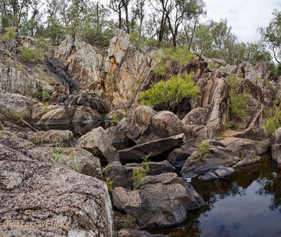
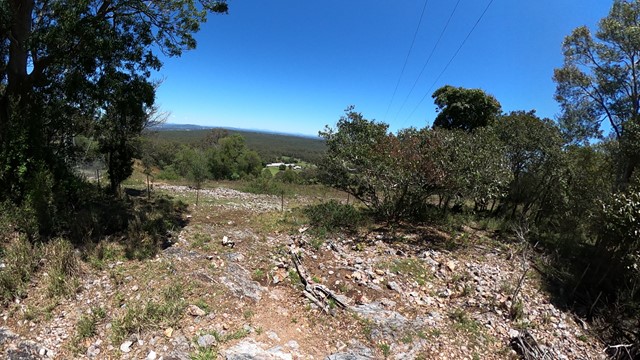
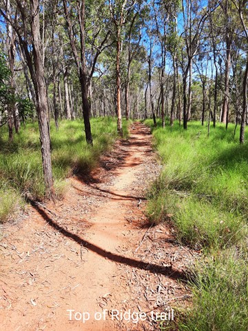
Crows Nest Falls Circuit
Crows Nest Falls via Kauyoo Loop (including The Cascades, Kauyoo Pool and Bottlebrush Pool).
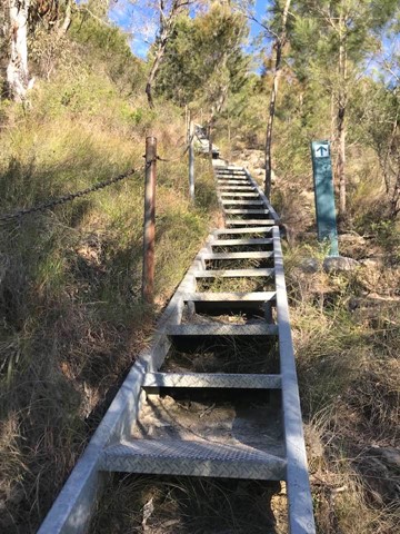
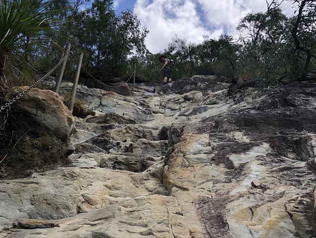
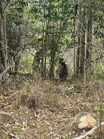
Explore the creek on your way to Crows Nest Falls. Steep crevices and slippery rocks lead to the Cascades, where you can hear the ‘tock tock’ calls of striped marsh frogs echoing around the boulders in summer. A short scramble over low boulders brings you to Kauyoo Pool, where a sandy beach allows easy access to the normally shallow water - a perfect swimming spot for families with small children. Further along the trail, a long staircase leads you down to Bottlebrush Pool, which is an ideal place to enjoy a swim and relax. Keep an eye out for brush-tailed rock wallabies as they move quietly around the surrounding granite hills and boulders.
Caution: Take care on the steps leading down to the creek and when rock-hopping across the creek, as these surfaces can be slippery when wet.
Note: BYO drinking water. Water from the picnic/camping areas must be boiled before use.
 440
m
return
20
mins
440
m
return
20
mins
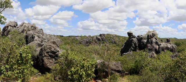
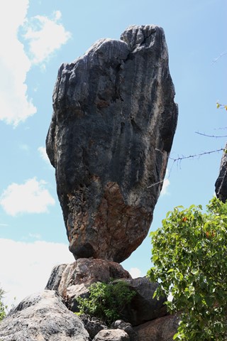
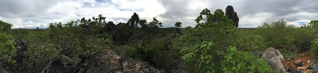
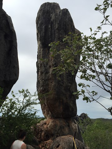
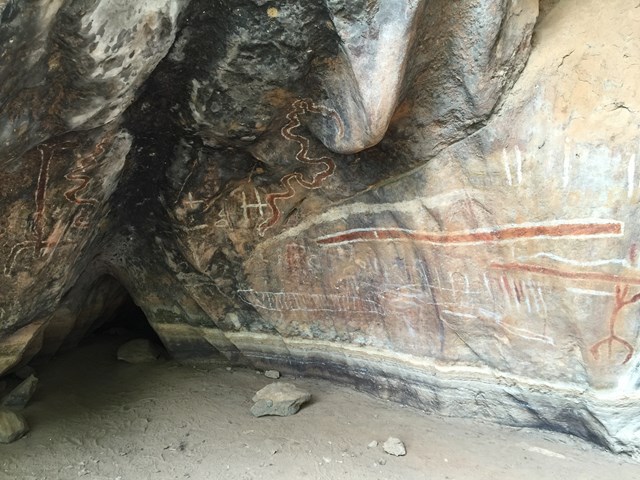
Balancing Rock
From the Balancing Rock car park a rough track climbs up a rock formation, providing views of Balancing Rock—a spectacular limestone outcrop. Take a moment to enjoy the view and photograph the surrounding open woodlands. The Wullumba art site is located to the right of the car park.
 500
m
return
45
mins
500
m
return
45
mins
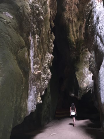
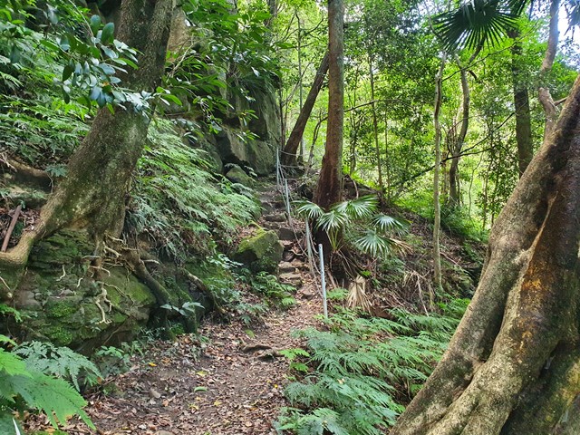
The Archways
The archways walk is spectacular, with narrow passage connecting larger caverns. You'll want to take the most photos at the Art Site and the end of the Archways walk.
NOTE: There are bats in the archways. There is one small hole you are required to crawl through however there is daylight on both sides.
 22
km
return
8
hrs
22
km
return
8
hrs
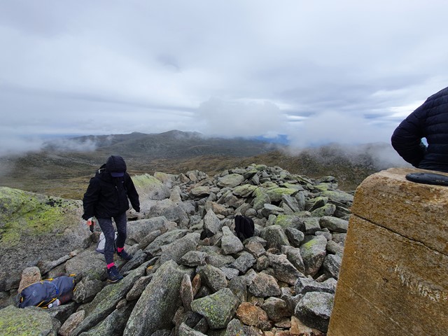
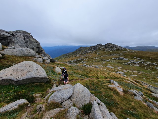
Mt Townsend
A long hike up to the 2nd highest mountain in Australia. Better views and greater seculsion than it's more popular neighbour Mt Kosciuszko.
 0
m
return
0
mins
0
m
return
0
mins
Mount Barney Remote Campsites
This .gpx file is for all the remote campsites in the Mount Barney National Park. I have taken the coordinates from the Parks DES website
1.1
km
return
15
mins
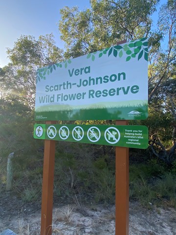
Vera Scarth-Johnson Wild Flower Reserve
A short walk through Banksia trees and alongside salt flats. The walking track splits in two not far from the car park and if you follow that in a loop you get this walk. There is another one way walking track that heads towards the salt flats of the Elliott River.
 2.6
km
return
2.5
hrs
2.6
km
return
2.5
hrs
Mt Cooroora
Become your own 'King of the Mountain'.
Mt Cooroora at 446m (Tuchekoi National Park), is probably the most famous of the Sunshine Coast climbs, due to the King of the Mountain race held annually in July since 1979. The fact that it is a race from the pub in town, and the best time is 22:43, gives you the false impression that this might be quite an easy climb, but you would be wrong!
Take time out as you climb to enjoy the stunning views south across the Sunshine Coast and the 360° vista from the top.
 3.5
km
return
75
mins
3.5
km
return
75
mins
Mt Cotton
Great short walk up with good views out to Moreton, Moreton bay and Stradbroke islands and to city, Glasshouse Mountains, and mountains to south and west. The view makes this one of the most rewarding walks in the area. Park at foot of 640 West Mt Cotton Rd near roundabout opposite the quarry entrance.
 1.2
km
return
45
mins
1.2
km
return
45
mins
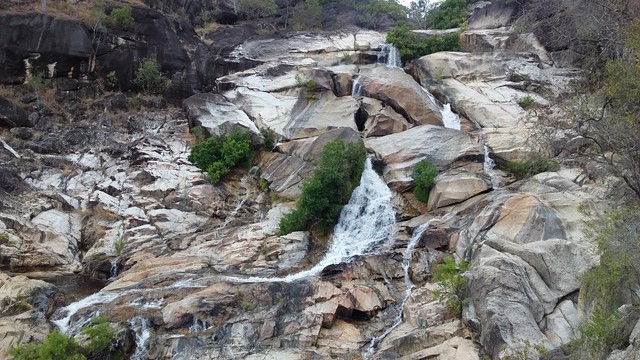
Davies Creek Falls Circuit
Close to Cairns and Mareeba, Davies Creek National Park is a favourite spot for locals. It offers a spacious picnic area and camping facilities, spread out amidst the rocky platforms and shady trees by the creek. Visitors can negotiate the rocks and swim in the pools in this area at their leisure. Davies Creek Falls is a magnificent waterfall which cascades over huge granite boulders
 2.7
km
return
90
mins
2.7
km
return
90
mins
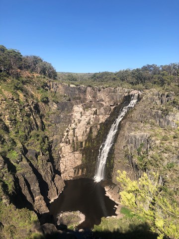
Oxley Walk via Apsley Gorge Rim
An easy out & back walk with scenic views of waterfalls and rugged ravines. It allows for you to get a better glimpse of the main falls & also offers viewing platforms of the landslide just a short distance from the main falls.
 2
km
return
30
mins
2
km
return
30
mins
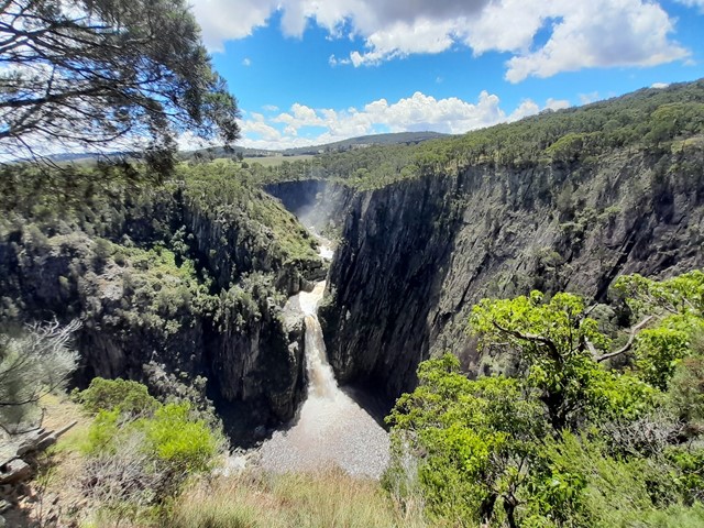
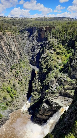
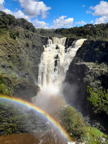
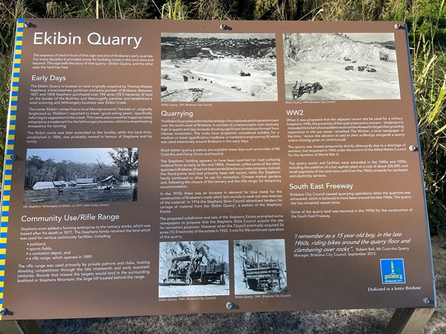
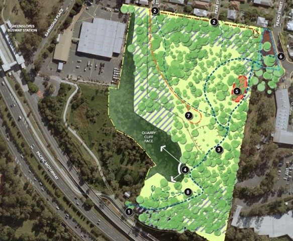
Stephens Mountain Reserve
Two connecting tracks that lead to a lookout platform. Old Quarry site.
 8.1
km
return
4
hrs
8.1
km
return
4
hrs
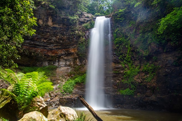
Clover Hill Trail
The Clover Hill Trail combines an easy walk along an old forestry road, followed by a challenging scramble through rainforest. It passes four spectacular waterfalls and some locely swimming holes.
 6
km
return
2
hrs
6
km
return
2
hrs
Water Race
Steep fire road to start of walk rewards you with a level stroll through the Forrest alongside an old mine water-race, crossing a few rivulets there are side tracks Or old timber bridges for the brave. The last 200m involves some sketchy bush bashing but terminates in an old concrete dam and swimming hole
 4
km
return
4
hrs
4
km
return
4
hrs
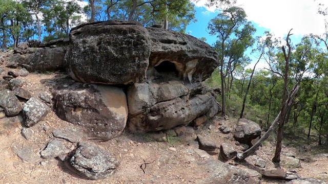
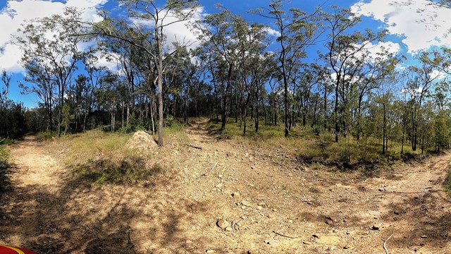
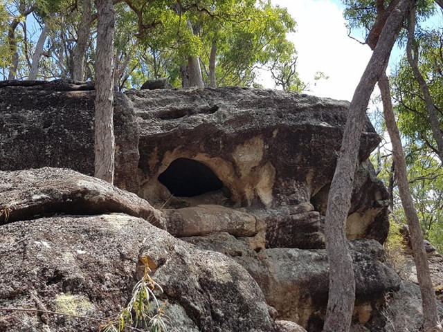
Mt Owen summit +cave
Amazing views from the summit of Mt Owen and a cave under a very ominous large boulder after a steep goat track and rock scramble
 3.5
km
return
1
hr
3.5
km
return
1
hr
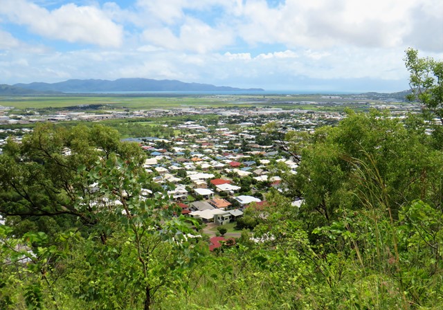
Mount Louisa Bush Walking Track
Popular walking track for fitness enthusiasts, 3.5km circuit track contains many stair climbs along the way to reach the summit and enjoy sweeping views to the north-east across Townsville and Cleveland Bay out to Magnetic Island, as well as views from the ridgeline and summit extending south-west from Mount Stuart to Kirwan.
 4
km
return
2
hrs
4
km
return
2
hrs
Small Cave (Plunkett Conservation Park)
This walk takes you through fairly open bushland, up an incline to a conglomerate rock outcrop with views of the Cedar Creek Valley.The paths in this reserve are mostly wide enough to fit a ranger's car but are quite rocky and steep in some places. You are able to cycle, horseride and walk your dog here (but no motorbikes).
 2.5
km
return
45
mins
2.5
km
return
45
mins
Melichrus Trail (Plunkett Conservation Park)
A short walk on relatively flat gradients through open forest with a mixture of swamp box, ironbark and spotted gum. The unusual soil type in this area promotes short grasses and sedge's that give a parkland type appearance. Keep an eye out for the plant Melichrus adpressus, a spiky native heath species that grows in the local area. This area is known for a good diversity of bird species best heard or seen early morning or late afternoon.
 13.4
km
return
4
hrs
13.4
km
return
4
hrs
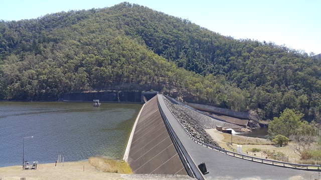
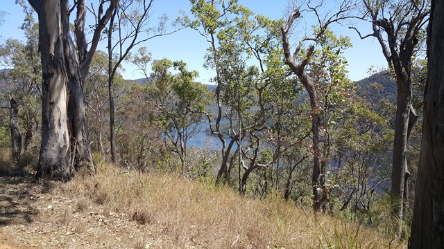
Mt Borumba
An undulating hike along fire trails starting at the Borumba Dam wall, finishing at the summit of Mt Borumba.
 10.6
km
return
3
hrs
10.6
km
return
3
hrs
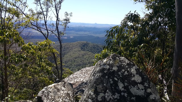
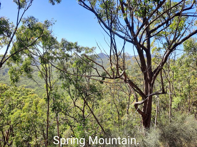
Pyros Loop
This is another walk in the White Rock Conservation park which has quite a few ups and downs, so does get the heart pumping. It also has quite a few good views to Spring Mountain, White Rock and Flinders Peak at various stages of the walk.
 10
km
return
4
hrs
10
km
return
4
hrs
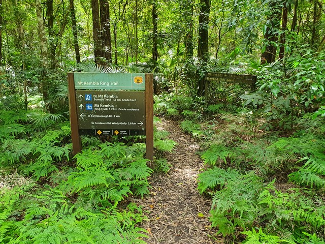
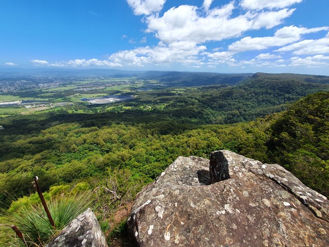
Mt Kembla
A nice half day walk from the end up Farmborough Road up to the summit of Mt Kembla where you will be rewarded with fantastic views over Wollongong.