
Menu

 7
km
return
7
km
return
 2
hrs
2
hrs
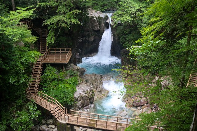
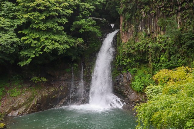
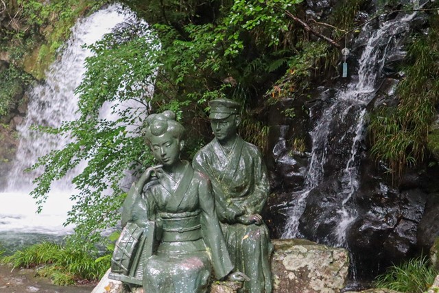
Ryujin Falls + Doukou Falls 龍神の滝 + 銅穴の滝 (Gifu Prefecture)
An easy hike with some of the most amazing waterfalls you will see.
 2.2
km
return
30
mins
2.2
km
return
30
mins
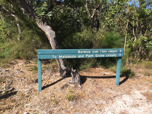
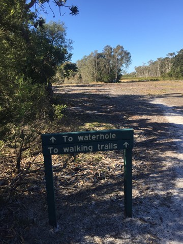
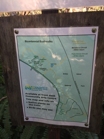
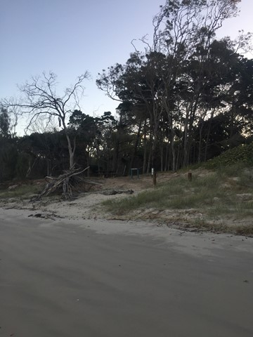
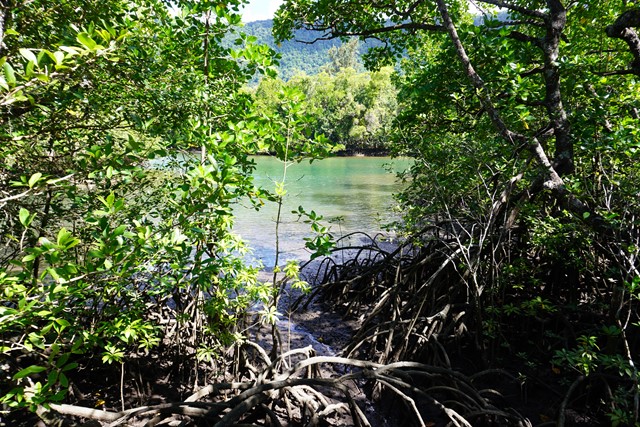
Banksia Bicentennial Bushwalk
Explore remnant wallum heathlands and spot colourful birds and other wildlife on this delightful bushwalk in a corner of the Bribie Island National Park.
 10
km
return
3
hrs
10
km
return
3
hrs
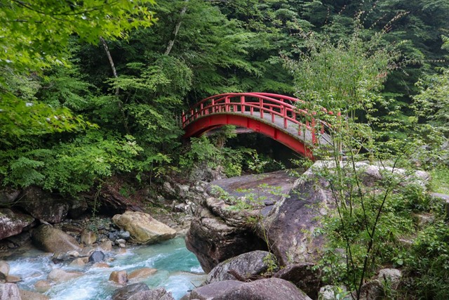
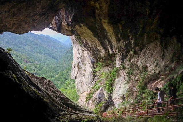
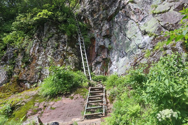
Chiiwakyo 乳岩峡 (Aichi Prefecture)
Chiiwakyo is one of the coolest natural places in Aichi Prefecture. The hike takes you past some waterfalls, forest and caves. It's kind of way out in the sticks, but worth it.
 4.5
km
return
1
hr
4.5
km
return
1
hr
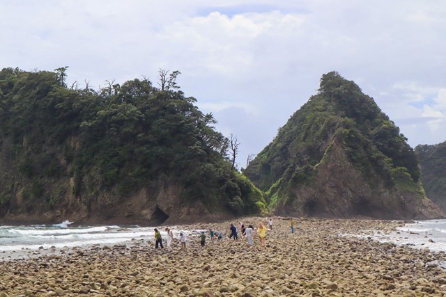
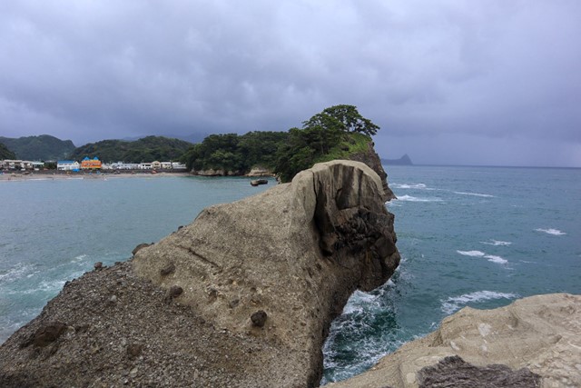
Dogashima Loop + Tombolo Land Bridge 堂ヶ島 (Shizuoka Prefecture)
Dogashima is one of the most famous area on the Izu Peninsula and part of the Fuji-Izu-Hakone national park. Dogashima has interesting rock formations and if the weather is good you can take a boat into the sea cave. It is also home to a land bridge that appears during low-tide which is pretty cool.
 1.5
km
return
30
mins
1.5
km
return
30
mins
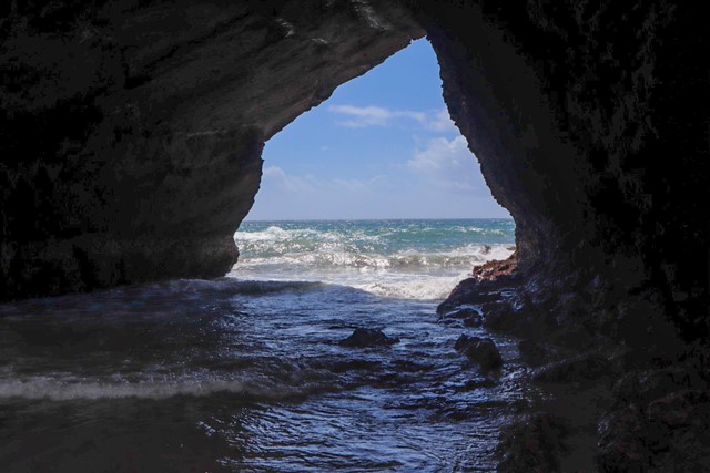
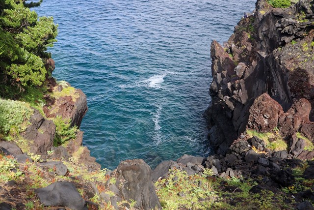
Ryugu Sea Cave 竜宮窟 (Shizuoka Prefecture)
Ryugu Sea Cave is one of the most famous spots in Izu and part of the Fuji-Hakone-Izu National Park. It isn't anything particularly spectacular, but if you are in the area, you may as well visit.
 4
km
return
1
hr
4
km
return
1
hr
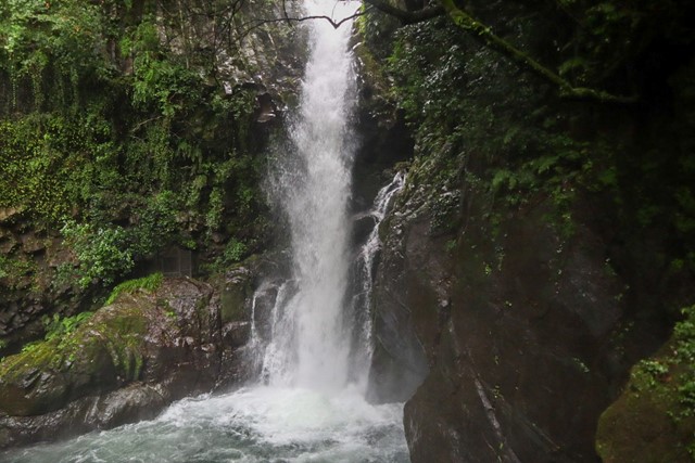
Kawazu Seven Waterfalls 河津七滝 (Shizuoka Prefecture)
The Kawazu Seven Waterfalls make up part of the Fuji-Izu-Hakone national park on the Izu Peninsula. It is a spectatular set of seven waterfalls that progressively get more impressive as you go along.
 2
km
return
30
mins
2
km
return
30
mins
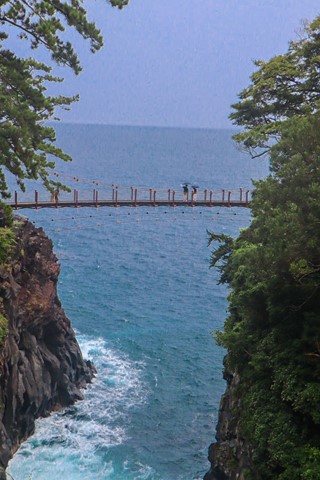
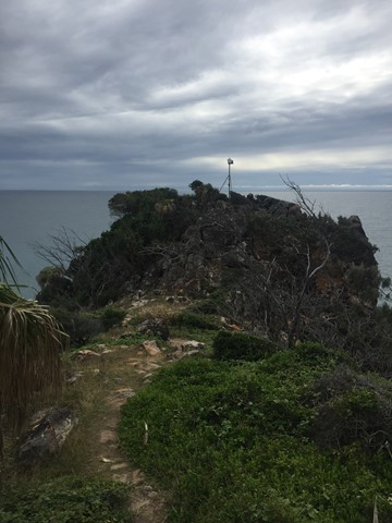
Cape Irozaki Lighthouse Track 石廊崎 (Shizuoka Prefecture)
Cape Irozaki is part of the Fuji-Izu-Hakone national park and has some of the best views of the Izu coast. It is the most southern point of the Izu Peninsula.
 3
km
one-way
90
mins
3
km
one-way
90
mins
Jogasaki Picnic Course 城ケ崎ピクニックコース (Shizuoka Prefecture)
The Jogasaki coast is one of the famous coastal regions of the Izu Peninsula and part of the Fuji-Izu-Hakone National Park. It has dramatic cliff faces and interesting rock formations.
 1.1
km
return
30
mins
1.1
km
return
30
mins
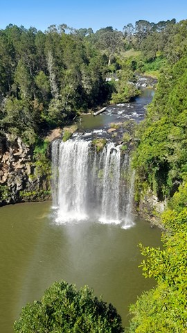
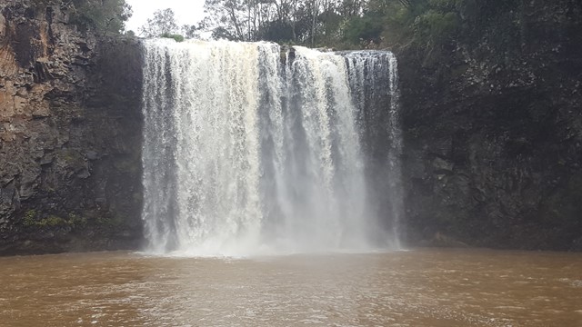
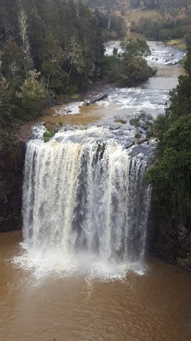
Dangar Falls
The Dangar Falls is a cascade waterfall located across the Bielsdown River just 1.2km north of Dorrigo. The falls are small, picturesque and are a popular local swimming hole. For a short time after rain, they are quite spectacular.
 1
km
return
20
mins
1
km
return
20
mins
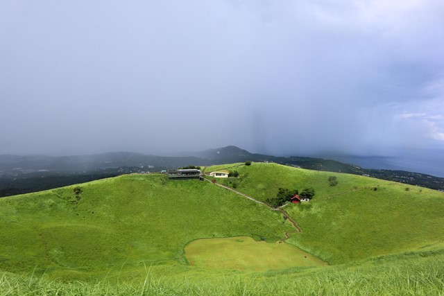
Mt Omuro 大室山 (Shizuoka Prefecture)
Mt. Omuro is a designated national monument by the Japanese government and is part of the Fuji-Hakone-Izu National Park. It's a very green extinct volcano
 3
km
return
1
hr
3
km
return
1
hr
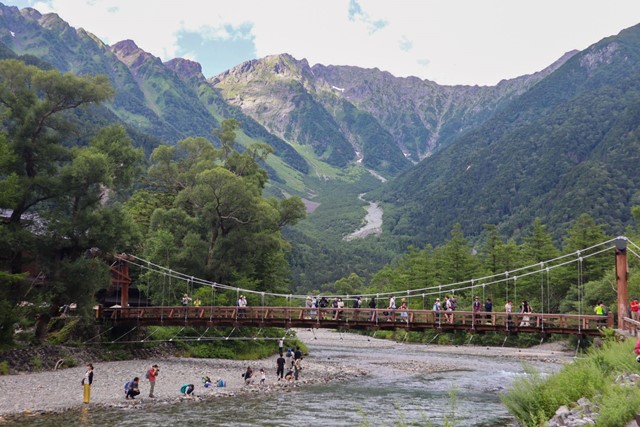
Kamikochi to Taisho Pond (Northern Alps, Nagano Prefecture)
Possibly the most popular walk in Kamikochi. Has iconic views that are seen in all guidebooks about Japan.
 10.5
km
return
7
hrs
10.5
km
return
7
hrs
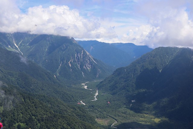
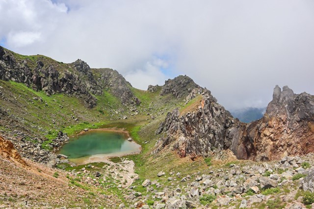
Mount Yakedake 焼岳 Northern Alps (Nagano Prefecture)
Mount Yakedake is an active volcano in the northern alps in Japan. It is one of Japan's 100 famous mountains and provides fantastic views over the surrounding area.
 200
m
return
15
mins
200
m
return
15
mins
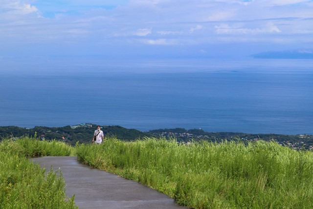
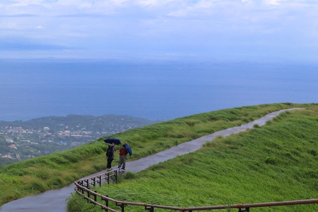
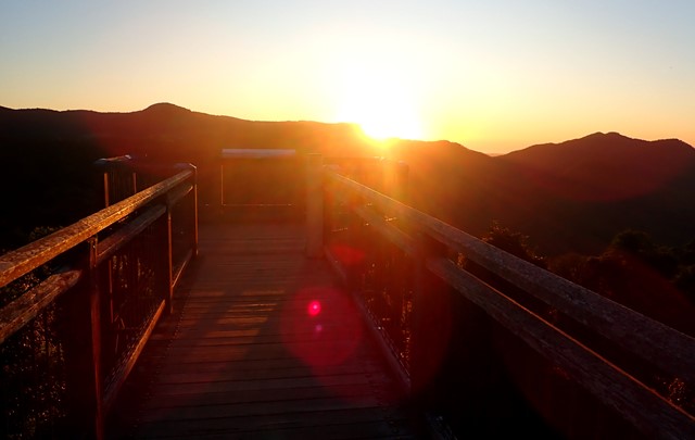
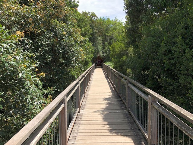
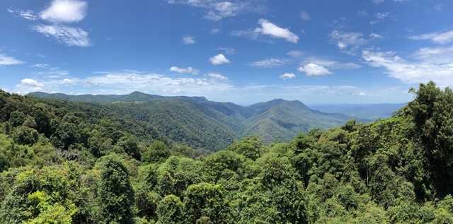
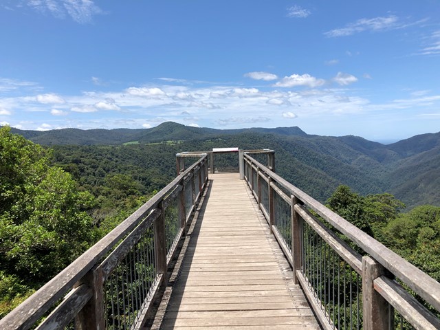
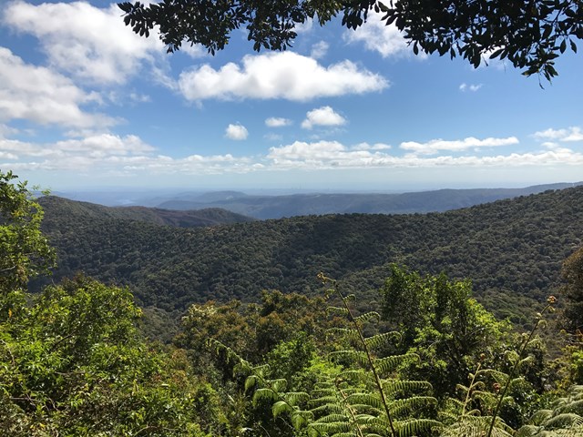
Skywalk Lookout
Attached to Dorrigo Rainforest Centre, Skywalk lookout offers superb views over Dorrigo National Park with the Coffs coast in the backdrop.
 500
m
return
10
mins
500
m
return
10
mins
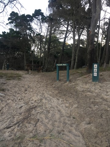
Russells Rest Track
Reward yourself with a picnic and endless ocean and estuary views at the end of this pretty walk.
After you’ve set up camp in the Burrum Point camping area, pack a picnic and meander through cypress pine and tea-trees to a small rest area on the beach. Soak up endless views of the ocean and the Burrum and Gregory river mouths.
Unwind to the sound of the wind in the trees and watch brahminy kites circle overhead. Look for shorebirds—resting here during long migratory flights. If you visiting during winter, keep your eyes glued to the horizon, you might be lucky enough to see whales breaching and playing in the offshore waters of the Great Sandy Marine Park.
 21.8
km
7
hrs
21.8
km
7
hrs
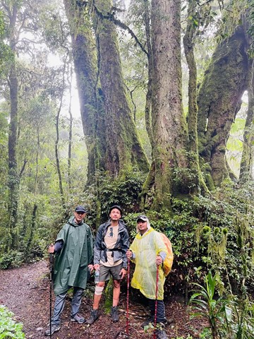
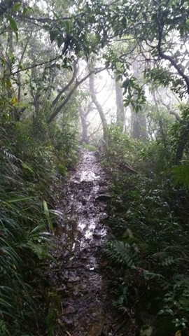
Border Track
Direct connection between Binna Burra and O'Reillys. Graded & well used, with very muddy sections after rain. Gentle inclines but many uneven surfaces due to rocks and roots and tree falls. Includes several side-tracks to lookouts (may be no views if the cloud is low).
(Officially graded as Grade 4/Hard, but feels like Grade 3 most of the way.)
 1.2
km
return
45
mins
1.2
km
return
45
mins
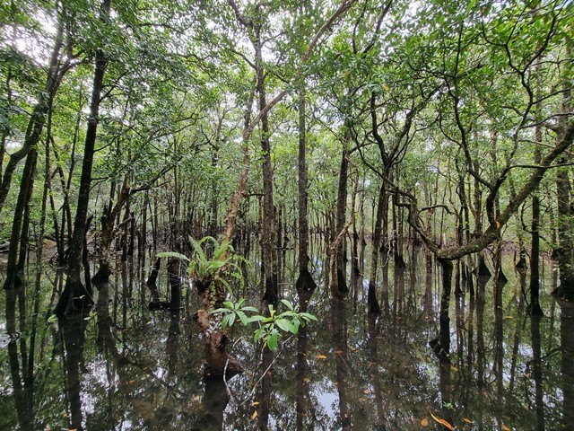
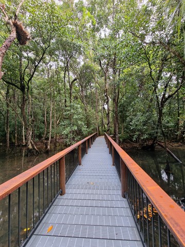
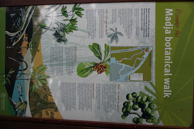
Madja Botanical Walk
Madja is one of the few places where plants, representing all stages of the evolution of land plants over the last 400 million years, are found.
 720
m
return
30
mins
720
m
return
30
mins
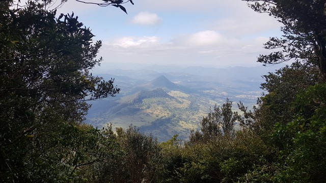
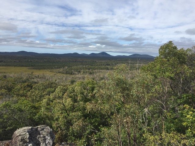
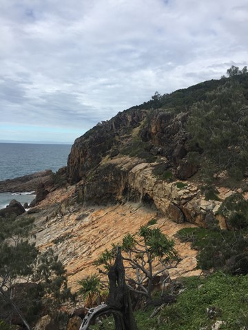
Ganoonga Noonga Lookout
Enjoy a short, steep climb to panoramic views over the eastern lowlands and mountain ranges to the west.
Pass through grassy, open woodland with bloodwood trees and rusty gums on this steep lookout walk. With sensational views over the surrounding coastal lowlands, the steep trip is well worth the effort—just make sure you bring your camera!
From the vantage point 60m above sea level, you can view the Ganoonga Noonga (low grounds) of swamps and heath that cover the parallel dunes below.
Enjoy sweeping vistas of Munro Range to the west, and Bray Hills and Bustard Bay to the north. Keen eyes might also spy Bustard Head Lighthouse on the rocky headlands to the north.
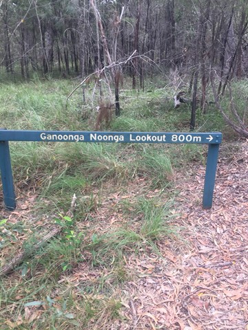 1
km
return
20
mins
1
km
return
20
mins
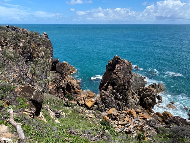
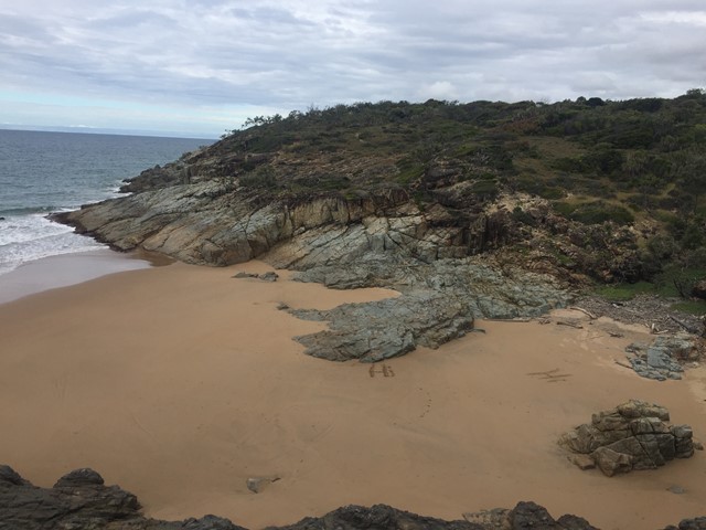
Round Hill Headland Track
This walk is situated in the Joseph Banks Conservation Park where you can absorb panoramic views from the tip of the headland. Coastal beach scrub closes around you and partly shades the track. A viewing platform offers distant views to Bustard Bay. As well as wave lookout which looks over a small rock bay.
 700
m
return
20
mins
700
m
return
20
mins
Yabba Creek Circuit
A short easy walk along the banks of Yabba Creek at Jimna State Forest camping area. Loads of birds to see and hear.
2.5
km
return
1
hr
Amamoor Creek Hiking Trail
This walk starts across the road from the main stage at the top of the hill at the Muster site and winds up hill through thick bush allowing no views. Crossing a couple of dry creeks, even though there has been rain here, until it hits a forestry road and follows it up another hill, before you start the down hill run. A lot of Bunya Pine and little else, with the track is well defined.