
Menu

 14
km
return
14
km
return
 5
hrs
5
hrs
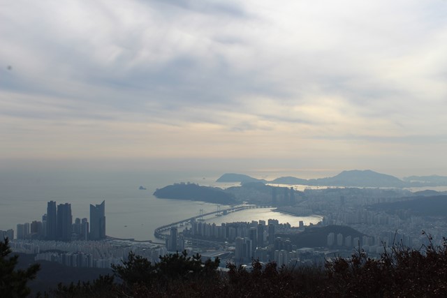
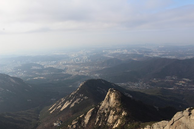
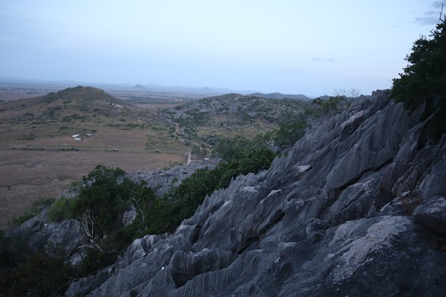
Jangsan Mountain
Jangsan Mountain is 634m. A good day trip from Busan. A nice walk with great views over the city and the ocean.
 8
km
return
5
hrs
8
km
return
5
hrs
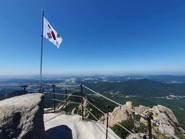
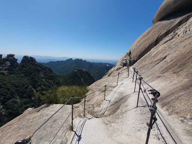
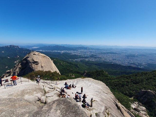
Baegundae Peak (Bukhansan National Park)
A short distance from Seoul, Baegundae is a great escape from the city. The national park offers hiking tracks for all levels. Anything from easy to rock scrambling. Baegundae is somewhere in-between. The national park is accessible by public transport and is quite popular. To avoid crowds, it is best to go as early as possible.
 13.4
km
return
4
hrs
13.4
km
return
4
hrs
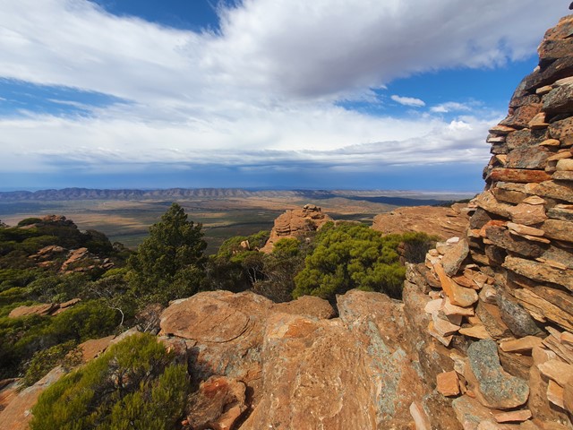
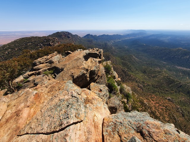
Rawnsley Bluff
A steep ascent followed by a nice flat walk along the top of the bluff to an incredible outlook.
 14.6
km
return
6
hrs
14.6
km
return
6
hrs
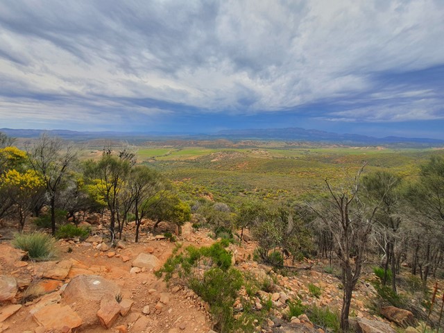
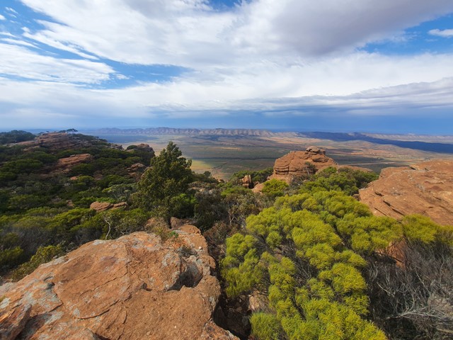
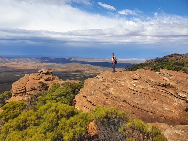
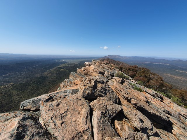
St Marys Peak
An adventure to the top of the highest mountain in the Flinders Ranges which hosts fantastic views of the surrounding Wilpena Pound.
 600
m
return
45
mins
600
m
return
45
mins
Prospect Hill
59 steps and 346 stairs takes you up this sand hill to the viewing platform with its 360° view of the eastern end of Kangaroo Island, particularly American River and Pelican Lagoon.
On 4th April 1802, Matthew Flinders climbed and named this hill as detailed on a number of information board.
 2.4
km
return
1
hr
2.4
km
return
1
hr
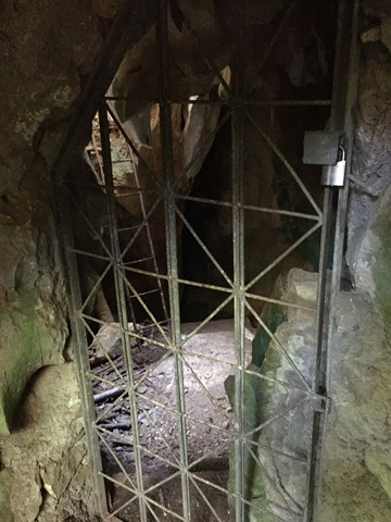
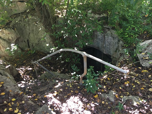
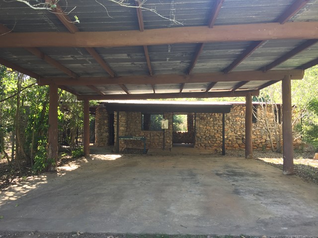
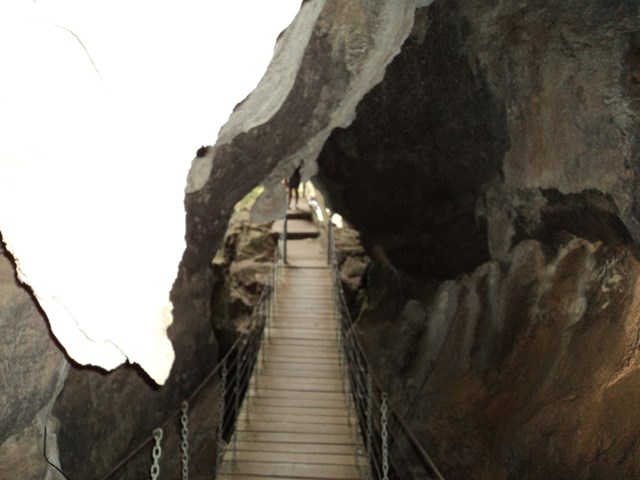
Mount Etna Walk Bat Cleft
A short walk up Mount Etna to the Bat Cleft. During November to February, the walk is only accessible by tour with a park ranger where you can see 110,000 bats emerge from the bat cleft.
 600
m
return
45
mins
600
m
return
45
mins
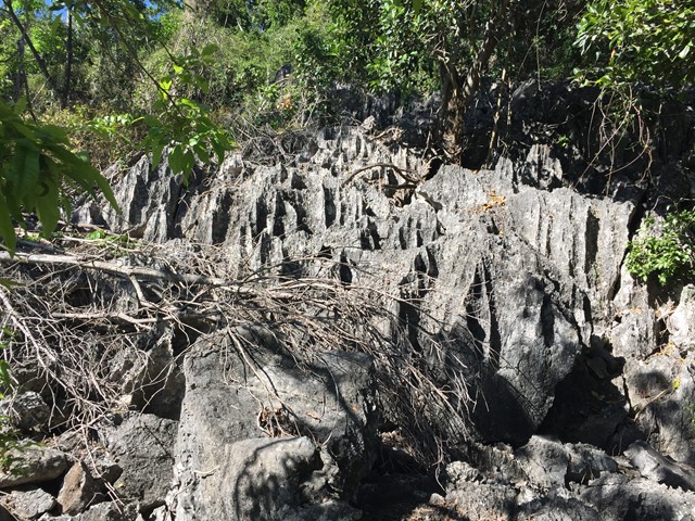
Cammoo Circuit
Located in the Cammoo section of the National Park, wander along a 600m self-guided walk through remnant dry rainforest clinging to limestone karst and uncover the secrets this fragile ecosystem holds. Read about the bitter battle between limestone miners and conservationists and how the dispute was finally resolved.
 1.5
km
return
1
hr
1.5
km
return
1
hr
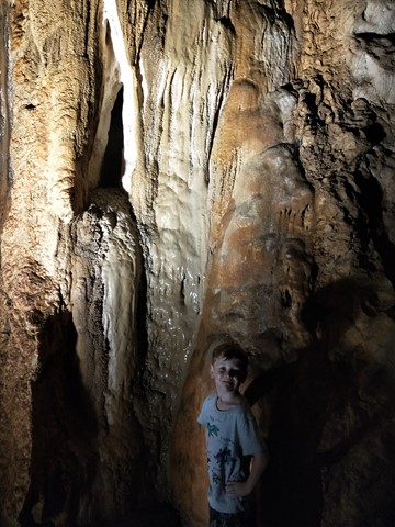
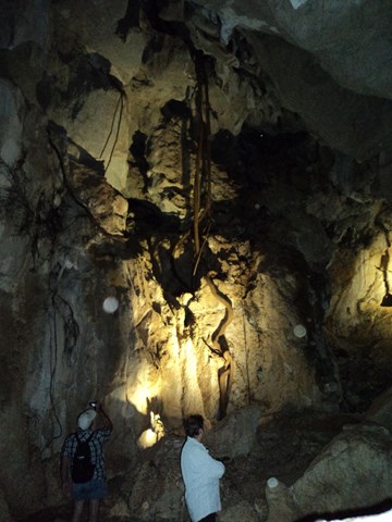
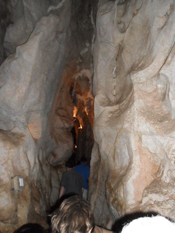
Capricorn Caves
These ancient above ground caves honeycomb a limestone ridge and offer more than 1.5km of passages to explore.
On a guided tour visit the labyrinth of large caves featuring beautiful decoration, amazing fig tree roots and maybe little insectivorous bats, highlighted by the 'Cathedral Cave', with its near perfect acoustics.
 1
km
one-way
15
mins
1
km
one-way
15
mins
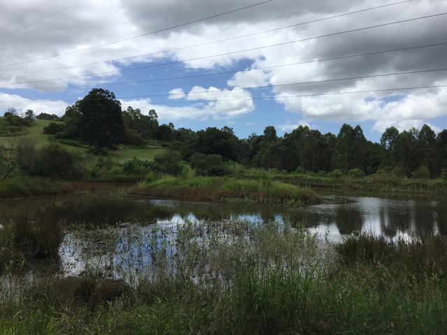
Bellbird Grove Access Trail
Trail leads from Ross Road, Upper Kedron into D'Aguilar National Park's Bellbird Grove Picnic Area following Cedar Creek and passing a pond.
 12
km
return
3
hrs
12
km
return
3
hrs
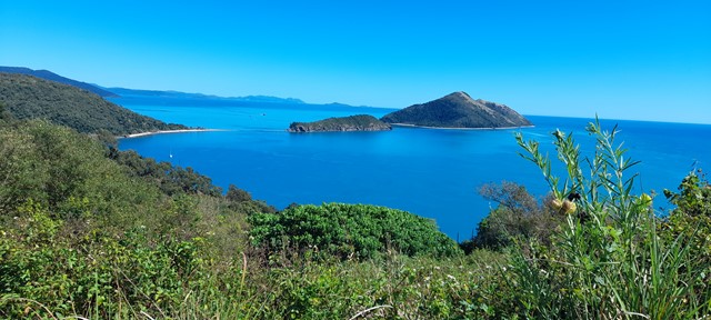
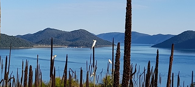
Spion Kop & Mt Jeffreys from Sandy Bay
A Spectacular walk with breathtaking views of the Whitsundays from every direction
 1.9
km
return
1
hr
1.9
km
return
1
hr
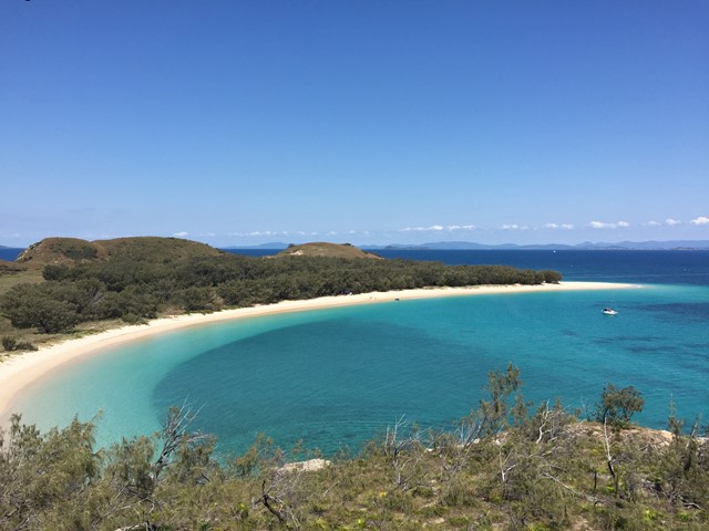
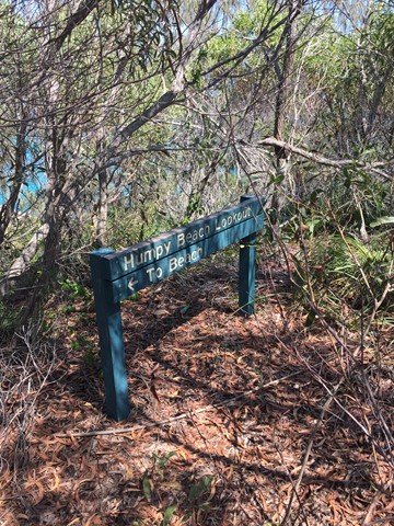
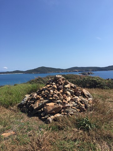
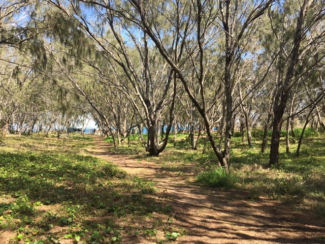
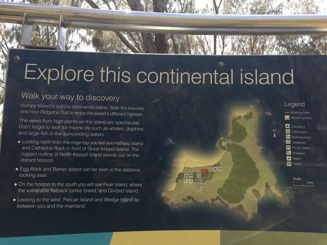
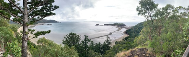
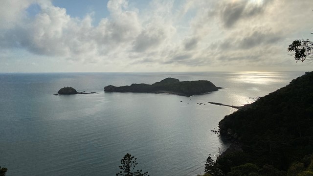
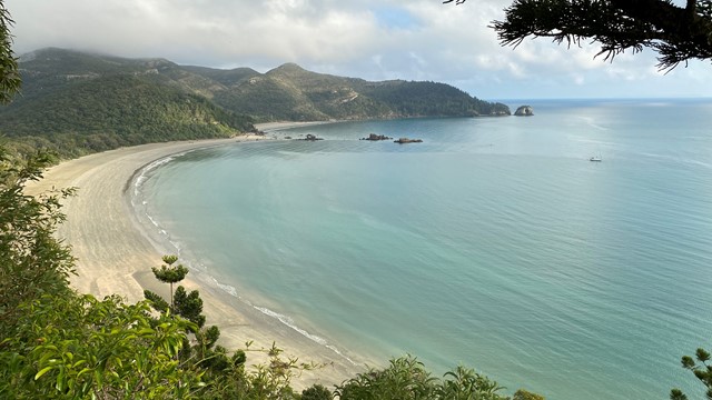
Humpy Island Ridgetop Trail
A rough track with an intial steep section, leaves from the camping area and takes you through the island's different habitats. Views from the island's high points are spectacular. Don't forget to look for marine life such as whales, dolphins and large fish in the surrounding waters. Looking north from the ridge top you will see Halfway Island and Cathedral Rock between Humpy and Great Keppel Island.
 700
m
return
20
mins
700
m
return
20
mins
Kegon Falls 華厳の滝 (Nikko National Park, Tochigi Prefecture)
Kegon no Taki is a 100m drop waterfall that is nothing short of stunning. It is a short walk from the bus terminal, it is a must visit for anyone checking out the Toshogu Shrine that's part of the Nikko World Hertigate Site.
 7
km
return
5
hrs
7
km
return
5
hrs
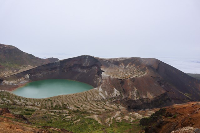
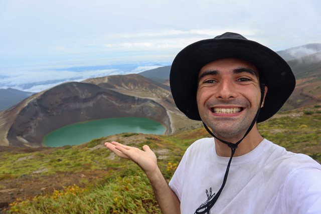
Mount Zao 蔵王山 (Yamagata Prefecture)
Mt. Zao is one of Japan's 100 famous mountains, located in Yamagata Prefecture part of the Mt. Zao quasi-national park. Mt Zao is an active volcano that is also famous for being a ski resort in the winter with the natural snow monster phenomenon.
 2.5
km
return
90
mins
2.5
km
return
90
mins
Fukuurajima 福浦島 (Miyagi Prefecture | Matsushima Bay)
Fukuurajima is an island that you can reach from the Japanese mainland via bridge. Matsushima is considered to be one of the 3 views of Japan. The bay is littered with small islands that house unique vegetation. Fukuurajima itself is one of those islands. It has been designated a prefectural park and is protected. On the island you can view the unique plantlife and get some views of the Matsushima Bay. For the best view of the bay, I recommend taking a boat tour.
 9.4
km
return
5
hrs
9.4
km
return
5
hrs
Mount Adatarayama 安達太良山 (Fukushima Prefecture)
Mount Adatarayama is one of Japan's 100 famous moutains located in Bandai-Asahi National Park in Fukushima Prefecture. It is an active volcano that has some of the most stunning views in north Japan.
 4.3
km
return
90
mins
4.3
km
return
90
mins
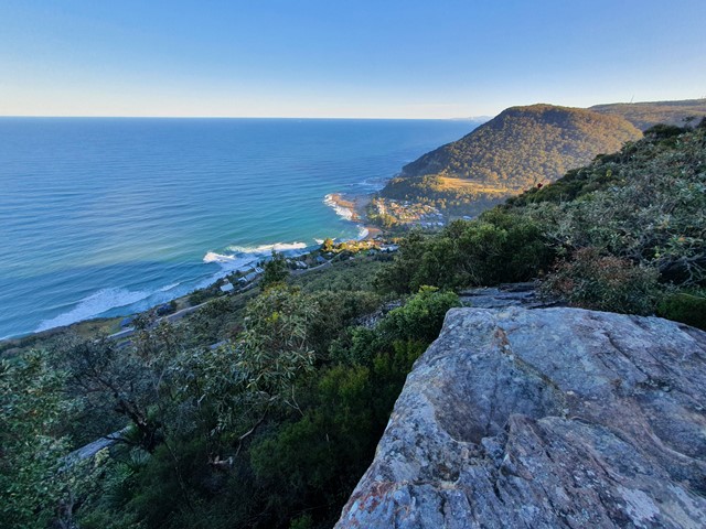
Mt Mitchell via the Wodi Wodi Track
A nice well marked trail from Lawrence Hargrave Road up to the top of the Illawara Escarpment.
 5
km
return
2
hrs
5
km
return
2
hrs
Cape Hillsborough National Park - Lookouts Walk
After experiencing the kangaroos and wallabies on the beach at sunrise take a hike to Twin Beach, Turtle and Andrews Point Lookouts offering spectacular views surrounding the Cape Hillsborough Region.
 7.7
km
return
2
hrs
7.7
km
return
2
hrs
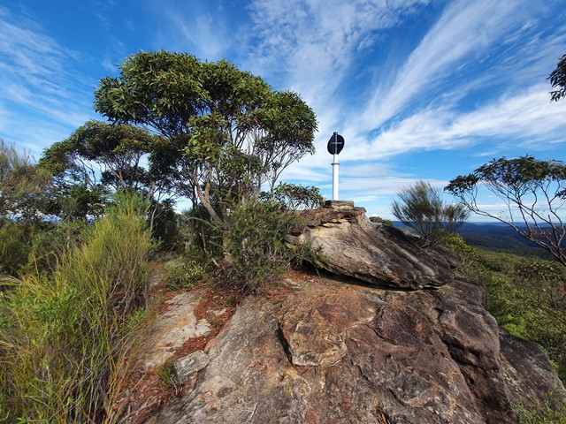
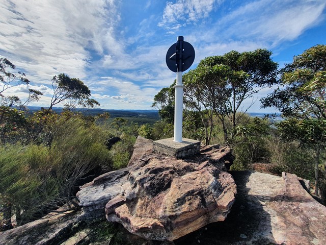
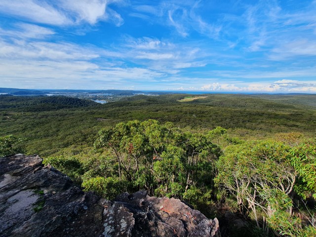
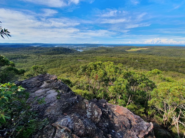
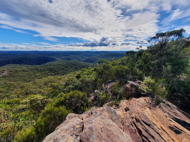
Mt Wondabyne
A nice easy stroll through the Brisbane Waters National Park followed by a short scramble to the summit marker.
 14
km
return
3.5
hrs
14
km
return
3.5
hrs
Kin Kin Countryside Loop
Good comfortable hike through picturesque landscape