
Menu

 5
km
return
5
km
return
 90
mins
90
mins
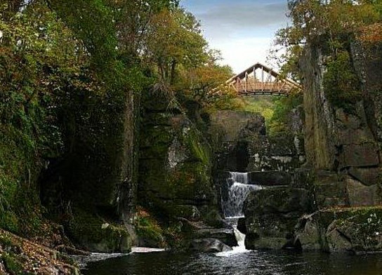
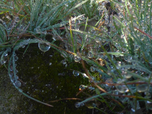
Bracklinn Falls
A loop walk past the idyllic Bracklinn Falls, a popular local picturesque spot and after crossing over the bridge the route climbs through forestry before descending to the quiet upper glen, with a return by minor road past the wishing well.
 3.7
km
return
3
hrs
3.7
km
return
3
hrs
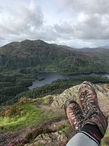
Ben A'an
Ben A'an is one of the most popular amongst Scotland's smaller hills.
Known as a mountain in miniature, the views from it in the middle of the Trossachs are wonderful.
 312
km
one-way
14
days
312
km
one-way
14
days
Coast to Coast
A 17 - 20 day walk, broken at with overnights at quaint English villages, and a couple of bigger towns. Average day is 20ks, and starts in St Bees on the West Coast and finishes in Robin Hoods Bay in the East, cover three national parks. Some days are very long and challenging, some quiet easy. Beautiful scenery. Some navigational skills are helpful, but there are some good guide books available. The trail is not well marked, but quite popular in summer months, recommend a good level of fitness and some back to back long hike training.
 2.4
km
return
45
mins
2.4
km
return
45
mins
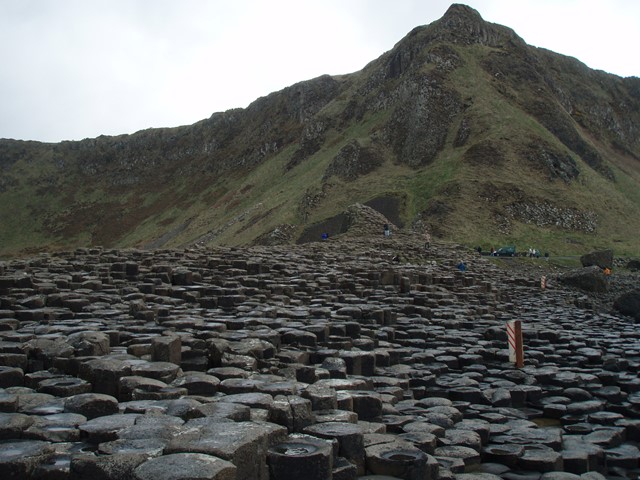
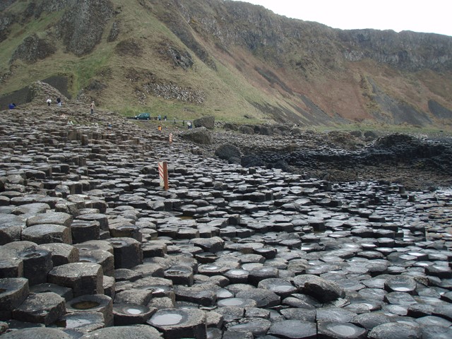
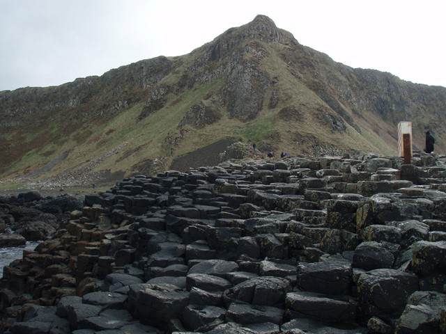
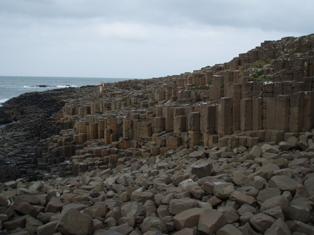
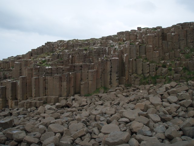
Giant's Causeway Blue Trail
A short walk to the famous Giant's Causeway in Northern Ireland. A rock formation on the coast made up of 40,000 hexagonal basalt columns caused by volcanic activity. 1.2 km each way can take whatever amount of time suits. Caution causeway rocks can be slippery. UNESCO World Heritage Site
The causeway its self is at 55.241014, -6.511652
 4.3
km
return
2
hrs
4.3
km
return
2
hrs
Glengarrif Woods Nature Reserve - Esknamucky + Waterfall & River Walk
Combination of three short walks the Esknamucky Walk, Waterfall Walk and The River Walk in the Glengarrif Woods Nature Reserve.
7
km
one-way
2
hrs
Bray to Greystones Coast Walk
This coastal walk is situated in County Wicklow, Ireland. Abundance numbers of birdlife and plant/flowers. Coastal views are spectacular. An easy walk but some climbing, the Dart train is available at the end of the walk for return. No permits or maps required.
5
km
return
2
hrs
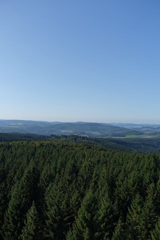
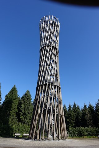
Lormecke Turm Tower
An easy walk on forestry roads to a tower that gives you spectacular views over the woods and to surrounding towns.
 16
km
return
4
hrs
16
km
return
4
hrs
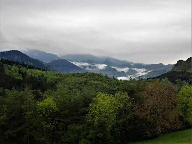
Forests de Belesta
A circuit walk through the extensive plantation forests above the village of Belesta, Ariege, France. Lots of climbing, strolling through forest, birdsong and half abandoned hamlets.
 25
km
return
5
hrs
25
km
return
5
hrs
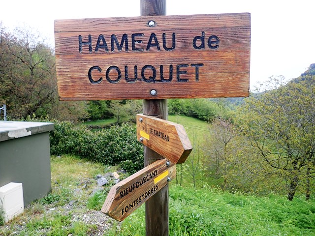
L'Hers river from Belesta and over the hills to Belesta
This is a 25 km circuit walk that takes you along the banks of a lovely river for 7 kms and then up onto a valley between two ridges, giving wonderful views of snow capped mountains(season dependent), before coming back down to Belesta.
4.5
km
return
75
mins
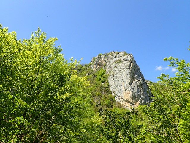
Gorges de Pereille
This is a walk of two halves in the Gorges de Pereille, just outside Lavelanet, Ariege, France. To begin you follow a well formed track which is the old access road for a mine in the gorge. The return journey is along the other bank of the river which flows through the gorge, and involves following animal tracks and some scrambling up steep sides of the gorge.
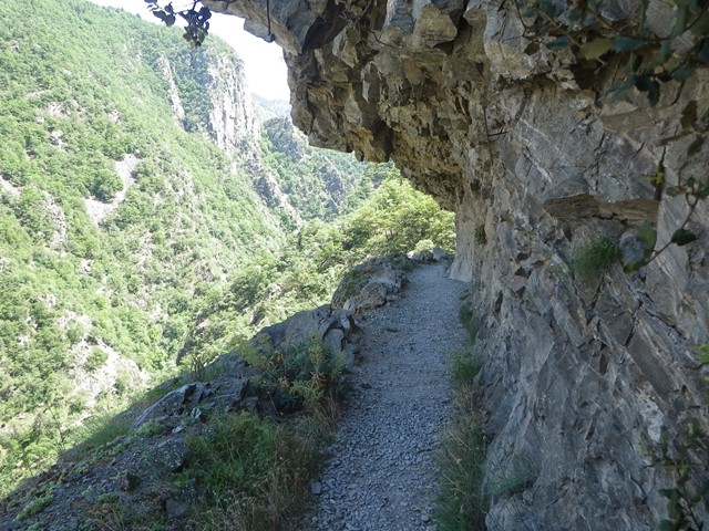
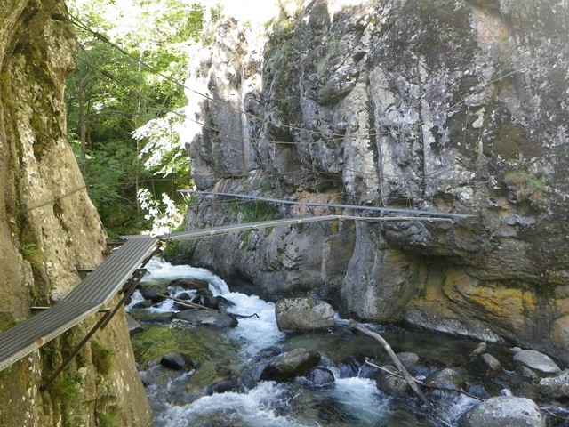
Caranca Gorge
This is an excellent walk up Caranca Gorge In the French Pyrenees, eventually leading unto Spain if you choose. There is a refuge near the highest point which is a good spot to stay whether returning to your start or continuing into Spain. Lots of scary cliff hugging path carved out of the mountain side and a of walk ways hanging above the river. Eventually you emerge onto Alpine pasture and forest.
 30
km
return
3
days
30
km
return
3
days
Col des tents via Breche de Roland and Orlu National Park circuit
This is an excellent, but slightly difficult 3 day circuit walk in the high Pyrenees. It takes in the imposing Breche de Roland, stunning and desolate high mountain scenery and wonderful canyon scenery in the Orlu canyon in Spain.
 40
km
one-way
2
days
40
km
one-way
2
days
Monastery Hike
This is a very challenging two day walk in the mountains of the Eastern Desert in Egypt. It runs between the two monasteries of saints Anthony and Paul and is a very ancient path. This hike is difficult and dangerous and should only be attempted by experienced, confident hikers.
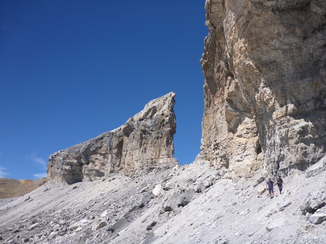
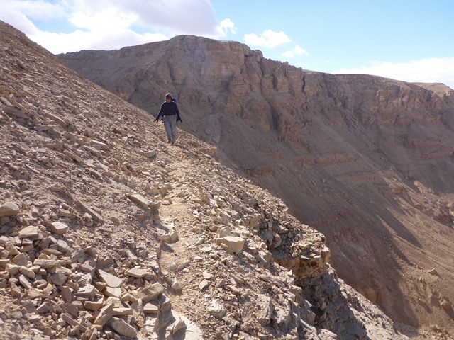
 5
km
return
5
hrs
5
km
return
5
hrs
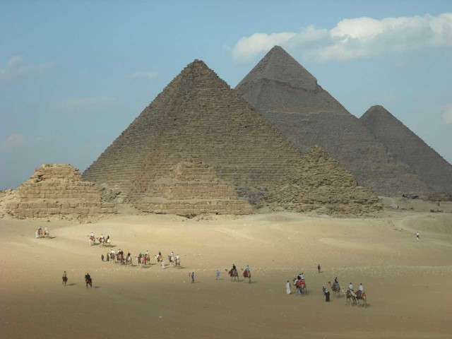
The Giza Necropolis
The Giza pyramid complex is 16,203 hectares and will require at least 5kms of walking to see all it has to offer.
 4.3
km
return
3
hrs
4.3
km
return
3
hrs
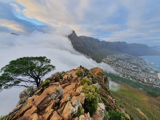
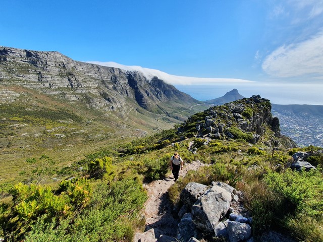
Lion's Head Mountain
A walk/climb up one of the most iconic peaks in South Africa. Very popular hike especially during sunset and sunrise.
 5.6
km
return
4
hrs
5.6
km
return
4
hrs
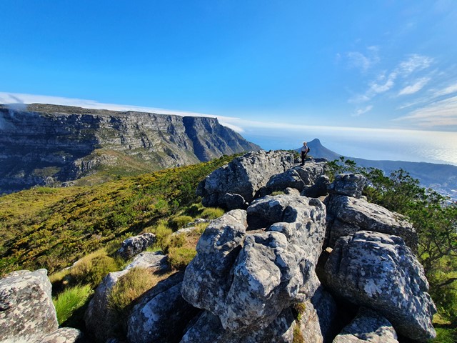
Devils Peak
A fantastic well marked track to the top of Devils Peak which hosts amazing views over Cape Town and across to Table Mountain.
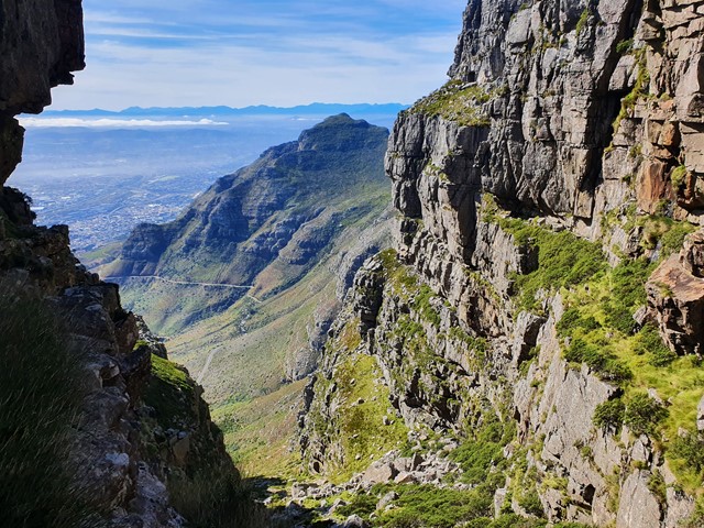 13.4
km
return
6
hrs
13.4
km
return
6
hrs
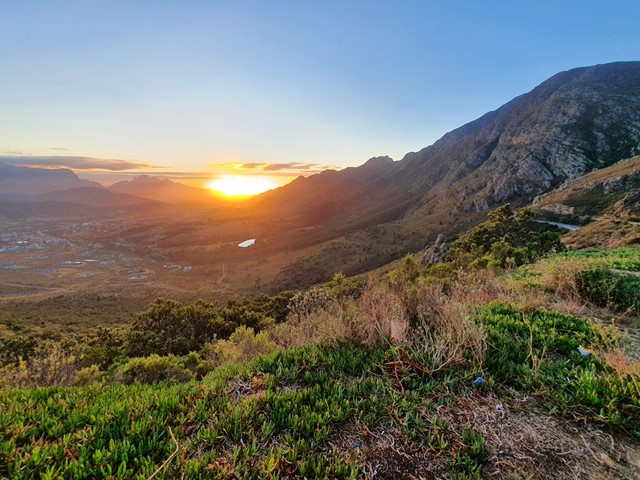
Perdekop Mountain
High up in the wine district not far from Cape Town you will find Perdekop Mountain - the highest point in the Mont Rochelle Nature Reserve.
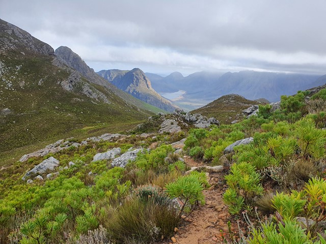