
Menu

 6.5
km
return
6.5
km
return
 84
mins
84
mins
Brushtail, Wallum, Banksia, Wallaby, Rocks
These are trails in Karawatha Forest added together for a longer walk
7.35
km
return
2
hrs
Brushtail, Maculata, Dianella, Wallaby, Rocks
Trails added together to increase walk time at Karawatha
 9.8
km
return
5
hrs
9.8
km
return
5
hrs
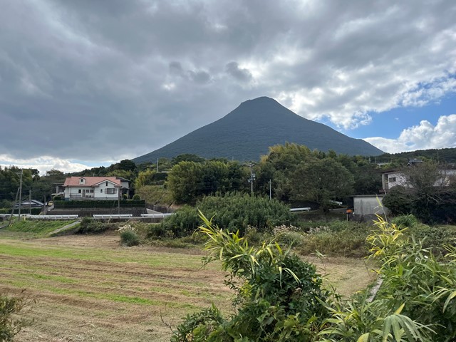
Mount Kaimon (Kagoshima Prefecture, Kyushu)
Inactive volcano with a distinctive conical shape next to the ocean.
 500
m
return
30
mins
500
m
return
30
mins
Windaroo Mountian
Short walk, one route is steep the other isn't not the best views on top but not bad. There are a number of trails and tracks. Nothing marked.
 700
m
return
20
mins
700
m
return
20
mins
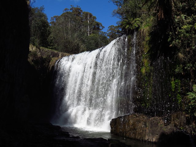
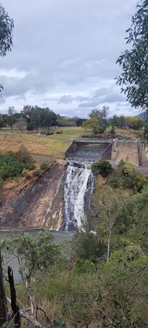
Guide Falls
This is a popular picnic area just south of Burnie, near Ridgley. An easy walking track to the base of the two-tiered falls is a few hundred metres upstream. The road continues to the top of the falls and an accessible viewing platform. A walking track leads you through the thick undergrowth of the riverside, down to a grassed area at the bottom. There are barbecues with picnic tables at both the top and bottom of the falls; a beautiful place to spend the day in summer.
 800
m
return
20
mins
800
m
return
20
mins
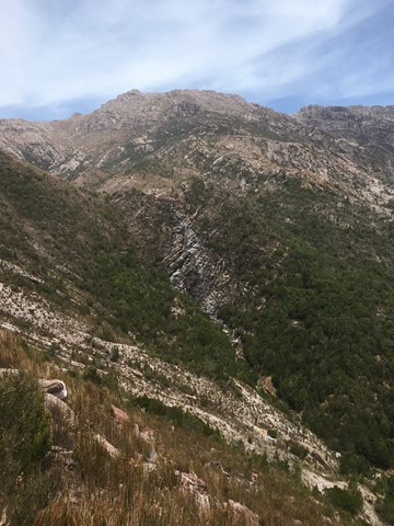
Horsetail Falls
A seasonal waterfall the cascades over 50 meters down a steep cliff face, best seen in winter and spring.
 3
km
one-way
2
hrs
3
km
one-way
2
hrs
Mt Tyndall Summit + Cave
Short walk through swampy teatree, climbing up to exposed rocky goat path to summit and surrounds. There is good water halfway up and at the plateau the track branches off. Take the left path to the summit, the last 500m is unmarked and offers some rock scrambling and pushing through low bushes. The right leads to hilltop lakes, a cave for overnight camping and a great view of the ampetheatre lake Huntley
4
km
one-way
90
mins
Cerro de Los Loros
Walk behind Ushuaia that goes through the local forest, following the winter cross-country ski tracks
6
km
return
2.5
hrs
Cerro Susana
Beautiful short walk that gives incredible views of the National Park, Ushuaia & the mountains in the region.
3
km
return
40
mins
Mashed Kidneys
Bushwalk and mountain bike track from Gormanston down across the hill to the Linda Cemetery, (and Linda cafe!) Stroll and scramble gradually down through open grassland surrounded by mountains with views to Lake Burbury before plunging through a couple wooded sections and onto the cemetery road.
 16
km
return
7
hrs
16
km
return
7
hrs
Cerro Esfinge
Incredible walk with amazing views of the coastline, many mountains and alpine lakes.
6
km
return
3
hrs
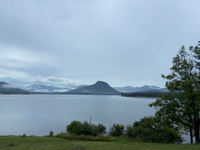
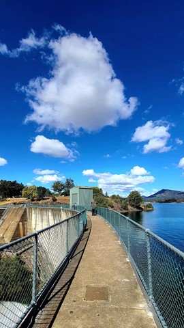
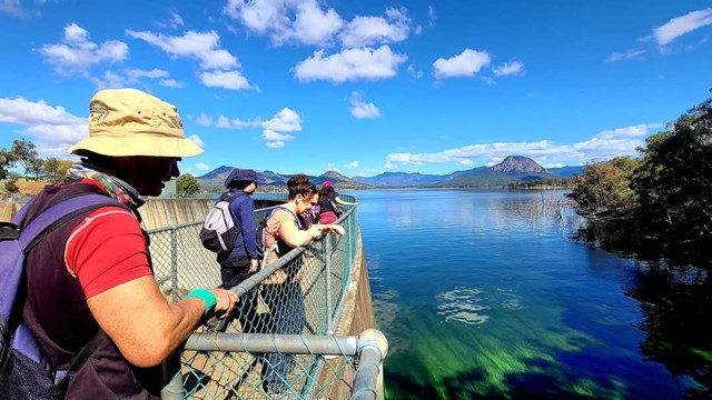
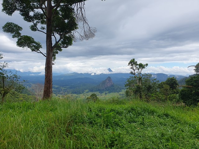
Mount Edwards
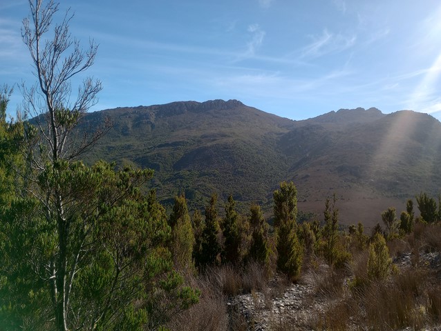
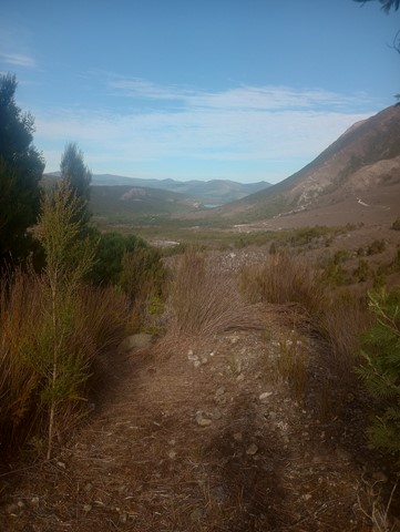
This hiking track takes you to the summit of Mt Edwards, the taller, conical-shaped peak beside Moogerah Dam. This trail crosses the dam wall then leads to the top the mountain with an elevation gain of almost 500m to really get your heart pumping. There is a lookout part-way up the track with views of Little Mt Edwards/Reynolds Creek below the dam wall, while the lookout at the summit faces north-east towards Brisbane and the Fassifern Valley.
Officially listed as Grade 5/Very Hard difficulty (unsigned trail, loose/rocky surface, some tree falls/overgrown sections + steep incline), this trail is suitable for walkers with a moderate-high fitness level who are confident and well prepared (wear appropriate shoes, take plenty of water etc.).
 29.3
km
return
10
hrs
29.3
km
return
10
hrs
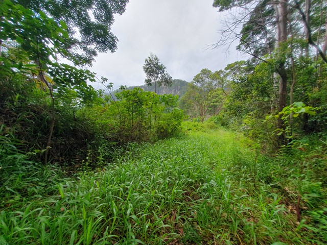
Mount Jerusalem
A long out and back day walk to the top of Mt Jerusalem near Nimbin in Northern NSW. Overgrown but easy to follow track that leads almost all the way to the summit.
 14.7
km
return
9
hrs
14.7
km
return
9
hrs
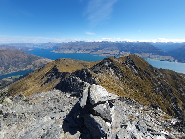
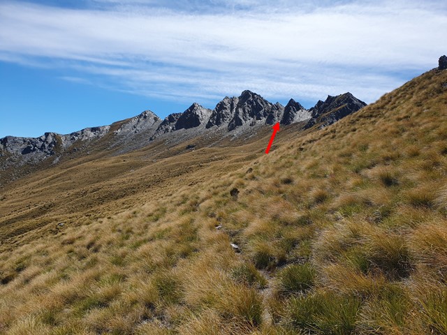
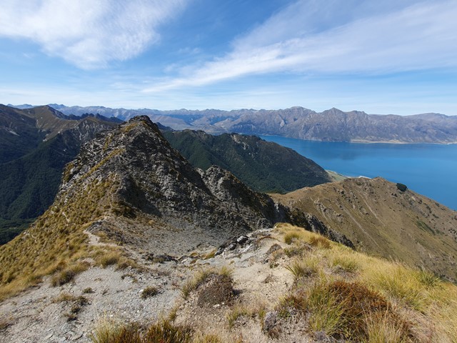
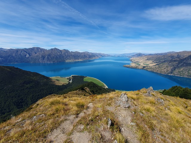
Sentinel Peak
A full day hike and scramble up a lesser known mountain overlooking the scenic Lake Hawea. Unlike more popular walks like Ben Lomond and Roys Peak, this mountain doesn't have an overly clear path and it will require some navigation.
 18.5
km
return
7
hrs
18.5
km
return
7
hrs
Cerro Cinco Hermanos and Cerro Cloche
Iconic mountain. Hiked to the furthest south 'Hermano', looks like you will need climbing gear to get up some of the others
7.5
km
return
2
hrs
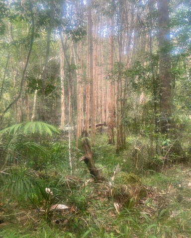
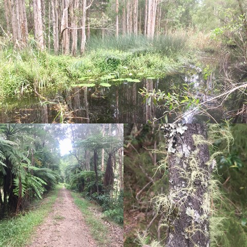
Billinudgel Nature Reserve South/Loop
Nice, easy walk through different types of costal vegetation and South Golden Beach
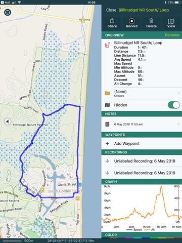 4.5
km
return
2
hrs
4.5
km
return
2
hrs
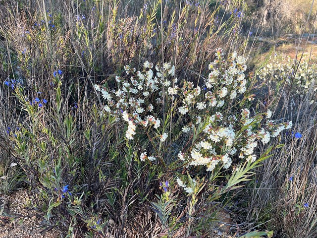
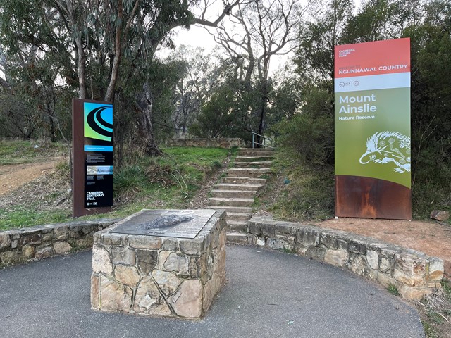
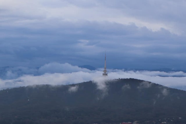
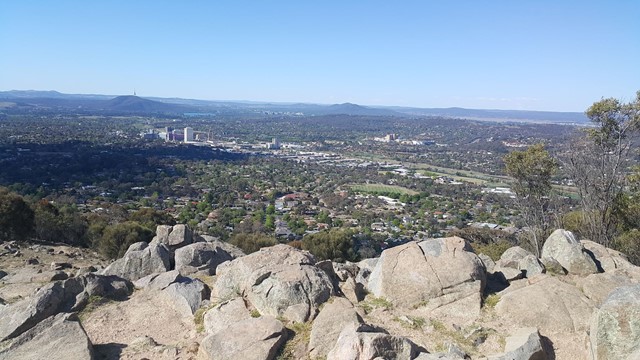
Mount Ainslie Summit Hike
A good little walk to the top of Mount Ainslie in the ACT.
 2
km
return
1
hr
2
km
return
1
hr
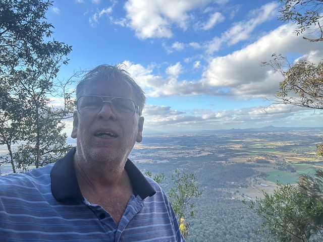
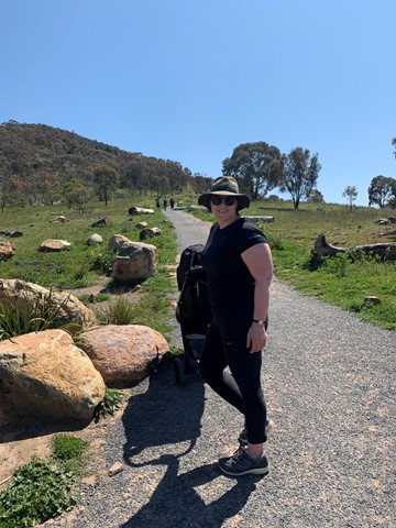
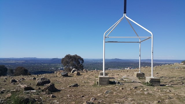
Mount Taylor
A short hike up to the summit of Mount Taylor will reward you with excellent views of Canberra and beyond. It is a good alternative to Black Mountain and Mt Ainslie that enables you to avoid all the tourists and actually hike up a mountain you couldn't just drive up.