
Mount Maroon Southern Route
Mt Barney National Park


Menu
This alternate route up Mount Maroon begins from the end of Dynans Hut Road following the fire trail until Paddy Plain Remote Bush Camp after which the small creek named Paddys Gully is followed upstream for a short way before turning right at the fork in the creek and following this mostly dry tributary up the Southern flanks of Mount Maroon. The exposed creek bed is followed up hill for a while until you exit it on the righthand side to join the forested gully you follow for the majority of the way up until the plateau. Once the plateau has been gained its not long until you run into the main tourist path and follow it up to the summit. Trail up the Southern flanks of Mount Maroon is off trail / overgrown and navigation skills will be needed.

Getting there
How do you get to the start of the walk?
If a 4wd is owned the trail can be started from the end of Drynans Hut Road note you will have to pass some gates which will need to be opened and closed behind you along the road. If a 4wd is not used then you will have to factor in some extra kilometers along the part of Drynans Hut Road you were unable to drive. Alternatively the trail may be commenced from the summit of Mount Maroon after having taken the tourist route up, the trail would take you down the southern flanks of Mount Maroon to Paddys Plain Remote Bush Camp where you could stay the night.
Maps
Which maps cover the area?
Maps of Mount Barney National Park.
Route/Trail notes
A detailed description of the walk!
This alternate route up Mount Maroon begins from the end of Dynans Hut Road following the fire trail until Paddy Plain Remote Bush Camp after which the small creek named Paddys Gully is followed upstream for a short way before turning right at the fork in the creek and following this mostly dry tributary up the Southern flanks of Mount Maroon. The exposed creek bed is followed up hill for a while until you exit it on the righthand side to join the forested gully you follow for the majority of the way up until the plateau. Once the plateau has been gained its not long until you run into the main tourist path and follow it up to the summit. Trail up the Southern flanks of Mount Maroon is off trail / overgrown and navigation skills will be needed.
Permits/Costs
Do you need any permits? What's the cost?
Free though National Park camping fees apply if you are camping in one of the designated remote bush camps.
Other References
How can I find more info? Any guide books?
GPS Tracks
- No GPS available for this walk yet.
 12.9
12.9 6
6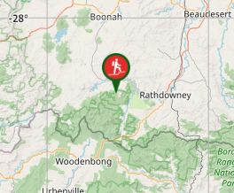
Comments
Nobody has commented on this walk yet. If you've done it then tick it off and add a comment.