
Menu

 2
km
return
2
km
return
 45
mins
45
mins
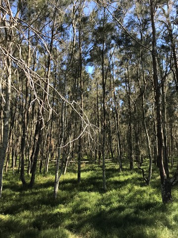
Billai Dhagun Circuit
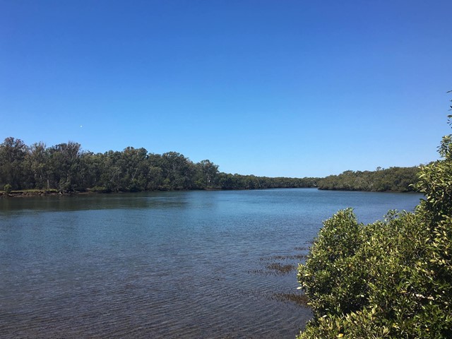
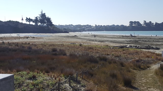
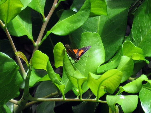
Billai Dhagun Circuit is part of the Boondall Wetlands, and after rain this walk can get quite wet. It is still quite an easy walk though. The name means 'Place of She-oaks', and you will see plenty of these here. There is a bird hide along the walk so that you can watch the water birds at the opening to Nundah Creek.
 15
km
10
hrs
15
km
10
hrs
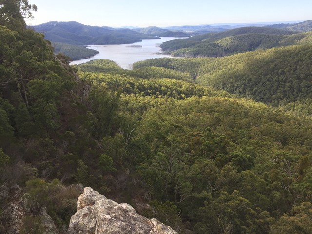
Coomera Gorge
A hard offtrack footslog up the Coomera river from Gwongoorool Pool.
 4.5
km
return
2.5
hrs
4.5
km
return
2.5
hrs
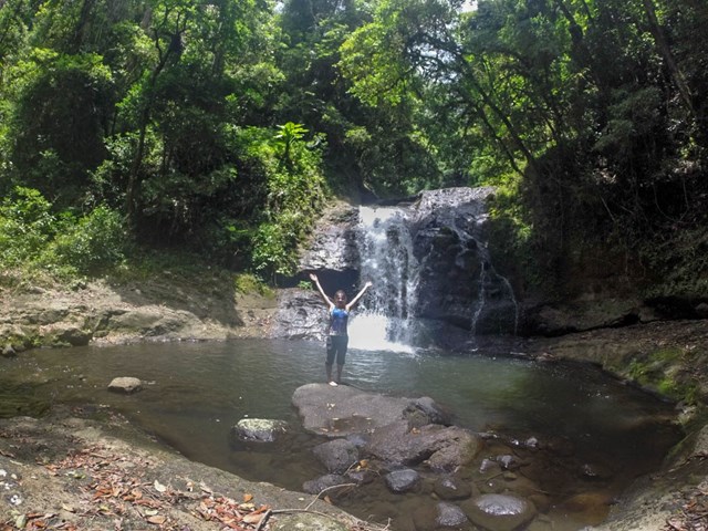
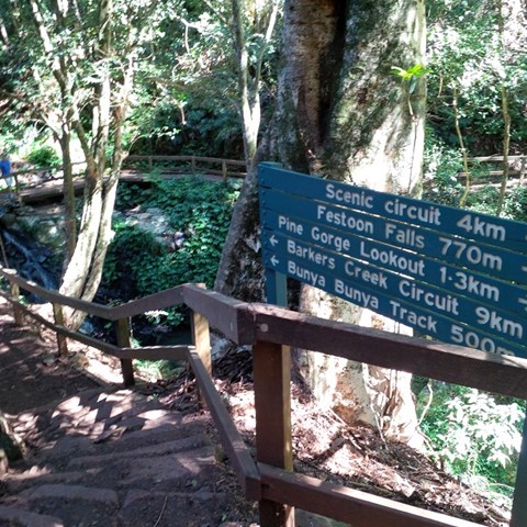
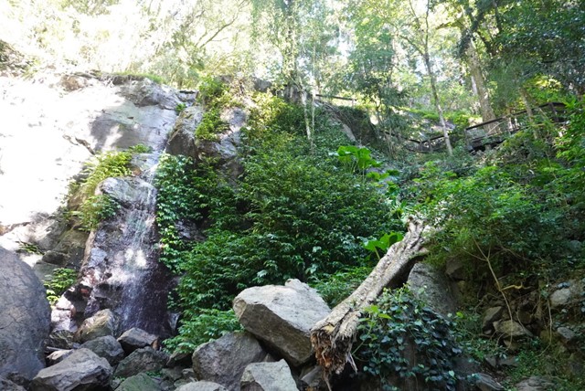
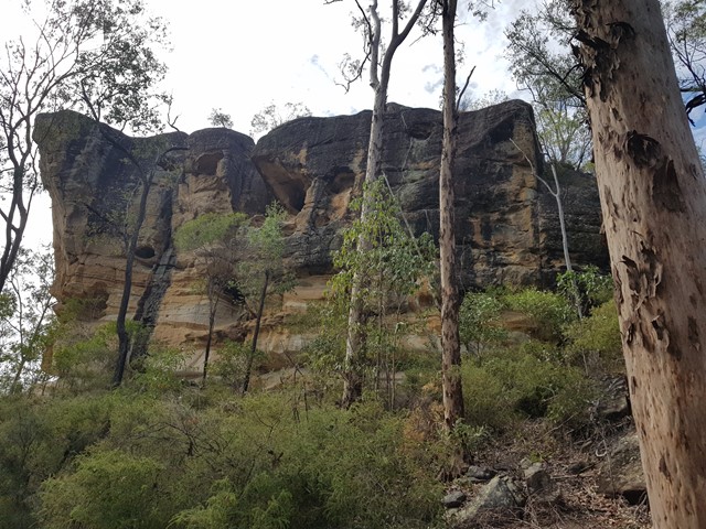
Mcgrory Falls via Pine Gorge
This is a relatively tough but short hike, leading to one of the biggest yet lesser known waterfalls. The first 3/5ths of the track is well maintained though from Pine Gorge Lookout there is a steep descent into Pine Gorge. It would be a good idea to bring some flagging tape to mark the exit point in the gorge.
 1.6
km
return
30
mins
1.6
km
return
30
mins
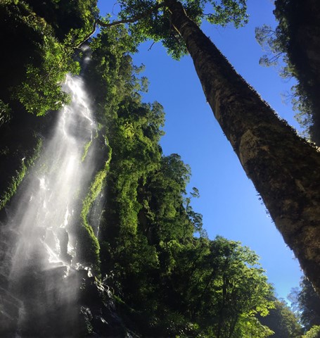
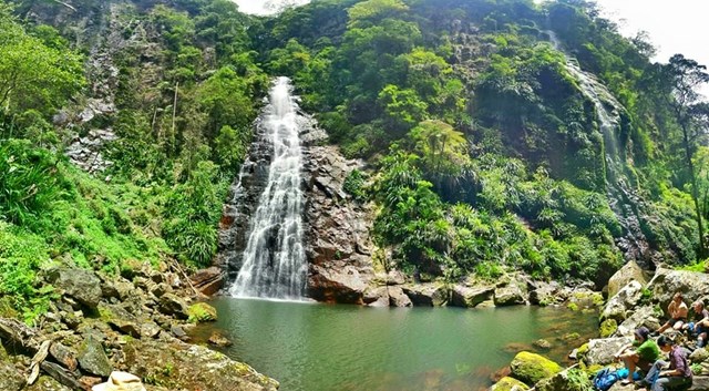
Festoon Falls and Mcgrory Lookout
A nice easy stroll to Festoon Falls a well known waterfall and to the top of Mcgrory Falls, a hidden gem just 50 metres downstream of Festoon Falls.
 2
km
return
40
mins
2
km
return
40
mins
Munros Camp Walk
The track takes you from Munro's Camp down to the top of a previous logging chute (clearing in the forest to lower logs down to the valley for milling). Many benches to pause, watch and listen along the trail. Prolific bird life.
 4
km
return
2
hrs
4
km
return
2
hrs
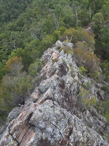
Lloyd Trig
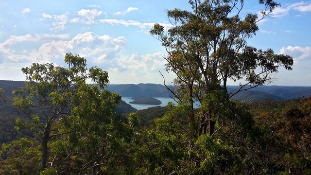
A short walk along an old convict road before climbing up a short rock scramble to Lloyd Trig cairn. Enjoy the panoramic views with landmarks such as the Hawkesbury River and Barrenjoey Lighthouse.
 12.6
km
one-way
5.5
hrs
12.6
km
one-way
5.5
hrs
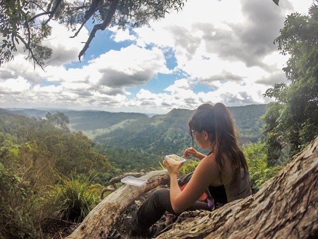
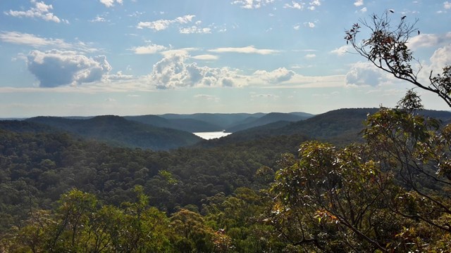
Galston Gorge to Mt Kuringgai (GNW)
This walk follows the eastern side of the steep Berowra Creek valley from Galston Gorge to Crosslands and then heads over the ridge to follow Lyrbird Gully up to the train station at Mt Kuring-gai. This enjoyable section of The Great North Walk spends most of the time enjoying the wide tidal creeks in the deep valleys. There are many grass trees and sandstone caves to enjoy as well as several lovely places to camp. Crosslands provides road access, a chance to fill up the water bottle and an optional side trip to motel style accommodation at Crosslands Conventions centre.
 10.3
km
return
3
hrs
10.3
km
return
3
hrs
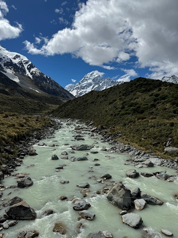
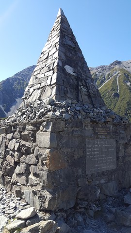
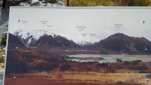
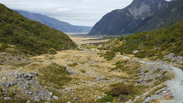
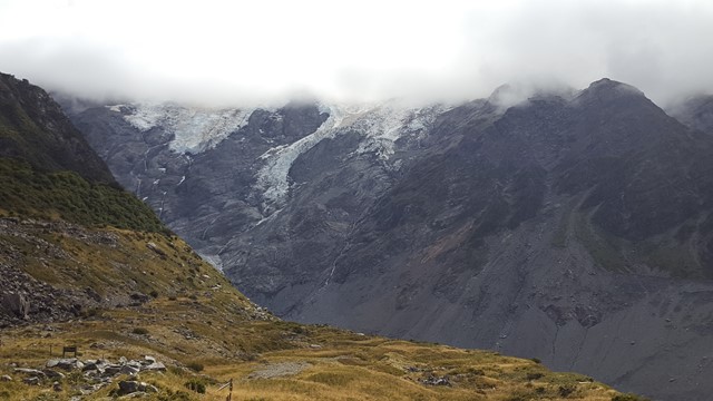
Hooker Valley Track
One of the most popular walks in the park with its picturesque icebergs, glaciers and majestic mountains; it will have you reaching for your camera at every turn. The track leads up the Hooker Valley towards Aoraki/Mount Cook and passes close to Freda's Rock and the Alpine Memorial before coming to the viewing platform of the Mueller Glacier and the first of three swing bridges.
The track ends with an amazing view over the iceberg-speckled Hooker Lake and up to majestic Aoraki/Mount Cook and the Southern Alps.
Listen for the rumbling of avalanches from the distant Mount Sefton and try to spot them before they crash into the Mueller Glacier below.
 6.1
km
return
2
hrs
6.1
km
return
2
hrs
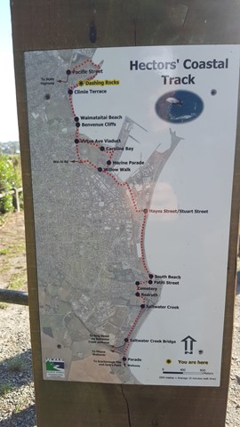
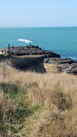
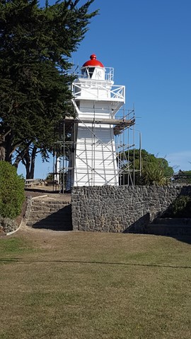
Hectors Coastal Track
Hector's Coastal Track offers coastal scenic views, as it crosses Caroline Bay, up to the old Lighthouse and along the cliffs to Dashing Point and beyond.
 3.2
km
return
75
mins
3.2
km
return
75
mins
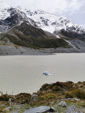
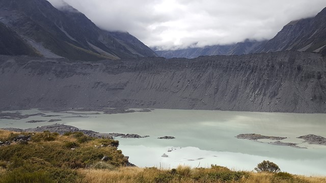
Kea Point
This walk gently winds its way through sub-alpine grasslands and scrub to the Mueller Glacier moraine wall. The track passes through a landscape that was formed in 1913 when a stream cut through from the glacier to the original Hermitage site, damaging the building. The walk ends at a viewing deck that gives stunning views of Mount Sefton, The Footstool, Hooker Valley, Mueller Glacier Lake and Aoraki/Mount Cook.
 6.5
km
return
2
hrs
6.5
km
return
2
hrs
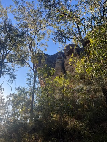
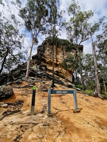
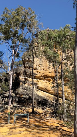
White Rock Multi-User Trail
A level track with some rough surfaces and stairs at the end.
Leading to the base of the culturally significant White Rock this trail goes through a mix of vegetation types and sceneries from riparian to open eucalypt forest and rocky ridges. Climb the stairs to gain views to Spring Mountain and the surrounding area.
Access to the top of White Rock is not allowed. Please respect the original Ugarapul custodians of the land.
 22
km
return
6
hrs
22
km
return
6
hrs
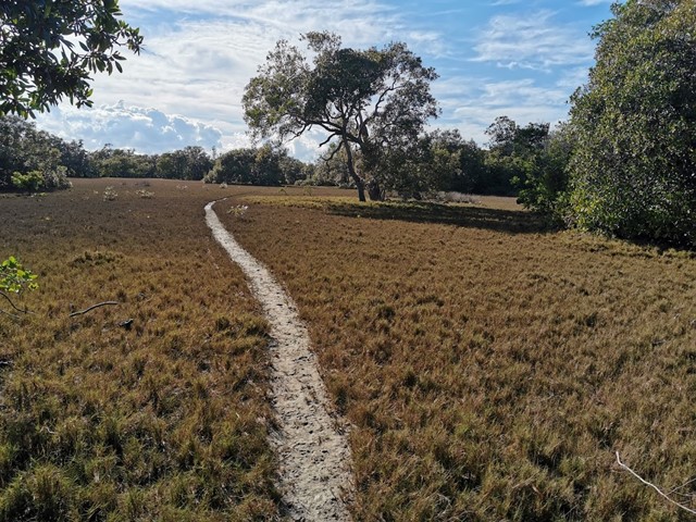
Yuddamun Trail
The Yuddamun Trail contains some steep inclines and rough surfaces. It crosses the northern section of the estate giving spectacular glimpses of Ipswich, Brisbane City and towards Moreton Bay. If you are planning to go for a leisurely mountain bike ride or hike, then access this trail from the Paperbark Flats Picnic Area car park. Horse riders can access the trail from the recently constructed facilities as you immediately enter the estate. A horse float parking area, hitching rails, water trough and picnic table will support all your riding needs.
Please note that water for horses is only available within the Horse Float Parking Area. Prior to your ride please ensure you read and follow Council’s Trails Guidelines
 1.6
km
return
1
hr
1.6
km
return
1
hr
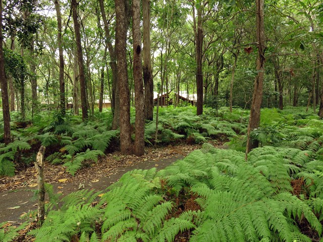
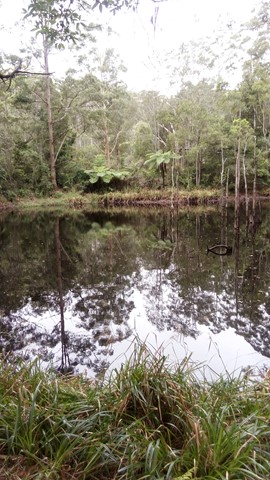
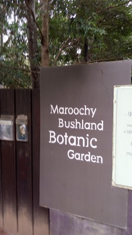
Lagoon Walk
A circular walk in the Maroochy Botanic Garden, this popular natural terrain bush track follows the banks of the lagoon. The open forest ecosystem has remnants Bloodwood, Blue Gum and Tallowwood in the canopy, while Piccabeen Palm and Tree Ferns fringe the rocky gullies and bridges along the track.
 30
km
return
5
hrs
30
km
return
5
hrs
Mac N Back
Trail 7 of the Noosa Trail Network; a relatively flat picturesque trail that crosses Six Mile Creek and traverses the Yurol State Forest from Lake MacDonald to Pomona.
8.7
km
return
4
hrs
Pages Pinnacle Eastern Approach via Neranwood Break
A steep ascent of 368 meters over the first two kilometers up Neranwood Break before following Pinnacle Break to the Pages Pinnacle footpad on the right where The Razorback Ridge is then traversed to the summit.
 1
km
return
45
mins
1
km
return
45
mins
Walk on Water Track
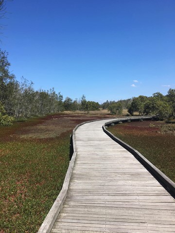
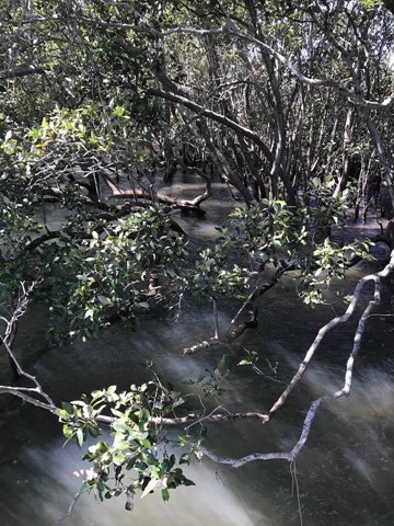
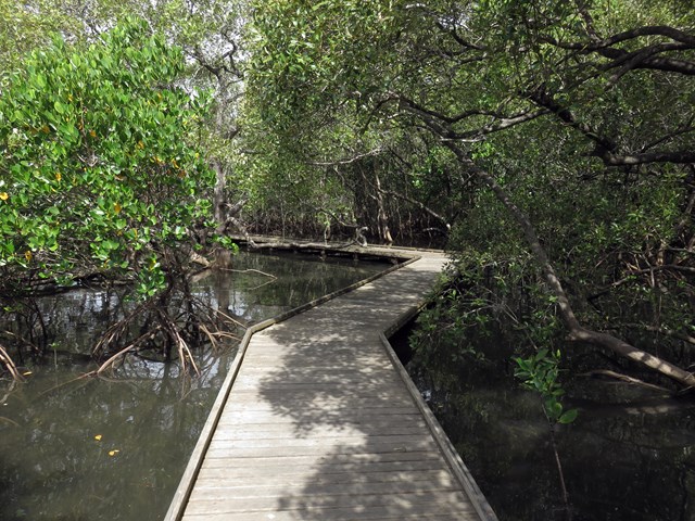
This short walk invites you to see beautiful bushland and mangroves while experiencing the Aboriginal cultural heritage that makes this area so special.
Starting from Minjungbal Aboriginal Cultural Centre, you’ll follow a wheelchair-accessible boardwalk and walking track through eucalypt forest, woodlands and swamp forests, before emerging among the diverse mangrove communities along Tweed River.
Read about the plants, animals, bush tucker and culture of the Minjungbal people from interpretive signage along the way. For a fascinating local perspective, why not take a guided tour from Minjungbal Aboriginal Cultural Centre?
See Bora Ring, a sacred Aboriginal site traditionally used for men’s initiation ceremonies. Today, it continues to be an important place for Minjungbal people, providing a spiritual link with their ancestors.
This easy walk also offers great birdwatching opportunities. Keep your binoculars handy to see shorebirds and waders like the greater egret and royal spoonbill.
 3.5
km
return
1
hr
3.5
km
return
1
hr
Upland Bushwalk
A circular walk in the southern end of Maroochy Botanic Garden, on a natural rough track with creek crossings that passes through a range of ecosystems including eucalypt open forest and riparian rainforest.
 1.4
km
return
45
mins
1.4
km
return
45
mins
Bracken Fern Way
A short walk at the top of Mt Archer to a lookout over southern Rockhampton.
700
m
return
40
mins
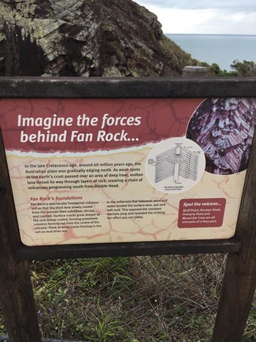
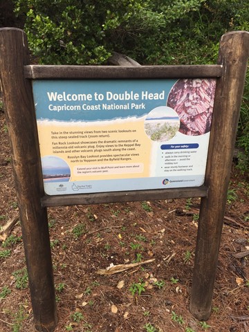
Double Head Track
This is a council maintained track up the southern peak of Double Head at Rosslyn near Yeppoon. It takes you to Fan Rock and a lookout towards the northern Peak.