
Menu
Suggested searches
Your search found 118 results...

 1
km
return
1
km
return
 45
mins
45
mins
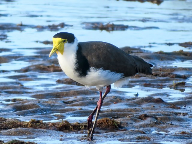
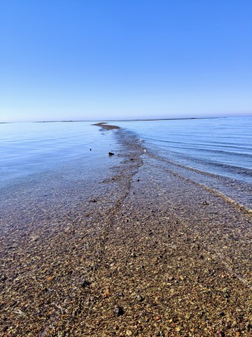
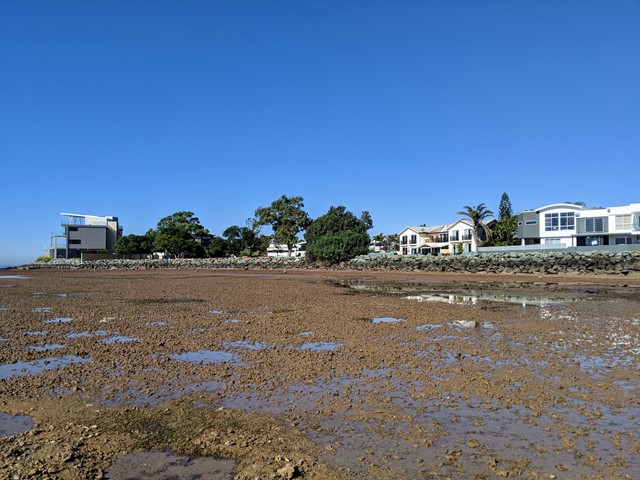
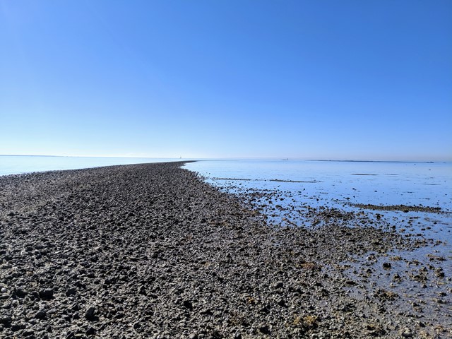
Scarborough Point Low Tide
Moreton Island National Park
A short 1km return walk over the mud flat & rocks at Scarborough Point, starting from Tingira Park. At low tide the rocks form a roughly 2m wide path out to a big rocky outcrop in the bay, there's often people fishing or fossicking here. At high tide the entire path and outcrop go underwater.
 800
m
return
40
mins
800
m
return
40
mins
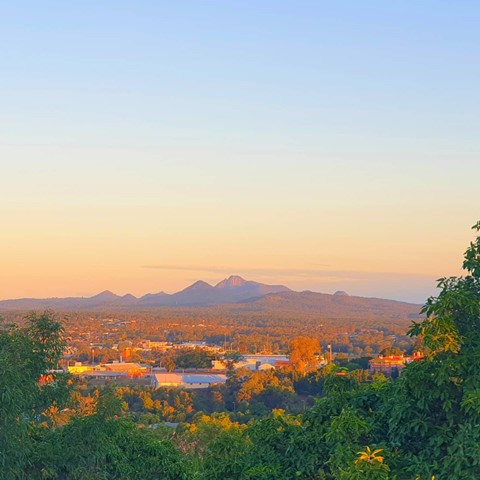
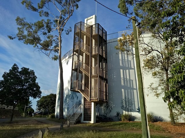
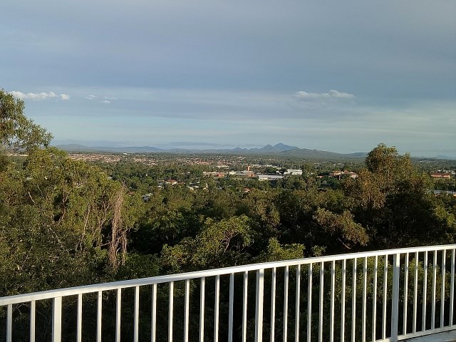
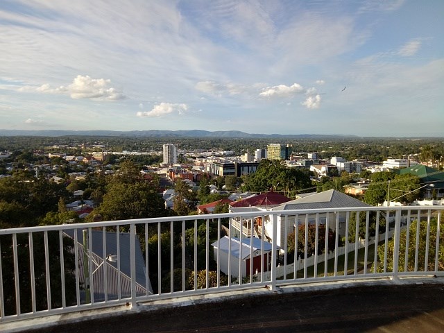
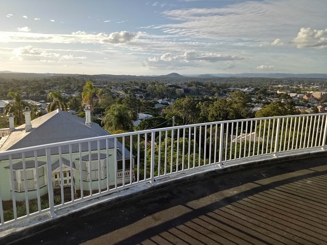
Water Tower Circuit
Ipswich - Demark HIll Conservation Park
Denmark Hill Conservation Park is within walking distance of Ipswich Central. The main entry and parking areas are located opposite the corner of Deebing and Clay Streets, just south of the city centre. Walking tracks lead to the water tower and provide 360° views of Ipswich City and on a clear day, all the way to Brisbane. Triassic Park, located within the park boundaries, provides visitors with an opportunity to explore the many fossils that were once found in the area.
 3
km
return
40
mins
3
km
return
40
mins
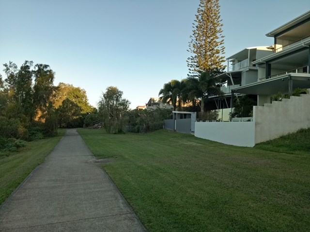
Sel Outridge Park Walk (Jack Gordon Pathway)
South East Queensland
Foreshore walk with views towards Minjerribah (North Stradbroke Island). Concrete pathway.
 3
km
return
1
hr
3
km
return
1
hr
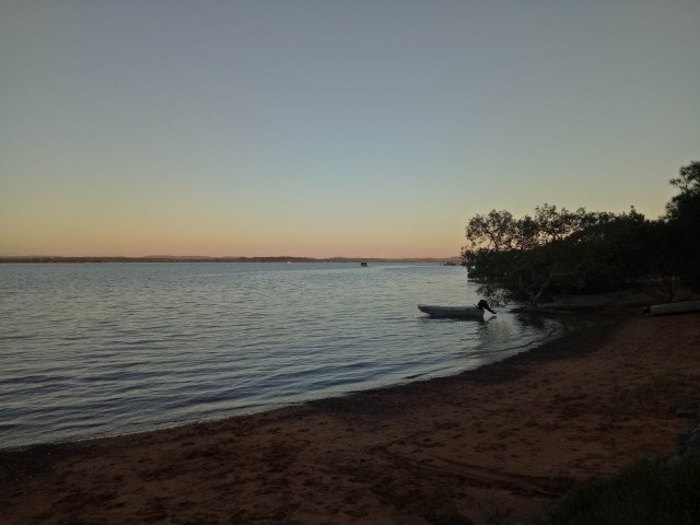
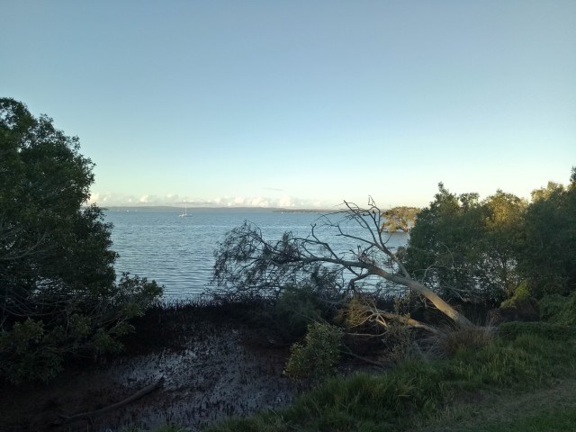
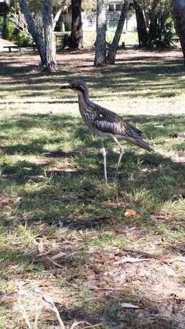
Melaleuca Wetland Reserve Walk (Coochiemudlo Island)
South East Queensland
This walk takes you around half Coochiemudlo Island anti-clockwise. Relaxed atmosphere with beach views, half way through the walk will take you through the reserve where you can easily spot some Bush Stone-curlews.
 9
km
one-way
2.5
hrs
9
km
one-way
2.5
hrs
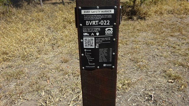
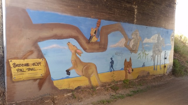
Diamantina Boulevard to Borallon Station Road - Part of BVRT
Brisbane Valley Rail Trail
10kms easy walking along the old Brisbane Valley Rail Trail. Passing old stations (or where they used to be, signs have been erected) of Muirlea, Pine Mountain and Borallon. Great for birdwatching. I would recommend for a winter walk - dappled shade, but would get very hot very quickly in summer.
4
km
one-way
1
hr
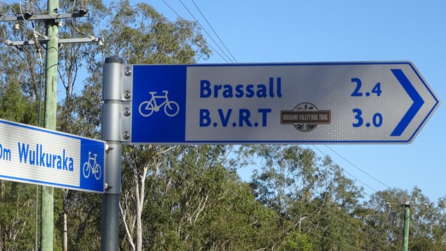
Wulkuraka Station to Diamantina Boulevard - Part of BVRT
Brisbane Valley Rail Trail
This first part of the BVRT (Brisbane Valley Rail Trail) is only 3.8kms of very easy walking along paved pathways between residential and bushland. As the name suggests this is along the old Brisbane Valley Railway, the whole trail is approximately 161kms finishing in Yarraman.
5
km
return
90
mins
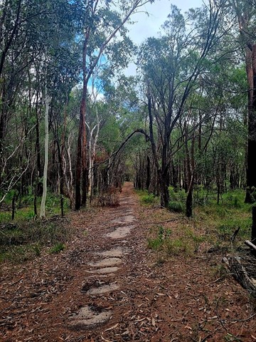
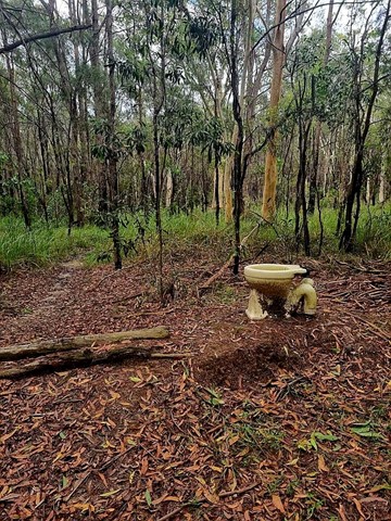
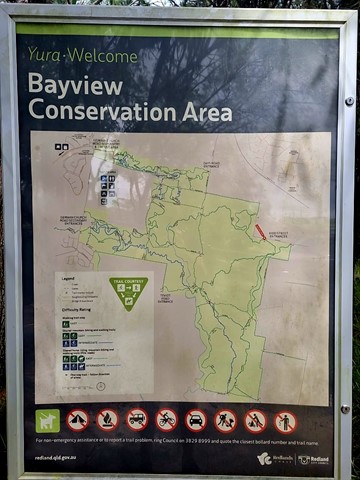
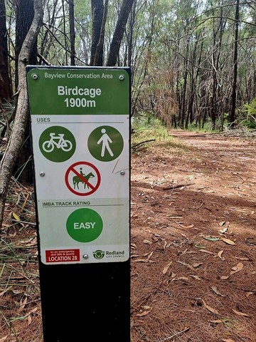
Bayview Conservation Area (Kidd Street Entrance)
Queensland
Multiple trails that crisscross the area. Includes the Birdcage Trail, an easy 1900m walk that is one of the many trails through the Bayview Conservation Area. Glimpses of the ever-growing suburbia nearby, the track winds through natural bushland with many native grass trees. Passes the "birdcage" itself, a quirky work of imagination.
As of July, 2025, the area was heavily battered by "Alfred" and next to it commenced a huge housing development. Likely, there will be another trailhead/ access in years to come.
 23
km
one-way
6
hrs
23
km
one-way
6
hrs
Wulkaraka to Fernvale - Part of BVRT
Brisbane Valley Rail Trail
I rode this but you are certainly allowed to walk it. A fun and enjoyable ride from Wulkaraka station to Fernvale. Look forward to a delicious thick shake and a pie at the renowned Fernvale bakery! The track is mostly flat and easy to follow. A couple of road crossings.
 10
km
one-way
2.5
hrs
10
km
one-way
2.5
hrs
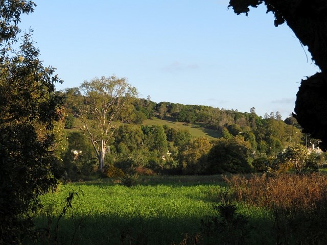
Borallon Station Road to Fernvale - Part of BVRT
Brisbane Valley Rail Trail
This is a nice part of the BVRT, the scenery changes quite a bit along the walk, bush track to farm land to open pasture looking out to the mountains. You'll need to do a quick crossing of the Brisbane Valley Highway, easy, but just keep your wits about you. Along the way you'll pass Wanora and Fairney View stations. Just after Fairney View is a lovely little creek where a bridge once crossed, a nice spot for a break. After this there is the slightest of inclines, but that incline continues all the way to Fernvale. But once there you've got a great excuse for a pie!