
Menu
Suggested searches
Your search found 118 results...

 8
km
return
8
km
return
 90
mins
90
mins
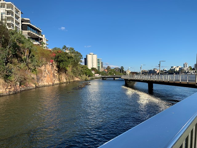
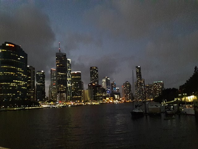
Brisbane River Walk
Brisbane City Council Local Walks
This is my taken pathway: Fortitude Valley, New Farm, Riverwalk, Kangaroo Point on a sunny hot day! It took me 1.5h equivalent to 10k & 11,000 steps
 2
km
one-way
30
mins
2
km
one-way
30
mins
The Cliffs Boardwalk
Brisbane City Council Local Walks
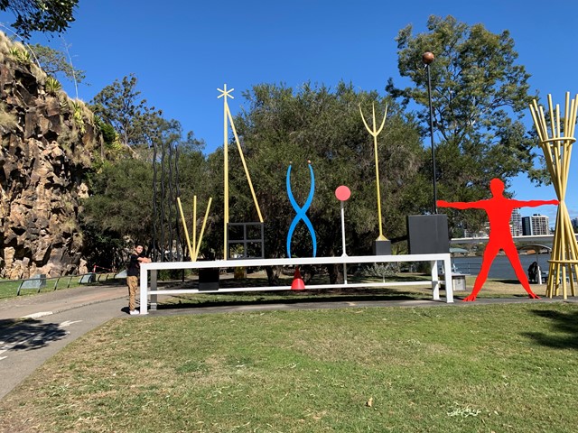
The area between the cliff face and the river, called The Cliffs Boardwalk, has been beautifully landscaped with walkways, including a boardwalk through the mangroves, barbecues, picnic areas and gardens.
Scattered along the walk are colourful artworks that were originally commissioned for the riverside promenade at World Expo 88 at nearby Southbank.
 2
km
return
45
mins
2
km
return
45
mins
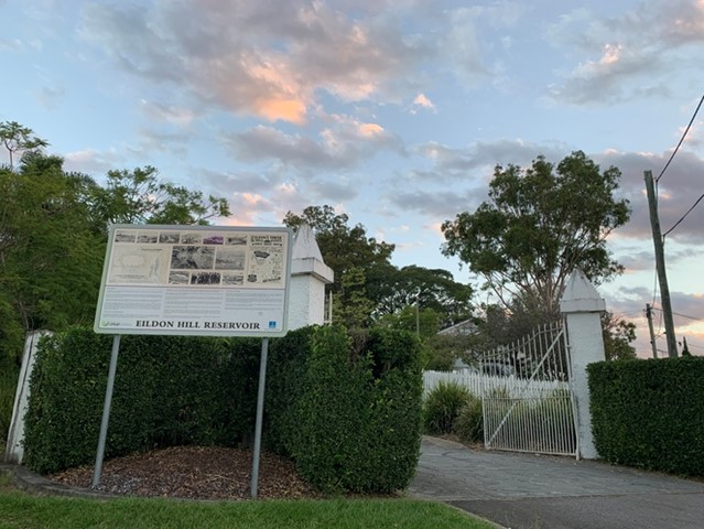
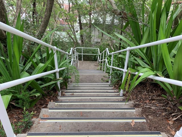
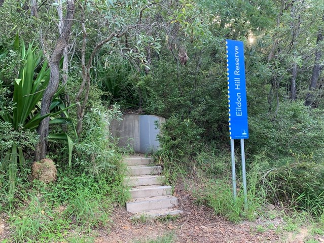
Eildon Hill Reservoir
Brisbane City Council Local Walks
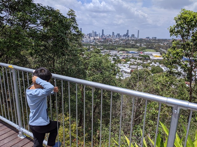
Eildon Hill Reservoir sits at the summit of Eildon Hill, which is a strategic location for viewing the City, Moreton Bay, the Border Ranges, Cunningham's Gap, Taylor and D'Aguilar Range.
Recently a new lookout has been build as a project to improve the great places in the suburb, make them safer and connect them with the communities, family and friends. There are walking trails on the steep hill of the reservoir, which connect Windsor and Wilston suburbs. The Loop walk is upgraded as well.
https://www.weekendnotes.com/eildon-hill-reserve/192915/
 1
km
return
20
mins
1
km
return
20
mins
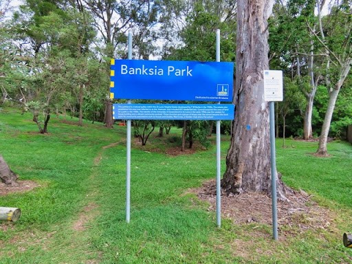
Banksia Park
Brisbane City Council Local Walks
A short, but pleasant bushwalk in St. Lucia close to UQ.
 6
km
2
hrs
6
km
2
hrs
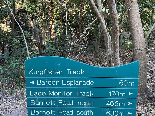
Bardon Bushland
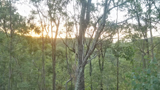
Mt. Coot-tha
Several short trails which link together through parts of Bardon/Ashgrove/The Gap. Entrances to the trails are the Bardon Esplanade (across the creek and bridge) north and south Barnett Rd and Trinder Rd The Gap. There is a goat track just off the Barnett Rd trails (before you reach the dead-end of the track at private property) which connects to the Quarry Trail - You need to walk along a steep ridge to get to it - and this will connect you to the rest of the Mt Coot-tha trails.
 1
km
return
20
mins
1
km
return
20
mins
Bowie Flats Wetlands
Brisbane City Council Local Walks
Located in the Suburb of Coorparoo there is a little hidden treasure to walk around. Take a look.
Have a look at the Video.
http://www.youtube.com/watch?v=QmQ77iMVHeY
 1.2
km
return
30
mins
1.2
km
return
30
mins
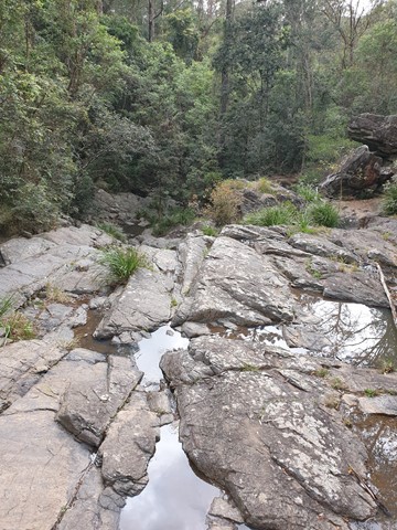
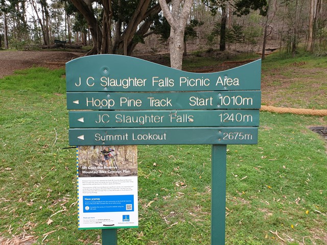
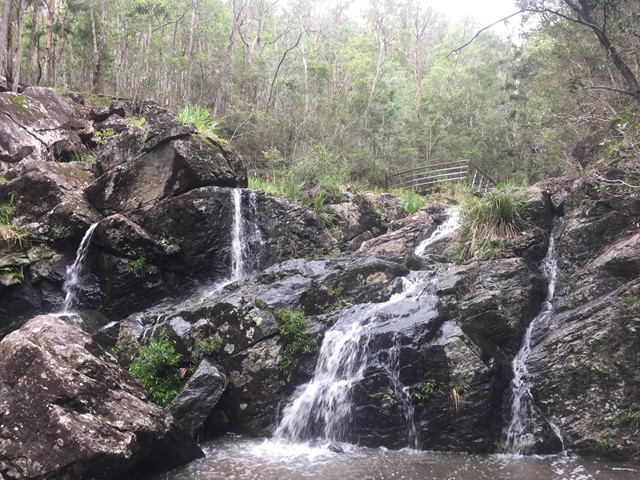
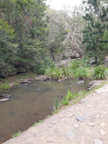
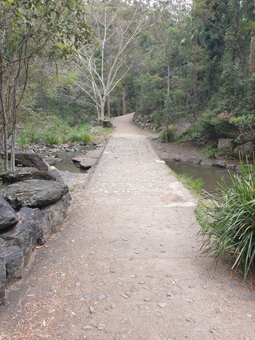
JC Slaughter Falls
Mt. Coot-tha
The walk begins at the far end of the JC Slaughter Falls Picnic area and follows for about 600m way one. Only about 200m on the walk has a steep rocky incline but it isn't very difficult. The falls are non-existent unless there has been some rain.
 2.6
km
one-way
40
mins
2.6
km
one-way
40
mins
Mahogany Trail
Mt. Coot-tha
An alternate track to the Summit Trail at Mt Cootha Brisbane that is shared with bikes and horse riders
 3
km
return
45
mins
3
km
return
45
mins
Seven Hills Circuit
Brisbane City Council Local Walks
Sort circuit track that is intersected by the Seven Hills Ridge track and the Seven Hills Gully Track. Wide and clear well maintained track.
 5.3
km
return
75
mins
5.3
km
return
75
mins
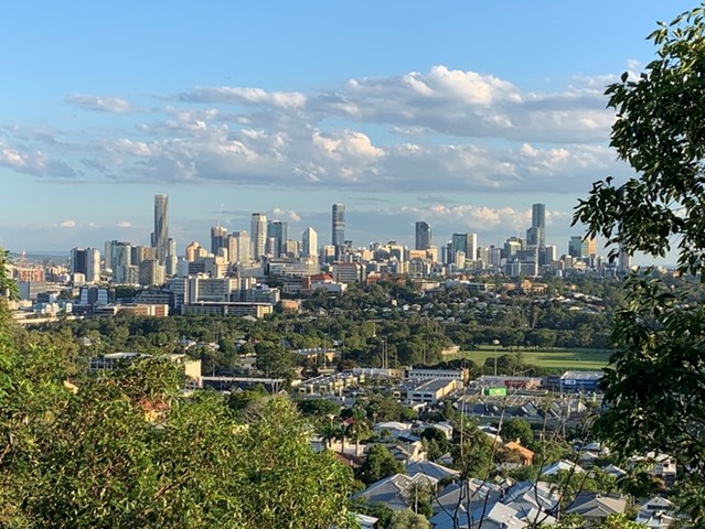
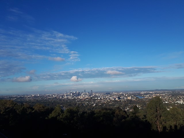
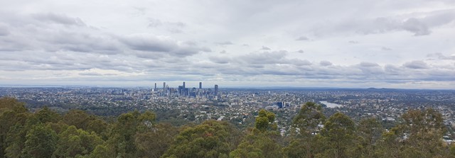
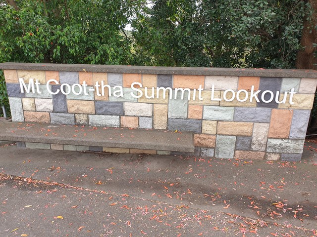
Mt. Coot-tha Summit Track
Mt. Coot-tha
Mt Coot-tha Lookout has sweeping views of Brisbane City, Moreton Bay, and around to the Tweed Volcano, Main Range and Mount Barney and Flinders Peak. The walk to this lookout, from JC Slaughter Falls Picnic Area, is a potentially slightly testing but generally easy walk on a paved track that straddles a gully.