
Menu
Suggested searches
Your search found 2444 results...

 14
km
14
km
 5
hrs
5
hrs
Sole Walk
Yorke Peninsula
Fantastic coastal walk from Kangaroo Island Lookout to Meehan Hill. A section of Walk the Yorke trail.
 5.6
km
return
3
hrs
5.6
km
return
3
hrs
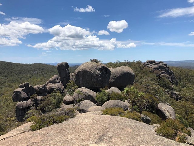
Cathedral Rock
Cathedral Rock National Park
The Barokee campground is the starting point for this walk. It is accessed via a rather rough unsealed road off the B78.
Cathedral Rock track is an exciting and challenging walk, near to Barokee campground and Round Mountain, offering scenic views across the New England Tablelands from the summit.
Hike up Cathedral Rock to sit on a natural throne perched on 100m of stacked boulders and survey your kingdom. The nearby Round Mountain is the highest point of the New England Tablelands, although only by a royal whisker at 1579m.
 15
km
4
hrs
15
km
4
hrs
Lonesome Trail
Expedition National Park
Expedition National Park - Lonesome Section. Good views of Arcadia Valley to the north. Remote walk.
 5
km
2
hrs
5
km
2
hrs
Mount Goolman
Ipswich - Flinders Goolman Conservation Estate
Easiest way is to start from the end of Stowers Rd. Follow fire trail keeping left at any intersections, and start of the track up is at -27.75821, 152.79298. Not an overly difficult climb, with a reasonably clear track all the way to the summit. Also a few ribbons may help you get there.
 6
km
4
hrs
6
km
4
hrs
Mt Lindesay
Mt Barney National Park
I've revised the description and left the original below.
From the border gate the route follows the western ridge before traversing the mountain's southern slopes. Once you reach the eastern ridge, look for the ascent point for the lower cliff-line, very close to the ridge crest. The climb starts with a steep chimney to a tree, which can be used as an anchor for this lower pitch if needed, then briefly traverses right before climbing straight up a very shallow gully to a ramp trending leftwards. Casuarina needles make this section slippery. The route is easy to follow from here but the upper cliff-line, while short, contains a slightly overhanging move and some climbers will require aid to ascend. It is far easier to abseil down the upper cliff-line, and safer to use a rope for all exposed sections. Rope doubled-over slings around trees, with separate sling retrieval line should work OK for descent, though the lead climber would need to be able to ascend without protection and the lower cliffs would be 2 pitches long. There were no views from the summit when I climbed this in early 2000s
ORIGINAL DESCRIPTION
This walk starts near the border gate and eventually becomes very steep on a relatively poorly defined path. It's possible to go nearly all the way to the top without a rope.
1
km
30
mins
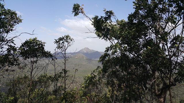
Mt Scoria
Central Queensland
Mt Scoria, the 'musical mountain', near Thangool, close to Biloela.
1
km
3
hrs
Mount Moon
South East Queensland
Mount Moon near Mount Alford is on private property (you can ask for permission to climb it) near Mt Greville. I took the difficult (not defined) route up, through lots of lantana (as tall as myself) in which I got severely tangled. Lots of scratches to show for it at the end. My first really hard bushwalk.
17.2
km
one-way
6
hrs
Elanda Point to Harry's Hut
Great Sandy National Park
Great day out, however you need to keep moving to get around. Easy walking but a little tricky as the bridge is out, you can either swim (as I did) or cross country around kin Kin creek and cross over the concrete bridge 1km west of the old bridge.
12.8
km
return
4
hrs
Harrys camping area to Camp site 3
Great Sandy National Park
Trail parallel to the Noosa River, opposite site from Harrys camping area (kayak/ boat needed to cross the river).
12
km
return
4
hrs
Camp site 3 to Cooloola sandpatch
Great Sandy National Park
Trail ap the hill through mostly banksia bush. Loose sand, quite hot in summer.