
Menu
Suggested searches
Your search found 2398 results...

 7
km
return
7
km
return
 3
hrs
3
hrs
Leehovden
Spitsbergen (Svalbard)
Great walk from Kapp Lee. Be careful where you walk, otherwise you may lose your boots. Can be steep at some points
6
km
return
3
hrs
Sysslgarden
Spitsbergen (Svalbard)
Good viewpoint over Longyearbyen and Adventfjorden
 7
km
return
3
hrs
7
km
return
3
hrs
Glacial Martial
Ushuaia Region
Probably the most popular hike in Ushuaia. Easy and beautiful. Remember to bring a jacket as it is significantly colder here than in Ushuaia
 20
km
return
7
mins
20
km
return
7
mins
Laguna de los Tempanos
Ushuaia Region
Beautiful lake that sometimes has ice caves
17
km
return
6
hrs
Cerro Dos Banderas
Ushuaia Region
Nice walk with a great view from the top
17
km
return
5.5
hrs
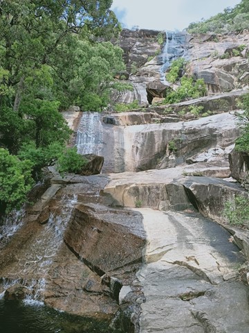
Alligator Creek Falls - Bowling Green Bay National Park
North Queensland
A longish walk (17 kilometres return) with a spectacular destination at the base of Alligator Creek Falls. The walk commences at the Picnic and Camping area, and is mostly gentle in grade, traversing up the Alligator Creek Valley through grassy open tropical woodlands, riparian forest and patches of rainforest. The walk involves 4 creek crossings, one at Cockatoo Creek, and 3 crossings of Alligator Creek itself. You will need to ford or boulder-hop at these crossings, depending on the water levels. Usually it is an easy boulder-hop, except for after flooding in the wet season. There are a couple sections in the middle of the walk which follow a power-line easement and access road. These sections can be hot and exposed in the middle of the day. This walk is best suited to the cooler months. Swimming is possible at the base of the Falls year round.
The 4 kilometre return walk to Cockatoo Creek provides a pleasant shorter option.
 4
km
return
90
mins
4
km
return
90
mins
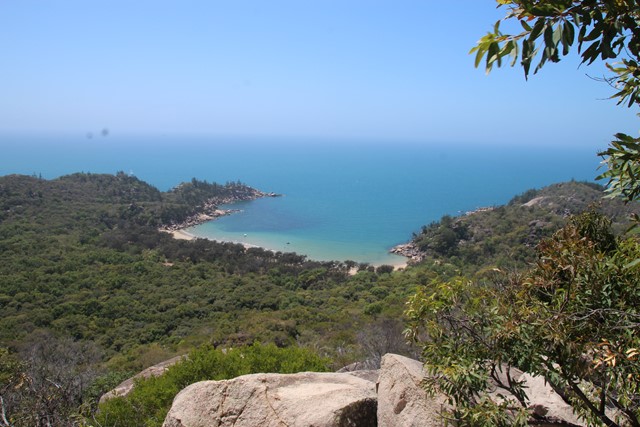
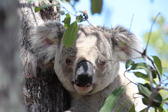
The Forts Walk
Magnetic Island National Park
This walk has it all - spectacular coastal views, WW2 history, and possibly the best walk in Australia for spotting Koalas in the wild and close up!
The walk leads to WW2 fortifications built to guard the entrance to the Townsville Port, and consequently they provide spectacular and un-interrupted views of the bay and surrounding coastlines. Along the way, the walk passes through the old encampment areas which has great interpretive signage to explain how the area looked during the war. It is in this area that walkers are almost guaranteed to spot a wild koala lounging low in the trees.
 1.2
km
return
45
mins
1.2
km
return
45
mins
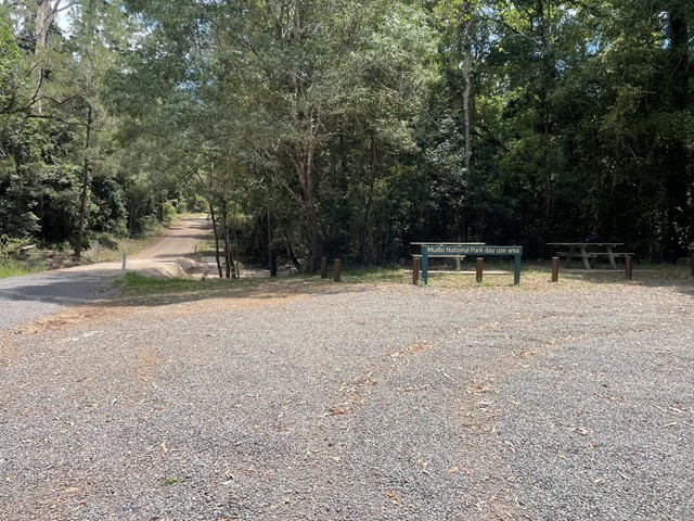
Scubby Creek Circuit
Mudlo National Park
Meandering along Scrubby Creek this track lets you explore the hoop pine vine forest and takes you past giant figs. Listen out for the “whip crack” call from the male eastern whip bird and the female’s “choo choo” response.
 40
km
return
9
hrs
40
km
return
9
hrs
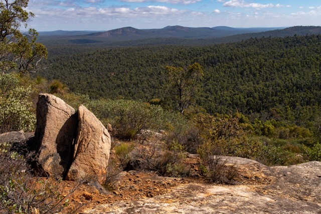
Monadnocks & Mt Cooke loop
Western Australia
A long day walk along the Darling Ranges section of the Bibbulman Track, the route combines Mount Cuthbert and Mount Vincent (Sullivans Rock to Monadnocks) as well as Mount Cooke, the highest point of the Darling Scarp. It avoids backtracking by utilising the Bibbulman Track and surrounding 4WD roads.