


 SE and Peasants (GPX)
 15
15 10
10- Mt Barney - East Peak - South Ridge (Mt Barney National Park)
- Mt Barney East Peak - South-East Ridge up and South Ridge down (Mt Barney National Park)
- Mt Barney - East Peak - Up Logan's - Down South (Mt Barney National Park)
- Mt Barney via Gorge and down Peasants Ridge (Mt Barney National Park)
- Mt Barney via Logans Ridge and return via Gorge (Mt Barney National Park)
Mt Barney - East Peak - Up South-East - Down South
Mt Barney National Park
Menu
GPS Tracks
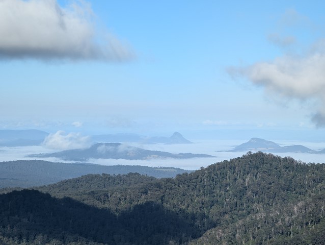
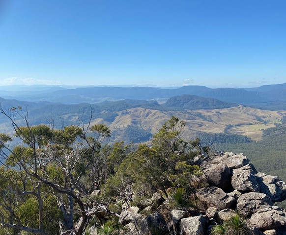

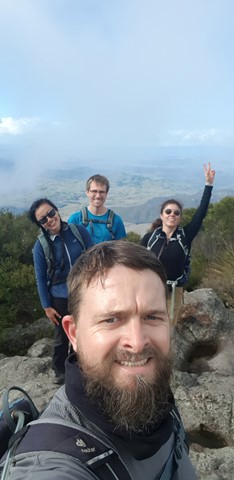
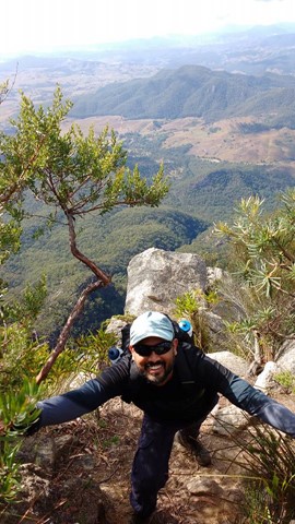
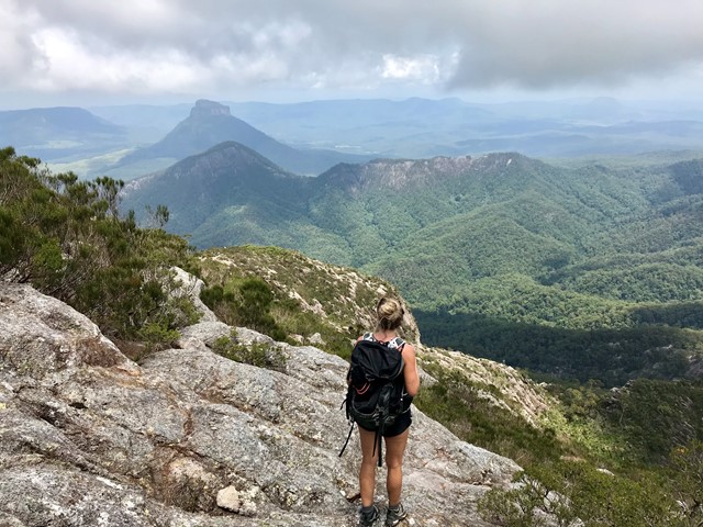
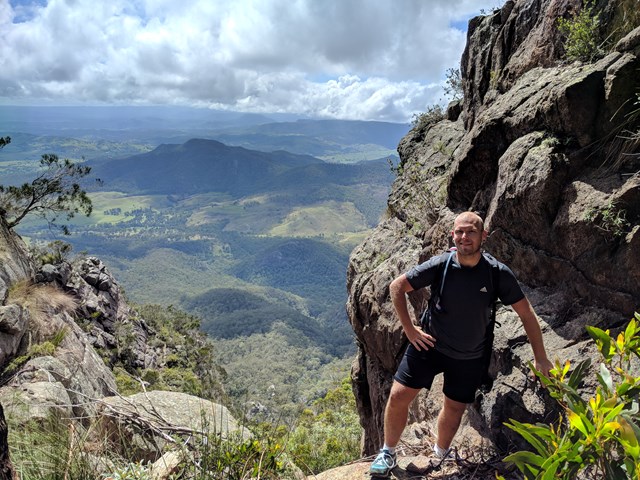

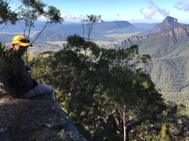

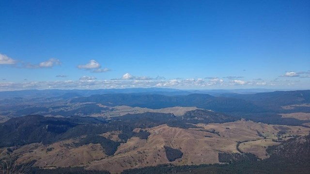
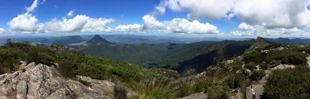


Ascent of Mt Barney via South East Ridge and descent via Peasants Ridge: a challenging but rewarding hike. The views are amazing and certainly worth the effort. If coming from Brisbane leave early and aim to be at Yellow Pinch car park by 7:30-8 am. Allow 3-4 hours for the ascent via the South East Ridge track and 2-3 hours for decent via South Ridge (Peasants Ridge) track.
Lookouts
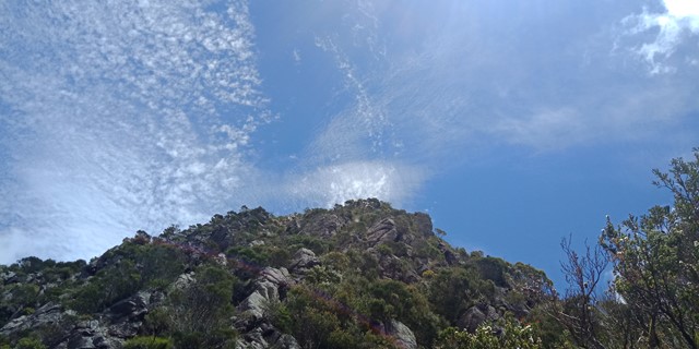
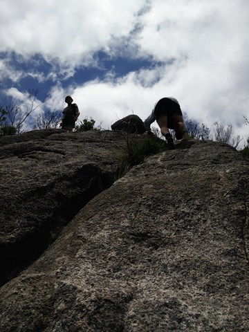
Scrambling or Climbing
Navigation Required
Camping Permitted
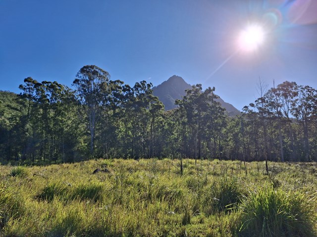
Eucalypt Forest
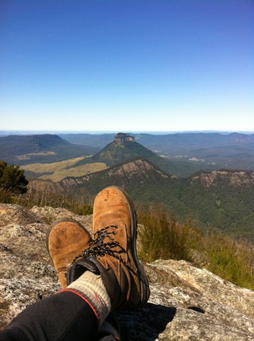
1351m
Maximum Elevation
1100m
Total Climb
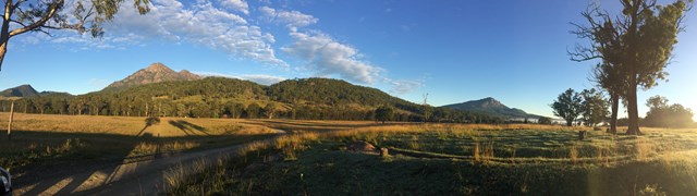
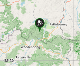
Getting there
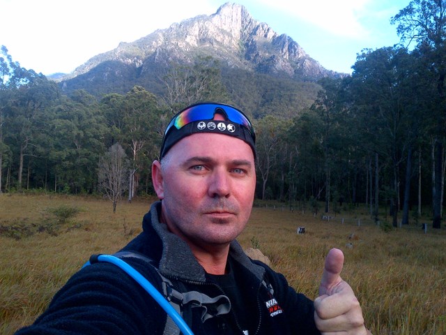
Access from Yellowpinch picnic area on Upper Logan Rd (enter "Yellowpinch" into GPS/Apple Maps and NOT Mount Barney!)
Maps
1:25K Mt Lindesay topographical map (Sun Map)
You can create a bespoke topographical map which can be downloaded as an image or PDF at QTopo
Route/Trail notes
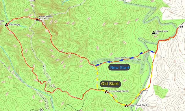
13/08/18: Updated with new South-East Ridge trailhead info (image attached showing changes)
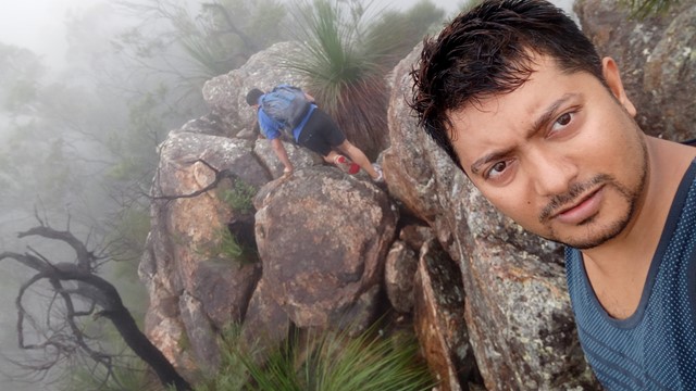
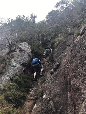
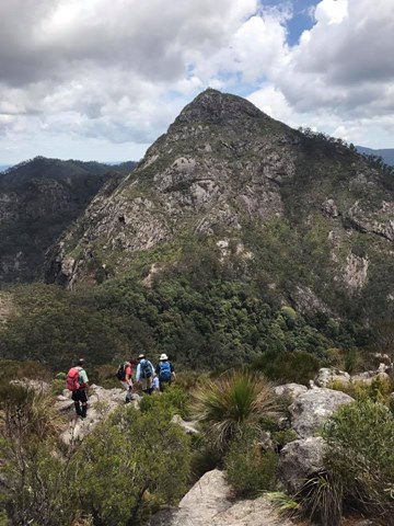
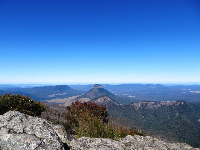
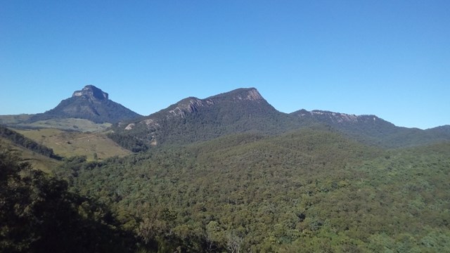
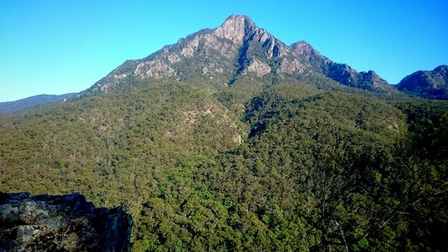
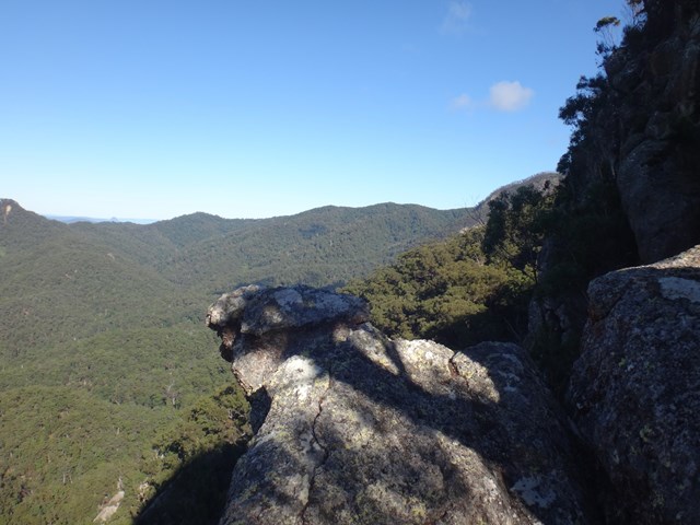
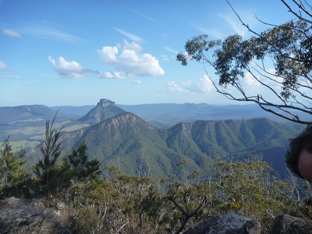
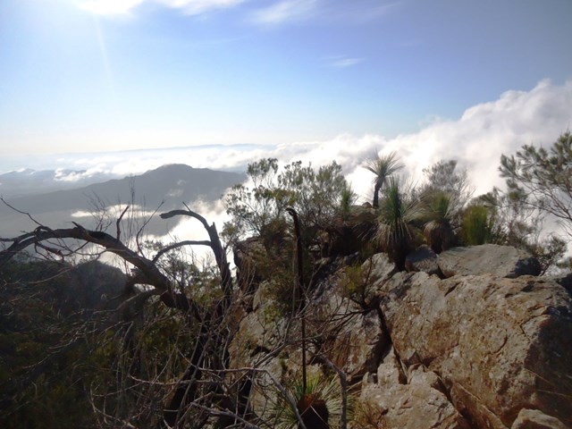
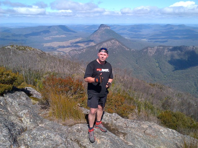
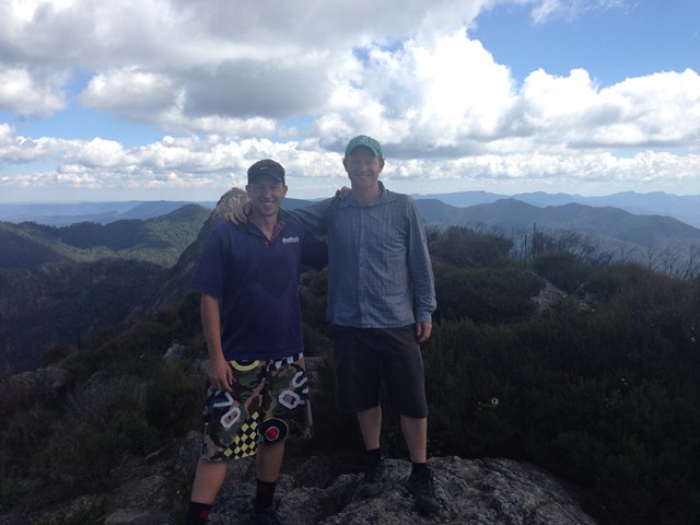
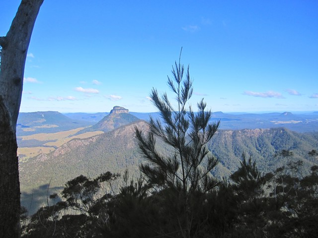
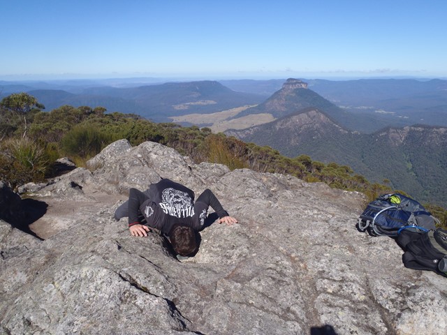
Start at the locked gate on the access road at the back of Yellowpinch carpark. Go around the gate and follow the gravel road uphill to Yellowpinch, go through the metal gate at the top and start walking downhill along the same gravel road. When you reach the bottom of the hill (approx 800m into the walk) there will be a cleared area on your right and you will see the NEW South-East Ridge trailhead; it is marked by a National Parks information board. Head along the path through the grass/shrub, cross the Logan River creek and then continue along the footpad up the steady incline. Approx. 1.5km into the walk you will reach an intersection; left going downhill and right continuing up the incline. This is where you join on to the traditional SER track. Take the right uphill, the incline will increase noticeably as the real ascent now begins. Continue along the footpath; when you come to a rock outcrop go to the right and keep heading up hill. At the next outcrop go left then right, where you should end up on a narrow ridge. Keep going up until you come to a steep deep gully go down and heading to the left climb an obvious route up. Keep going up past a razorback ridge. Where after a while you will come to a shallow gully where you head uphill to the right to a rocky slab that is a bit slippery so be careful. Keep going up hill follow the trail until another steep section and rock slab. Keep going and the summit soon comes into view. Keep going uphill with a few scrambles to the top of a rocky knoll. I found I reached here in about 3 and half hours from Yelllowpinch and followed the faint trail through scrub uphill to the summit.
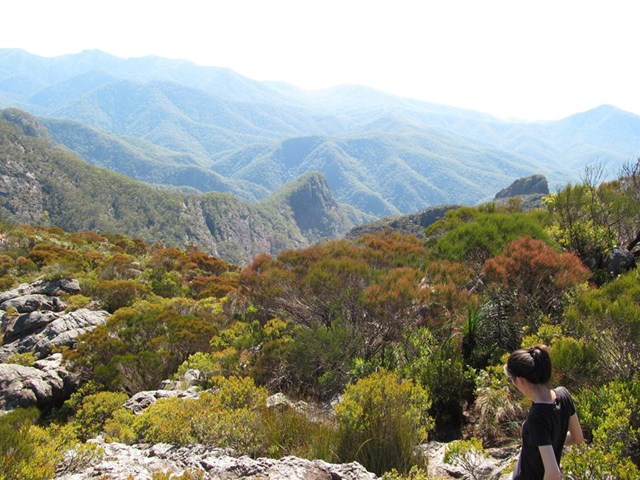
Once you finish enjoying the summit head west and downhill for about an hour aiming for the faint circle of the old Barney Hut There are obviously many different descent routes some over rock slabs some down gullies. Generally follow a south by south west bearing. Once at the Campsite cross the creek and move uphill to Rum Jungle Campsite. The route out goes uphill with some arrows showing the way. After 10 mins or so the route descends. Keep the rocks to your left as the track steeply descends a narrow rocky ridge. When you descend to a small clearing the trail turns right then left and keep going down till you come to a steep rocky slab that can be slippery. Descend this carefully! keep following the path downhill till you reach the sign at the beginning of Peasants Ridge. Follow the road to the beginning of SE Ridge and retrace your steps back to the carpark at Yellowpinch. This walk was done when the weather was good and rock dry.
Permits/Costs
If you camp anywhere in Mt Barney National Park, the cost is $6.15.
Other References
Take A Walk In South East Queensland. Rob Rankin Secrets of the Scenic Rim
GPS Tracks
Where
Click here to load this map.
Comments