
Menu
Popular Walks
-
Mt Maroon
(513 ticks) -
Lower Portals
(333 ticks) -
Mt Barney - East Peak - Up South-East - Down South
(150 ticks) -
Mount May
(124 ticks) -
Mt Barney - East Peak - South Ridge
(92 ticks)
Summary
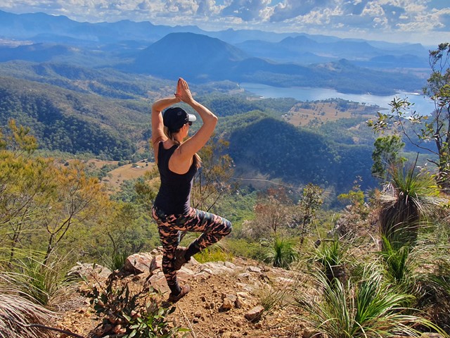
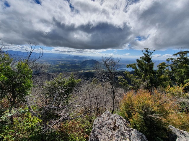
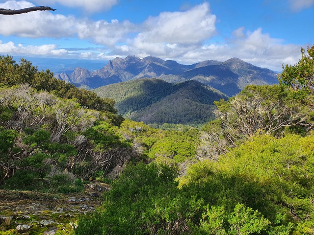
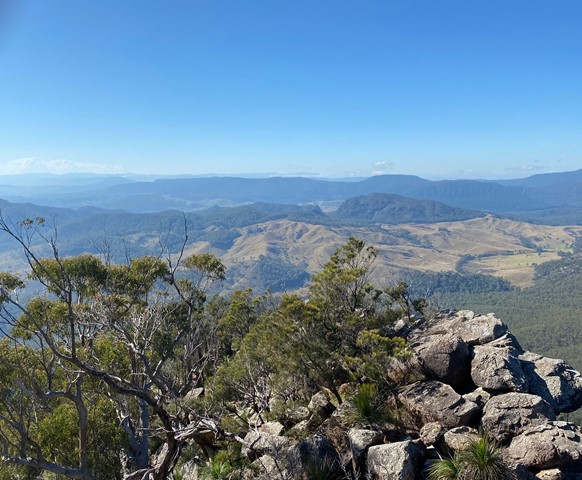
Mt Barney with it's two peaks (Mount Barney East at 1,351m and Mount Barney West at 1,354m) is the highest peak in Mount Barney National Park, and one of the most popular bushwalks in South-East Queensland. Other peaks in Mount Barney National Park include Mount Maroon (967m), Mt May (836m), Mt Clunie (1155m). Many of the walks in the park are rated "hard" and require some experience and route-finding skills.
The Lower and Upper Portals are also popular day-walks.
Popular Walks
-
Mt Maroon
(513 ticks) -
Lower Portals
(333 ticks) -
Mt Barney - East Peak - Up South-East - Down South
(150 ticks) -
Mount May
(124 ticks) -
Mt Barney - East Peak - South Ridge
(92 ticks)
Features
What are the standout bushwalking features?
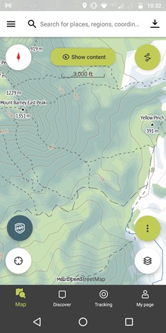
Access
No public access. Car access via Rathdowney. Multiple Mount Barney summit routes start at Yellowpinch carpark.
Maps
1:25K Mt Lindesay topographical map
Accommodation
Mount Barney Lodge Country Retreat is close to the Park. There are multiple camping spots, both car-accessible and more remote sites (booking required and fee applies)
Camping
Camp sites must be booked and a small fee applies – you can do this on-line via the Queensland National Parks Booking Service. You’ll be able to print a Camping Tag to attach to your tent.
Other
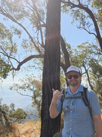
Mount Barney summit trip report - https://hikingtheworld.blog/2018/07/08/mount-barney/
Contact details
https://parks.des.qld.gov.au/parks/mount-barney/about.html
Walks in Mt Barney National Park

 12.9
km
return
12.9
km
return
 6
hrs
6
hrs
Mount Maroon Southern Route
This alternate route up Mount Maroon begins from the end of Dynans Hut Road following the fire trail until Paddy Plain Remote Bush Camp after which the small creek named Paddys Gully is followed upstream for a short way before turning right at the fork in the creek and following this mostly dry tributary up the Southern flanks of Mount Maroon. The exposed creek bed is followed up hill for a while until you exit it on the righthand side to join the forested gully you follow for the majority of the way up until the plateau. Once the plateau has been gained its not long until you run into the main tourist path and follow it up to the summit. Trail up the Southern flanks of Mount Maroon is off trail / overgrown and navigation skills will be needed.
9
km
return
5.5
hrs
Mount May
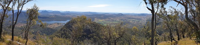
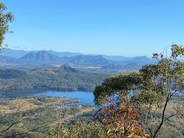
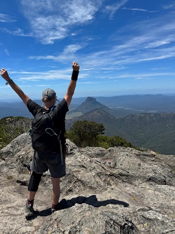
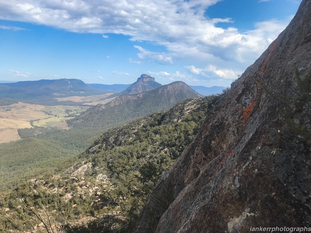
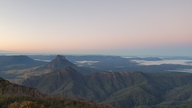
A challenging half day circuit walk of Mount May with great views of the surrounding mountains.
 12
km
return
8
hrs
12
km
return
8
hrs
Mowburra Peak
A slightly less travelled walk up a steep grassy ridge and then disappear into rain forest to get to a small cleared rocky slab with wonderful views out to Mt Barney.
 17
km
return
10
hrs
17
km
return
10
hrs
Mt Barney - East Peak - South Ridge
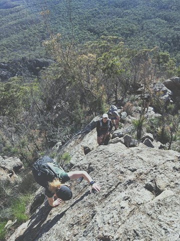
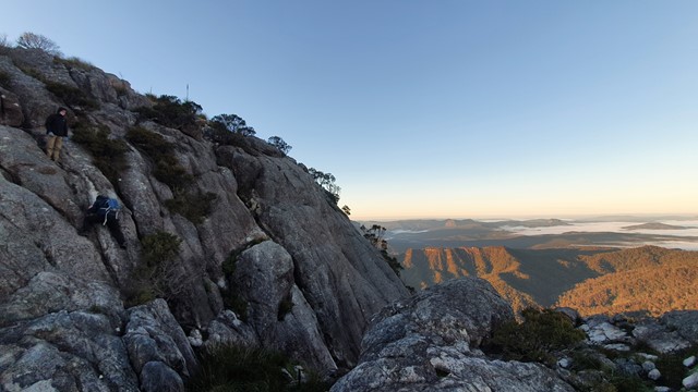
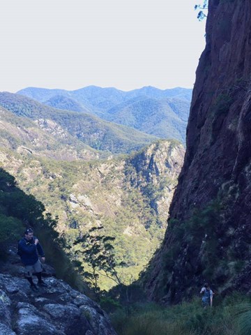
South Ridge is the easiest track up Mt Barney (but it's NOT easy!). Sometimes referred to as Peasants' Ridge (a dig that only Peasants would take such a boring route up the mountain), South Ridge is an excellent choice for a first ascent of Barney. The track has triangular trail markers but there are still opportunities for navigational difficulties if you're inexperienced.
You MUST start early in the day. Expected time is 8-10 hours with almost 1200m of climbing from the carpark. Make sure to leave early to allow time for any mishaps and be prepared to turn back if necessary.
 15.4
km
one-way
6
hrs
15.4
km
one-way
6
hrs
Mt Barney - East Peak - Up Logan's - Down South
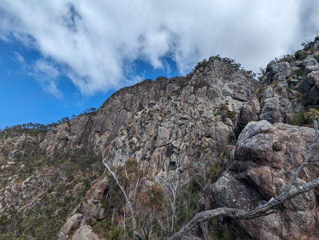
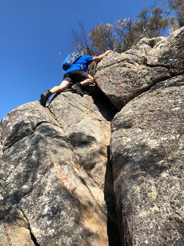
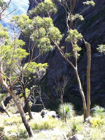
The original route taken by Captain Patrick Logan & Allan Cunningham. AC actually gave up leaving Logan to climb on alone. It's the steepest, sharpest most direct route up to East Peak short of needing ropes, harnesses and belays etc. The views are spectacular. Rock scrambling experience, sound navigational skills and a good head for heights are an absolute must for this walk. NEVER climb it alone. There have been dozens of rescues off this ridge, don't be next. Extensive signage recently installed at Yellow Pinch do not mention Logan's Ridge, for good reason.
 15
km
return
10
hrs
15
km
return
10
hrs
Mt Barney - East Peak - Up South-East - Down South
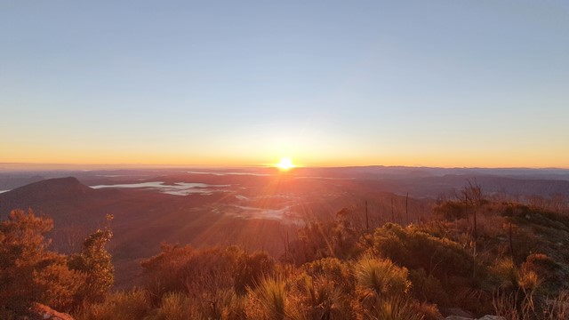
Ascent of Mt Barney via South East Ridge and descent via Peasants Ridge: a challenging but rewarding hike. The views are amazing and certainly worth the effort. If coming from Brisbane leave early and aim to be at Yellow Pinch car park by 7:30-8 am. Allow 3-4 hours for the ascent via the South East Ridge track and 2-3 hours for decent via South Ridge (Peasants Ridge) track.
 7
km
return
8
hrs
7
km
return
8
hrs
Mt Barney - Up Logan's Ridge Down SE Ridge
Very challenging route up Mt Barney with some technical rock climbing required. You must have some decent scrambling experience and a high level of fitness. Whist there is some exposure it is the technical climbing that is the most challenging. Allow plenty of time and plenty of water and if in doubt (as we were numerous times) just stick to centre of the ridge. There are times where you have to rely on your boots for grip so make sure you are comfortable with you choice of footwear. I recommend a day pack only with this route as there are several sections where you need to haul yourself over ledges that would be almost impossible with a full pack. I rate the SE ridge as a 5 and Logan's ridge as a 9 in terms of difficulty. Take this on board and give it a go :)
 15
km
return
10
hrs
15
km
return
10
hrs
Mt Barney East Peak - South-East Ridge up and South Ridge down
Very tough. Be prepared for plenty of rock scrambling at height and no trail markers on the summit. Long walk back to the car park from South ridge track.
 9
km
return
8
hrs
9
km
return
8
hrs
Mt Barney East peak south east ridge
This seems to be a duplicate of part of another walk. The information shown here is incorrect. Please refer to the Mt Barney - East Peak - Up South-East - Down South walk instead: https://www.aussiebushwalking.com/qld/mt-barney/mt-barney-summit/mt-barney-south-east-ridge-ascent-peasants-ridge-descent
Starting from yellow Pinch assend the as per the signage the south east ridge track to the summit
 16
km
one-way
1
days
16
km
one-way
1
days
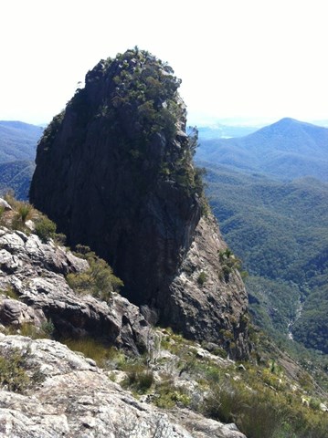
Mt Barney East Peak via SE Ridge, traverse North Pinnacle to Leaning Peak, descend to Barney Gorge and Lower Portals
We did this as a day walk, starting at Yellow Pinch carpark around 7AM and arriving at Lower Portals about 4PM. We were told by a professional guide we bumped into at Yellow Pinch carpark that we wouldn't be able to complete our planned route in 1 day. We completed it easily in about 9 hours and taking plenty of stops, but we're experienced hikers and you need to hold a good pace. Most people would probably prefer to break it up into a 2-day walk.
A couple things you need to know first up:
1. This route starts at Yellow Pinch Carpark but finishes at Lower Portals Carpark, so you either need to pre-arrange a way to get back to your car or you have an extra walk at the end from Lower Portals back to Yellow Pinch.
2. A rope is needed to descend a couple short sections of the couloir on the western side of Leaning Peak. This is a very steep scramble through thick grass and over a few small cliffs, so only attempt if you are comfortable with doing this, as once you pass the first cliff you're pretty much committed to continuing the descent because it's difficult to get back up.