
Sandy Dandy Hike
Moreton Island National Park


Menu
This is a shorter version of the other submitted walk on this island (Moreton Island Traverse).
If you want to see beautiful beaches, lovely lagoons, capacious capes, comfy camps and to fill every crevice on your body with sand then this walk is for you!
This walk will take you to Moreton Island's beaches, camp sites, lighthouse, inland trails, Mt Tempest, blue lagoon, the wrecks and Tangalooma Resort.

Getting there
A ferry from Redcliffe (Newport Marina) can get you to Bulwer.
Maps
Use an online map of moreton island and the trail notes below to figure out the directions.
Route/Trail notes
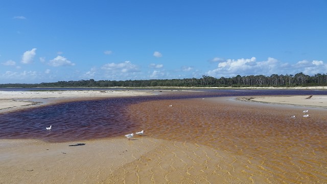
Day 1: You start by catching a ferry that will get you to Bulwer and once you land on the island you will walk north on the beach to Comboyuro Point then past Dog Creek and onto Heath Island, it is best to cross that section during low tide. You will walk towards the North Point campgrounds and take the FWD road towards Cape Moreton Lighthouse. After the lighthouse take the FWD road down to the eastern beaches of the island, walk along those beaches until you reach the Blue Lagoon Campsite and set up camp for the night.
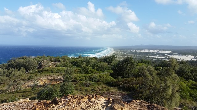
Day 2: Leave Blue Lagoon and head towards the Bulwer-Blue Lagoon Road (there is a shorter route if you look on a detailed map). Once you're on that road walk a few kilometers to the Telegraph Walking Track. Take that track and after a few hours you will eventually reach a steep section which will lead you to the start of Mount Tempest. Tempest is a 2km return track so going up will give you awesome views of the island.
Continue south after Mt Tempest and turn right when you reach the Middle Road. This is a harsh section of sandy road and there is plenty of 4x4 traffic so you can possibly hitch a ride. You will end up on the western beaches and you can walk to your camp site at The Wrecks.
Day 3: This day is your R&R day so congratulations on completing the trail and enjoy the many things the tangalooma area has to offer, beautiful beaches, snorkelling at the wrecks and a walk to the desert south of the resort. You will head back to brisbane on the micat ferry which lands just north of the wrecks.
Permits/Costs
You require camping permits for the camp sites, Blue Lagoon Campgrounds and The Wrecks Campgrounds were my chosen camp sites.
You also have to buy ferry tickets to get on and off the island.
Other References
Lots of info on google and you can get advice from the ferry companies.
GPS Tracks
- No GPS available for this walk yet.
 50
50 3
3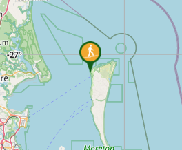
Comments