
Moreton Island Traverse From Tangalooma
Moreton Island National Park


Menu

one way loop can be undertaken in either direction
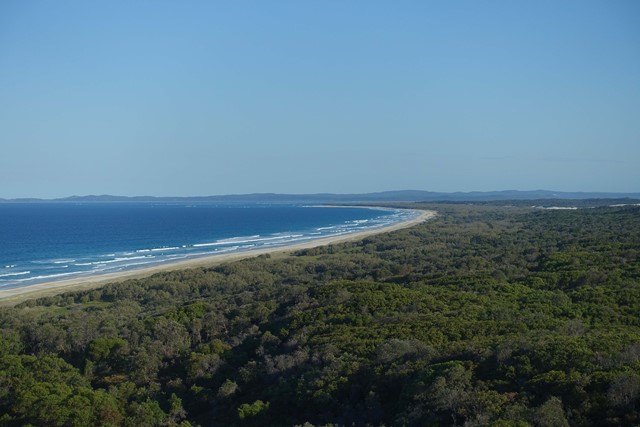
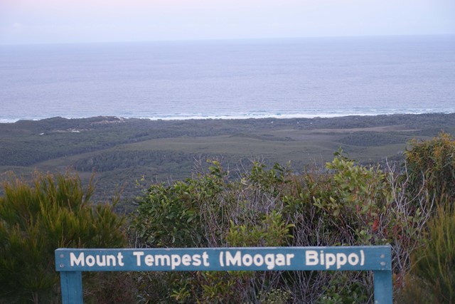
Start where the Ferry drops you off just North of Tangalooma. Walk down to Tangalooma and along the beach till the turn off for the Desert (there's a hazard beacon on the hill). Continue through the desert to the far side then continue along the Rous Battery track (9.8kms). Next day after exploring bunkers head straight North along the beach on the East side of the island. Next is to head along middle road then turn north where mount tempest can be climbed then continue along telegraph track (16Kms) then through to Buwler. Then from the North West corner of the island back south along the western shoreline to the ferry.
undertaken over 4 days

Getting there
A ferry to Moreton Island from Moreton Bay
Maps
Maps of morton island
Route/Trail notes
mentioned before hard to go off track
Permits/Costs
cost of ferry
Other References
How can I find more info? Any guide books?
GPS Tracks
- No GPS available for this walk yet.
 60
60 4
4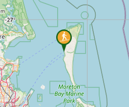
Comments
Nobody has commented on this walk yet. If you've done it then tick it off and add a comment.