
Menu
Popular Walks
-
Castle Hill
(64 ticks) -
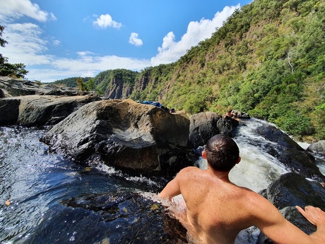
Babinda Boulders
(41 ticks) -
The Forts Walk
(18 ticks) -
Djyinda Walk
(14 ticks) -
Horseshoe Bay - Rotary Lookout
(13 ticks)
Parent Regions
Sub-Regions
Popular Walks
-
Castle Hill
(64 ticks) -
Babinda Boulders
(41 ticks) -
The Forts Walk
(18 ticks) -
Djyinda Walk
(14 ticks) -
Horseshoe Bay - Rotary Lookout
(13 ticks)
Parent Regions
Sub-Regions
History
Any interesting history for the region?
Features
What are the standout bushwalking features?
Access
How do you get there? Include all access points if there are many?
Maps
Which maps cover the region?
Accommodation
Where can I stay there? or near there?
Camping
Council Areas:
- Mount Isa City
- Cloncurry Shite
- Mckinlay Shire
- Richmond Shire
- Flinders Shire
- Charters Towers Regional
- Palm islands
- Hinchinbrook Shire
- Townsville City
- Burdekin Shire
Contact details
Contact details for National Park offices or similar...
Walks in North Queensland

 13.4
km
return
13.4
km
return
 4
hrs
4
hrs
The Bump Track
A steep but relatively straightforward walk that takes you from the Mowbray River Valley near Port Douglas to the Black Mountain Road.
 2.8
km
return
50
mins
2.8
km
return
50
mins
Towers Hill Walking Track
A short but steep circular walk with amazing views over Charters Towers and the surrounding land. As the site of the first gold discovery in Charters Towers, there are loads of points of historical interest including the ruins of Clark's Mines, the Pyrites Works, many WWII bunkers and the seismograph station. These are well signed with plenty of information boards and even audio-visual displays in two of the bunkers. There is also plenty of wildlife including rock wallabies and birds.
Walks in Magnetic Island National Park
1.2
km
return
30
mins
Hawkings Point Lookout
Short walk up to a lookout with lovely views of the island.
 4
km
return
7
hrs
4
km
return
7
hrs
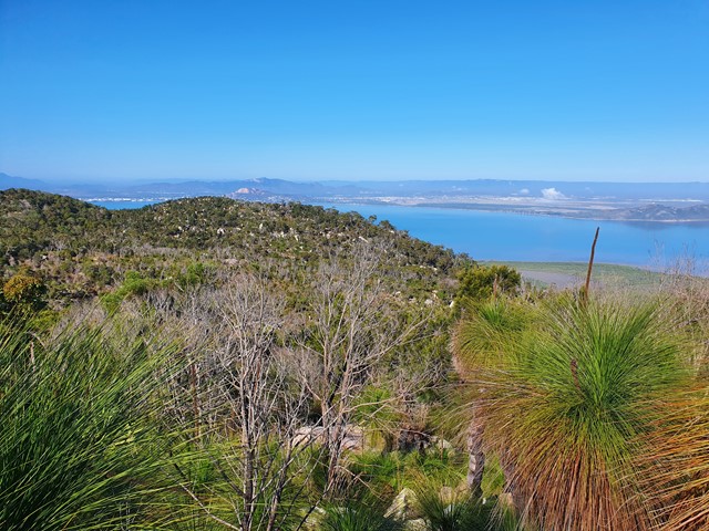
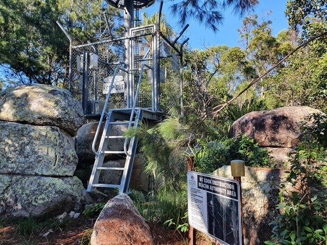
Mt Cook
A difficult bushbash to the top of the highest mountain on Magnetic Island.
 4
km
return
90
mins
4
km
return
90
mins
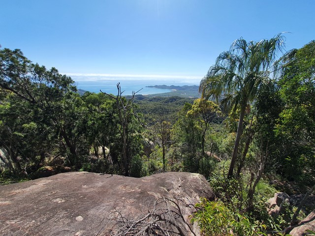
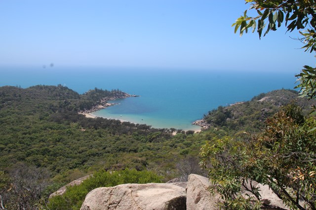
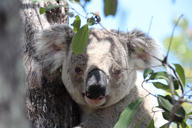
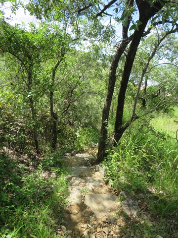
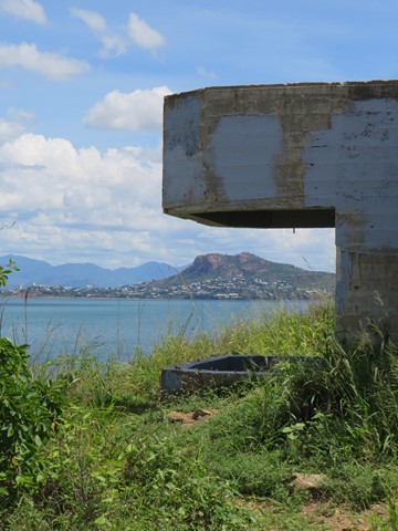
The Forts Walk
This walk has it all - spectacular coastal views, WW2 history, and possibly the best walk in Australia for spotting Koalas in the wild and close up!
The walk leads to WW2 fortifications built to guard the entrance to the Townsville Port, and consequently they provide spectacular and un-interrupted views of the bay and surrounding coastlines. Along the way, the walk passes through the old encampment areas which has great interpretive signage to explain how the area looked during the war. It is in this area that walkers are almost guaranteed to spot a wild koala lounging low in the trees.
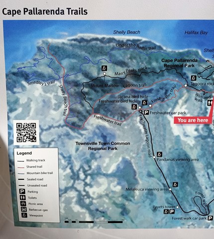
Walks in Pallarenda Conservation Park
 7.2
km
return
2
hrs
7.2
km
return
2
hrs
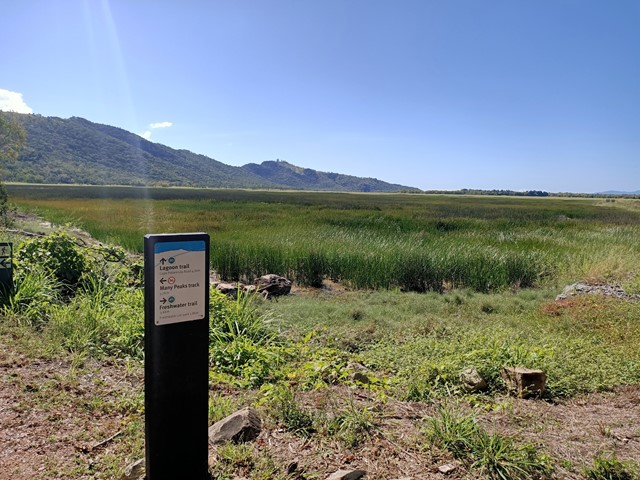
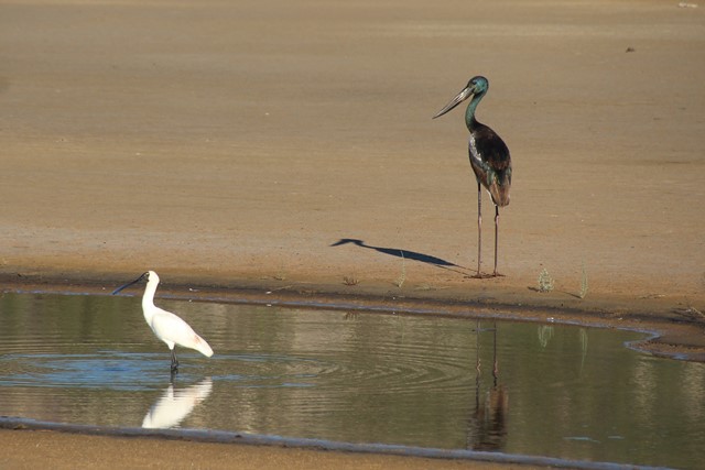
Freshwater & Lagoon Trails
The Freshwater and Lagoon trails form a 7.2 km circuit around the coastal wetlands of the Town Common Conservation Park. This is a beautiful area to explore, full of birdlife, great photo opportunities and so close to the city of Townsville
 9.2
km
return
2.5
hrs
9.2
km
return
2.5
hrs
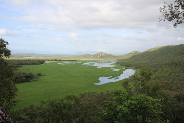
Lagoon Circuit
An outstanding walk for exercise, bird-watching, or just taking in the expansive views across the wetlands of the Townsville Town Common. Combining the Lagoon Trail and the Freshwater Trail allows you to circumnavigate the freshwater lagoon. There are excellent opportunities for viewing both wetland birds (Brolgas are frequently seen), and open forest birds. Part of the Freshwater Track traverses the top of an old earthen dam through the centre of the wetlands. The track is mostly flat and does not involve any climbing. The route is a shared walking/cycling track, and is mostly open with good visibility. Winter months, and mornings and afternoons are best.
 10.3
km
return
3.5
hrs
10.3
km
return
3.5
hrs
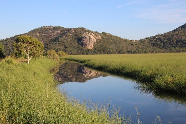
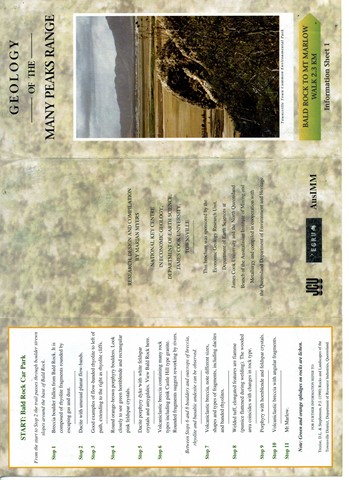
Mt Marlow
Excellent walk for the views, traverses open forests and semi-deciduous vine thickets along the side of the peaks. The summit of Mt Marlow provides superb 360 degree views of the wetlands and coastline. You can complete a circuit by returning via the Lagoon Trail or the Freshwater Trail through the wetlands. These trails provide excellent opportunities for viewing wetland birds.
Only the middle sections of the Many Peaks Track are considered hard. The other sections are medium, and the Lagoon and Freshwater Trails are easy shared bicycle/walking trails. Mosquitoes can be a problem at certain times of the year, so bring some repellent. Winter is the best season. Refer to the track notes below.
 1.5
km
return
40
mins
1.5
km
return
40
mins
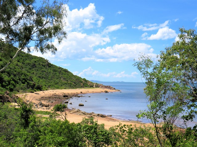
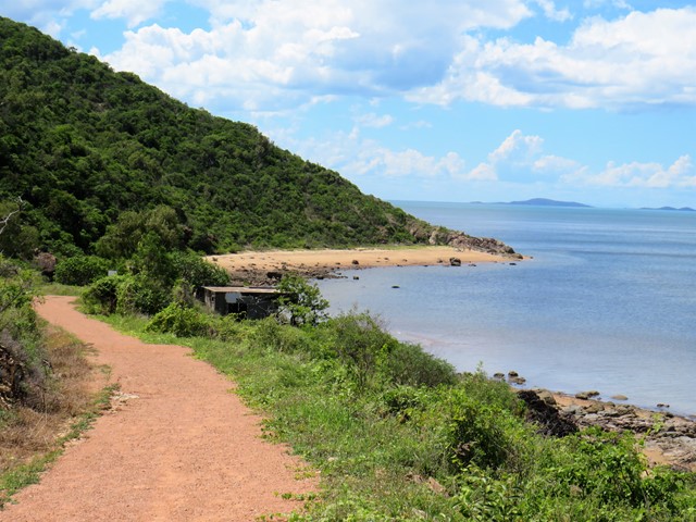
Shelly Cove Trail
A beautiful coastal walk through Cape Pallarenda Conservation Park to Shelly Cove, 1.5km return overlooking Cleveland Bay and across to Magnetic Island.