
Paddy's Peak
Mt Barney National Park


Menu


A reasonably straight forward walk up a lesser known peak nestled between Mt Barney, Mt Maroon and Mt May.

Getting there
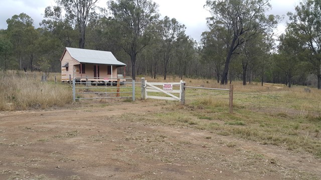
Located not too far from Mt Barney, coming from Upper Logan Rd turn right onto Seidenspinner Rd. Follow that road for 1.5kms, then turn right down a dirt road where you will eventually come to a gate. You can either park here, or continue down further (making sure to close the gate behind you) until you get to a Private Property gate (photo in description). It appears that so long as you don't go past this 2nd gate, you are not crossing private property, and there is space to park here without blocking the gate.
Maps
https://www.wikiloc.com/hiking-trails/pattys-peak-51803577
Route/Trail notes
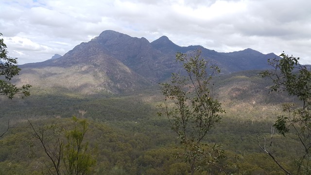
From the parking area, continue along the 4wd track (Not the driveway leading into private property). You will cross a creek and then around 30 meters later you will see trees on your left with red and white tape. Get off the 4wd track and head up to the left until you reach the top of the ridge (this part is pretty well trackless). Once you reach the top of the ridge you should be able to see the river below and a side profile of Mt Barney. From here it's just a matter of following the ridge to the top of the peak - the track becomes more pronounced the further you go. Along the way, and at the top you will get fantastic views of Barney, May and Maroon.
GPS Tracks
- No GPS available for this walk yet.
 8
8 3.5
3.5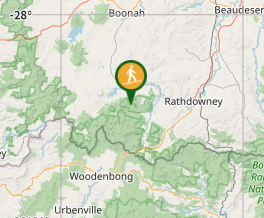
Comments