
Mt Castle
Main Range National Park


Menu
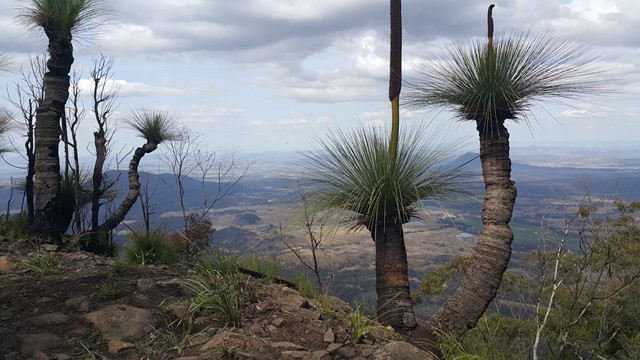

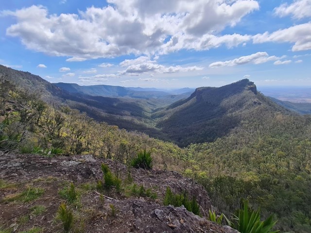
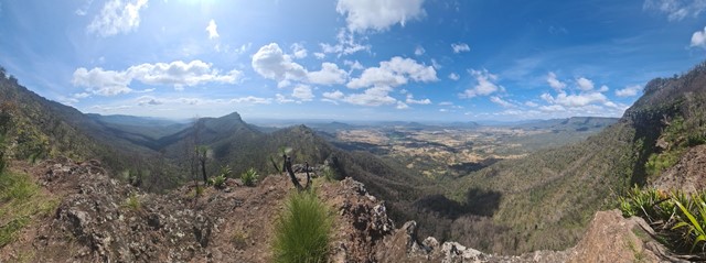
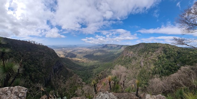
Mt Castle is situated North of the more iconic Mt Cordeaux along the Great Dividing Range. Though you technically lose elevation making your way from the carpark to the summit don't let this fool you, it is a very long and challenging hike. There are sections of scrambling along exposed cliffs, bush bashing and steep inclines in either direction. That being said, the walk has some of the best views of the Great Dividing Range.

Getting there
Park your car on the side of the road next to the entrance for the walk to Sylvesters Lookout. To get there drive down Inverramsy Rd, which will eventually become Forestry Reserve Road. You will reach a carpark, keep left and cross a river to head up Lookout Rd in the start of the walk. Would recommend a car with high clearance to cross the river.
Route/Trail notes
The hike starts off quite nicely with a short and flat walk to Sylvesters Lookout. From here you continue on to Mt Castle Lookout which has some of the best views of the Great Dividing Range. Leaving Mt Castle Lookout the track begins to steeply descend to the start of the Razorback section. At this point you used to be able to decide whether to bypass the ridge, or attempt to cross it (tracking east), but after the fires the razorback ridge is impassable. Sections have completely collapsed and the parts that are left are brittle and precarious. The ridge appears pretty decent for the first few hundred meters but if you follow it along you will get to a sheer drop off and will be forced to backtrack. So the alternative is following the tracks that bear roughly north until you reach a small river/waterfall. Cross the stream and you will see a track that zigzags down the side of the embankment leading you to the safe track located on the north (left) side of the razorback. A good tip to note is going along the rocky cliffs is often a bad idea, so you are better off to stay slightly to the left of the cliffs where possible. Eventually you will follow the ridgeline north (when it makes a 90 degree left turn towards Mt Castle) and this track is a fantastic example of a non suicidal razorback ridge. Big drop off on either side, however very secure footing and only basic scrambling required. When you get closer to the mountain you will have to once again bypass some smaller cliffs, this time staying to the immediate right of them (fairly well marked track). Continue up as high as you can go until you reach the massive vertical cliff of Mt Castle. The track to the summit starts here, it's very hard to find otherwise so aim to be close enough to touch the cliff wall before you start moving left around it. The aim of the game here is to duck around the left side of the vertical cliffs until you reach the back of the mountain, then commence a very gradual walk to the summit. The walk around the left side of the mountain is slippery, loose and covered with spiders so be prepared for that. GPS is recommended but avoid downloading any tracks that appear to scoot across the razorback ridge as it is no longer a viable route.
GPS Tracks
- No GPS available for this walk yet.
 12
12 7
7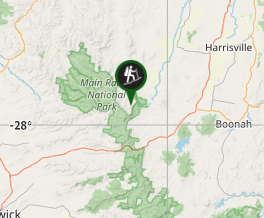
Comments