
Menu
Popular Walks
-
Carlo Sandblow
(66 ticks) -
Double Island Point Light House
(47 ticks) -
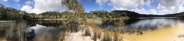
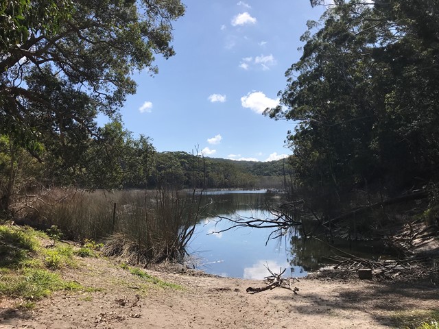
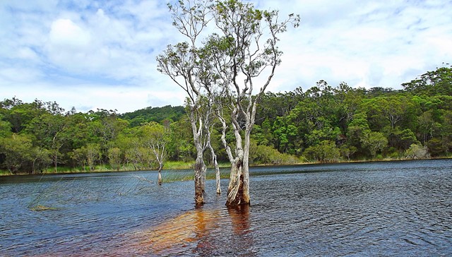
Poona Lake walk
(31 ticks) -
Champagne Pools Boardwalk
(16 ticks) -
Cooloola Great Walk (original inland route)
(16 ticks)
Parent Regions
Summary
Including Fraser Island, the largest sand island in the world, along with Cooloola on the mainland, Great Sandy National Park is a focal point for canoeing, fishing and some excellent bushwalking.
The highlight is the Fraser Island Great Walk and the Cooloola Wilderness Trail.
Popular Walks
-
Carlo Sandblow
(66 ticks) -
Double Island Point Light House
(47 ticks) -
Poona Lake walk
(31 ticks) -
Champagne Pools Boardwalk
(16 ticks) -
Cooloola Great Walk (original inland route)
(16 ticks)
Parent Regions
History
Any interesting history for the region?
Features
What are the standout bushwalking features?
Access
How do you get there? Include all access points if there are many?
Maps
Which maps cover the region?
Accommodation
Where can I stay there? or near there?
Camping
Other
Contact details
https://parks.des.qld.gov.au/parks/cooloola/about.html
Walks in Great Sandy National Park

 5.6
km
return
5.6
km
return
 2
hrs
2
hrs
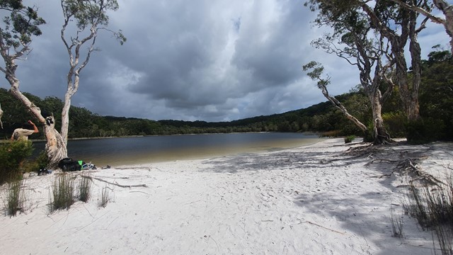
Basin Lake
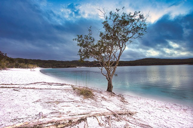
Walk through lush rainforest and woodlands to what is regarded by many as the island’s most beautiful lake.
21
km
return
6
hrs
Bymien Day Use Area to Freshwater Campground
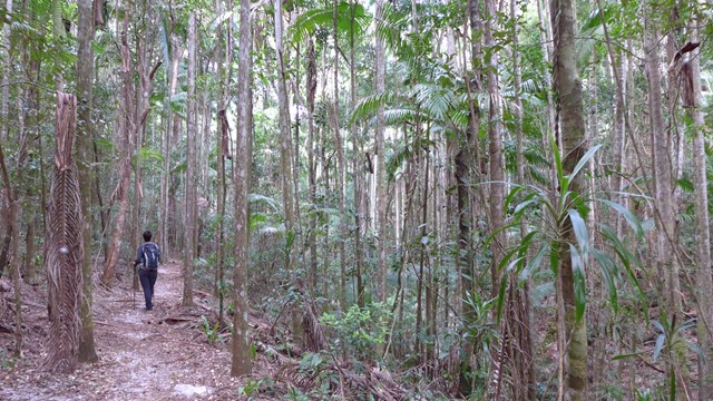
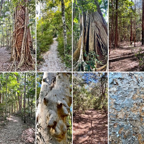
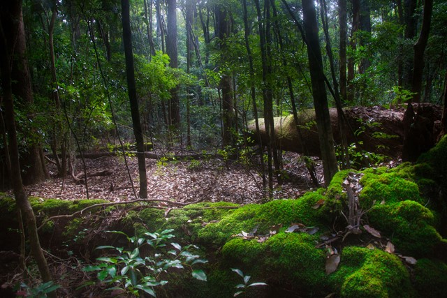
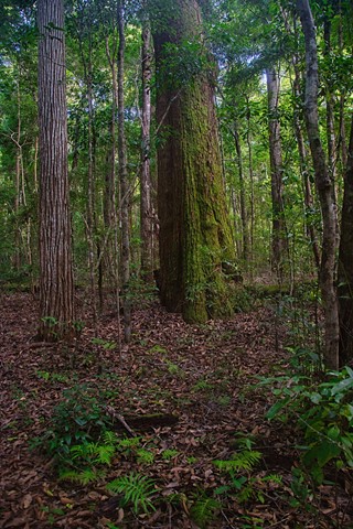
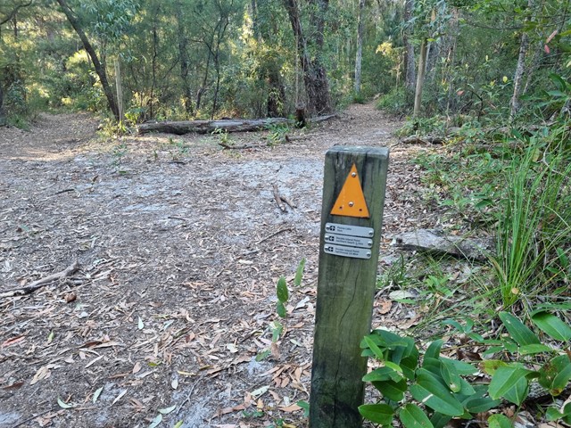
A wonderful walk through rainforest, kauri and hoop pines, Piccabeen and strangler figs. The walk is pretty straightforward with gentle inclines and descents over a mostly sandy base. Stop at Poona Lake for a swim and then continue on to Freshwater Lake then Freshwater campground before returning via the same track... Or leave Bymien Day Use area and head straight to Freshwater Campground for lunch then visit Freshwater Lake on your way back to Bymien. The track is well signed the entire way.
 12
km
return
4
hrs
12
km
return
4
hrs
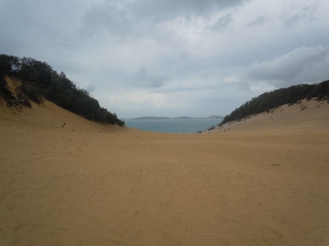
Camp site 3 to Cooloola sandpatch
Trail ap the hill through mostly banksia bush. Loose sand, quite hot in summer.
20
km
return
7
hrs
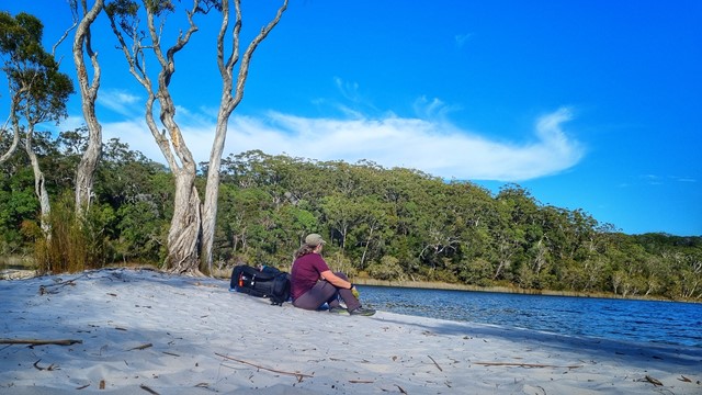
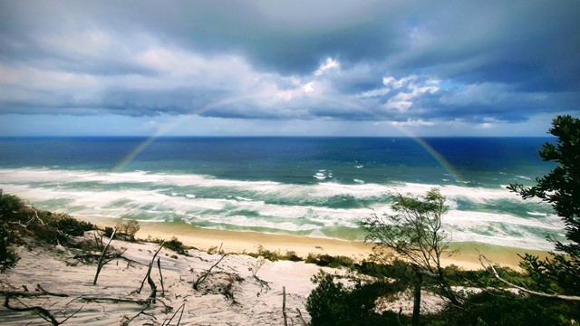
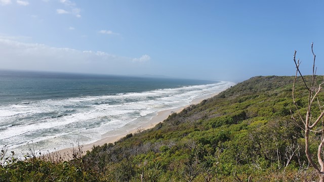
Carlo Sand Blow to Poona Lake
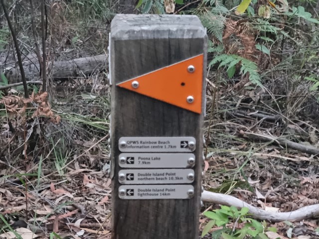
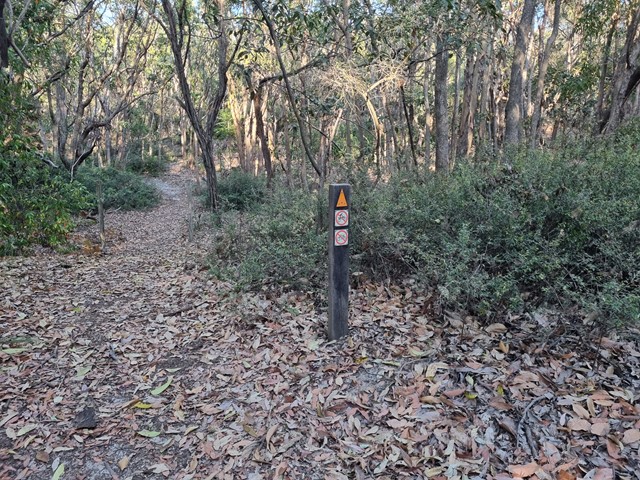
This walk is part of the Cooloola Great Walk. Starting from the Carlo Sand Blow car park at Rainbow Beach, its a short 10 min walk to the Carlo Sand Blow. From there cross the sand blow to the other side and continue along the track. It is well sign posted. At the 5km mark the track parts into 2. Follow the path to Poona lake which is another 5km. This track is a much smaller track, but is well defined. Take a swim and have lunch at the lake and then return via the same way.
 3.2
km
return
90
mins
3.2
km
return
90
mins
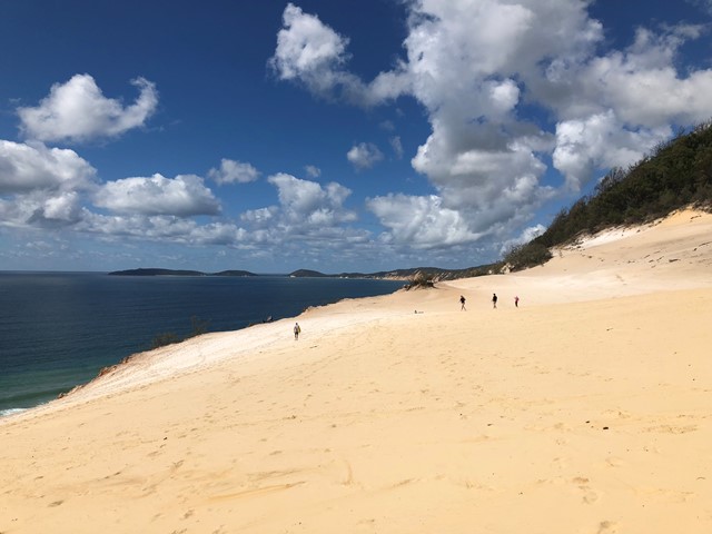
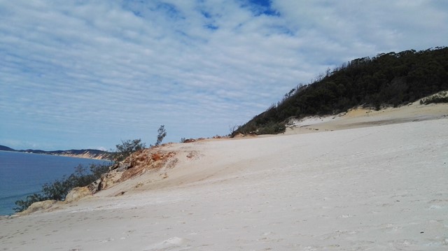
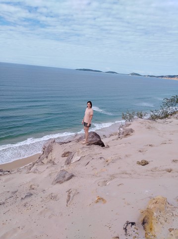
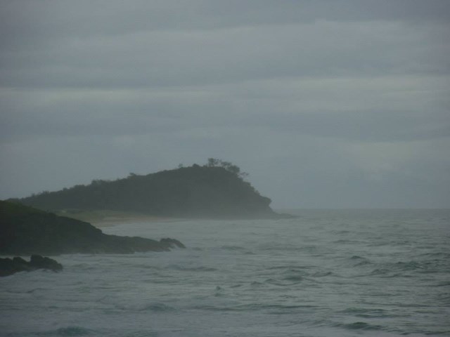
Carlo Sandblow
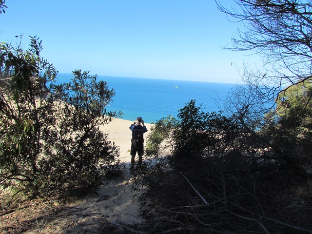
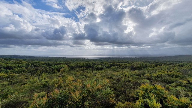
Named after one of Captain Cook's crew (Carlo), Carlo Sandblow provides magnificent 360° views. To the north is Fraser Island and Inskip Point and to the south the length of Rainbow Beach all the way to Double Island Point. Informative signs on the Sandblow are provided.
 14
km
one-way
5
hrs
14
km
one-way
5
hrs
Central Station to Lake Mckenzie via Pile Valley
A walk from Central Station to Lake McKenzie via the rain forest at Pile Valley
 1.6
km
return
1
hr
1.6
km
return
1
hr
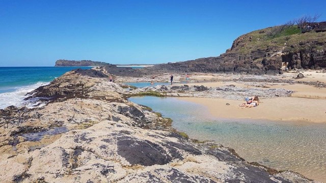
Champagne Pools Boardwalk
An nice boardwalk that leads from the car park to the Champagne Pools with a a viewing platform along the way. Located at the Northern tip of Fraser Island along 75 mile beach north of Indian Head. needless to say 4wd access only !
 18
km
one-way
5
hrs
18
km
one-way
5
hrs
Cooloola Great Walk - S5 track to Freshwater Campground
Day 1 of the Cooloola Great Walk starting at the Rainbow Beach end but staying at the Freshwater campground rather than the walkers camp.
 20
km
one-way
5.5
hrs
20
km
one-way
5.5
hrs
Cooloola Great Walk - S6 track vis Leisha Track
Freshwater Campground to Rainbow Beach via Leisha Track
 88.1
km
one-way
5
days
88.1
km
one-way
5
days
Cooloola Great Walk (original inland route)
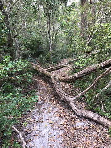
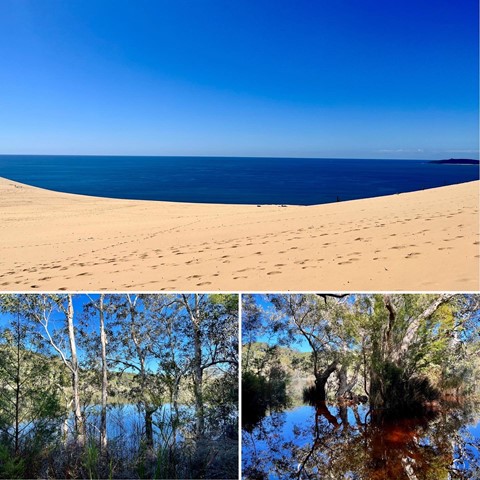
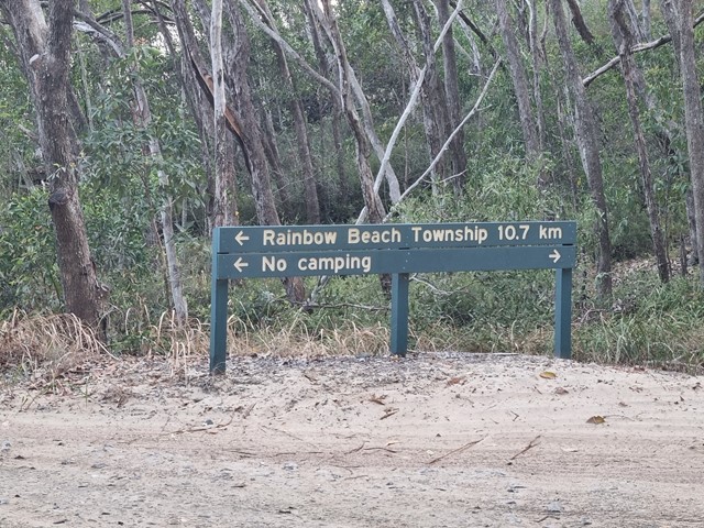
This is a 5 day hike starting at Noosa North Shore and ending at Rainbow Beach (or vice versa). The inland route is shorter, at 88.1km. This route includes Poona Lake on Day 5 (or Day 1 if you are walking North to South). The 4 campsites each have toilets (bring toilet paper) and water tanks. Do your homework, get the topo map, do the prep and you will have an awesome time. The Cooloola Sandpatch, Carlo Sandblow and Poona Lake are highlights, but the scenery is breathtaking at many points along the way. I have downgraded the difficulty to medium as while at times the going is hard because of the distance, overall the hiking isn't that hard and if you're doing a multi-day you've probably done some training, yes?