
Menu
Popular Walks
-
Hooker Valley Track
(20 ticks) -
Milford Track
(14 ticks) -
Kepler Track
(13 ticks) -
Routeburn Track (At least to Harris Saddle and back)
(12 ticks) -
Roy's Peak
(10 ticks)
Parent Regions
Popular Walks
-
Hooker Valley Track
(20 ticks) -
Milford Track
(14 ticks) -
Kepler Track
(13 ticks) -
Routeburn Track (At least to Harris Saddle and back)
(12 ticks) -
Roy's Peak
(10 ticks)
Parent Regions
Walks in South Island NZ

 60
km
one-way
60
km
one-way
 4
days
4
days
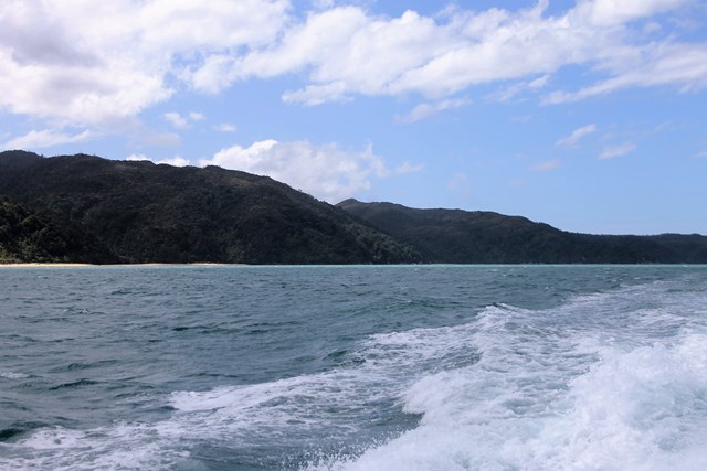
Abel Tasman Coastal Track
Discover Cleopatra's Pool – natural rock pool with a moss-lined waterslide.
Admire the beautiful inlet to Falls River as you walk across a 47 m suspension bridge.
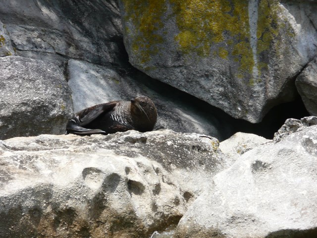
Keep an eye out for fur seals/kekeno.
Crystal-clear waters of Tonga Island Marine Reserve.
The track is well marked and signposted, but some sections may be steep and rough and the track could be muddy.
There is one compulsory tidal crossing – check the tide tables for when it's safe to cross.
Part of the Abel Tasman NP. Easy but challenging walk on well maintained coastal track. Day walks are possible as drop off and pick up by water taxi is available. Combining with sea kayaking amongst the seal colony is a special experience. Many coves, beaches, even a few crossings on hanging bridges. Stunning scenery and lots of birds and wildlife.
 1.4
km
return
30
mins
1.4
km
return
30
mins
Ayrburn Waterfall Walk
A short walk from the Ayrburn entertainment & eatery complex to a waterfall.
 13.4
km
return
8
hrs
13.4
km
return
8
hrs
Ben Lomond
A physically challenging ascent to the summit of the most iconic mountain in the Queenstown area.
 5
km
return
2
hrs
5
km
return
2
hrs
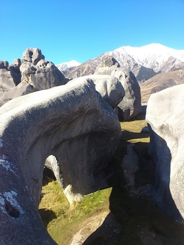
Castle Hill
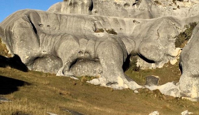
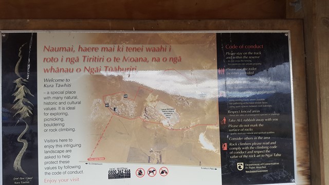
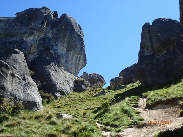
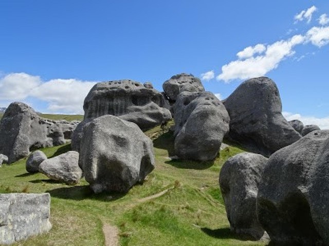
Castle Hill Basin lies between the Torlesse and Craigieburn mountain ranges and is characterised by its distinctive limestone rock formations. These limestone rock formations are the water eroded remnants of limestone formed during the Oligocene age 30-40 million years ago when much of present day New Zealand was covered by the sea.
The area is of special cultural, spiritual and historical significance to Ngai Tahu who named it Kura Tawhiti (treasure from afar). Hidden amongst the limestone outcrops of Castle Hill are traces of 500-year old charcoal drawings traditionally said to have been left by the Waitaha, the first people to travel through this area.
 18
km
one-way
7
hrs
18
km
one-way
7
hrs
Copland Track
This popular tramp gives a glimpse of Westland’s spectacular forest, river and mountain scenery, with natural hot pools at Welcome Flat an added attraction.
5.9
km
return
105
mins
Cowans Hill
The track passes the Church of the Good Shepherd and Dog Statue, along the shoreline, before heading along the edge of an exotic forest to open hillside tussock country and small tarns where wetland birds stop to feed, before heading back down to the Tekapo River through a plantation.
 200
m
return
10
mins
200
m
return
10
mins
Crown Range Saddle
A short walk from the Crown Saddle (1076m) which is where the Crown Range Road reaches its highest point & this is the highest sealed road in New Zealand. From the pullover read the information & monuments & make your way to the gate where longer trails can be undertaken.
1
km
return
30
mins
Dobson Peak (Mount Dobson)
From the top of the Fairlie Ridge T-Bar at Mount Dobson Ski Field hike up the ridge to the top of Dobson Peak (2095m) in the Two Thumb Range.
300
m
return
20
mins
Eglington Valley Walk
Also known as the Mackay Creek Walk it is a short walk along the valley floor with some information boards to a view over the creek.