
Cassia Hill
West MacDonnell National Park


Menu
GPS Tracks
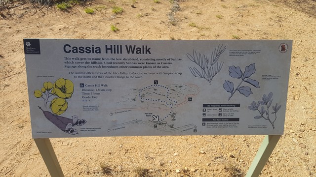
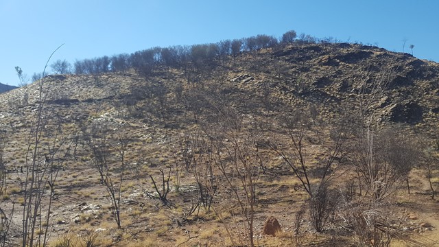
This walk gives excellent elevated views of the range and Simpsons Gap area. The walk illustrates local plants and a self-guided walk sheet is available.

Getting there:
From Alice Springs, head west out of town on Larapinta Drive (Red Centre Way) for 18km before turning right (signposted Simpsons Gap) and travelling 5.5km to the car park on the right.
Maps:
Route/Trail notes:
From the car park, take the signposted track in towards the hill for 300m. From there, turn right or left to follow the circular track around and then up and over to top of the hill and back to the start.
Permits/Costs:
None.
Other References/Comments:
This is just one of a dozen or more walks that are accessible along the 130km stretch of Larapinta/Namatjira Drive from Alice Springs to Glen Helen. Recommendation is to spend two/three days completing all the walks by taking an overnighter at the Glen Helen pub.
 250 Cassia Hill (GPX)
 1.8
1.8 45
45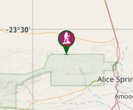
Comments