
Menu

 1.5
km
return
1.5
km
return
 90
mins
90
mins
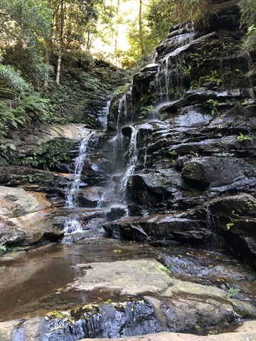
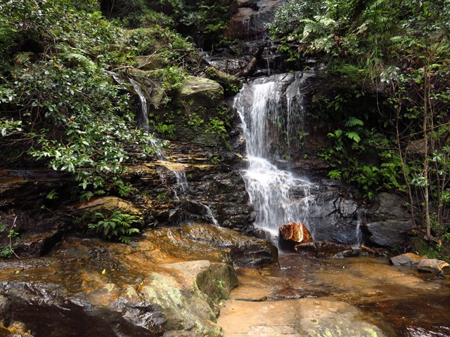
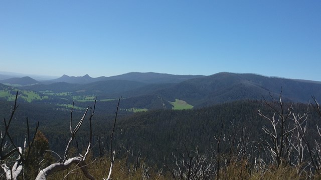
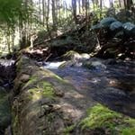
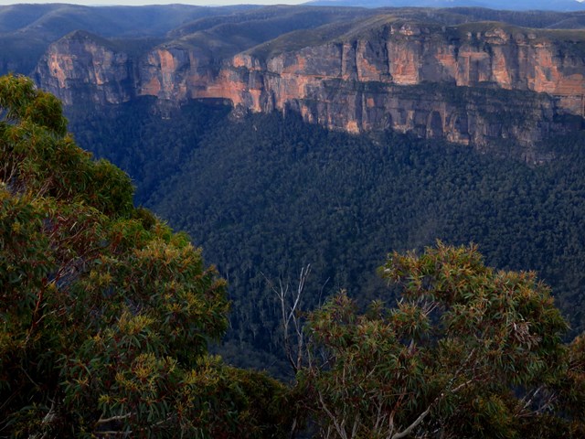
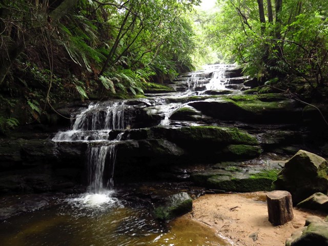
Valley of the Waters
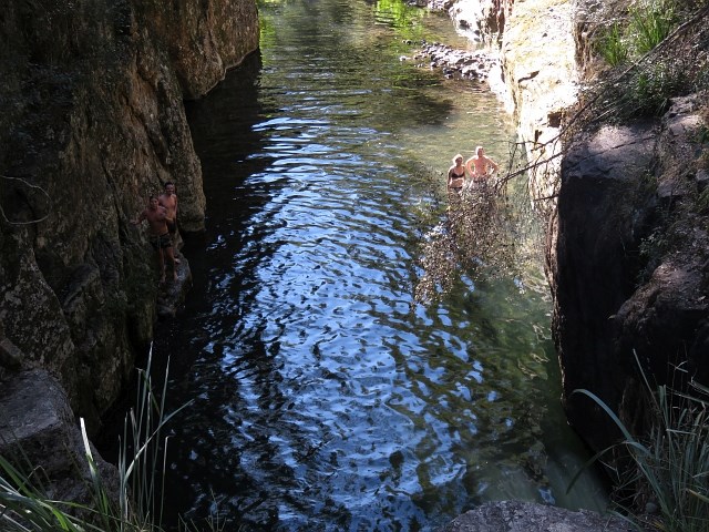
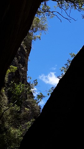
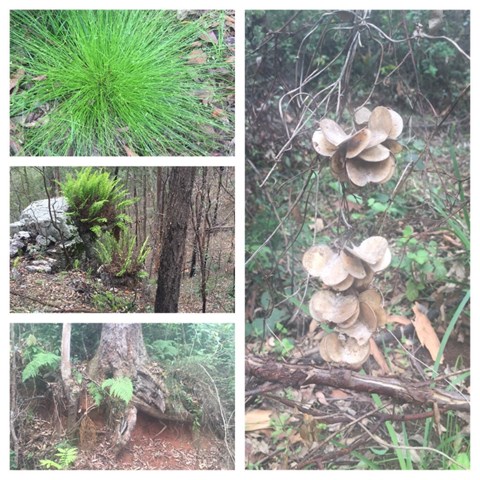
Venturing into the canyon of the Valley of the Waters along a slippery winding track, this walk demonstrates the beauty of the deep valley of Wentworth Falls. This walk explores the upper section of the track as far as Wentworth Pass. The walk passes several waterfalls, a great highlight especially in early morning when the falls form a mist over the valley.
 7
km
return
4
hrs
7
km
return
4
hrs
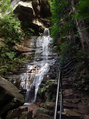
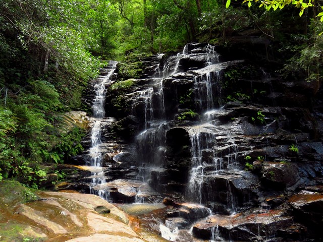
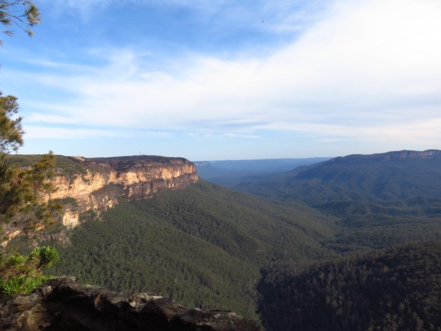
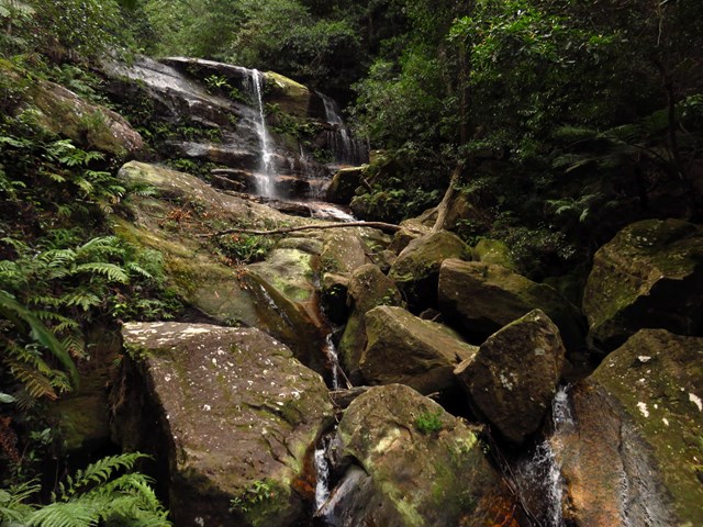
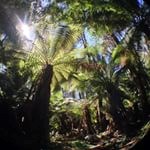
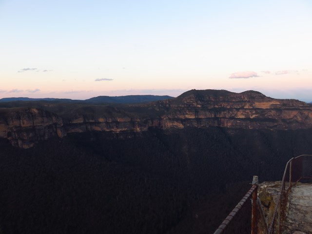
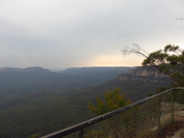
Wentworth Pass
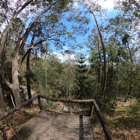
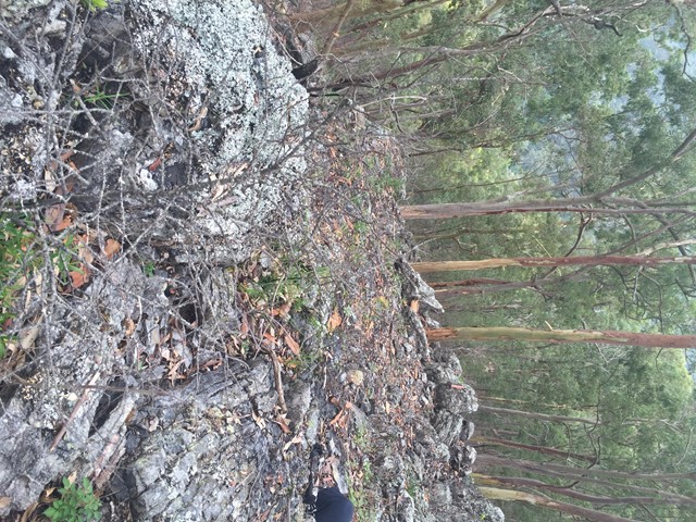
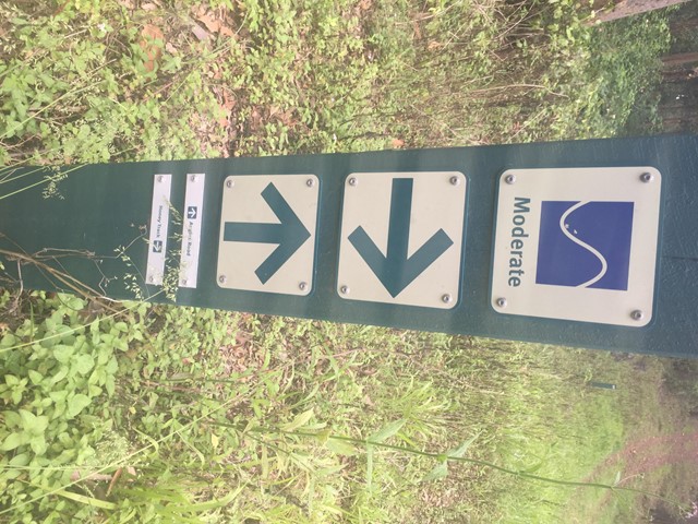
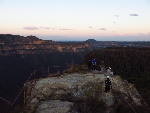
This challenging walking track, from Conservation Hut, explores the magical, upper section of Valley of the Waters in Jamison Valley at Blue Mountains National Park. The circuit continues up Slacks Stairs. Wentworth Pass takes in scenic waterfalls and valley views as well as magnificent open forests and dense rainforest.
The track leads to Empress lookout with exceptional views, before it plunges deep into the valley. You’ll notice the eucalypts and angophoras give way to lush fern trees and moss-covered rocks. Everywhere you look there’s water; from the gentle splashing of creeks to the dull roar of cascading waterfalls.
The pool beneath Wentworth Falls is a perfect spot to relax and revel in the moist cool because from here on, the only way is up. Taking the Slack stairs you’ll join National Pass before arriving at Wentworth Falls picnic area. Head to the ‘Hut’ for an easy lunch or unpack the picnic hamper.
 16
km
return
6
hrs
16
km
return
6
hrs
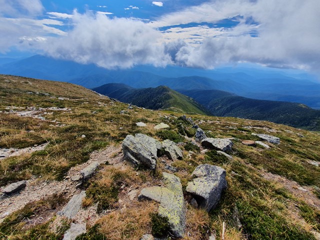
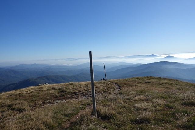
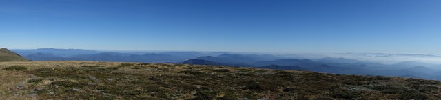
Mt Bogong via Staircase Spur Track
Mount Bogong (1986m) is the highest mountain in Victoria and provides a challenge to ascend but is worth every drop of perspiration to get those forever views.
 11
km
one-way
6
hrs
11
km
one-way
6
hrs
The Northwest Spur Track & Tom Kneen Track to Mount Feathertop
The Northwest Spur leads up from the valley half way between Harrietville and Smoko to the Melbourne University Mountain Club (MUMC) Hut and is not always clear with little signage and then the Tom Kneen Track leads on past a spring and to the main trail to the summit of Mount Feathertop. Time needed variable going down ~3hrs going up ~6hrs.
 1.2
km
return
40
mins
1.2
km
return
40
mins
Clear Hills Track (Craigs Hut)
Share a part of Australian film history at iconic Craig’s Hut. High atop Mt Stirling, around 51 kilometres from Mansfield, the hut was originally constructed as the set for the 1982 film The Man from Snowy River. Bushfires ravaged it in 2006 but it was rebuilt and reopened to public visits two years later. Arrive by 4WD or following the 1.2 kilometre walking track from the Day Visitor Area to be wowed by panoramic, celluloid-worthy views.
 11
km
return
4
hrs
11
km
return
4
hrs
Keppel Lookout Trail
The most challenging walk in the area, Keppel Lookout Trail climbs up through Mountain Ash and Stringybark forest to visit four of Marysville’s best lookouts.
There are spectacular views across Marysville, Cathedral Range State Park and Steavenson Falls. The trail is fairly uneven and steep in places, and walkers need to be self sufficient with food and water and wear sturdy footwear.
 4
km
return
2
hrs
4
km
return
2
hrs
The Beeches
Immerse yourself in the best rainforest trail the national park has to offer.
This enjoyable circuit walk skirts through Mountain Ash regrowth before entering a delightful temperate rainforest of Myrtle Beech, Southern Sassafras, Blackwood, tall tree ferns and thick green mosses.
The trail passes Taggerty Cascades, which provide a noisy contrast to the quiet Whitehouse Creek.
A number of timber bridges and floating boardwalks are crossed along the way.
Lyrebirds are common in the area.
 4
km
return
2
hrs
4
km
return
2
hrs
Cumberland Walk
This easy walk through beautiful rainforest includes waterfalls, views and spectacular trees including The Big Tree - the tallest known living tree in Victoria. The walk also visits Cora Lynn Falls, Cumberland Falls, the Sitka Spruce planted by a forest ranger over 60 years ago and Sovereign View, a lookout over the Armstrong Creek Valley towards Warburton.
 2.5
km
return
45
mins
2.5
km
return
45
mins
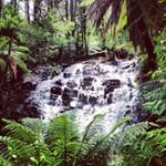
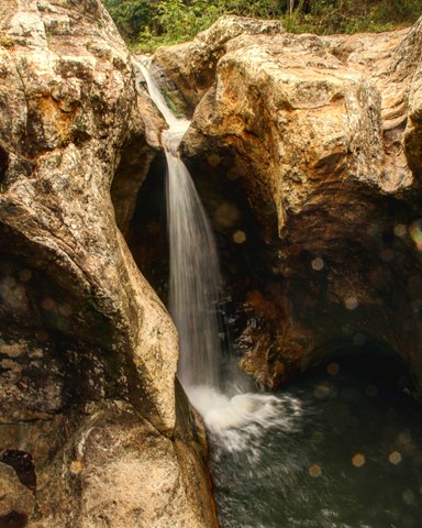
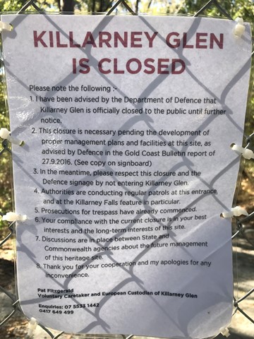
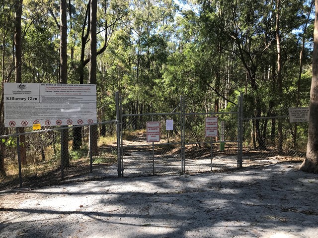
Killarney Glen - PERMANENTLY CLOSED
Killarney Glen has been permanently closed. This page is maintained to allow members to record previous visits to this walk.
 200
m
return
15
mins
200
m
return
15
mins
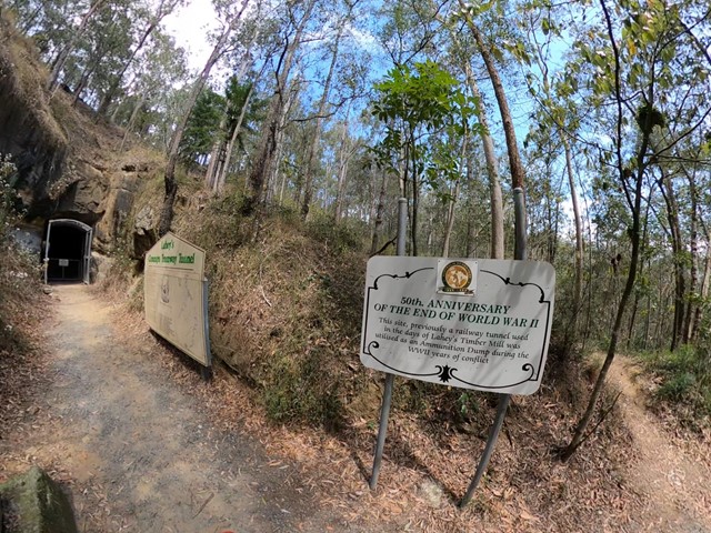
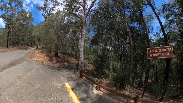
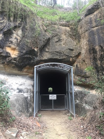
Lahey’s Tramway
Very short, easy walk. Just off the road so it’s very accessible. Informative sign at the bottom. You can’t go in to the tunnel though, but you can learn a bit about the history.
 3
km
return
1
hr
3
km
return
1
hr
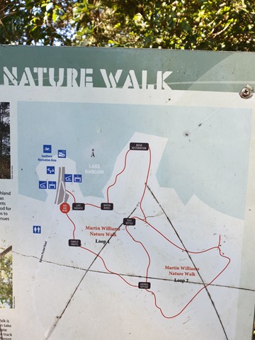
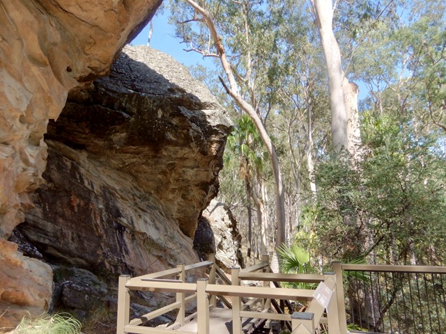
Martin Williams Walk
Lovely walk at Lake Baroon, near Maleny Qld
Two loops. Total approximately 3 km's
 1
km
return
45
mins
1
km
return
45
mins
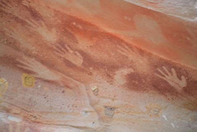
Baloon Cave
THIS WALK IS NOW CLOSED. DUE TO THE FIRE DESTRUCTION IN 2018 AND THE CULTURAL SIGNICANCE OF THE SITE, IT IS UNLIKELY TO EVER BE REOPENED.
Located within a gap in Clematis Ridge, Baloon Cave is part of an entry point to the gorge used by Aboriginal people for thousands of years. This short walk among the fan palms and cycads leads to a small sandstone overhang featuring a fine example of stencilled Aboriginal rock art.
 13
km
return
3
hrs
13
km
return
3
hrs
Mt Nebo - Honey Track
This is a beautiful walk along mostly well maintained forestry roads. We parked at Bullocky's Dam - there is no sign and the road is tucked away, but it is between Boombana and is about 500 m from Jolly's Lookout.
Following South Boundary road, you will wonder through the mossy rainforest for about 2 km – where you will enjoy the beautiful sounds of the Bellbird – and see them! Go right when you reach Augies Road and continue for another 2 km (approx.), Honey Track splits off to the right – it is sign posted. The entrance to this track was a little overgrown, but don’t let this put you off as it clears back to the vehicular track after approximately 500 metres. Most of the next 2.5 km is along a ridge through eucalypt forest – keep your eye out for sunbaking snakes, goannas and lots of local birds. This track stops at the end of the of the ridge, where on a clear day you should enjoy glimpses of the valleys in the distance and Lake Manchester. Take a well-earned rest, enjoy the views and then retrace your steps. I loved this walk!
 500
m
return
15
mins
500
m
return
15
mins
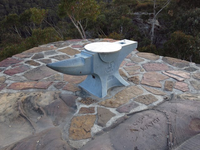
Anvil Rock
A nice walk if you are in the area, and worth doing before Pulpit Rock lookout. This walk is not as busy as many of the other lookout walks in the area. The view across the valley is fantastic. The lookout makes a great place for a picnic lunch, and the lack of crowds makes it that much more attractive
 400
m
return
20
mins
400
m
return
20
mins
The Rock Lookout
The Rock Lookout area of Blue Mountains National Park is situated within the historic Mulgoa Valley, only minutes from the bustling city of Penrith. A short track of a few hundred metres leads to 'The Rock' with panoramic views of the Nepean River.
 1.8
km
one-way
75
mins
1.8
km
one-way
75
mins
Leura Cascades to Gordon Falls
Varied between rocky climbs and patches of rainforest. An easy day walk from Leura Cascades that finishes at Gordon Falls Reserve (barbie and picnic facilities available at both ends). Lovely views of the Jamison Valley throughout.
 4
km
2
hrs
4
km
2
hrs
Round Mountain Walk
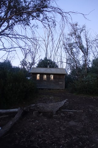
This short but steep return walk starts from the round Mountain trail head on the Khancoban-Cabramurra rd (closed June-October)Walk 1.5 km to the Farm Ridge Junction, then descend 500m to Round Mountain Hut, which was restored folling the 2003 bushfires.
5
km
2.5
hrs
Blowering Cliffs Walk
This walk begins at the Log Bridge Creek picnic area, Approx 16 km south of Tumut on the Snowy Mountains Hwy. The track has some steep sections, along with amazing veiws over Blowering Reservoir. It ends at the base of the Cliff Falls. A short walk, however one not to be missed in the Tumut area.
10
km
3
hrs
Landers Falls
50 km south of Tumut on the Snowy Mountains Highway, this walk begins at the northern end of the Cumberland Trail, there is a car park 300 mtrs off Highway. You will follow a 4x4 track for 4.2km then continue the last 800 mtrs on a well defined track to the impressive falls and Valley Lookouts.