
Menu

 4.42
km
return
4.42
km
return
 5
hrs
5
hrs
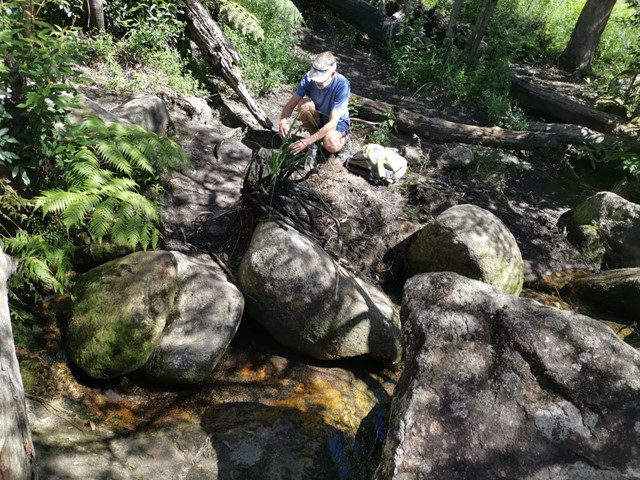
Branch Creek
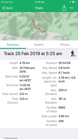
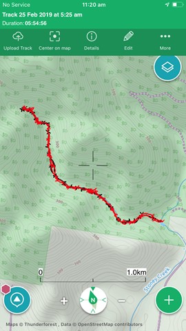
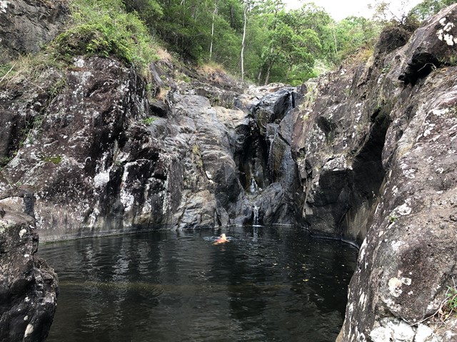
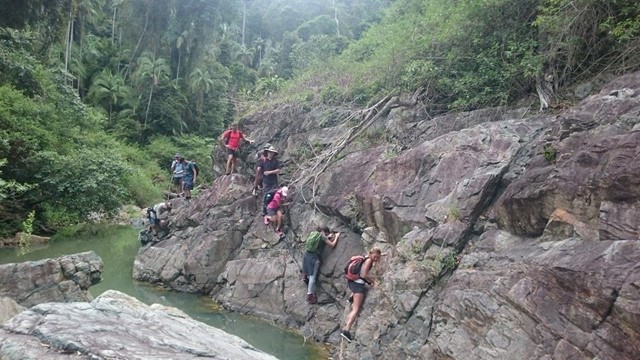
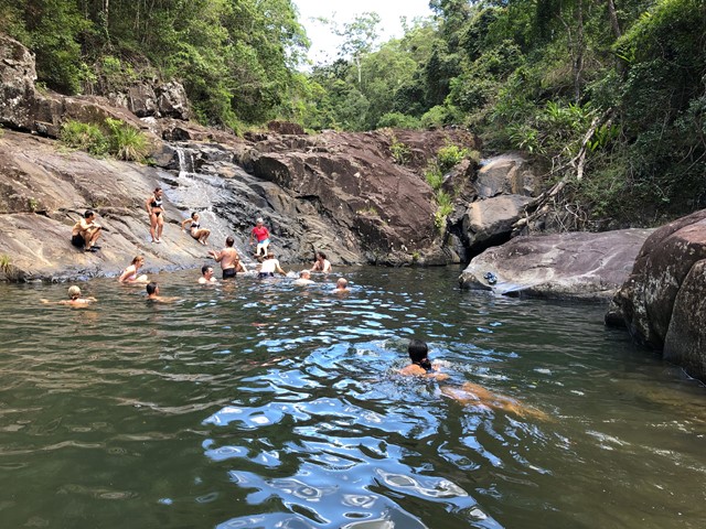
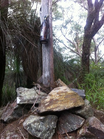
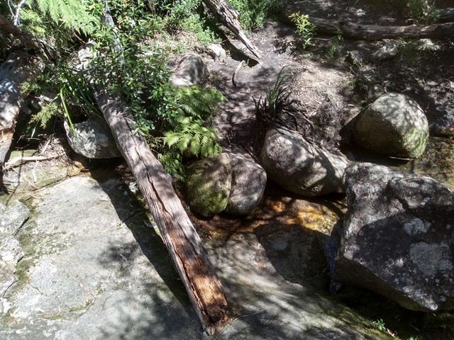
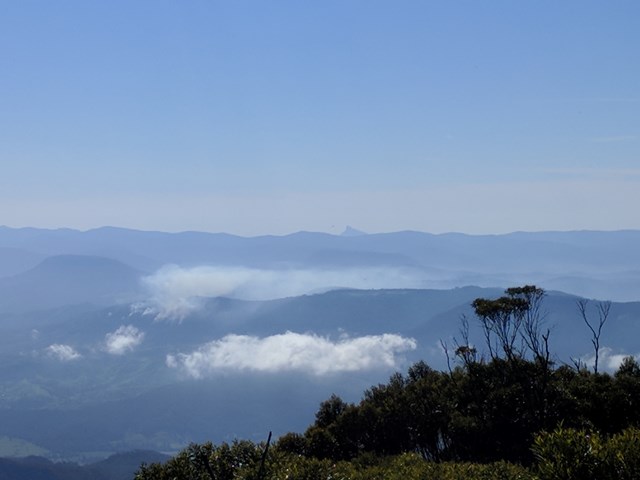
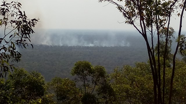
From the Stony Creek day use area, the junction of Branch Creek with Stony Creek is at the main swimming hole. Branch Creek goes west from here. Can be very slippery after wet weather. Lots of rock hopping, and a few places to climb waterfalls.
 6
km
4
hrs
6
km
4
hrs
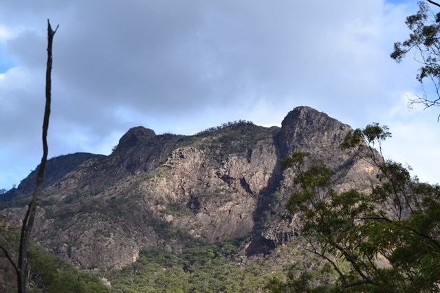
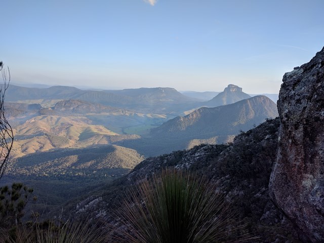
Mt Lindesay
I've revised the description and left the original below.
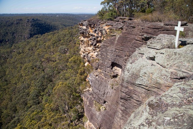
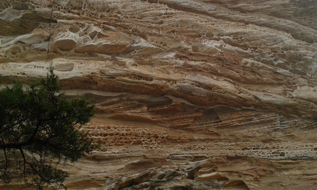
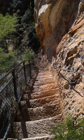
From the border gate the route follows the western ridge before traversing the mountain's southern slopes. Once you reach the eastern ridge, look for the ascent point for the lower cliff-line, very close to the ridge crest. The climb starts with a steep chimney to a tree, which can be used as an anchor for this lower pitch if needed, then briefly traverses right before climbing straight up a very shallow gully to a ramp trending leftwards. Casuarina needles make this section slippery. The route is easy to follow from here but the upper cliff-line, while short, contains a slightly overhanging move and some climbers will require aid to ascend. It is far easier to abseil down the upper cliff-line, and safer to use a rope for all exposed sections. Rope doubled-over slings around trees, with separate sling retrieval line should work OK for descent, though the lead climber would need to be able to ascend without protection and the lower cliffs would be 2 pitches long. There were no views from the summit when I climbed this in early 2000s
ORIGINAL DESCRIPTION
This walk starts near the border gate and eventually becomes very steep on a relatively poorly defined path. It's possible to go nearly all the way to the top without a rope.
7.6
km
return
4.5
hrs
Mount Samson
Sorry, this walk is now closed. This area is now private property, no entry is permitted.
 18
km
return
7
hrs
18
km
return
7
hrs
Mt Rufus
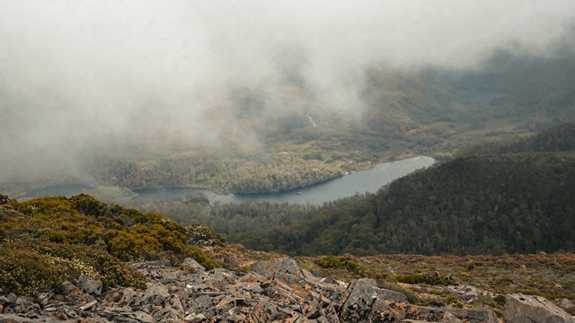
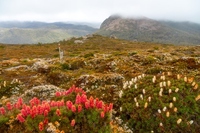
Climbs up from Lake St Clair to Mt Rufus, which provides sweeping views over Lake St Clair, Mt Olympus, Frenchmans Cap and the headwaters of the Franklin River. You can return the same way, or do a circuit which takes you back past Shadow Lake (a large alpine tarn). Incredible displays of flowering heath (scoparia) in summer. A well marked track with boardwalks in sections.
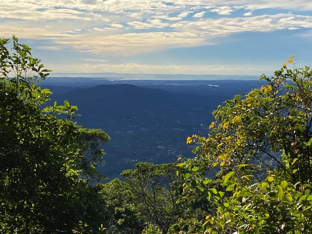
Little Hugel
A panoramic view of Lake St Clair, Mt Olympus, Mt Byron and Mt Hugel from the top of a rocky peak. A lesser-walked track but one that combines great views with some alpine lakes and rainforest areas.
 17
km
return
10
hrs
17
km
return
10
hrs
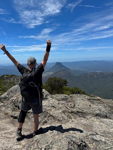
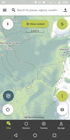
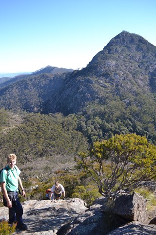
Mt Barney - East Peak - South Ridge
South Ridge is the easiest track up Mt Barney (but it's NOT easy!). Sometimes referred to as Peasants' Ridge (a dig that only Peasants would take such a boring route up the mountain), South Ridge is an excellent choice for a first ascent of Barney. The track has triangular trail markers but there are still opportunities for navigational difficulties if you're inexperienced.
You MUST start early in the day. Expected time is 8-10 hours with almost 1200m of climbing from the carpark. Make sure to leave early to allow time for any mishaps and be prepared to turn back if necessary.
 18.5
km
return
12
hrs
18.5
km
return
12
hrs
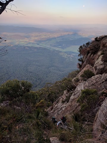
Mt Barney via Gorge and down Peasants Ridge
A tough hike in up the Gorge mostly off track with some challenging rock scrambling. Upon reaching Barney Saddle the trek up West Peak is reasonably challenging and shouldn't be attempted unless you have a head for heights as it is quite steep and exposed in places. After returning to the saddle if time allows the return trip up East Peak is well worth tackling as the views from the summit are unbeatable on a clear day. The trip down via Peasants Ridge is relatively straight forward but does offer a couple of interesting sections. After reaching the car park at Yellow Pinch it is about 6km to the start point by road at Lower Portals Carpark. It is preferable to have organised a car shuffle so as to avoid this at the end of a long day.
 15
km
return
9
hrs
15
km
return
9
hrs
Mt Barney via Logans Ridge and return via Gorge
The climb up Logan's Ridge is challenging but offers superb views on a clear day. The first recorded climb was undertaken by Captain Patrick Logan, Charles Fraser and Allan Cunningham in 1828. The climb became too difficult for Fraser and Cunningham who turned back leaving Logan to climb on alone. This ascent should not be attempted unless you are an experienced rock scrambler and have a head for heights. Any climb too difficult for Allan Cunningham deserves respect.
 2.5
km
return
1
hr
2.5
km
return
1
hr
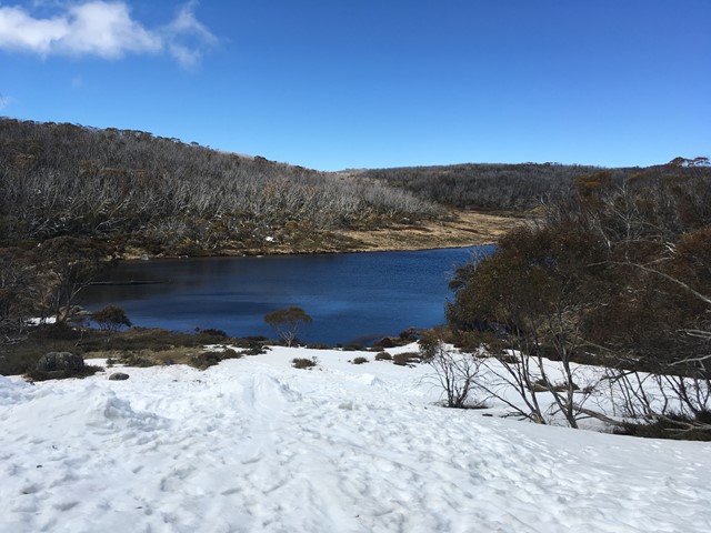
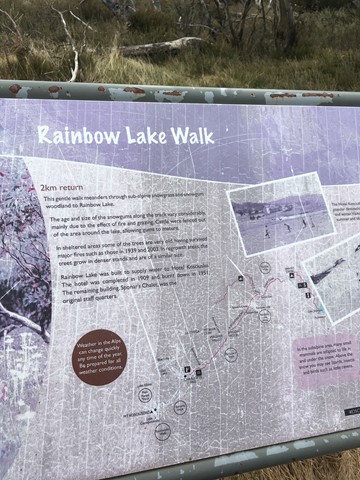
Rainbow Lake Track
A relatively easy short walk in kosciuszko national park. patches of snow can obscure the path a bit. Beautiful eucalypts and wildflowers would be beautiful in spring.
 4
km
2
hrs
4
km
2
hrs
Mt Piper (Smiggin Holes)
From Perisher carpark follow the fenceline that seperates the snowplay area from the ski runs. Follow the piper t-bar lift to the end. Walk along the ridge line keeping Smiggins Hole resort on the right. As you appriach the summit you will find a false summit surrounded by large rocks. Look to the north north west and you will see a second summit with a radar tower to the right. This is the true summit (1850m) and is marked by a survey marker on a large rock. Return either by Smiggins Hole resort or the same way on ascent. Good views of Guthega, Blue Cow to the south. Difficult in snow (advise to take snowshoes but not neccesary). Be careful not to disturb snowwalls near rocky areas.
1.5
km
return
45
mins
Mt Cahill
A short walk to Mirral Lookout from the viewing platform atop Mt Cahill, one of only a few vantage points to view the floodplains below.
 5.4
km
return
3
hrs
5.4
km
return
3
hrs
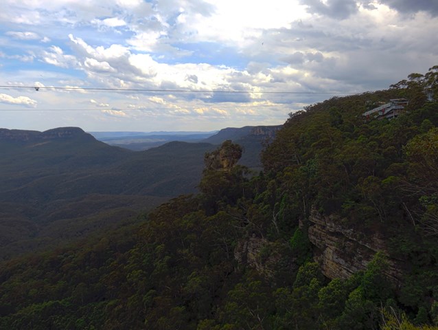
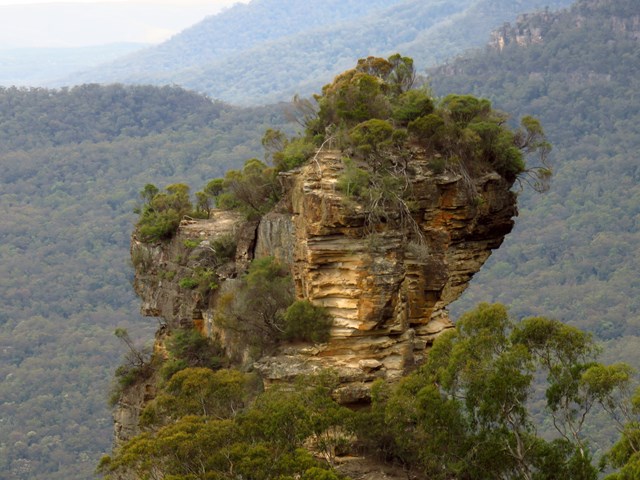
Martins Lookout to Lost World Lookout
A half-day walk with nice views in the lower Blue Mountains – be prepared for some short but tough climbs. Starts at Lost World Lookout before descending to the bottom of the valley, and back up the other side to Lost World Lookout. Steep and rough track up from the creek, but nice views once you reach the ridge on the opposite side.
 10
km
return
3
hrs
10
km
return
3
hrs
Schultz Track
This walk can be accessed via Schultz road, in Witta, and appears to be a 4x4 telegraph track (frequently crossing through a power line area). It includes wet and dry Schlerophyll forests, and is Ideal in spring when it isn't too cold. Also, don't go after heavy rain, as creek crossings may be flooded.
 400
m
return
20
mins
400
m
return
20
mins
Reids Plateau Loop
This walk starts near Katoomba Kiosk, opposite Katoomba Park, on Cliff Drive. The walk heads through the bush, on a well established track, out to Reids Plateau. The loop around Reids Plateau explores several lookouts and the bush through the area. There are a couple of short side trips out to extra lookouts, including one that passes through a natural tunnel. Reids Plateau Picnic area has a few picnic tables, shelter, and a great view making a great spot for a picnic lunch.
 4
km
one-way
90
mins
4
km
one-way
90
mins
Govetts Leap to Pulpit Rock
There is nothing more interesting than taking a remarkable walk to Pulpit Rock. The area offers magnificent scenery beyond the cliff line surrounding the Grose Valley. Most of the views are coming from the Griffiths Taylor Wall, the Evans Lookout and the Govetts Leap. You will get to see amazing section of coastline and heath land which makes Pulpit Rock an interesting place to explore
 500
m
return
20
mins
500
m
return
20
mins
Blue Pool Track
This short, pleasant walk, starts close to the Glenbrook entrance of the Blue Mountains National Park. The walk follows a staircase and track down to Blue Pool. The blue colouring of the water can vary in intensity, depending on water and weather conditions. A popular swimming hole, this creek is particularly dangerous after rain, take care when swimming.
 400
m
return
15
mins
400
m
return
15
mins
Wind Cave
The interesting cave is formed by a tall and long section of wind carved stone. The cave is much taller than it is deep, and there are some nice rock formations. It is a fairly long drive in for a short walk, so you might be better combining this with a walk to Anvil Rock.
 3.5
km
return
3.5
hrs
3.5
km
return
3.5
hrs
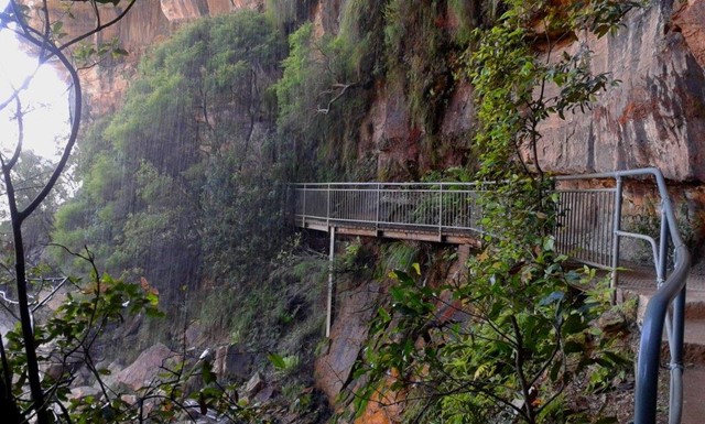
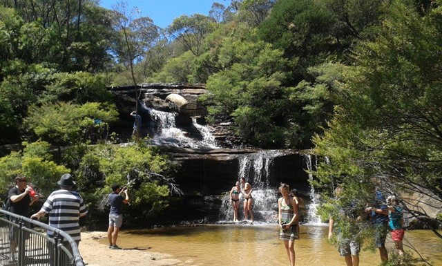
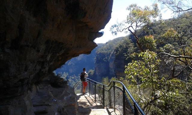
National Pass
This walk offers fantastic views of the Jamison Valley and the surrounding cliffs. Take time to explore the historic and very scenic ledge halfway down the cliffs. There are beautiful waterfalls at both ends and recent track maintenance has made this walk easier and more enjoyable. Allow time to soak up the wonders of the cliffs and waterfalls of this area before returning to Conservation Hut via the Shortcut Track.
 7.5
km
return
2.5
hrs
7.5
km
return
2.5
hrs
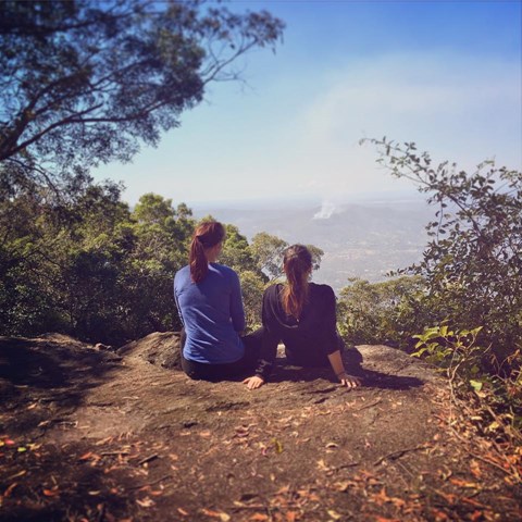
Mt Nebo Lookout Track
This track meanders through a variety of forest types , enjoy the view of Samford Valley and Mount Tempest once reaching the rocky outcrop of Mt Nebo Lookout point. Note: this walk is along a 4WD track, for the dedicated walking track (through the rainforest areas) see: Morelia Track.
 800
m
1
hr
800
m
1
hr
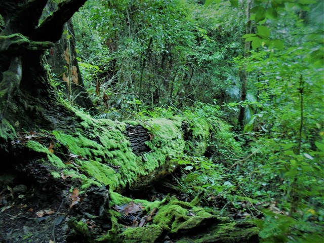
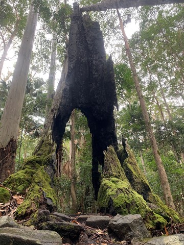
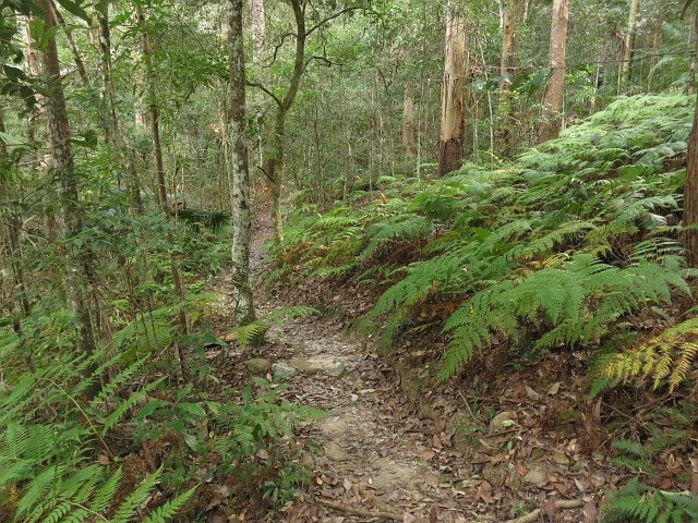
Atrax Circuit
Take a short walk through a wet eucalypt forest. Look closely at the forest floor and notice the ferns, mosses and fungi that thrive in the moist environment. Glimpse inside the trunk of a brush box Lophostemon confertus, a former giant of this species-rich ecosystem.