
Menu

 6
km
one-way
6
km
one-way
 2
hrs
2
hrs
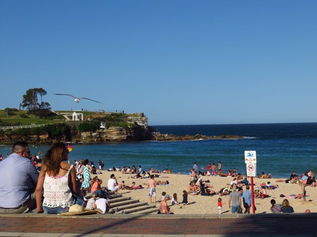
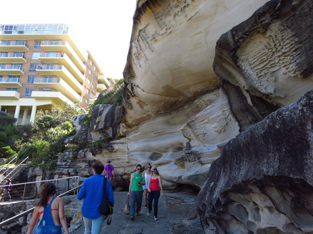
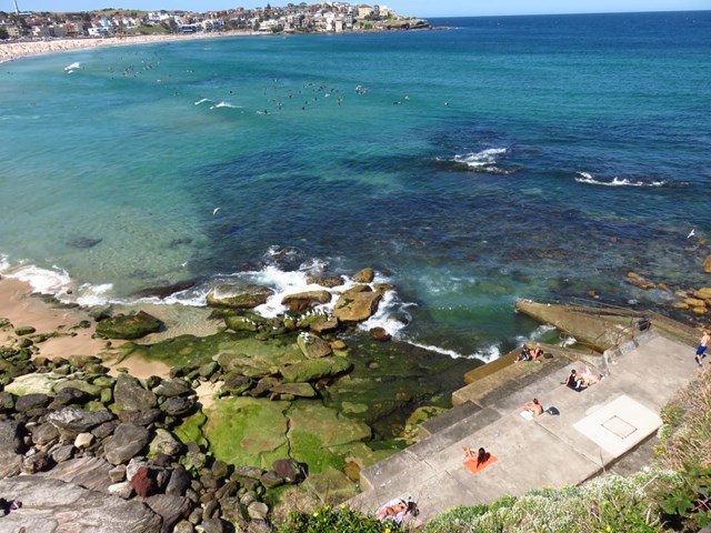
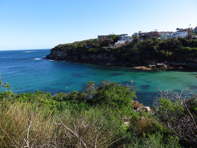
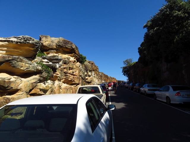
Bondi to Coogee
Technically not a bushwalk, this meander takes you along a coastal pathway from Bondi Beach through Bronte and the Waverley Cemetery to Coogee beach.
This walk is well known in Sydney - you will not be alone!
There are a few stairs along the way.
 8.5
km
return
3
hrs
8.5
km
return
3
hrs
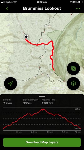
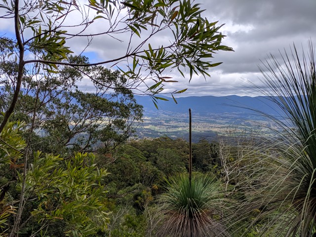
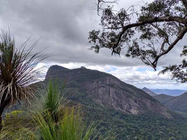
Brummies Lookout
A nice return walk along a rising forestry trail through tall forest and rainforest, then on to a foot trail ending at a small peak with great views towards nearby Mt Warning and the Border Ranges.
 2.5
km
return
1
hr
2.5
km
return
1
hr
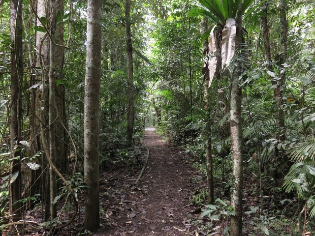
Culmaran Valley Trail
Commence walk at the Cambridge Plateau picnic Area. This sub-tropical rainforest walk is level for a short while before descending steeply towards the valley where you cross a bridge and then the path ascends again steeply to skirt around the crest of the valley.
 400
m
return
15
mins
400
m
return
15
mins
Calmaran Loop Trail
Short walk through rainforest. The track doesn't seem to get too much use and so isn't very clear in some places due to the leaf litter. There was a fallen tree near the end in what looked a bit like a clearing making it difficult to see where to go next. The path was to the right of the tree and we realised that we were all but back to the start. Not a very interesting walk. Disappointing.
460
m
return
30
mins
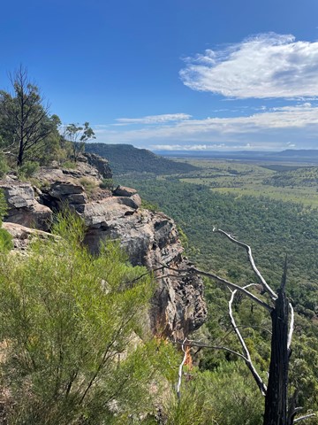
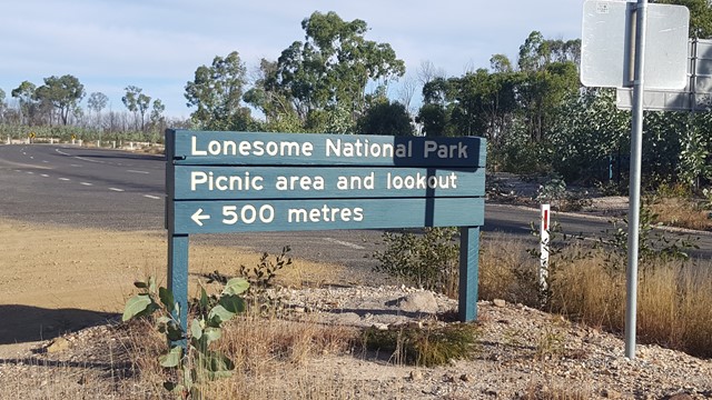
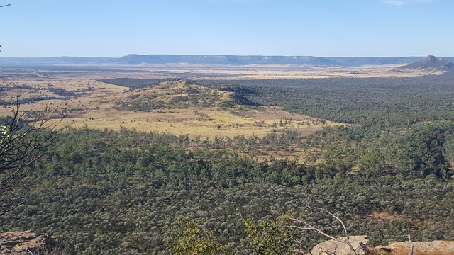
Lonesome Lookout
This high vantage point provides fantastic views up along the Arcadia Valley and across the Dawson River to the unreal Expedition National Park's sandstone escarpment: to Pyramid Hill, Sphinx, Castle Hill and Battleship.
 1
km
return
30
mins
1
km
return
30
mins
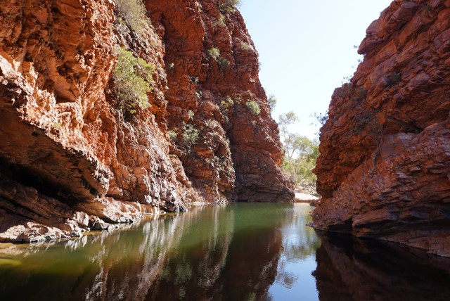
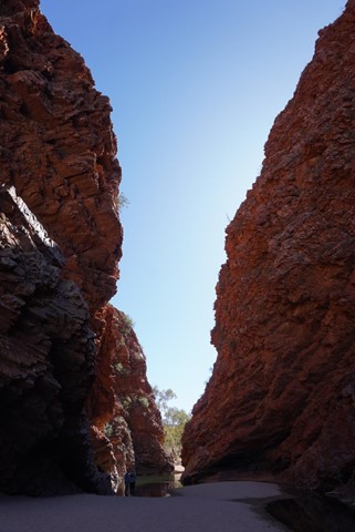
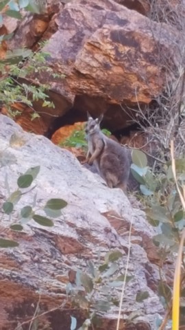
Simpsons Gap
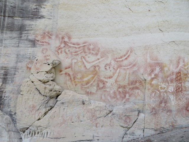
A number of scenic gaps pierce the West MacDonnell Ranges, one of which is Simpsons Gap; site of one of the most prominent waterholes in the region. The area is an important spiritual site to the Aranda Aboriginal people, where several dreaming trails and stories cross. At dawn or dusk Simpsons Gap is renowned as a place to see Black-footed Rock-wallabies along the gap's short walking track. Good examples of many of the vegetation communities of the MacDonnell Ranges are found in the Simpsons Gap area, including large stands of Mulga, and the area around the gap is a major stronghold for some of the rare and relic plants of the region.
 15
km
4
hrs
15
km
4
hrs
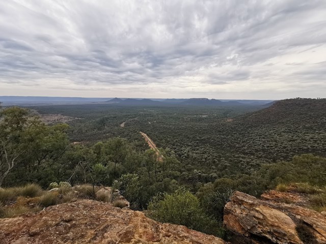
Lonesome Trail
Expedition National Park - Lonesome Section. Good views of Arcadia Valley to the north. Remote walk.
 1
km
3
hrs
1
km
3
hrs
Mount Moon
Mount Moon near Mount Alford is on private property (you can ask for permission to climb it) near Mt Greville. I took the difficult (not defined) route up, through lots of lantana (as tall as myself) in which I got severely tangled. Lots of scratches to show for it at the end. My first really hard bushwalk.
 1.5
km
return
1
hr
1.5
km
return
1
hr
Minymaku, Watiku Walk (Talinguru Nyakunytjaku)
Take one or both of the short walks at Talinguru Nyakunytjaku to increase your understanding and appreciation of Anangu culture and survival skills. Men and women are welcome on both tracks.
Minymaku Walk (Women’s Walk)
Follow this track to learn about women’s business (such as how women process bush foods) and some of the games young children play.
This is a 1 km (30 minute) loop track and is wheelchair accessible.
Watiku Walk (Men’s Walk)
Take this track to learn about men’s business, including making tools and using fire to hunt.
This is a 1.5 km (45 minute) loop track and is wheelchair accessible.
1.6
km
return
1
hr
Champagne Pools Boardwalk
An nice boardwalk that leads from the car park to the Champagne Pools with a a viewing platform along the way. Located at the Northern tip of Fraser Island along 75 mile beach north of Indian Head. needless to say 4wd access only !
 76.6
km
one-way
76.6
km
one-way
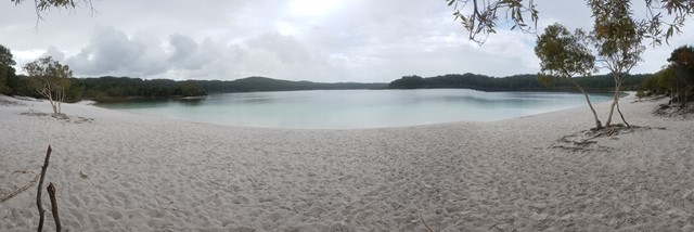
Fraser Island
Kingfisher - Lake McKenzie - Central Station - Lake Boomanjin - Dili Villiage - Jabiru Swamp - Hook Point
Walking on Fraser is a must-do! It's beautiful and unique. The walking tracks are separate to the vehicular tracks, so it feels like you are really in the guts of nowhere with no one else anywhere nearby, when in fact, if you need it, you can call a taxi and get the heck out of dodge if something crops up. The campsites at almost all the locations are fenced, have gear lockers , a wooden platform and a cleared area for your tent. All the sites have a separate camping area for hikers. The best thing about walking on Fraser is that you don't need to stress out about water because it's everywhere all year round, whatever the weather.
 4.8
km
return
105
mins
4.8
km
return
105
mins
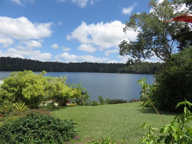
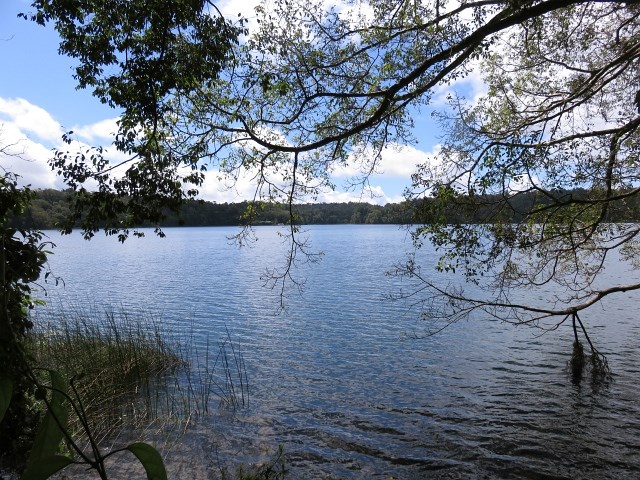
Lake Barrine
This picturesque freshwater lake has a walking track all the way around, together with Tea House and the opportunity of a Cruise on the waters. This is a water filled crater that was created some 10,000 years ago as a result of a volcanic eruption.
 3.2
km
return
75
mins
3.2
km
return
75
mins
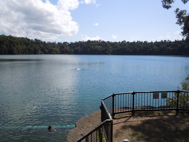
Lake Eacham
A clear, blue lake surrounded by cool rainforest, Lake Eacham offers swimming, bird watching, canoeing, picnic areas and shady walking tracks. It is a popular recreation area for locals and visitors.
In geological terms, the lake is a maar; a volcanic crater formed by massive explosions from the superheating of groundwater. The crater fills with rain water only, forming a lake 65m deep.
Over 180 bird species have been recorded from the rainforest and you may be lucky enough to see one of the few species of marsupial active during daytime—the small musky rat-kangaroo.
 8.2
km
return
2
hrs
8.2
km
return
2
hrs
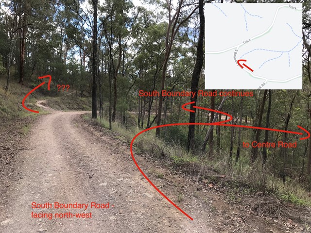
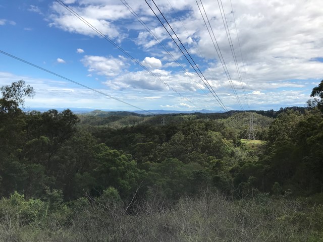
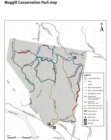
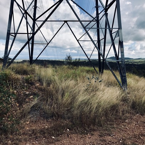
Centre Road and Tower Break Loop
The walk begins in the riparian rainforest and winds its way up into the dry eucalypt expanse of the Brisbane Forest. Note, there a quite a few steep sections (both up and down) which may be covered in loose shale.
 5.8
km
return
90
mins
5.8
km
return
90
mins
Devils Break Loop
Great short to medium length bush walk with not too many many people. There is a very steep section on the southern end of Devils Break which can be covered in shale so appropriate walking shoes are a must here.
 5
km
return
2
hrs
5
km
return
2
hrs
Lantana Break
A nice 5k walk from Wirrabarra road. I would recommend heading along powerline break first, then up lantana break and coming back down Rocky Mountain High. Lantana break is heading directly up from the gullly to the top of the ridge, quite a challenging walk, but well signposted and takes about two hours all up. I'd recommend heading there after a little bit of rain so that the ground is softer and not at slippery.
 1
km
return
40
mins
1
km
return
40
mins
Mushroom Rock (Rainbow Valley Conservation Reserve)
A 1 km loop walk allows visitors to view Mushroom Rock, an interesting sandstone formation with many Fairy Martin (Petrochelidon ariel) nests attached to the upper walls.
1.6
km
return
1
hr
Claypan Walk (Rainbow Valley Conservation Reserve)
The Claypan Walk is 1.6 km return and meanders along the edge of the mostly dry claypans that transform into reflective pools for short periods after rain. There are several viewing platforms
along the way that provide the best views of Rainbow Valley.
1
km
return
1
hr
Tnorala (Gosse Bluff) Conservation Reserve
According to Aboriginal belief, Tnorala was formed in the creation time, when a group of women danced across the sky as the Milky Way. During this dance, a mother put her baby aside, resting in it’s wooden baby-carrier (tarne - pronounced tar-na). The carrier toppled over the edge of the dancing area and crashed to earth where it was transformed into the circular rock walls of Tnorala. The Aboriginal and scientific interpretation of the Bluff are similar in that both have a celestial origin. Scientists believe that around 142.5 million years ago anobject from space, believed to be a comet about 600 metres wide, crashed to earth, blasting a crater some 20 km across. Today’s landsurface is about 2 km lower than the original impact surface and the
bluff is about 5 km in diameter, reduced over time by erosion. The remnant crater was named Gosses Range by the explorer Ernest Giles in 1872 after H. Gosse, a fellow of the Royal Society.
1.6
km
return
45
mins
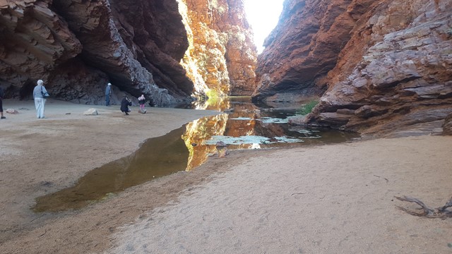
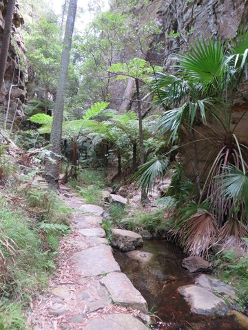
Nature Trail
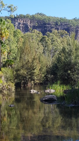
This short stroll along the shady banks of Carnarvon Creek provides a snapshot of the plant life on the gorge floor. You can see turtles basking in the sun, and if you're quiet enough you may see the elusive platypus. Dusk and dawn provide the best opportunities for watching wildlife.