
Menu

 1.7
km
return
1.7
km
return
 45
mins
45
mins
Otanewainuku Rimu Loop Walk
This gently graded walk with some impressively large rimu trees is suitable for walking children - it's not suitable for strollers or wheelchairs.
 16
km
return
12
hrs
16
km
return
12
hrs
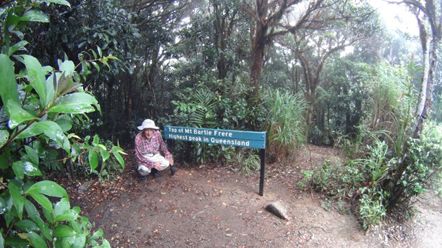
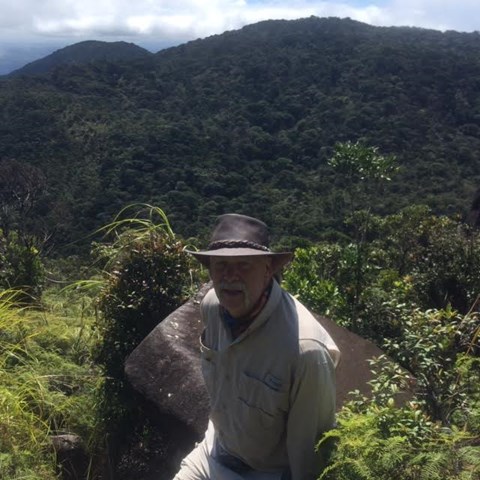
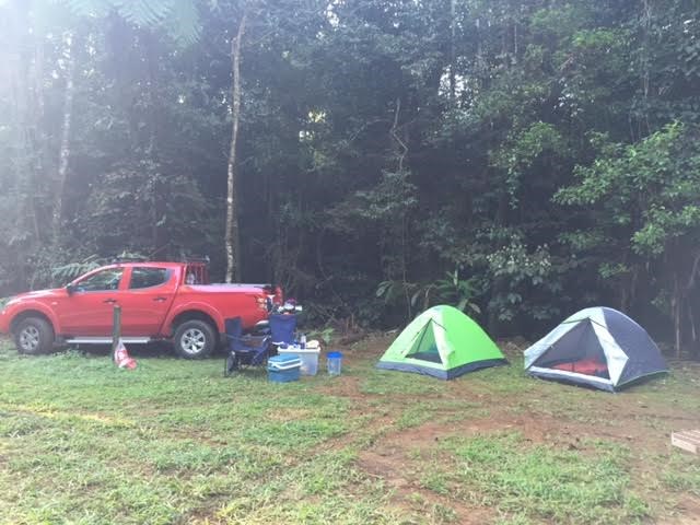
Mt Bartle Frere - Western Approach
Climb to the summit of Queensland's highest mountain (1,622m) provides a challenging way to explore this part of the World Heritage-listed rainforest of the Bellenden Ker Range. This is not a race, so allow yourself two days to walk (recommended), climb and enjoy this trail. The fabulous summit views include the township of Innisfail and the coast to the east, and to the west, the undulating landscape of the Atherton Tableland.
 1
km
return
80
mins
1
km
return
80
mins
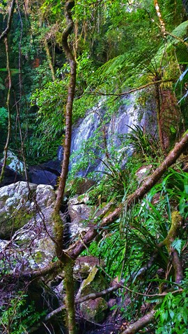
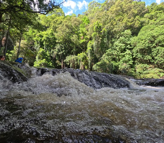
Swanson Falls
Off trail to Swanson Falls on Brindle Creek. This waterfall appears to have once been along the Brindle Creek walking trail though the trail to the falls is mostly lost to the rainforest. A combination of using the old trail and bush bashing can be used or by wading / rock hopping up the creek itself. Bring a dry bag to make your life easier.
 2
km
return
40
mins
2
km
return
40
mins
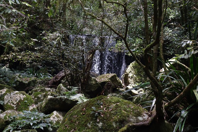
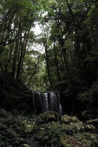
Brushbox Falls Lookout
Also known as the Palm Forest Walking Track.
Brushbox Falls lookout can be reached via an easy walk along Palm Forest walking track from Sheepstation Creek campground, and is a great spot for families as well as larger groups of children. Tall brushbox and dainty Christmas orchids are dotted along the mostly downhill walk, with strangler figs and Bangalow palms adding to the charming scenery. Bring along your binoculars for birdwatching, as this World Heritage-listed park is teeming with birdlife. Keep a look out for green catbirds, paradise riflebirds, rose-crowned fruit-doves and wompoo fruit-doves. Brushbox Falls is particularly impressive during the wet season in late summer, or after heavy rains at any time of year.
An easy walk through the subtropical rainforest near Sheepstation Creek campground, Palm Forest walking track follows a historic old logging track into the heart of the lush wilderness of Border Ranges National Park. The short track leads through forests of bangalow and piccabeen palms where you’ll feel the cool calm of the rainforest descend. The towering brush box in the tall forests that you’ll enter, are estimated to be hundreds of years old. If you’re into birdwatching, watch for the brightly coloured wompoo fruit-dove or the bell birds with their distinct call.
Passing booyong and strangler figs, you’ll hear the soothing tinkering of water before arriving at the picturesque Brushbox Falls lookout. Be sure to look for the historic moss-covered carvings, on a sandstone rockface to the north of the creek, where cedar getters carved their names. If the waters are high enough, you can have a refreshing swim in the crystal clear waters and soak in the tranquility.
Behind the old sign for Brushbox falls a short side trail descends to the base of the falls. Whereas the lookout from above is situated around a short loop at the far end of the walk before heading back the way you came to Sheepstation Creek Campground.
 750
m
return
20
mins
750
m
return
20
mins
Red Cedar Loop
Go for a wander in the bush through Red Cedar loop and be rewarded with a grand finale. The scenic walking track leads you to the foot of a 48m red cedar tree. It’s a sight to behold and possibly 1000 years old. Look for epiphytes growing on the bark, such as bird’s nest fern, orchid and staghorn.
Cedars often grow close to creek lines, which made them easy pickings for the early European settlers who used flooded creeks and rivers to float the logs down to waiting ships and saw mills. This particular one was lucky enough to not be too close to the water’s edge.
 1
km
return
30
mins
1
km
return
30
mins
Helmholtzia Loop
Helmholtzia loop walking track takes you on a short, easy walk through a beautiful section of Border Ranges National Park. It takes you across pristine Brindle Creek on low bridges and into World Heritage rainforest.
The name of this track comes from the helmholtzia plant that grows in the area. Also referred to as the stream lily, this rare plant is found only in the rainforest of north-east NSW and south-east Queensland. Helmholtzia are large strap-leafed plants which require a reliable water supply and are usually found along the banks of creeks and in gullies.
Helmholtzia loop walking track is also home to hoop pines, stands of Antarctic beech and abundant epiphytes - a plant that grows on another without being a parasite, while sourcing moisture and nutrients from the atmosphere and nearby debris.
Be sure to bring your binoculars along for a spot of birdwatching and keep your eyes and ears out for some endangered frog species including Fleay's barred frog and pouched frog.
 6.9
km
return
3
hrs
6.9
km
return
3
hrs
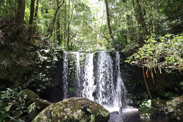
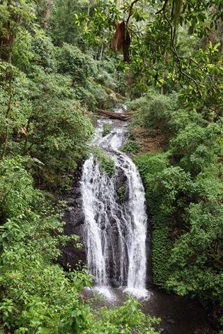
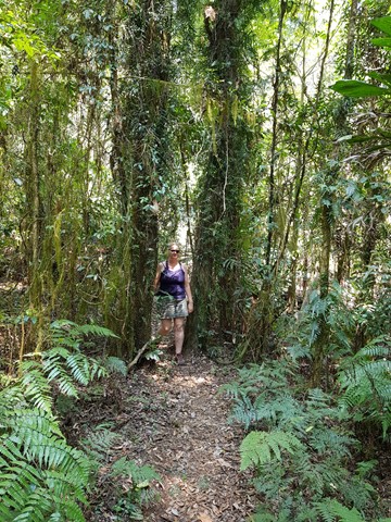
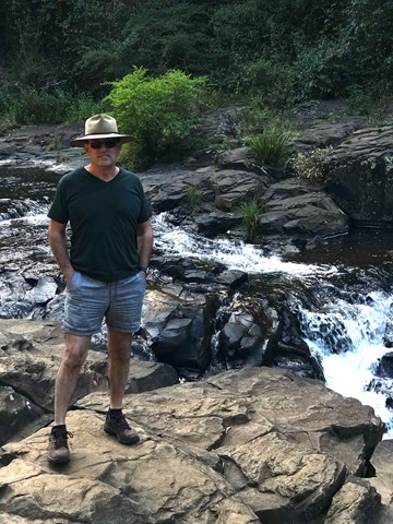
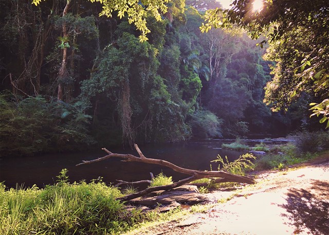
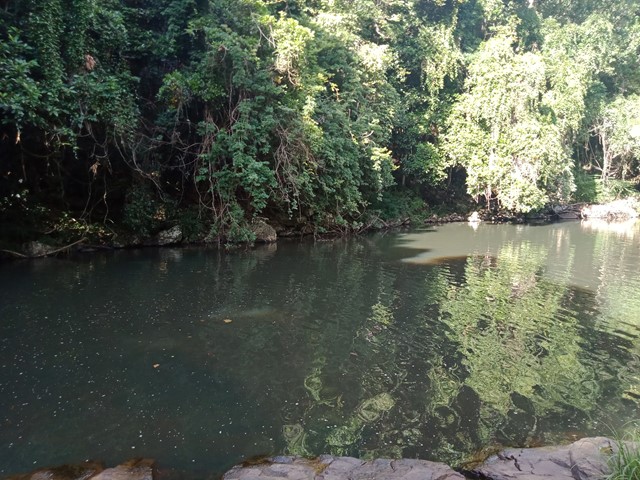
Brindle Creek Walking Track
A beautiful walk starting at Brindle Creek Picnic Area, Border Ranges National Park. Stunning rainforest with well maintained track. Numerous easy creek crossing and a waterfall with large boulders you can sit on for a relaxing lunch break mid walk. The track is moderate (easy in many places).
If you love waterfalls and ancient rainforest, then you can’t go past Brindle Creek walking track in the high country of Border Ranges National Park. Following the creek line, this medium walk passes through unspoilt wilderness from Brindle Creek picnic area to Antarctic beech picnic area in the north-east of Border Ranges National Park, near Kyogle.
Passing the turn off to Helmholtzia loop, you’ll think you stumbled into a timeless rainforest wonderland. Here you’ll see huge hoop pines and massive ancient Antarctic beech trees whose trunks grow thick and hairy with lichens and fragrant ferns. Keep your eye out for the huge helmholtzia lillies that thrive in the damp moist air. This high mountain plateau is a cloud factory all year round and you could be enveloped in mist even in the middle of summer.
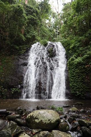
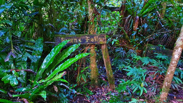
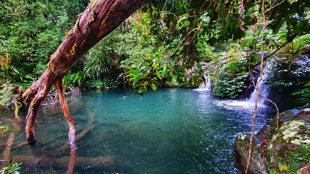
Unpack a picnic beside picturesque Evans Falls where the swimming hole below the waterfall is ideal for a dip. Further along at Selva Falls, clean mountain water cascades over large moss-covered boulders.
 4
km
return
2.5
hrs
4
km
return
2.5
hrs
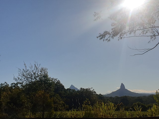
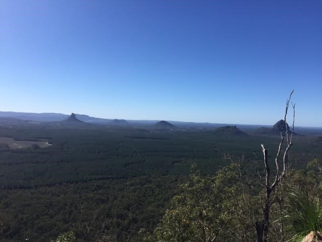
Mount Cooee
At just 167m, this is probably the least climbed and one of the least known mountains in the area, especially as it is overshadowed by Mount Tibrogargan immediately to the west.
 4.7
km
return
3.5
hrs
4.7
km
return
3.5
hrs
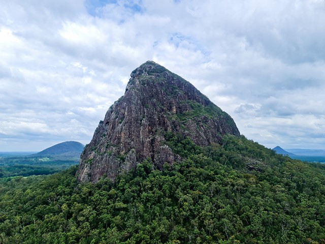
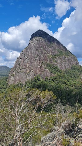
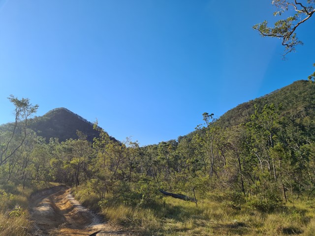
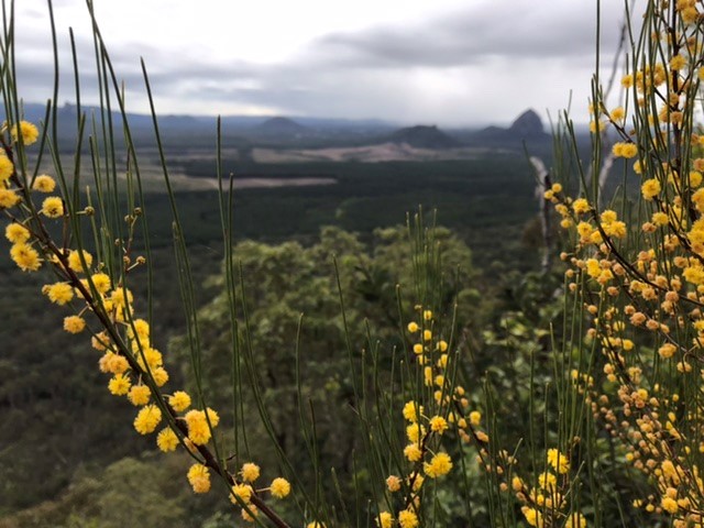
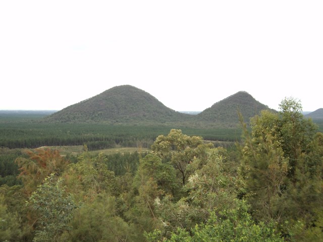
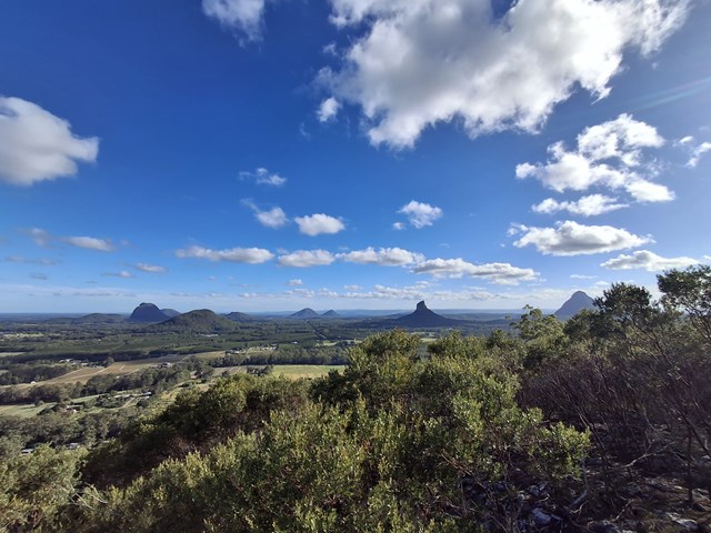
Mt Tunbubudla West
Mt. Tunbubudla is in fact two mountains known as The Twins. Not easy to access and certainly not easy to climb, but the reward is a new perspective of the remainder of the Glass House Mountains to your north.
 4.9
km
return
3.5
hrs
4.9
km
return
3.5
hrs
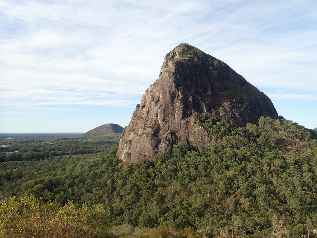
Mt Tunbubudla East
Mt. Tunbubudla is in fact two mountains known as The Twins. Not easy to access and certainly not easy to climb, and the view of the rest of the Glasshouse Mountains from the South really isn't visible through the trees on the summit. However, it can provide and excellent challenge in bush-bashing or in steep rocky ascents.
 2.8
km
return
2
hrs
2.8
km
return
2
hrs
Mt Coochin (East and West Peaks)
This is a great scramble on a pretty twin peak mountain, with some outstanding views of the Glass House Mountains region to the south and the Brisbane CBD in the far distance.
 600
m
return
30
mins
600
m
return
30
mins
Gardners Falls
Short stroll along a section of the Obi Obi Creek to a couple of small waterfalls and a swimming hole.
 5.4
km
return
90
mins
5.4
km
return
90
mins
Rocky Creek Circuit
Parklands Regional Park is a valuable wildlife habitat with vegetation ranging from eucalypt forests of bloodwood and tallowwood trees (with banksia, wattle and grass tree understorey) to rainforest gullies with flooded gum, turpentine and, in protected wetter areas, groves of palms.
A number of creeks lead to rock pools and cascades, which flow after heavy rainfall.
 7
km
return
2
hrs
7
km
return
2
hrs
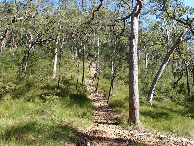
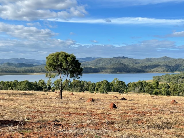
Pine Hill
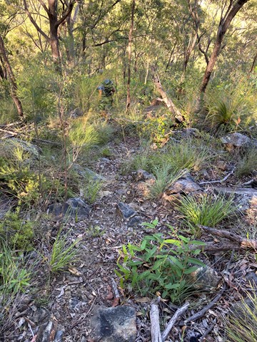
An easy walk through the bushland around the southern end of Lake Wivenhoe to the high point on Pine Hill. The eucalyptus trees look very young, so I can only suppose that this will get better with age.
 27
km
one-way
10
hrs
27
km
one-way
10
hrs
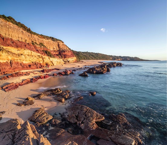
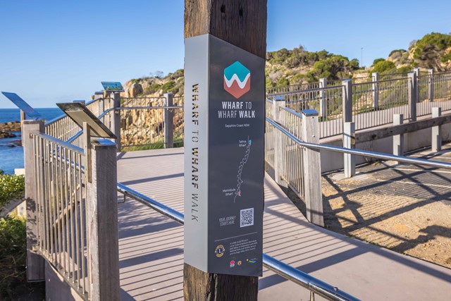
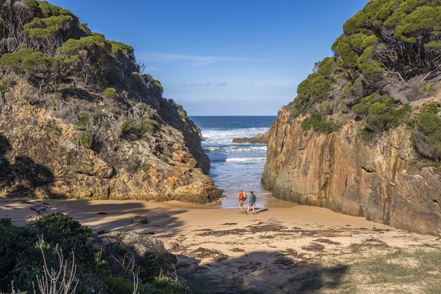
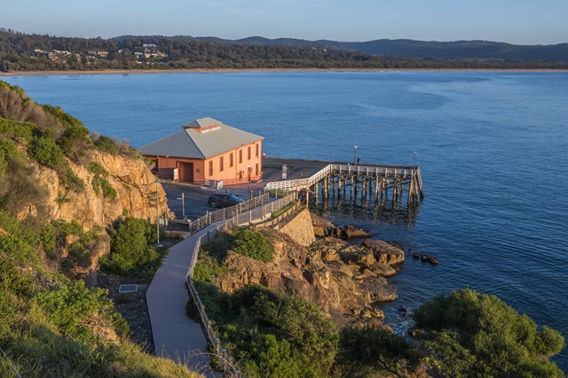
Wharf to Wharf Walk
The Wharf to Wharf Walk is a spectacular coastal walk from Merimbula to Tathra, linking existing trails through public coastal reserves, flora reserves, beaches and Bournda National Park. It is a walk for coast lovers, nature enthusiasts and photographers. The trail follows a wild coastline, leading to hidden coastal lagoons, long isolated beaches, rugged headlands and secluded coves. Wildlife is abundant, and more than 200 species of birds have been observed in the region. The walk can be undertaken as an overnight hike, day hike or section day hikes, with car access points available throughout the route.
 3.8
km
return
2
hrs
3.8
km
return
2
hrs
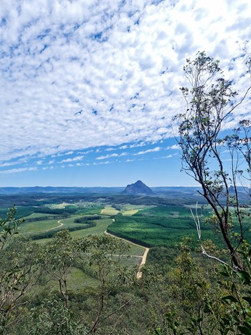
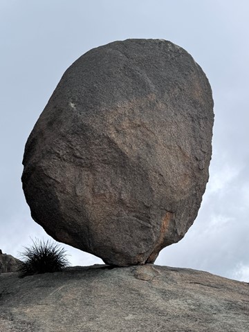
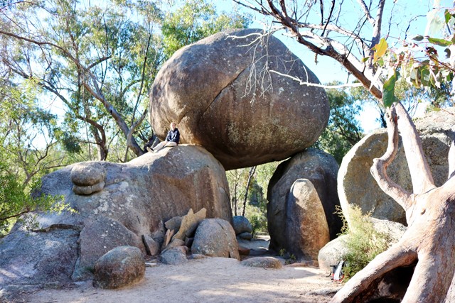
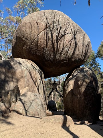
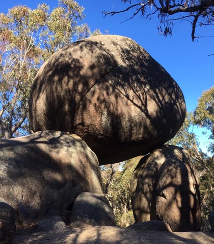
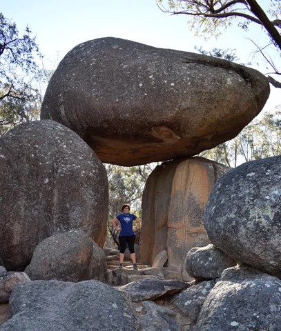
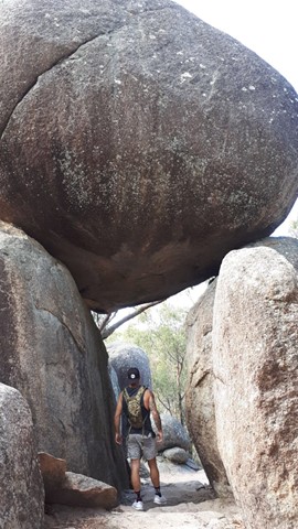
The Pyramid
Grab some magnificent views from the first of Girraween's dominating Pyramids. If the climb doesn't take your breath away, the views of Balancing Rock, Second Pyramid and over Girraween National Park will.
 1.7
km
return
30
mins
1.7
km
return
30
mins
Granite Arch
If time is limited, or if you prefer an easy stroll, this circuit track is ideal. Cross bald Rock Creek and wind through blackbutt and stringybark forest to Girraween's very own natural stone archway.
 3.3
km
return
90
mins
3.3
km
return
90
mins
Moreton Terrace Park
Lovely flat walk long boardwalk and sandy track taking around 1.5 hours return, through mangroves and out to Caboolture river mouth. Broad views across Moreton Bay, shady and easy. At the board walk end cross the dog off-leash area and you see the sandy path begin, follow your walk through the mangroves at high tide or take the beach, however, the track remains in the mangroves for the most. You end at the point of the Caboolture River.
100
m
return
5
mins
Buliya-Buliya Jagun Boardwalk
Visit Gauriemabah - place of stories, at the old schoolhouse, and discover the many tales of Springbrook. Take a short walk along Buliya-Buliya Jagun Boardwalk look and listen for the many little birds along your way to the lookout.
 7.3
km
return
3
hrs
7.3
km
return
3
hrs
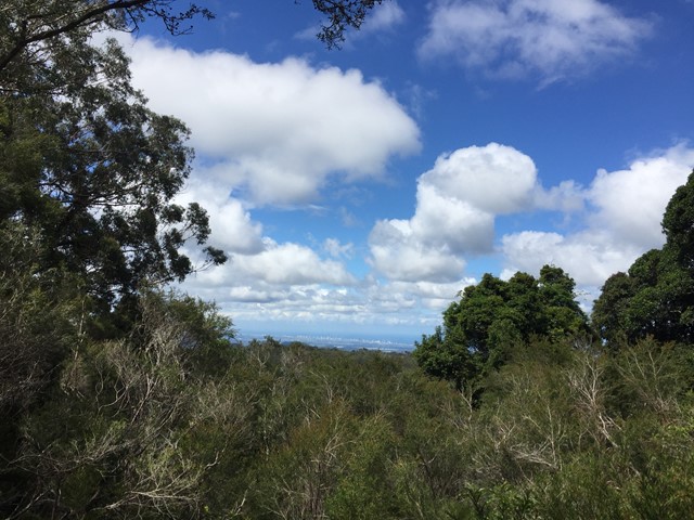
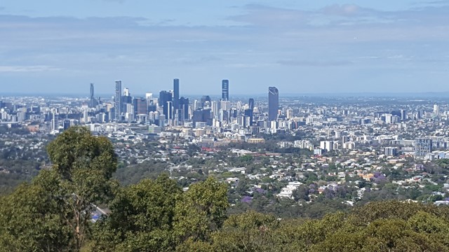
Botanic Gardens to Mt Coot-tha
An opportunity to enjoy a walk through the Botanic Gardens and continue on up through the Reserve to the summit lookout atop Mt Coot-tha.