
Menu

 1.8
km
return
1.8
km
return
 45
mins
45
mins
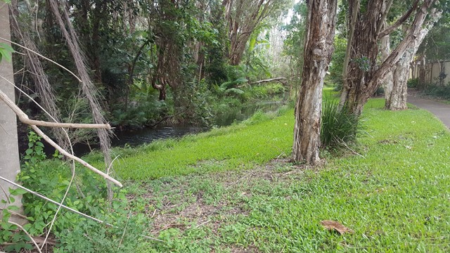
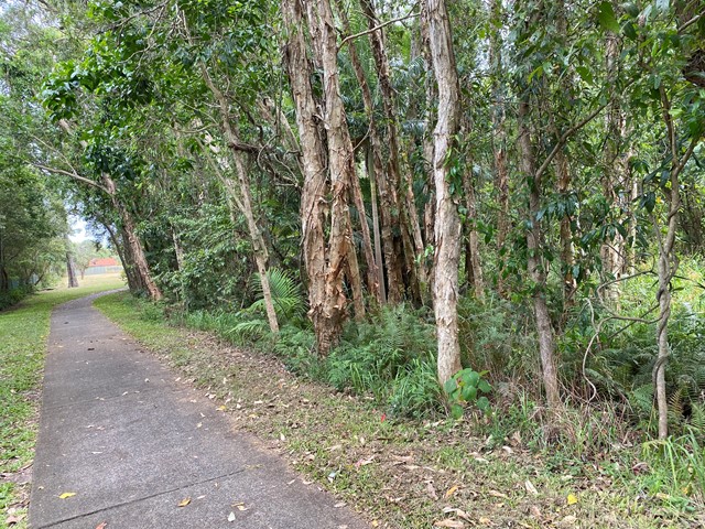
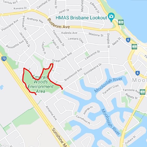
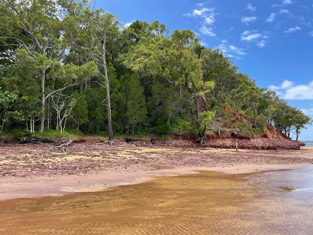
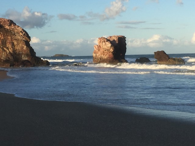
Emerald Woods
A family-friendly 1.8km circular walk around one of the few remaining patches of coastal forest in Mooloolaba. This 45 min walk leads through a patch of coastal rain forest with towering paperbark trees and palms providing ample shade and valuable habitat for local wildlife.
Keep an eye out for the flying fox and bin chicken roosts on the western section of the walk and the odd water dragon sunning itself on the edge of the path.
 5.4
km
return
2.25
hrs
5.4
km
return
2.25
hrs
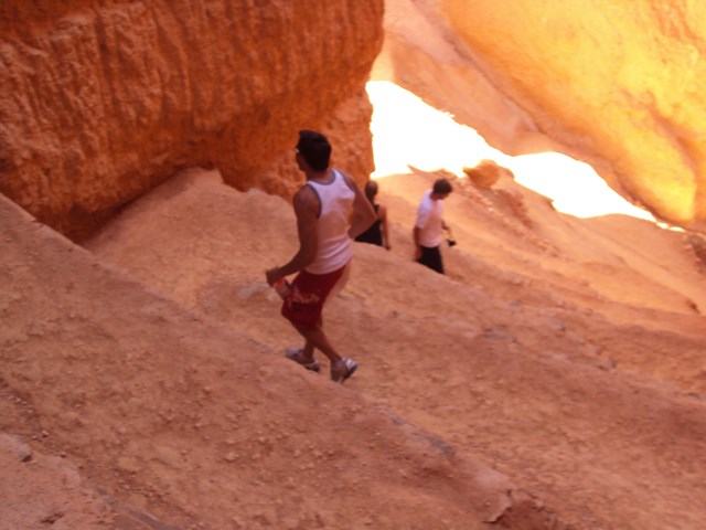
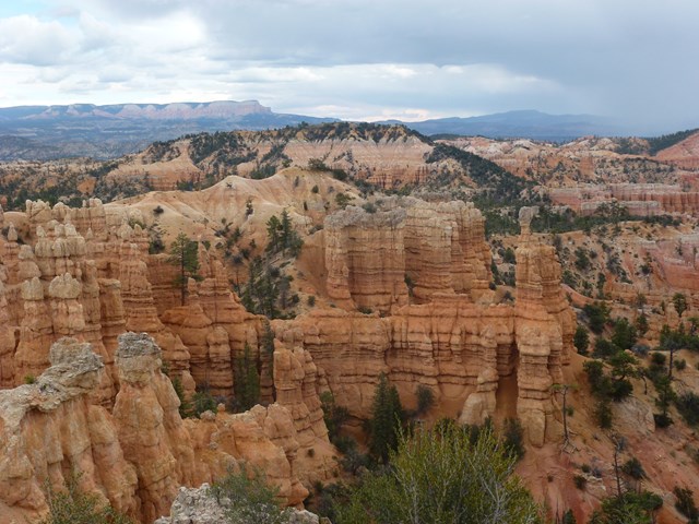
Bryce Canyon National Park
Several hikes in this park to from Medium to Hard. All provide stunning scenery. The most popular is the Navajo Trail , does go zig zag down and is a loop so goes back up again and some level of fitness is required but worth the hike.
 600
m
one-way
30
mins
600
m
one-way
30
mins
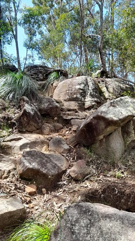
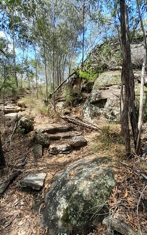
Little White Rock Track
Moderate level track suitable for average fitness levels. Pass along the base of a rocky ridge where you will see caves and relics of a World War 2 training bunker. The spotted gum forest supports a local koala population.
 6
km
return
4.5
hrs
6
km
return
4.5
hrs
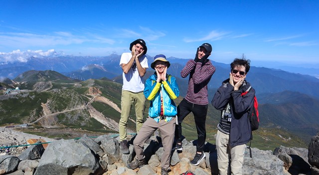
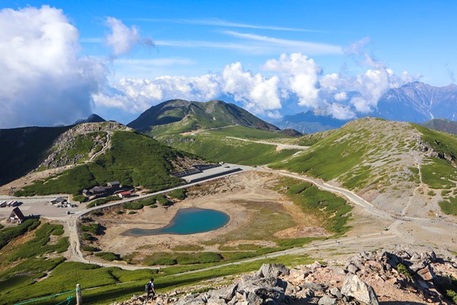
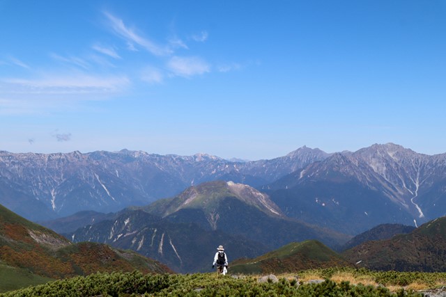
Mt. Norikura 乗鞍岳 (Gifu Prefecture)
Norikura is one of Japan's 100 famous mountains and one of the 20 odd mountains in Japan that are over 3000 metres. On a clear day you get jaw dropping views of the Hotaka Mountain range and the northern alps, if you are lucky you can see as far as Fuji. There are volcanic lakes galore. It's worth the trek out to Norikura.
 480
km
one-way
28
days
480
km
one-way
28
days
Via Egnatia
This a walk that follows, where possible, the ancient roman road, the Via Egnatia, from Durres in Albania to Thessaloniki in Greece. I only walked sections, in Albania and Northern Macedonia. The highlights of the walk are spending several days walking on the remains of the Roman road, which are well preserved in one mountainous section of the walk, walking along the shores of Lake Ohrid and walking over the mountains from Ohrid to Resen.
 18.6
km
return
4.5
hrs
18.6
km
return
4.5
hrs
Peklanica Circuit
this is one of the best walks I've done. 6kms or so up a deep gorge with lots of waterfalls and then up onto the heights above before descending again and crossing the river back to carpark. stunning views and lots to see.
11
km
return
3
hrs
Jenny Lake Trail
Take the ferry across Jenny Lake and hike up to Hidden trail and Inspiration Point. Awesome views from above the lake and a waterfall in between. From inspiration point you may , just may see some black bears that roam in the area. Grand Teton National Park is worth a visit and just down the road from Yellowstone
 2
km
return
78
mins
2
km
return
78
mins
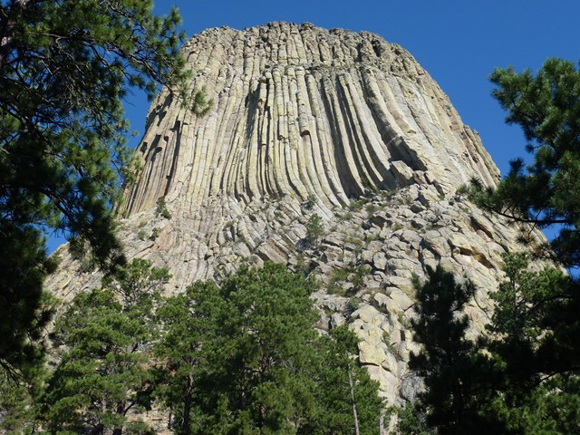
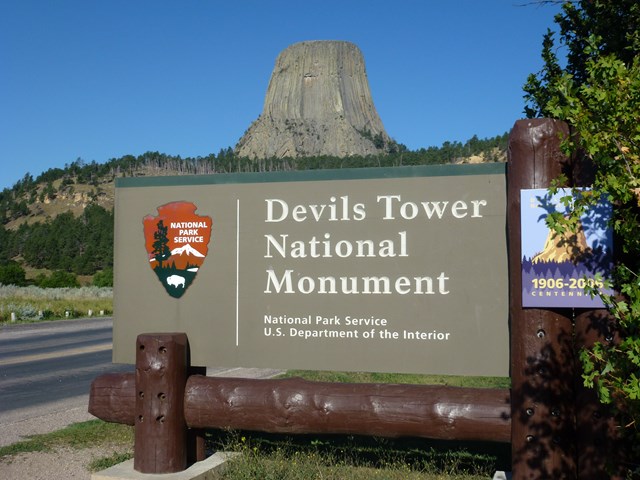
Devils Tower
Devils Tower is an interesting national monument in Wyoming. The walking trail around is very easy and flat and goes around in a loop. Nice lil walk when driving past !
 1
km
return
6
mins
1
km
return
6
mins
Cougar Mountain Regional Wildland Park
King County's 25,000 acre park system, minutes from Eastside cities such as Bellevue, Newcastle and Issaquah (Seattle).
6
km
return
2
hrs
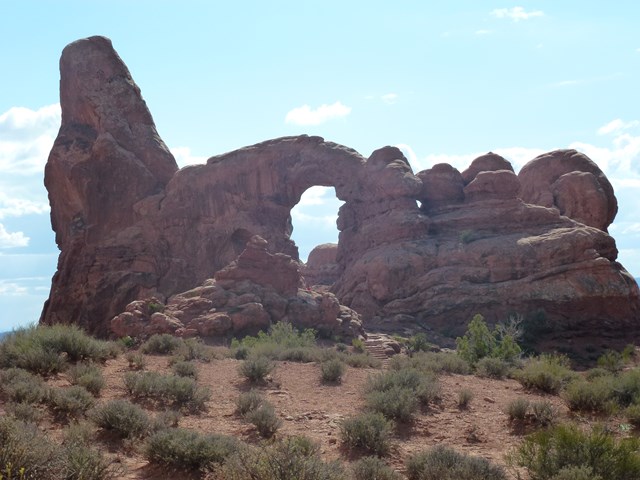
Arches National Park
Several hikes here but the most popular is to " Delicate Arch " quite easy walk and worth the hike ( and others ) when in Utah.
 5
km
return
2
hrs
5
km
return
2
hrs
Coochiemudlo Island Walk
Starting from the jetty walk onto the island then turn right. Follow the trail markers around the island, some on street, but mostly bush tracks.
 2.5
km
return
1
hr
2.5
km
return
1
hr
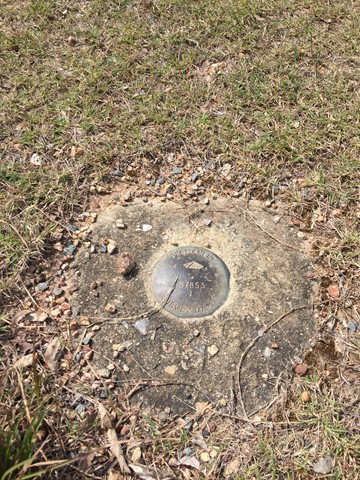
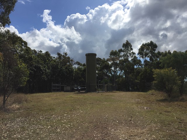
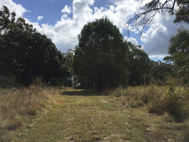
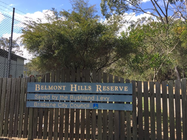
Belmont Hills Reserve
A short walk to the top of Belmont Hill. Journey to the top of the hill has some great views of the city and surrounding suburbs.
Top of the hill has some great places to rest under the tree canopy and have a picnic
 2.8
km
return
45
mins
2.8
km
return
45
mins
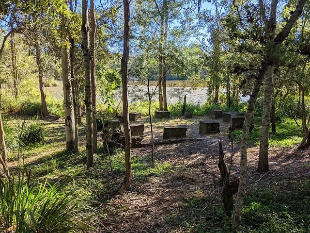
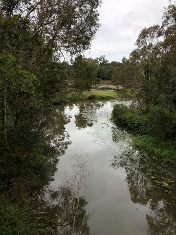
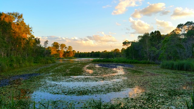
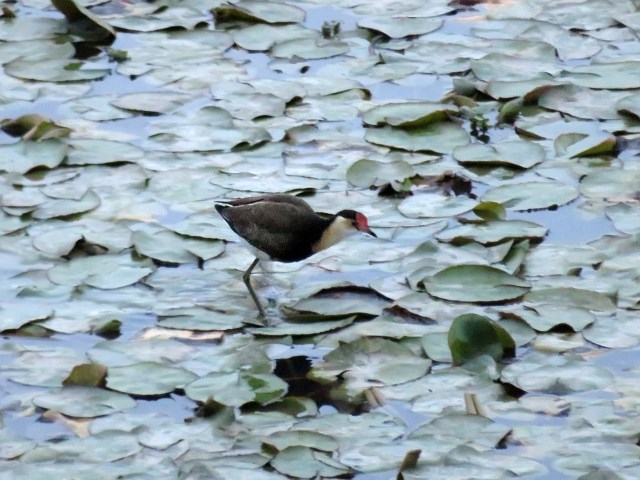
Greater Wetland Walk (Berrinba Wetlands)
Berrinba Wetlands is a must for nature lovers. Explore these serene and picturesque wetlands along more than eight kilometers of shared walking and bicycle tracks. This track loops around the wetland.
 11
km
one-way
4
hrs
11
km
one-way
4
hrs
Fira to Oia
The Fira-Oia Hike is a highlight of visiting Santorini.
The hike takes between 2 and 5 hours depending on how fast you walk and how often you stop.
The hiking trail from Fira to Oia is just under 10.5km (6.5 miles).
Elevation along the route: Oia 130 meters; Imerovigli 350 meters (the highest point on the hike);
1
km
return
30
mins
Red Rock Headland
Headland trail from the beach to the top. Views to the north (Yuraygir NP) and south (Solitary Islands).
 1.8
km
return
1
hr
1.8
km
return
1
hr
Acropolis Walk
A short walk to the top of the Acropolis a prominent limestone and schist peak in central Athens topped with an ancient citadel which is a UNESCO World Heritage Site and houses the world famous Parthenon. Views of Athens.
 2
days
2
days
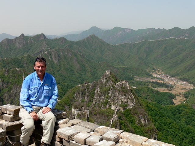
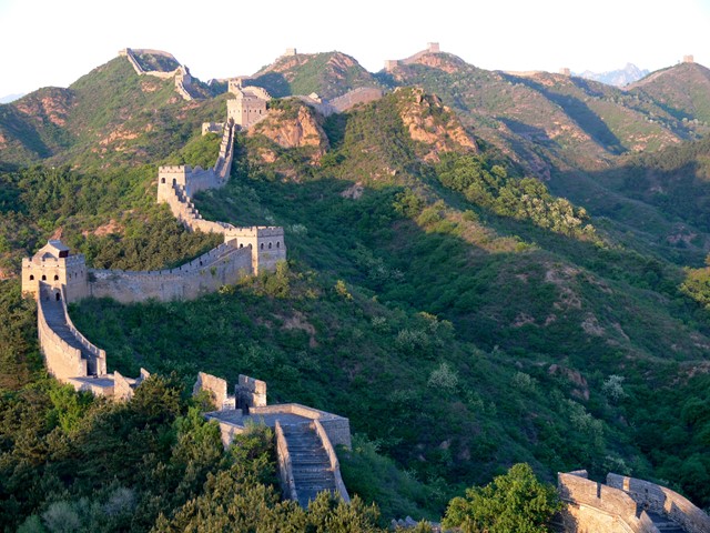
Great Wall of China - Jinshanling / Mutianyu Section
2 day/1 night along two different sections of the Great Wall. Overnight stay in a Watchtower.
 19.5
km
6
hrs
19.5
km
6
hrs
Grand Canyon Rim Walk
The highlight of course is the Grand Canyon, nothing you have ever seen can prepare you for how big it really is, the path is mostly paved with some gravel sections, and views up to 40miles to the other side of the canyon. There is a bus for the return journey and planning to be on the rim at sunset is a must.
120
km
14
days
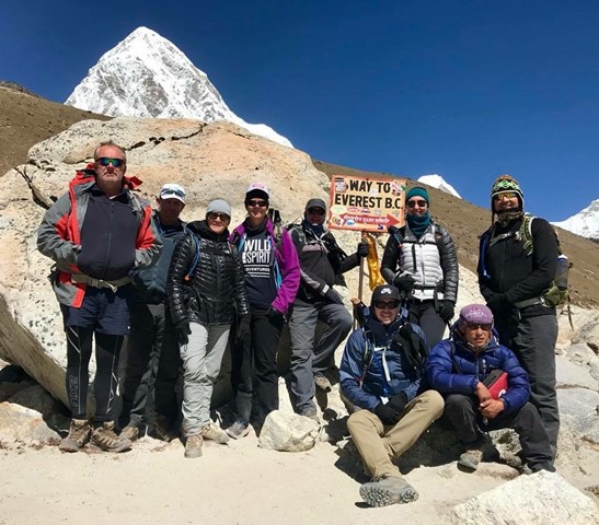
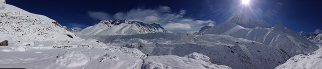
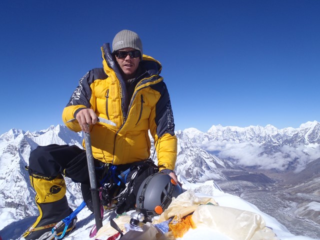
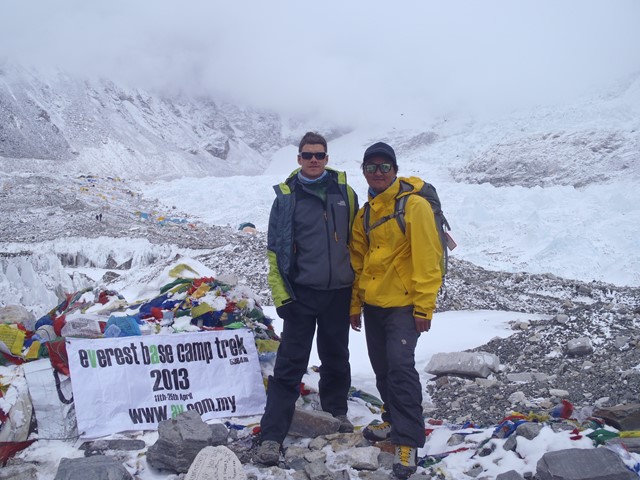
Everest Base Camp
Everest Base Camp Trek is extremely popular and famous trekking trail has people from all over the world come here to be totally absorbed by this exotic corner of the world, to be placed in visual awe of the magnificent Mt Everest and its sibling mountain ranges. Trekking to Everest base camp takes you to the Base Camp (5,320m/17,450ft) of the highest mountain in the world- Mt. Everest (8,848m/29,021ft).
 2
days
2
days
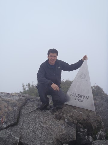
Mt Fansipan (Phan Xi Pang)
Fansipan is a mountain in Vietnam, the highest in Indochina (comprising Vietnam, Laos, and Cambodia), at 3,143 metres (10,312 ft). It is located in the Lào Cai province of Northwest Vietnam, 9 km southwest of Sa Pa Township in the Hoang Lien Son mountain range.
Fansipan is dubbed "the Roof of Indochina"; it is to be approved as one of the very few ecotourist spots of Vietnam, with about 2,024 floral varieties and 327 faunal species.[